Tagged: rural-area
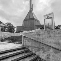
Green Squares and Secret Gardens
31 Jul 2021
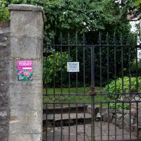
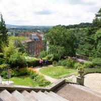
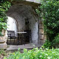
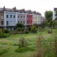
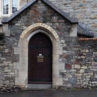
At the end of July I went to have a look around some of the private gardens opened up by the annual Green Squares and Secret Gardens event. Sadly it was compressed into a single day this year, for various Covid-related reasons, it seems, so I didn't get to poke around too many places. I went to:
- A talk by the oldest resident of Victoria Square
- The St Vincent's Rocks Hotel garden
- The Paragon garden
- Cornwallis Crescent gardens, both east and west
- The Polygon garden
And snapped a few things in between, too. It was a lovely day—a bit too hot, if anything—and it was interesting to get into a few places I'd only ever seen from the outside, especially The Paragon and Cornwallis gardens, which are the least visible to passing strangers of all of them.
The Victoria Square event was at 11am, and I didn't have a lot of energy, so hanging around until 2pm for the Richmond Terrace Garden to open would've been too much for me. Maybe next year! The event might be back up to the whole weekend by then, rather than being squeezed into a single day.
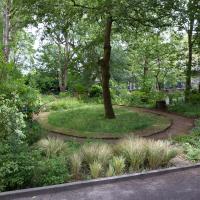

One of my nearest private gardens. The Polygon folk were very welcoming, and when they heard I lived locally said I was welcome back at any time. It's a nice little garden. Maybe I'll take them up on it at some point.
A Long Wander Of Miscellany and Magick
08 Aug 2021
This was a wide-ranging wander. I started off crossing the river to Bedminster, to walk a single little cul-de-sac, Hardy Avenue, that I'd managed to miss on at least one previous walk. Then, pausing only to explore a few back alleyways, I headed for a few destinations related mostly by the Hughes family, who I've been researching a little as part of background for a possible novel, as several of them were involved in the Stella Matutina.
However, mostly it's the artistic side of the family I wanted to explore today, as that's where most of their public history lies (as you might expect, there's often not much in the public record about the workings of an occult organisation.) First I visited College Green, where the façade of the Catch 22 Fish & Chip shop still bears the work of Catherine Edith Hughes. Then I wandered up to the top of Park Street to pop into the Clifton Arts Club's annual exhibition, as Catherine, her half-brother Donald, his wife Hope and at least two other Hugheses were members. Donald was chairman for 40 solid years; Hope was Secretary for eight, and Ellard and Margaret Hughes, two more Hughes siblings, were members along with Catherine.
Finally I walked home with a small diversion to Berkeley Square, to confirm the location of Donald Hughes's house by checking for a particular plaque by the front door.
I must admit I'm not entirely sure where all this research is really leading me, but I'm finding it quite interesting to bump across the faint lines of history that link the Hermetic Order of the Golden Dawn, founded in 1888, to modern, quotidian Bristol.
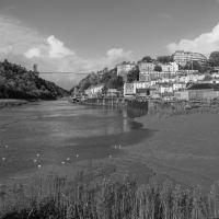
Museum of the Moon, and a Bit of Redland
21 Aug 2021
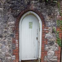
Lisa and I mostly went out to have a look at Luke Jerram's Museum of the Moon as its tour hit Bristol Cathedral—I missed it when it was previously in town, at Wills Hall, I think—but we also took a trek up to Redland. Lisa's kind enough to indulge my strange current fascination with the Edwardian eccentrics that made up the Stella Matutina, so we swung by a couple of places with a vague connection to the Bristol branch of the organisation. Well, it was good walking, anyway...
As a stunning bonus, one of the picture's descriptions has more information than you'd probably want on the Bristol Port Railway and Pier's Clifton Extension Railway line, but I did happen to coincidentally write up this wander after reading about the extension line during my lunch hour at work today. It's a thrilling life, I tell you...
"They afterwards built, in connexion with their convent, an asylum for the reception of about one hundred sick and aged poor, means for the maintenance of whom they obtained by soliciting alms from door to door"
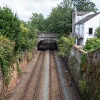
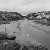
There's actually a Hotwells connection here, fairly literally. This section of track, from Ashley Hill, Montpellier, Redland, this bit right here, then Clifton Down and through a tunnel under the Downs to Sneyd Park Junction and Sea Mills station, was built as the Bristol Port Railway extension line, the Clifton Extension Railway.
The original Bristol Port Railway and Pier connected Hotwells to a deep-water pier at Avonmouth (with a few stations along the way) avoiding the need to have ships wait for the right tide to come into Bristol to unload. We've previously been inside one of its tunnels.
It was also used by plenty of passengers—during WWI an extra platform was added in Hotwells to cope with the sheer number of Bristolians commuting to the docks and munitions factories daily as part of the war effort, as well as troop movements and incoming wounded on hospital trains.
Later on this isolated Bristol Port track needed to join up to the existing railway network to survive, so this extension line was added to connect it with Ashley Hill with help from the Great Western and Midland railways. Only later did the section to Hotwells fall into disuse and close in favour of the Portway road.
(Information mostly courtesy Colin Maggs' The Bristol Port Railway & Pier, Oakwood Press, 1975.)
Shiny New Hope
24 Sep 2021
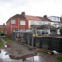
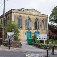
A quick lunchtime jaunt to Clifton Village. Along the way I admired the new sign on Hope Chapel and added to my tsundoku collection.
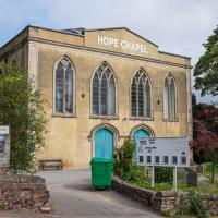
The scaffolding is down and there's a nice new sign (reminiscent of a historical one, I think,but I can't find the photo at the moment because Know Your Place Bristol is down) and you can just see the newly-installed solar panels on the roof behind it.
A Morning of Research and a Cafe in a Castle
25 Sep 2021
I needed to pop to the library, as they'd kindly dug a book out of the reserve store at the B Bond warehouse for me and emailed me to let me know it was ready. So, I took a little trip to town, straight down the Hotwell Road, and spent a few hours reading before stretching my legs with a walk to a new cafe in the actual castle (or remnants thereof, anyway) of Castle Park, before heading back home down the other side of the harbour. As well as books and coffee, I bumped into a remote-controlled pirate ship, which isn't something you see every day, even in Bristol.
Fresh Fields
17 Oct 2021
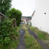
For the first time in a while, I had the time and energy to go further afield and knock off some new roads from my "to do" list. I headed through the first Hotwells Festival to Ashton and Bedminster to cross off a few of the suburban roads south of North Street.
First, though, I decided to try to reproduce an old photo of the now-demolished Rownham Hotel just around the corner from where I live...
It's not technically a public road, I'm sure, but it looked like a handy way of routing myself so I didn't have to go down the same street twice.
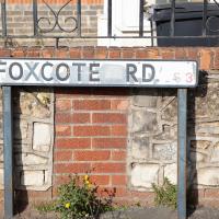
I presume a foxcote is like a dovecote, only for foxes. Nice to imagine them all there in their array of little foxholes.
A Wide Angle View
30 Oct 2021
I had an unsuccessful wander last week, on Tuesday afternoon: my GPS died within about five minutes of leaving the house, and I didn't notice, plus I found hardly anything I'd been looking for. On the plus side, as I was wandering around Park Street I decided to nip into London Camera Exchange on the offchance they had a secondhand Canon 17-40mm lens. I've been thinking of buying one for around a year, I think.
Long story short: not only did they have one, but due to a mistake with their price labelling which they kindly honoured, I now have a shiny new (to me) wide-angle lens and it cost me less than £300, which is a very good price for one of these in good condition (and including a lens hood.)
So, rather than try to salvage Tuesday's walk, here's a walk where I basically just bimbled up to Clifton Village for a coffee and wandered around taking photos of as many wide views as I could find. I took a lot more photos than these seventeen, but as you might expect, a new lens takes some practice getting used to, so most of them ended up in the "outtakes" pile.
Ticking Off a Few Streets in Bedminster
31 Oct 2021
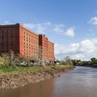
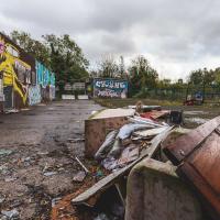
There were only a few streets left to wander in the more residential bit of Bedminster, so I thought I should target those today. The streets themselves weren't that notable, though Balfour Road has a contrasting mix of old and new housing. I tried to snap a few more interesting things along the way there and back, snapping all three of the familiar bond warehouses, nipping onto North Street to find some new street art, and finding a few pumpkins for good measure. It is hallowe'en, after all...
I went out simply wanting to knock off the very last little unwalked section of Clanage Road, over by Bower Ashton, which has been annoying me for a while as it's quite close by and I've walked the other bits of it several times. So, my plan was to nip over to Greville Smyth Park via a slightly unusual route to wander Clanage Road and tick it off.
Along the way, though, I inevitably got a bit distracted. I took a few photos of Stork House, a grand Hotwell Road building that's recently been done up a bit (I imagine it's student lets, though I'm not sure) and which I found a reference to in a book about the Port Railway and Pier the other week, and also tried to match up a historical photo of Hotwells before the Cumberland Basin Flyover System laid it waste, which included some interesting markers I'll have to do a bit more digging into...
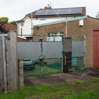
View into the car park of the former stables/kennels. I just poked my camera through a big hole in the gate.
The more I research it, the more I find that Hotwells had far better transport links back in Victorian and Edwardian times than it has today. Along with buses that went to more useful places than the City Centre, there were trams, the funicular up to Clifton, the landing stage for paddle steamer services and two railway stations all within easy walking distance of me.
Today I took a day off work as preparation for doing the bookkeeping for my tax return1, and took a wander along to the site of what would have been my nearest station, Hotwells (or Clifton, as it started out in life), nestled in the shadow of the suspension bridge, the Bristol terminus of the Bristol Port Railway and Pier.
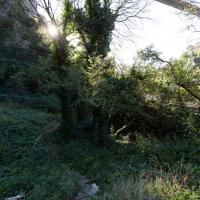
From there I wandered down the Portway, following the original line, until I got to the area around Sneyd Park Junction, where the tunnel from the slightly later Clifton Extension Railway joined up with this originally-isolated BPR line. Then I headed up to Clifton through the "goat gully" at Walcombe Slade, seeing the few above-ground bits of evidence of the tunnel (which is still in regular use) along the way.
It was a lovely day, and a good walk, and it was interesting to daydream of the times when I could have walked a few minutes from my flat down to Dowry Parade, caught a short tram ride to Hotwells Stations, and then headed from there to Avonmouth, perhaps even to board a transatlantic passenger service. The completion of the Clifton Extension Railway that linked the Avonmouth station with Temple Meads made relatively direct transatlantic travel from London via Bristol possible, with passengers travelling up from Paddington to Temple Meads, on to Avonmouth on the Clifton Extension Railway and Port Railway and Pier line, then perhaps catching a Cambpell's paddle steamer—which sometimes acted as tenders for large steamers—to a larger ship that was headed out for Canada, say.
1 I've learned that the best approach is to take two days off and deliberately do something that's not my bookkeeping on the first day, as otherwise I just inevitably end up procrastinating and feeling guilty on the first day no matter what. I have an odd brain, but at least I'm learning strategies for dealing with its strange ways as I get older...
2 Information mostly gleaned from Colin Maggs' The Bristol Port Railway & Pier and the Clifton Extension Railway, The Oakwood Press, 1975.
If I hadn't seen the photos and maps I'd have had no clue that there was once a busy railway station here, with three tracks, a platform, a ticket office, a turntable, a station master's house and so on. The last train would have been, I think, on 19 September 1921.
Hotwells Halt, the extension platform put in just north, on the other side of the first tunnel, survived until 1922, but after that everything would have changed for the Portway.
Not everything was lost, though. The rest of the line was effectively saved by the fact that it joined up to the main rail network (and didn't need to be completely obliterated to make room for the road.)
The joining to the mainline was achieved by the Clifton Extension Railway, which included a tunnel from Clifton Down to Sea Mills, the next station along from Hotwells Halt, and the closest surviving Bristol Port Railway station to Bristol.
The CER line is still in use, and we'll be taking a route that checks in on the tunnel in a few pics from here...
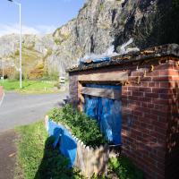
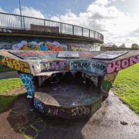
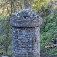
I have literally no idea what the hell this is. Weird that it seems to have been filled with expanding foam and has a little fence.
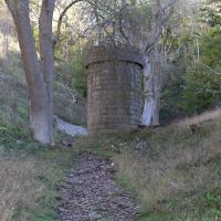
So, along with the horizontal shaft that comes out rather unattractively in the side of the quarry below, there are two other air shafts for the tunnel. This one marks the spot where this path up Walcombe Slade crosses directly above the dead-straight Clifton Extension Railway tunnel running from left to right in the depths of the rock below.
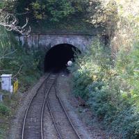
Well, we didn't quite see the far end, but seeing as we've seen the three ventilation holes, I thought it would be worth actually seeing some of the tunnel! This is the Clifton end, adjacent Clifton Down Station.
The tunnel is dead straight. You can, apparently, see right from one end to the other, though I don't think there's anywhere for a member of the public to stand that allows that view. Of course, in the days of steam, the view was mostly obscured by smoke from the trains themselves, and this exit had a succession of jury-rigged bell systems so that the driver would know when to apply the brakes to avoid overshooting the station, as it was hard to tell when they were about to emerge from the tunnel.