Tagged: street-light
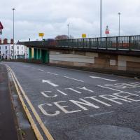
Underpass
25 Nov 2020
A quick lunchtime jaunt for coffee. I've often wondered about the dots on the wall of the underpass. Apparently they're not intelligible Braille. Maybe it's Marain :D
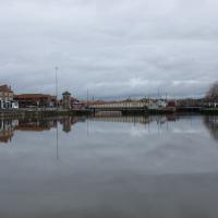
I really must try another long-exposure with ND filters here; it looks very strange with the water made artificialy still like that, and I enjoy the effect.
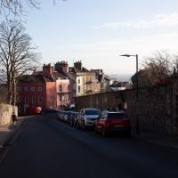
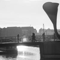
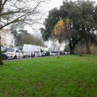
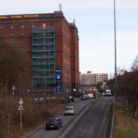
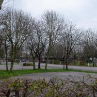
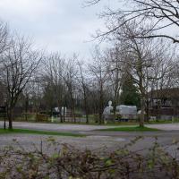
The Cumberland Basin Flyover System is indisputably ugly, I'd say. At least you get presented with the rather lovely pink of the Rose of Denmark when you get through it and swing around onto the main Hotwell Road into town.
Avoiding the Accounts
26 Nov 2020
I took the day off my day job to do my accounts—or at least do enough bookkeeping to send them to my accountant. I hate doing the books. I woke up late, tired and with a headache and decided to bunk off for a walk around Cliftonwood, Clifton Village and Clifton instead, taking in a couple of good coffees along the way. Thanks, Foliage Café, and Twelve for the flat whites.
The Long Lunchtime at the End of the World
27 Nov 2020
I took an extra-long break at lunchtime today as I'd taken the day off my normal day-job to do the accounts for my previous side-job, which is still generating paperwork, though not much in the way of money. This took me through some undiscovered bits of Cliftonwood, including Worlds End Lane, which unexpectedly leads to White Hart Steps. That's certainly not where I expected the end of the world to lead to...
A long ramble, starting with trying to find the Hot Well of Hotwells and leading up the side of the Avon Gorge to the Downs and then through Clifton for coffee.
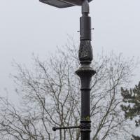
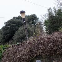
I always think this style of lamp looks like a duck's bill. This is the same lamp head as the ugly ones on the Portway, here stuck allegedly temporarily onto a grand old lamp post in Clifton Village while the rather more matching head is off for repairs, but it's been away more than a year at this point, so I think it's unlikely to come back.
Ten O'Clock Shop and Can't Dance Coffee
30 Nov 2020
I had to return a faulty AirPod Pro to Apple (there's a first-world problem!) so I just took a quick trip up the hill to the nearest UPS drop-off point, The Ten O'Clock Shop, which is famously open until 11pm. Unfortunately it's a fairly cramped little place and neither of the staff were wearing masks, so I made it a very quick drop indeed and got out of there as quickly as I could.
I grabbed a quick coffee from Can't Dance, a stall that's—as of yesterday—in a tiny converted cargo container on the edge of Victoria Square; up until this week they were running from a little trike parked in the same place. Hopefully the new premises will let them see out the winter without worrying quite so much about the weather.
I tried to fit in a few extra streets from the surrounding area on my there and back, but that was basically my wander today: a quick little shopping trip.
This bit of grass is apparently called "Bobby's Green" or "Bobbies Green"—I've seen it written both ways. Several locals call it this; the only guess I've seen came from Louise on NextDoor:
don’t know why it’s called the Bobbies green except sometimes policemen used to lean or leave their bikes on the railings before there were so many parked cars. They used to come up constitution hill from the old police station at the entrance to Brandon hill on Jacobs Wells Rd and cycle around clifton so maybe that’s the reason- but that’s just a random guess.
Looking down onto Hanover Lane, which I often use as a cut-through when heading for the Triangle. In the Beforetimes I'd often walk between Waitrose and home via that route.
Fruitless Coffee Excursion
01 Dec 2020
Unfortunately by the time I got to Greville Smyth Park I was already about halfway through my lunch-hour, and the queue was too long to wait to actually get a coffee. Is that a fruitless excursion? Presumably a coffee bean is technically a fruit...
This kind of vague musing was sadly overshadowed by my delay at Ashton Avenue Bridge on the way back, where someone—hopefully still a someone, rather than a body—was being stretchered up the bank of the river, presumably having just been rescued from the water. As I made my way home the long way around, avoiding the cordoned-off area at the back of the CREATE centre and its car park, I saw an ambulance haring across the Plimsoll Bridge, siren running, presumably on its way to the BRI. I'd like to think that was a good sign.
Nothing New
02 Dec 2020
This may be the very first time I've gone for a One Mile Matt wander and not actually gone down any new roads, trod any new steps. I just wanted a coffee, frankly, so I went the same old way to Imagine That in the marina and back again.
Cliftonwood and a Secret Garden
03 Dec 2020
I love the isolation of Cliftonwood -- the geography of it, with its solid boundary of Clifton Vale to the west and Jacob's Wells Road to the east mean that you tend not to be in Cliftonwood unless you've got a reason to be there. It's not a cut-through to anywhere, at least not from side-to-side, and you can only really exit to the south on foot.
I sense that I'd be happy living in Cliftonwood -- like my bit of Hotwells, it's a quiet little area with a sort of quirky feel to it. Plus it contributes the colourful houses that are the backdrop of about half of all Bristol postcards ever made :)
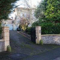
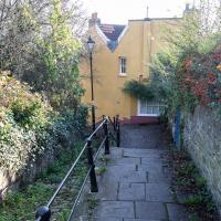
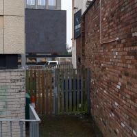
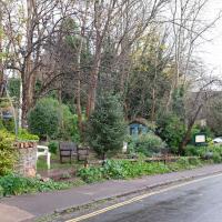
I found the "secret" garden especially interesting, just for the fact that it really does feel quite secret, despite the obvious name on the gate. I've lived a half-mile from it for twenty years and I don't think I've ever noticed it before, despite exploring the area a few times.
More Cliftonwood
05 Dec 2020
Back to Cliftonwood for a wander that included some of the belle views of Bellevue Crescent and other bits of the easternmost part. Highlights included watching someone bump-starting an elderly Nissan Micra in the narrow confines of Bellevue Crescent.
Alma Vale
06 Dec 2020
I wasn't really feeling it when I set out today, on my first car-assisted wander. By the time I'd parked on Alma Vale Road in Clifton it was just starting to rain and I picked my way about in quite a desultory way. It felt strange, as I was very familiar with the area because I'd walked through it hundreds of times when I worked at the top of Whiteladies Road, and used to walk up the hill from Hotwells and through Clifton to get there, and back again, every day.
Then a complete coincidence seemed to make the change I'd been hoping for. I was standing taking a photo of Christ in the front garden of All Saints church when a couple of people walked out of the front door. I got talking with a lady I took to be part of the ministerial team, who invited me to come in and look around—something I'd always wanted to do on the morning commute. (I think we connected a bit when I recognised the name John Piper, who did the amazing windows—I learned about him while I was at Warwick, through his connections to Coventry Cathedral.
I left with much more of a spring in my step, wandered around the area a bit more, finally working out that the tennis courts I used to pass every morning are those of Clifton Lawn Tennis Club, and finally grabbing an excellent Hungarian sausage hot dog from the Budapest Cafe. I feel a lot better now than I did before I went out.
I walked past this a lot on my way to work for a couple of years, and always vaguely wondered what it was.