Tagged: tints-and-shades
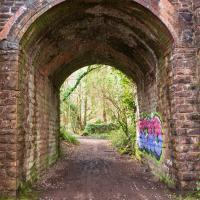
Downs Wander
23 Feb 2021
Just a quick trip to knock off a path or two on Clifton Down. I'm not actually convinced I walked down the paths I was hoping to, but I suppose I'll see once I upload this and look at it on the map :)
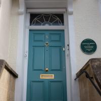
Today's highlight turned out to be retrospective—looking up Gertrude Hermes' amazing wood engravings when I got home. (By complete coincidence, I was trying to discover the location of the Stella Matutina's former Hermes Lodge in Bristol as part of my researches last night...)
Picture Postcards, Bikers and Wild Food
25 Feb 2021
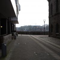
I almost didn't bother bringing out my GPS today, but as it turned out I may have knocked off a tiny bit of Baltic Wharf, having been diverted through there on my way back from Imagine That café by finding Cumberland Road closed. Not sure whether it was just some kind of delivery to the roadworks there or if they're surfacing the increasingly-dodgy looking bit of the one lane that's left open...
I also snapped a picturesque view of Cliftonwood, hung out with a biker gang, and found a little something to nibble on growing on the Hotwell Road.
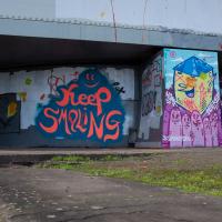
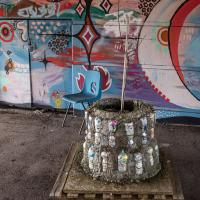
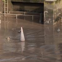
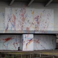
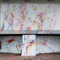
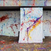
I'm all for the general efforts being made to cheer up the Cumberland Basin in general, but I feel like this particular experiment could have been called a failure.
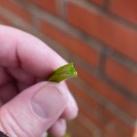
And just to confirm this is wild garlic, here's a stem. The Latin name is allium triquetrum, the three-cornered leek, because of its distinctive cross-section.
A Day Off Wander in Clifton
26 Feb 2021
I'm on the first day of a long weekend, and I certainly picked the right one for it. This may be the first proper spring-like day of the year in Bristol; it was glorious.
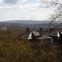
I headed up to Clifton, around the area where I got my Covid vaccine jab the other day, to knock off a few remaining roads in that area and because it would be good exercise for an extended lunchtime walk.
Along the way I saw some very Clifton sights, including an Aston Martin, some Jacobethan architecture, and some private college sports grounds. Mostly, though, I just enjoyed the sunshine, and took every opportunity I could to snap views across the city.
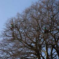
I say, there's men in that tree! Lots of pruning being done in the Paragon back garden today.
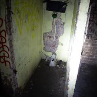
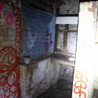
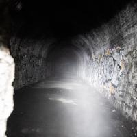
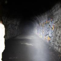
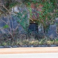
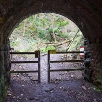
I'm glad my friend Lisa joined me today; she drove in from Shirehampton and told me that the Portway was looking rather lovely, so we set off that way. She's also braver than I am when it comes to doing urbex stuff, so this was just the opportunity to take a peek into the Portnalls Number One Railway Tunnel/Bridge Road Deep Valley Shelter whose entrance I'd found on a previous wander.
It was definitely dark and spooky and impressively big, with a side tunnel that Lisa explored that leads to a little door I don't think I've previously noticed on the side of the Portway. I didn't get many photos—even my astoundingly powerful little torch (£) didn't do much to light things up, and you're not going to get much joy hand-holding a camera in that darkness—but I did shoot a little video, which I might edit and add later.
After plumbing the bowels of the earth, we went up Bridge Valley Path to Clifton, explored some bits around the College and Pembroke Road, then came home via Foliage Cafe for coffee. Nice.
A Bristol estate agent would probably sell this as having an excellent view, too.
Lisa went right to the end of the side tunnel that leads to this door inside the Portnalls tunnel.
Harbour Circumnavigation
01 Mar 2021
Normally I don't have enough time in my lunch hour to get all the way around the harbourside. This is a shame, as Wapping Wharf is a great place to get coffee and a snack, but it's pretty much diametrically (perimetrically?) opposite me on the harbour. Today I had the day off, so I decided to go and knock off a few streets around Anchor Road that I'd not covered, as well as visiting the site of the Read Dispensary (well, one of them) and dropping into Mokoko for one of their astounding almond croissants. From there I came back along the south side, checking out the views from as much of the Chocolate Path as you can venture down at the moment, and swapping from Cumberland Road to Coronation Road at Vauxhall Bridge.
There's a lot of meh photos on this walk—my chief output from this project could be politely described as "record shots"—but a few turned out well, especially those of Vauxhall Bridge from the Chocolate Path, which reminded me how much of a loss the current closure of the Chocolate Path is to walkers and cyclists in Bristol.
I dream of a future like the past, where we just had one bin, but where everything from robots to enzymes at the recycling centre nevertheless manage to pull everything back apart.
Walking under the bridge next to one of the stanchions, I noticed this big crack. I wonder whether that's just complete coincidence or if they're inspecting the bridge because of some problem that someone's noticed, or a recent accident?
Of Bridges and Buoys
04 Mar 2021
A trip to Imagine That coffee, so no fresh roads knocked off my list, but I stopped off to snap a couple of the engineering-related bits of the docks: the Campbell Buoy (used by P&A Campbell for mooring their paddle steamers) and Brunel's "other" bridge, the foot/horse swing bridge that now sits sadly disused in the shadow of the Plimsoll Bridge at Howard's Lock.
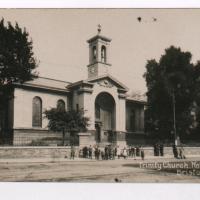
I headed to Bedminster to do a crossword with my support bubble today. On the way I delved into a couple of bits of Hotwells history, first of all snapping a "now" shot to go with a historical photo of Holy Trinity I happened across recently, and second of all to snap the Britannia Buildings.
The Britannia Buildings are a little strip of offices on a corner of the Hotwell Road. They've mostly been the headquarters of a cleaning company for years, but I've often wondered what this distinctive curve of offices, its ground floor standing proudly out from the upper floors, used to be. Well, after my last wander, where I poked about the landing stage just down the road, I found out! Researching the paddleboat company P&A Campbell I came across this nugget in The A-Z of Curious Bristol, by Maurice Fells (£):
The firm of P & A Campbell was the main steamer operator in the Bristol Channel, with its local headquarters in offices close to the Hotwells pier and overlooking the harbour at the Cumberland Basin. Campbell's named their offices Britannia Buildings, after one of the ships in their White Funnel Fleet.
So! Turns out the Britannia Buildings were named after a paddle steamer—you can see some pictures of Britannia here.
In related news, I've now bought three of Maurice Fells' local history books, and they were hand-delivered by the author on Sunday, a half-hour after I ordered them online (through a message exchange on Nextdoor!) Not even Amazon Prime has managed to deliver me anything that quickly...
One Albermarle Row, Granby Green and... People
12 Mar 2021
I was browsing some historical photos the other day, and came across "Rear of Unspecified House" in the Bristol Archives' John Trelawny Ross collection, and immediately recognised it as being the back of 1 Albermarle Row, just around the corner from me. I've not had much time to research the history of this odd little addition to Albermarle Row, or what happened to 1-4 Cumberland Place, number 4 of which used to be attached to the side of 1 Albermarle Row, but it was interesting to look at old maps for a few minutes and work out what used to be where.
That all connects with the little local bit of land at Granby Green, too, as it used to be numbers 1-3 Cumberland Place. There was something of a planning battle over Granby Green, and I've included an old edition of Hotwells & Cliftonwood News that I found online, a copy of which would have been popped through my letterbox at the time.
I was also inspired by some old pictures of Hotwell Road to try to put a few more people in my pictures, though I set my pre-focus a couple of extra metres out from normal to make sure I didn't get too close to anyone!
"Rear of unspecified house, Jun 1979"
As soon as I saw this photo, I thought, "That's not unspecified! That's 1 Albermarle Row!" I mean, it still looks like that today, and it's quite distinctive.
From the Bristol Archives, filed under "Bristol City Council: Urban Design and Conservation: Photographs by John Trelawny-Ross/ Photographs taken by John Trelawny Ross during the course of his work as conservation officer for Bristol City Council, within the Urban Design and Planning Department/Dowry Parade, Albermarle Row and St Vincents Parade"
Leigh Woods Walk
14 Mar 2021
An enormous walk today, or at least it felt enormous. My feet are sore, anyway. I started off recreating a couple of local historical photos in Hotwells, but then headed for my traditional walk along the towpath in the Avon Gorge to the far extreme of Leigh Woods, up and through the woods to the height of the Suspension Bridge, finally crossing into Clifton Village for a well-deserved vanilla latte.
I say "traditional" because this used to be a very regular route for me, first walking, years and years ago, and later jogging—this route combined with a circuit of the Downs on the other side used to be my way of making sure I was fit to do a half-marathon (I did six of them in total, between 2010 and 2014).
I miss the routine of this walk, even though it's a long way and it used to pretty much wipe me out when I did it—I'd come back home and collapse and do very little for the rest of the day. But perhaps that's what Sundays are for, and I should try to remember that.
Doing this walk regularly was quite a meditative experience. Not so much of that today, but once I got to the further extreme of the towpath, where the roar of the Portway traffic on the other side of the river dwindles and I turned into Leigh Woods to climb ever closer to birdsong and further from rushing cars, I did seem to recapture a little of the feeling of previous walks. (I would say my mind cleared, but I was mentally singing along to Life Without Buildings' The Leanover for most of the wander. There are worse songs to have stuck in one's head, though; it's a great track...)
Anyway. Apparently the walk made me more likely to ramble in words, too. I'll stop now :)
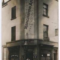
"Untitled. handwritten note on reverse 'Merchants Arms, Merchants Road, Hotwells. Licencee 1912 Mrs Florence Norris (over right hand door)'"
Photograph by L. Worsell, Bristol. Courtesy Bristol Archives/The Vaughan Collection

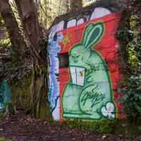
Presumably this is how David Icke views the British monarchy.
(It's Queen Lizzie, by sledone.)
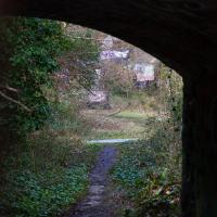
One of many archways under the Portishead railway line that runs along the edge of Leigh Woods.
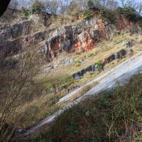
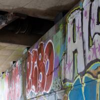
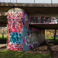
Here's an interesting little place—not that I'm athetic enough to climb into it like the graffiti artists who've clearly been at work. This little disused quarry was a police firing range for a while, and the last time I wandered into it, perhaps ten years ago—I happened to walk past while it was unlocked for some reason—you could still see the piles of old tyres and other ricochet-deadening material that would have lain behind the targets.
Harbourside Milestone
17 Mar 2021
The other day I realised (hello, Maggie!) that my next walk would be my hundredth, and that I'd done 393.4km so far. I figured it would be nice to get to 100 walks and 400km on the same walk, so I went for a nice long harbourside wander after work, rather than dashing out at lunchtime. As it turned out, we're just coming up to the time of year where I can leave the house at 5:30 in the evening and there's still just enough light to take photos by the time I've made it around the harbourside. Though only just, and mostly because I've got a full-frame camera that's not bad in low light...
Still, the evening light made a lovely change, and some of the photos turned out to be pretty good photos per se, rather than just record shots of my walk. I'm looking forward to more evening walks like this as summer approaches.
On the way around this evening I wandered through one of the oldest bits of the city to extend my walk and snapped some interesting bits of architecture, including an NCP car park(!) and a nighttime shot of one of my favourite subjects, the clock tower at the Albion dockyard.
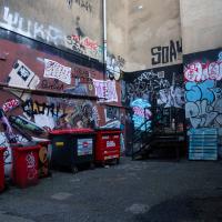
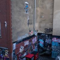
Oddly, everyone in Bristol knows the wall above this little alleyway/loading bay, but probably woudln't recognise this bit down here.
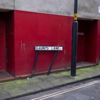
If you were able to walk directly down Guants Lane on a straight line through to Park Street, you'd end up walking through St Mark's Church, also known as the Lord Mayor's Chapel, and formerly known as Gaunt's Chapel. It was built as the chapel to the adjacent Gaunt's Hospital, now demolished, founded in 1220. Something tells me there's a strong possibility that it stood hereabouts. From Wikipedia:
In 1220 Maurice de Gaunt (d.1230), a grandson of Robert Fitzharding (d.1170), first feudal baron of Berkeley, Gloucestershire, founded a hospital, that is to say a mediaeval charitable residential institution, next to his grandfather's foundation of St Augustine's Abbey, to provide relief for the sick and poor. It was to be called the "Hospital of St Mark of Billeswyke-by-Bristol" and was housed in the Abbey's almonry.
This is yet another example (like QEH) of the meaning of the word "hospital" changing over time. It comes from "hospes", Latin for "guest" or "stranger", and "hospital", "hostel", and "hospitality" all share the same root. (And there's another connection with QEH: QEH was originally housed at Gaunt's Hospital mansion house, Unity Street, just around the corner.)
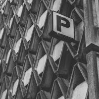
The NCP car park. Designed by Kenneth Wakeford Jarram & Harris in 1966, one of many brutalist Bristol buildings.
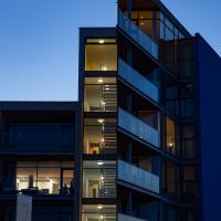
I'd love to live in one of those flats. I don't care if the balcony is strangely impractical because of the sharp point; I just really like the architecture.
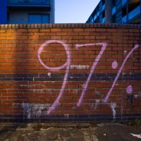
I thought this might be a reference to the working-class student club at Bristol Uni, but I'd misremembered: they're the 93% club.
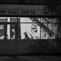
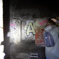
A bit blurry—very little light by this point—but you don't see anyone working in the Puppet Place very often.