Tagged: vegetation
Leigh Woods Purple Path
12 Mar 2022
There's a few tracks in Leigh Woods that lie within my mile and show up on my map but that I've not walked yet, so I decided to take one of my traditional big long walks through the woods on this nice crisp sunny morning.
For years—decades, even—I've been doing a similar route from my place, along the towpath to the far woods entrance, up the hill for a varied walk on one of the marked tracks and then across the Suspension Bridge to Clifton Village for a coffee-based reward. It's my default "long walk", really, and I almost always enjoy it. Today, at last, spring actually seemed to be springing, which made for some extra positivity...
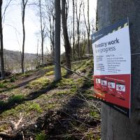
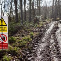
I was heading for my usual mid-walk picnic bench but I guess they're logging in that area right now, so I had to divert.
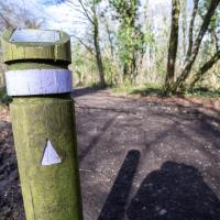
Making sure I'm still on the Purple trail. It wasn't far from here I bumped into Patsy, an erstwhile colleague who apparently still has one of my photos up in her house, which is nice to know. She was looking positively healthy—apparently retirement suits her. She's already been for a swim before her forest walk, so she's clearly keeping fit...
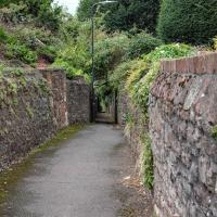
I noticed I had a few things on my "potential wanders" list that could all be done relatively close to home, and in a fairly straight line, so I set off at lunchtime to recreate a photo of a now-defunct pub, wander behind a Spar (which turned out to be more interesting than I'd expected, but I admit it's a low bar) and spend some time browsing in Dreadnought Books before coming home via a coffee from Spoke & Stringer, a little diversion up Gasworks Lane and a tiny bit of the Rownham Mead estate I'd somehow previously skipped.
On my way home I popped through Rownham Mead estate and snapped a few things, starting with this house number that I've always enjoyed. This used to be my regular cut-through to the commuter ferry service back when I used to get the boat to work, so I'm very familiar with this little area.
As usual, the somewhat bland housing estate is elevating itself by means of the horticulture—I really do like the job their landscapers do in general, but most of the houses also seem to take a lot of pride in the individual gardens, too.
Easter Monday Gardens and Flowers
18 Apr 2022
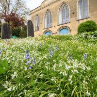
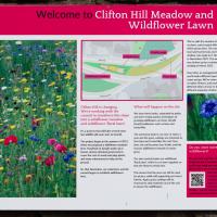
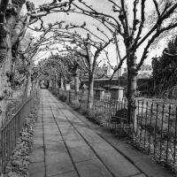
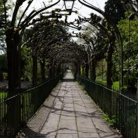
I didn't really set out with a theme of flowers and gardens in mind for this walk. I just fancied heading up to Clifton Village to get lunch. As it turned out, though, Spring was springing, so a minor theme emerged as I started off with the graveyard flowers of Hope Chapel and wandered up to see the beginnings of the new wildflower garden at Clifton Hill Meadow.
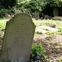
There will be a minor theme of flowers and gardens for this little trip. We'll start at Hope Chapel, though this is more a graveyard than a garden.
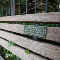
The bench at the top of Clifton Vale doesn't really have a view, and it's squeezed into an awkward little corner in the tight dogleg turn up to Goldney Avenue. On the plus side, Clifton Vale is very steep and many people are grateful for the opportunity it provides for a breather.
I last used it when showing my friend Heather the way back to her hotel in Berkeley Square after a meal in the Pump House. It's a fairly direct route to take, but even a local like me who's used to the hills around here can feel the need for a short rest here before pressing on to the heights of Clifton.
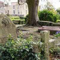
...doesn't sound like the kind of man who would appreciate the somewhat lax attitude his gravestone is taking to uprightness.
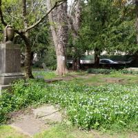
I rather like the stone drape across the funerary urn on the pedestal. Plenty more flowers on show, too. This is the bit where most of the squirrels hang out; I imagine they're in favour of the new dogs-on-leads rule.
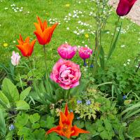
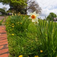
Continuing our minor theme of flowers and gardens, here's some from the Albert Lodge garden.
A Quick Swing Past Ashton Court
05 Jun 2022
Another day not dissimilar to my last wander: I'm feeling a bit tired and rather than just moping around the house I thought I'd find some tiny bit of somewhere that I'd not yet walked and get outdoors. This time I headed for the Tobacco Factory Market in Bedminster, as I often do, but went the long way around via Ashton Court Mansion as I knew there were some footpaths and a small section of road I'd not ticked off up there. Finishing all the Ashton Court footpaths will be quite a long job, but you've got to start somewhere...
I did feel rather better by the time I got home, and, pretty much astoundingly given the weather forecast, managed to avoid the rain completely.
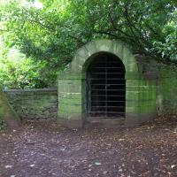
I was 99% sure this was an ice house, and a quick search finds a confirmation from Weird Bristol.
Nipping Up the Zig Zag to the Shops
19 Aug 2023
It's been a long while since I did one of these walks.
I'm thinking of finishing up the project by walking one or two last bits of road, thus being able to declare with all honesty that I've done my best to walk every public road within my mile (and quite a few alleyways besides.) As a prelude, and just because I felt like it, I decided to drag out the camera and GPS on this little wander to the local shops.
My exercise for the day is to be a short sharp shock: first we descend down Hinton Lane to the Hotwell Road, then I'm going to ascend the Zig Zag, and possibly die in the process. My fitness has suffered recently because although I've been keeping my step count up it's mostly been on the fairly flat commute to work and back, so hills are coming as a bit of a shock to the system at the moment.