Tagged: brick
Nothing New
02 Dec 2020
This may be the very first time I've gone for a One Mile Matt wander and not actually gone down any new roads, trod any new steps. I just wanted a coffee, frankly, so I went the same old way to Imagine That in the marina and back again.
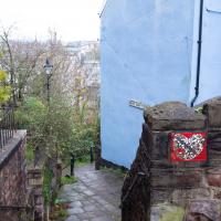
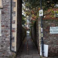
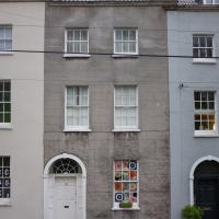
Cliftonwood and a Secret Garden
03 Dec 2020
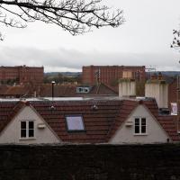
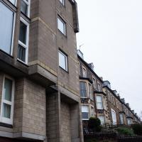
I love the isolation of Cliftonwood -- the geography of it, with its solid boundary of Clifton Vale to the west and Jacob's Wells Road to the east mean that you tend not to be in Cliftonwood unless you've got a reason to be there. It's not a cut-through to anywhere, at least not from side-to-side, and you can only really exit to the south on foot.
I sense that I'd be happy living in Cliftonwood -- like my bit of Hotwells, it's a quiet little area with a sort of quirky feel to it. Plus it contributes the colourful houses that are the backdrop of about half of all Bristol postcards ever made :)
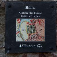
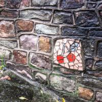
I found the "secret" garden especially interesting, just for the fact that it really does feel quite secret, despite the obvious name on the gate. I've lived a half-mile from it for twenty years and I don't think I've ever noticed it before, despite exploring the area a few times.
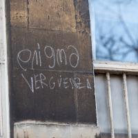
Something about this seems Greek, possibly because a Greek capital Rho looks like an English "P".
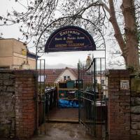
I did once have a beer in the garden when it was The Spring Gardens. It became La Demi Lune for a while, from what I remember, then shut down. Having just Googled it, before it was the Spring Gardens apparently it was "Durty Nelly's"!
From what I can see on Street View it's just flats now, but I can't be sure without going and having a proper look around the front. Maybe next time...

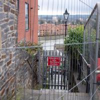
Strangers' Burial Ground
04 Dec 2020
I tried to find the Strangers' Burial Ground the last time was up in Clifton, but I'd not realised that Lower Clifton Hill continues further on after the turning with Constitution Hill. Sadly it was chained shut, but it still looks beautifully-maintained, perhaps by the same man referenced by this story from John Hodgson, which helped me find it. Apparently Thomas Beddoes is buried here.
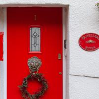
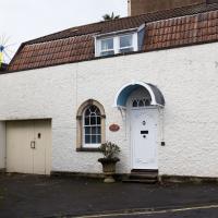
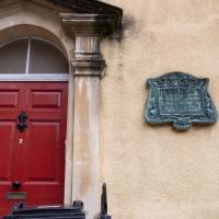
This seems to be a side-door into 1 Bellevue, rather than being 1 Constitution Hill, but I suppose the house could have been subdivided so that it's now both. Either way, it's very red.
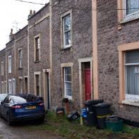
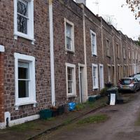
More Cliftonwood
05 Dec 2020
Back to Cliftonwood for a wander that included some of the belle views of Bellevue Crescent and other bits of the easternmost part. Highlights included watching someone bump-starting an elderly Nissan Micra in the narrow confines of Bellevue Crescent.
Part of the wall has collapsed. It seems like the Council don't want to do anything about it until they can figure out the exact ownership, though local residents are urging them to fix it and worry about recovering money from anyone who might be responsible for some of the repair costs later.
Alma Vale
06 Dec 2020
I wasn't really feeling it when I set out today, on my first car-assisted wander. By the time I'd parked on Alma Vale Road in Clifton it was just starting to rain and I picked my way about in quite a desultory way. It felt strange, as I was very familiar with the area because I'd walked through it hundreds of times when I worked at the top of Whiteladies Road, and used to walk up the hill from Hotwells and through Clifton to get there, and back again, every day.
Then a complete coincidence seemed to make the change I'd been hoping for. I was standing taking a photo of Christ in the front garden of All Saints church when a couple of people walked out of the front door. I got talking with a lady I took to be part of the ministerial team, who invited me to come in and look around—something I'd always wanted to do on the morning commute. (I think we connected a bit when I recognised the name John Piper, who did the amazing windows—I learned about him while I was at Warwick, through his connections to Coventry Cathedral.
I left with much more of a spring in my step, wandered around the area a bit more, finally working out that the tennis courts I used to pass every morning are those of Clifton Lawn Tennis Club, and finally grabbing an excellent Hungarian sausage hot dog from the Budapest Cafe. I feel a lot better now than I did before I went out.
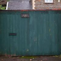
This green door and the lamp post just out of sight to the right are my mental markers for diving down the alleyway that leads through to Thorndale. They're direclty opposite. It's easy to miss otherwise.
Mark's Bread
07 Dec 2020
I realised that if Hopper Coffee in Greville Smyth Park was in reach during my lunch hour, then perhaps Mark's Bread at the end of North Street would be do-able, too. And I was right. I also managed to cross Clift Road, with its pretty gable bargeboards, off my list, and encounter a dapper gent walking his dogs while playing loud jazz music from somewhere under his jacket. That's North Street for you.
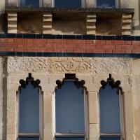
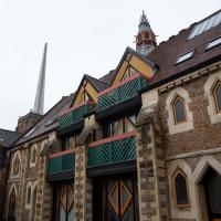
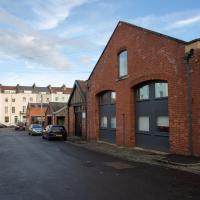
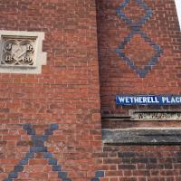
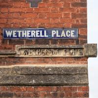
Gothic Revival
08 Dec 2020
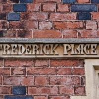
I had a chance to dash down a few new roads during my lunchtime jaunt today. My favourite feature was 7 Wetherell Place, at the corner of Frederick Place, one street behind the University of Bristol Students' Union building. Apparently I'm a sucker for gothic revival, which seems appropriate for this little project, which is reviving my interest in the local area.
The listing starts "1860. By JA Hansom. For himself".
This is one of those streets you don't really go down unless you have a reason, which is why I always forget there's a busy garage right here. The nearest building seems to be offices, but I don't know if they're connected to the garage.
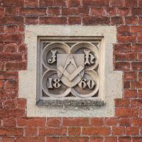
Apparently he built this gothic revival pile (which I love) for himself. Presumably he was a stonemason.
Bedminster, Ashton, Ashton Court sunset walk
12 Dec 2020
A walk with Sarah focusing on Ashton and the surrounds, taken on a day with really nice light around sunset. Just what I needed.
Rainy Clifton
13 Dec 2020
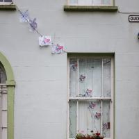
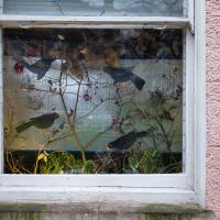
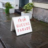
A long walk around Cliftonwood and Clifton with my friend Lisa, taking in some of the 12 Days of Christmas display at Queens Parade, picking up a take-away coffee from Pinkmans of Park Street, and poking our heads up against the glass of SS Peter and Paul Catholic Cathedral.
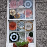
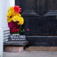
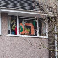
This house in Queens Parade had chosen not to take part in the Twelve Days theme, but nevertheless had an interesting display.
Cliftonwood and Clifton Village Lunchtime Stroll
14 Dec 2020
The lunchtime walk has been feeling a bit of a chore lately, especially as I only have an hour and have to keep a mental watch out for my "bingo" point or risk being late back. Today I went for a deliberately brief local walk and got home in time to have lunch on my sofa rather than while I was back at work.
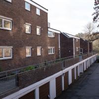
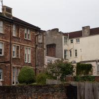
It's interesting filling in the gaps in my Clifton Village knowledge, especially starting to "see" the bits I can't see, the negative spaces. The size of both Fosseway Court and the Bishop's House gardens (check out the latter on Google Maps for an idea) are both something I've noticed by just getting to know the areas around them. I may also have to walk into the driveway of the very well-hidden Nuffield hospital to get an idea of how big it is.
None of those are anything compared to the trick of hiding the gargantuan public school that is Queen Elizabeth's Hospital so well that I keep on forgetting it's there, until a glimpse of it from somewhere like Lower Clifton Hill reminds me about it, of course...
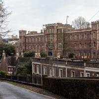
Queen Elizabeth's Hospital is not, of course, a hospital. That would be too simple. Founded (like Christ's Hospital) in the 16th century—1586 to be precise—it was and remains an independent school.
I'm always surprised how easy it is not to notice this giant grand building, set back and screened off by a tall wall along most of its border along Jacobs Wells Road, and backing onto the park at Brandon Hill.