Tagged: brickwork
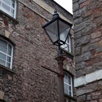
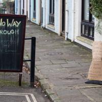
I have no idea how anyone managed to smack this street furniture so hard, or what direction they came from to do it. It's a pretty straight 30mph road right there, and this is only one side of the dual carriageway. Never seen so much as a near-miss there.
Underpass
25 Nov 2020
A quick lunchtime jaunt for coffee. I've often wondered about the dots on the wall of the underpass. Apparently they're not intelligible Braille. Maybe it's Marain :D
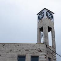
One of the other sides of this clock is very broken. At least these two show the same time, even if they're wrong. By my calculation, this broken clock is right six times per day.
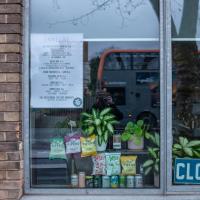
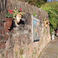
At least someone's still watering the plethrora of plants that are arranged in Spike Island cafe's windows.
And Back Down the Hill from the Flu Jab
21 Nov 2020
This is my return from getting my annual flu jab at Christ Church, as explained in more detail in my wander up the hill.
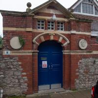
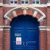
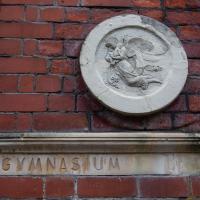
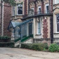
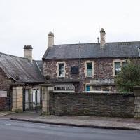
This is now the Bristol School of Dancing. Their website says:
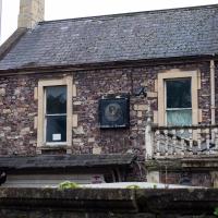
Built in 1893, it stands in the garden of 20 Vyvyan Terrace and it is rumoured that it was once a Swedish diplomatic building that contained a gymnasium. This is probably why on either side of the main entrance the words “Swedish Gymnasium” are carved.
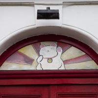
The Maneki-neko (招き猫, lit. 'beckoning cat') is a common Japanese figurine which is often believed to bring good luck to the owner.
Up for the flu jab
21 Nov 2020
A trip up the hill to get my winter flu jab. I'm not sure I really needed it this year, what with avoiding Covid—I haven't had so much as a sniffle in more than a year—but seeing as they offered... Instead of the doctor's surgery on Pembroke Road, they'd taken over Christ Church, presumably to give more room and ventilation for the necessary social distancing at the moment. As usual, it was their typically efficient operation, and I was in and out in about three minutes.
On the way there and back I snapped as much as I could, but I wanted to be home in time for the first online Times Crossword Championship. As it turned out, I needn't have bothered, as the technology at the Times couldn't keep up with the demand from competitors, and their system just collapsed under the weight of page-views. They tried again the day after, and it collapsed just as badly. Maybe next year...
This wander is split into two parts, as I turned my tech off to go into Christ Church for my jab. The walk home can be found over here.
Avoiding the Accounts
26 Nov 2020
I took the day off my day job to do my accounts—or at least do enough bookkeeping to send them to my accountant. I hate doing the books. I woke up late, tired and with a headache and decided to bunk off for a walk around Cliftonwood, Clifton Village and Clifton instead, taking in a couple of good coffees along the way. Thanks, Foliage Café, and Twelve for the flat whites.
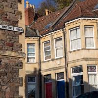
From what I've worked out so far, the use of St Vincent's name around so much of Bristol, especially Hotwells and Clifton, dervies from the ancient hermitage and chapel dedicated to St Vincent of Saragossa, which (possibly) was in Ghyston’s Cave, the cave in the rock face now accessible through a tunnel from the observatory, but at the time only by a perilous cliff climb (which I can only presume is what made it so appropriate for a hermitage.)
Why St Vincent of Saragossa? Anthony Adolph says:
It should be explained that the connection of Bristol with the Iberian wine trade led, in the Middle Ages, to Bristol’s importing of the cult of Lisbon’s patron saint, Vincent.
I have done very little real research on this so far, though, so don't take my word for any of it. I am not a historian, etc.
A rubai from The Rubaiyat of Omar Khayyam:
Perplext no more with Human or Divine,
To-morrow's tangle to the winds resign,
And lose your fingers in the tresses of
The Cypress — slender Minister of Wine.
The Long Lunchtime at the End of the World
27 Nov 2020
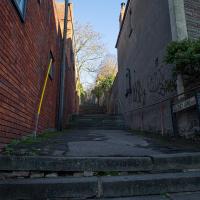
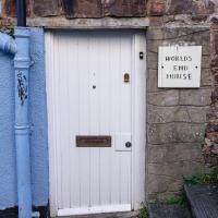
I took an extra-long break at lunchtime today as I'd taken the day off my normal day-job to do the accounts for my previous side-job, which is still generating paperwork, though not much in the way of money. This took me through some undiscovered bits of Cliftonwood, including Worlds End Lane, which unexpectedly leads to White Hart Steps. That's certainly not where I expected the end of the world to lead to...
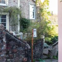
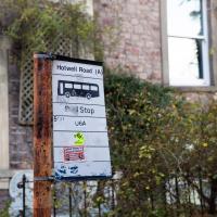
You'll have trouble getting the bus up the White Hart steps.
Edit to add: According to my friend Jess (a very reliable source of information about Cliftonwood who's quoted in this Bristol Post article about the bus stop) it was put in 15 years ago as part of the West Bristol Arts Trail...
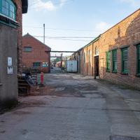
Well, I think bits of it are, anyway. There's one along this stretch of road, and Google Maps seems to indicate that the buildings on the left might be Thomas Ware & Sons, tanners.
A long ramble, starting with trying to find the Hot Well of Hotwells and leading up the side of the Avon Gorge to the Downs and then through Clifton for coffee.
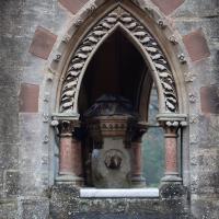
I tried it. It didn't work. No drinking fountain I've ever tried in Bristol has ever worked. It seems like such a shame. I'd use 'em.
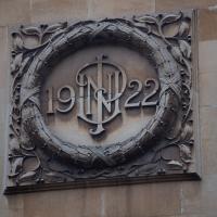
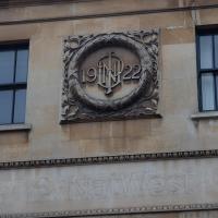
Not sure whose initials those are, but this is The Ivy, Clifton, formely NatWest bank, on the corner of The Mall and Caledonia Place. The listing says of 32-44 Caledonia Place, "he left-hand end pair rebuilt as one in 1922 to form a bank", and mentions 'the monogram "NUP"'
Ten O'Clock Shop and Can't Dance Coffee
30 Nov 2020
I had to return a faulty AirPod Pro to Apple (there's a first-world problem!) so I just took a quick trip up the hill to the nearest UPS drop-off point, The Ten O'Clock Shop, which is famously open until 11pm. Unfortunately it's a fairly cramped little place and neither of the staff were wearing masks, so I made it a very quick drop indeed and got out of there as quickly as I could.
I grabbed a quick coffee from Can't Dance, a stall that's—as of yesterday—in a tiny converted cargo container on the edge of Victoria Square; up until this week they were running from a little trike parked in the same place. Hopefully the new premises will let them see out the winter without worrying quite so much about the weather.
I tried to fit in a few extra streets from the surrounding area on my there and back, but that was basically my wander today: a quick little shopping trip.
I'm not sure I've ever noticed this clock before. It is, as with many Bristol clocks, non-functional.
Fruitless Coffee Excursion
01 Dec 2020
Unfortunately by the time I got to Greville Smyth Park I was already about halfway through my lunch-hour, and the queue was too long to wait to actually get a coffee. Is that a fruitless excursion? Presumably a coffee bean is technically a fruit...
This kind of vague musing was sadly overshadowed by my delay at Ashton Avenue Bridge on the way back, where someone—hopefully still a someone, rather than a body—was being stretchered up the bank of the river, presumably having just been rescued from the water. As I made my way home the long way around, avoiding the cordoned-off area at the back of the CREATE centre and its car park, I saw an ambulance haring across the Plimsoll Bridge, siren running, presumably on its way to the BRI. I'd like to think that was a good sign.
Nothing New
02 Dec 2020
This may be the very first time I've gone for a One Mile Matt wander and not actually gone down any new roads, trod any new steps. I just wanted a coffee, frankly, so I went the same old way to Imagine That in the marina and back again.
