Tagged: mixed-use
A Day Off Wander in Clifton
26 Feb 2021
I'm on the first day of a long weekend, and I certainly picked the right one for it. This may be the first proper spring-like day of the year in Bristol; it was glorious.
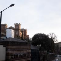
I headed up to Clifton, around the area where I got my Covid vaccine jab the other day, to knock off a few remaining roads in that area and because it would be good exercise for an extended lunchtime walk.
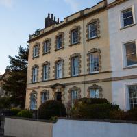
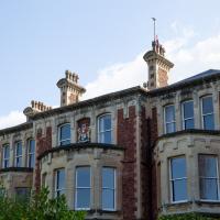
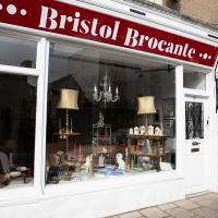
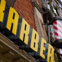
Along the way I saw some very Clifton sights, including an Aston Martin, some Jacobethan architecture, and some private college sports grounds. Mostly, though, I just enjoyed the sunshine, and took every opportunity I could to snap views across the city.
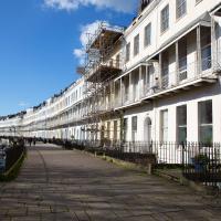
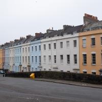
Given the number of houses in the road, there's normally some scaffolding going on at one place or other on the crescent.
Harbour Circumnavigation
01 Mar 2021
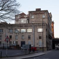
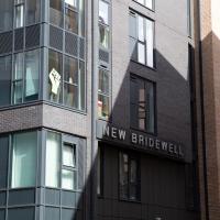
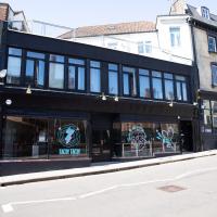
Normally I don't have enough time in my lunch hour to get all the way around the harbourside. This is a shame, as Wapping Wharf is a great place to get coffee and a snack, but it's pretty much diametrically (perimetrically?) opposite me on the harbour. Today I had the day off, so I decided to go and knock off a few streets around Anchor Road that I'd not covered, as well as visiting the site of the Read Dispensary (well, one of them) and dropping into Mokoko for one of their astounding almond croissants. From there I came back along the south side, checking out the views from as much of the Chocolate Path as you can venture down at the moment, and swapping from Cumberland Road to Coronation Road at Vauxhall Bridge.
There's a lot of meh photos on this walk—my chief output from this project could be politely described as "record shots"—but a few turned out well, especially those of Vauxhall Bridge from the Chocolate Path, which reminded me how much of a loss the current closure of the Chocolate Path is to walkers and cyclists in Bristol.
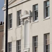
This is the interesting building next door to the Read Dispensary as-was. I've always loved this window. Can't find anything out about from a quick search, though.
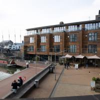
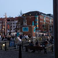
Broken Dock is the name of one of the restaurants down there, but also seems to be the name for this little harbour inlet in general, if the Bristol Post's many articles about how people keep gathering in illegally large numbers here are anything to go by. The local residents seem a bit fed up with everyone piling up here and then going to the loo all over the place because there aren't any toilets open anywhere due to the pandemic. Nice. It was fairly quiet on this weekday afternoon, which is why I chose today for a round-the-harbourside walk.
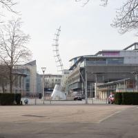
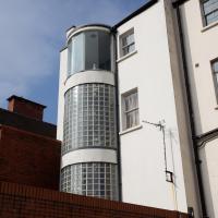
As well as being public art, the Telespine is a mobile phone mast, originally built for Orange. I'm assuming it's still functional and is now working for EE.
Clifton Down Dash
02 Mar 2021
A quick wander up to Clifton Village to wander down a path or two either around Observatory Road that I'd missed out previously. On the way around I took a moment to take in the incongruous 11 Windsor Terrace, smiled at a couple of mounted police, stopped to smell the crocuses, grabbed a coffee in Foliage and came home through the Polygon accompanied by the delightful Spring sound of a woodchipper running at full blast. Nice.
I headed to Bedminster to do a crossword with my support bubble today. On the way I delved into a couple of bits of Hotwells history, first of all snapping a "now" shot to go with a historical photo of Holy Trinity I happened across recently, and second of all to snap the Britannia Buildings.
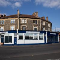
The Britannia Buildings are a little strip of offices on a corner of the Hotwell Road. They've mostly been the headquarters of a cleaning company for years, but I've often wondered what this distinctive curve of offices, its ground floor standing proudly out from the upper floors, used to be. Well, after my last wander, where I poked about the landing stage just down the road, I found out! Researching the paddleboat company P&A Campbell I came across this nugget in The A-Z of Curious Bristol, by Maurice Fells (£):
The firm of P & A Campbell was the main steamer operator in the Bristol Channel, with its local headquarters in offices close to the Hotwells pier and overlooking the harbour at the Cumberland Basin. Campbell's named their offices Britannia Buildings, after one of the ships in their White Funnel Fleet.
So! Turns out the Britannia Buildings were named after a paddle steamer—you can see some pictures of Britannia here.
In related news, I've now bought three of Maurice Fells' local history books, and they were hand-delivered by the author on Sunday, a half-hour after I ordered them online (through a message exchange on Nextdoor!) Not even Amazon Prime has managed to deliver me anything that quickly...
Since setting up a search for Hotwells on eBay I've mostly managed to restrain myself from buying much (or in one case, was outbid, luckily for my finances.) However, I couldn't resist a 1902 flyer for a singalong at the Terrett Memorial Hall, which would have stood five minutes' walk from my flat, overlooking Howard's Lock.
I've found out a fair bit about this non-denominational seaman's mission, including tracking down both a Loxton drawing and an aerial photo of it. The main thing that's eluded me, ironically enough, is finding out who Terrett was, so as a Memorial Hall it didn't do a very good job 😀.
EDIT: Ah! Did a little more digging and found that the Bristol Archives has a Bristol Dock Company document on file called "William Terrett, Esq.; corresp. etc. re proposed erection of a Mission Hall at Cumberland Basin, 1892", so that might be worth a look once the Archives are properly open again. Given that:
Sarah Terrett died suddenly on 25 November 1889, aged 53, after speaking at a meeting of the White Ribbon Army, the temperance organization she had founded in 1878. Following her death many people sent letters of sympathy to her bereaved husband, William. One of these, from the Rev. W. F. James, a minister of the Bible Christians, makes for especially interesting reading. The Bible Christian denomination, to which Sarah and William belonged, was one of the smaller Methodist connexions, and had its heartland in rural Devon, the area where she had grown up. James recalled the hospitality he enjoyed when visiting the Terretts’ home, Church House, in Bedminster, south Bristol...
...I wonder if William Terrett built the hall in memory of his late wife. They were clearly just the kind of temperance movement people who would've founded a seaman's mission to get people together to have a nice non-alcoholic singsong rather than a night out on the tiles.
Anyway. This walk to grab a coffee from Hopper Coffee in Greville Smyth Park was mostly an excuse to post the leaflet, a few other things I found related to it, and some pictures of how the site looks now. I would suggest that the present day is not an improvement.
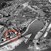
I was fairly sure the Terrett Memorial Hall would have faced Entrance Lock—after all, they'd be wanting to drum up trade from sailors!—and I eventually came across an aerial photo from 1934 on the ever-helpful Bristol City Docks website's Cumberland Basin page that confirmed my hunch.
I haven't had the time to find out when it was demolished, but the whole Cumberland Basin Flyover System (which you can see being built on that web page) had replaced this area by the mid-1960s.
This is photo PBA487 on that page, I think courtesy Bristol Museums Galleries and Archives.
Harbourside Milestone
17 Mar 2021
The other day I realised (hello, Maggie!) that my next walk would be my hundredth, and that I'd done 393.4km so far. I figured it would be nice to get to 100 walks and 400km on the same walk, so I went for a nice long harbourside wander after work, rather than dashing out at lunchtime. As it turned out, we're just coming up to the time of year where I can leave the house at 5:30 in the evening and there's still just enough light to take photos by the time I've made it around the harbourside. Though only just, and mostly because I've got a full-frame camera that's not bad in low light...
Still, the evening light made a lovely change, and some of the photos turned out to be pretty good photos per se, rather than just record shots of my walk. I'm looking forward to more evening walks like this as summer approaches.
On the way around this evening I wandered through one of the oldest bits of the city to extend my walk and snapped some interesting bits of architecture, including an NCP car park(!) and a nighttime shot of one of my favourite subjects, the clock tower at the Albion dockyard.
No, it's not a massively distorting wide-angle lens I'm using, that's just not ninety degrees!
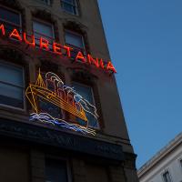
Some of the furnishings from the RMS Mauretania were installed in a bar/restaurant complex at the bottom of Park Street... The lounge bar was the library with mahogany panelling: above the first-class Grand Saloon with French-style gilding overlooks Frog Lane. The neon sign on the south wall still advertises the "Mauretania": installed in 1938 this was the first moving neon sign in Bristol. — Mauretania Public House, Wikipedia
I'd heard her approach, but I hadn't expected her to pose for me. Those are actually peace-style "V" signs she's flicking, believe it or not :)
I'm not sure about the signage here. It doesn't seem that appealing. On the other hand, if this place was in Crete (where my parents live) I'd have no problem believe that the food was amazing. Strange thing, context.
I wasn't going to take a very long walk on this nice spring evening; it just happened. I was going to knock off a path or two on Brandon Hill, home over centuries to hermits and windmills, cannons and Chartists, and then just wander home, stopping only to fill up my milk bottle at the vending machine in the Pump House car park.
However, when I heard a distant gas burner I stayed on the hill long enough to see if I could get a decent photo of both the hot air balloon drifting over with Cabot Tower in the same frame (spoiler: I couldn't. And only having the fixed-focal-length Fuji with me didn't help) and then, on the way home, bumped into my "support bubble", Sarah and Vik, and extended my walk even further do creep carefully down the slipway next to the old paddle steamer landing stage and get some photos from its furthest extreme during a very low tide...
I got interested in Bristol's medieval water supplies after poking around near Jacobs Wells Road and Brandon Hill. It was during that research I found out about a pipe that's still there today, and, as far as I know, still actually functioning, that was originally commissioned by Carmelite monks in the 13th century. They wanted a supply of spring water from Brandon Hill to their priory on the site of what's now the Bristol Beacon—Colston Hall, as-was. It was created around 1267, and later, in 1376, extended generously with an extra "feather" pipe to St John's On The Wall, giving the pipework its modern name of "St John's Conduit".
St John's on the Wall is still there, guarding the remaining city gate at the end of Broad Street, and the outlet tap area was recently refurbished. It doesn't run continuously now, like it did when I first moved to Bristol and worked at the end of Broad Street, in the Everard Building, but I believe the pipe still functions. One day I'd like to see that tap running...
There are a few links on the web about the pipe, but by far the best thing to do is to watch this short and fascinating 1970s TV documentary called The Hidden Source, which has some footage of the actual pipe and also lots of fantastic general footage of Bristol in the seventies.
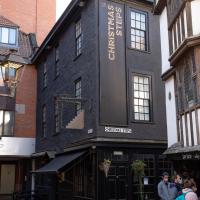
On my walk today I was actually just going to the building society in town, but I decided to trace some of the route of the Carmelite pipe, including visiting streets it runs under, like Park Street, Christmas Street, and, of course, Pipe Lane. I also went a bit out of my way to check out St James' Priory, the oldest building in Bristol, seeing as it was just around the corner from the building society.
There are far too many pictures from this walk, and my feet are now quite sore, because it was a long one. But I enjoyed it.
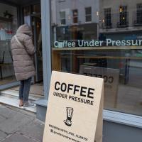
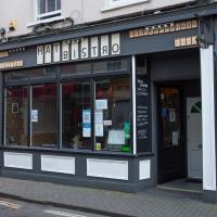
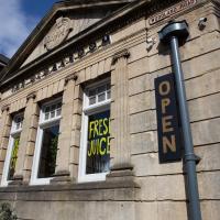
Never tried them before, but they did me a great flat white and I'll be going back.
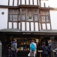
When I was working at NatWest and livinng in Redland I'd often walk through here on the way to and from work. Back then this was an excellent fish & chip shop. Now it's Ahh Toots, who make amazing cakes. They used to be in St Nick's Market—Tam from Ahh Toots took over the Sourdough Cafe from a friend of mine.
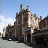
The building itself is fascinating: Part of St Bartholomew's Hospital, a medieval almshouse founded in 1240, It's also been home to two schools that are still going elsehwere in Bristol: QEH—Queen Elizabeth's Hospital—which now occupies a Victorian gothic revival pile on Jacobs Wells Road, and Bristol Grammar School, whose "modern" (Victorian gothic perpendicular) building is between Park Row and the main University of Bristol campus, and which by coincidence I'm going to explore tomorrow...
I bumped into my friend Lisa in town during yesterday's wander, and we decided to have a wander today, too. We managed quite a long ramble, starting up through Clifton and nipping down Park Row to investigate the two tower blocks I'd noticed popping up behind Park Street yesterday, then took in a few roads I'd not managed to get to before, including cutting through the grounds of Bristol Grammar School.
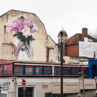
A lot going on here. The little orange thing that looks like a cross between a litter bin and a buoy is the heat vent for the electrical substation that's below the double metal doors in the pavement to its left. Then in the middle is an Edwardian toilet converted to a cafe, though the last time I was in there it was hosting an art exhibition. Finally on the right is a mural that I completely missed when taking this photo because I was concentrating so much on the old lavvy!
An Evening Wander to the Gallows
06 Apr 2021
I'd originally intended just to pop up to the area around Alma Road, where I'd missed a few streets on earlier wanders. It was such a nice evening, though, I decided to extend my walk up to the very top of Pembroke Road, just outside my one mile radius, to take a few snaps of something intriguing I'd found in my researches.
I've driven, walked and jogged past the little triangle of land at the top of Pembroke road a great deal in my time in Bristol, but I didn't know that it used to be the site of a gibbet, in fact that the road itself there used to be called Gallows Acre Lane. According to the Durdham Down history trail, by Francis Greenacre (an excellent name for a Downs researcher!) among other sources:
...it was below this quarry near the top of Pembroke Road, once called Gallows Acre Lane, that a gibbet stood. It was sometimes occupied by those who had committed robberies on the Downs and was last used in 1783 to hang Shenkin Protheroe for the murder of a drover. Stories quickly spread that he descended from the gibbet at midnight every night and stalked through Clifton. Such was the alarm that his body was cut down and buried.
Also very close to this little triangle of land was one of the gates of the extensive turnpike system...
Anyway. Along the way I encountered a wooden tortoise and a real squirrel, among other things. It was a good walk, and more light in the evenings means I can move my wanders out of the ticking countdown clock of work lunch-hours and be a bit more leisurely.
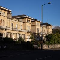
I came across this photo of 5 Wellington Terrace back when it was the Gaping Goose, two doors down from the Portcullis, and decided to snap the site as it is today. Interesting comparison!
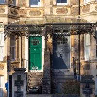
"I need a design for our front door." "Tell you what, how about we just stretch next door's in Photoshop?"
Both the left-hand and right-hand pairs get similar listings, unsurprisingly. Attached houses, c1850.
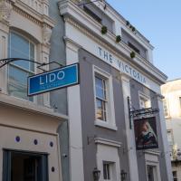
The Lido, as once saved by Dorothy Brown, the tireless conservationist whose plaque we saw earlier.