Tagged: monochrome
Victoria Square Underpass
06 May 2021
I'm meant to be taking a little break from this project, but in my Victoria Square researches after my last walk I noticed a curiosity I wanted to investigate. The community layer on Know Your Place has a single photograph captioned, "The remains of an 'underpass' in Victoria Square".
Looking back through the maps, I could see that there really did used to be an underpass across what used to be Birdcage Walk. I can only guess that it was there to join the two halves of the square's private garden that used to be separated by tall railings that were taken away during WWII. Maybe it was a landscaping curiosity, maybe it was just to save them having to un-lock and re-lock two gates and risk mixing with the hoi polloi on the public path in the middle...
Anyway. Intrigued, I popped up to Clifton Village this lunchtime for a post-voting coffee, and on the way examined the remains of the underpass—still there, but only if you know what you're looking for, I'd say—and also visited a tiny little road with a cottage and a townhouse I'd never seen before, just off Clifton Hill, and got distracted by wandering the little garden with the war memorial in St Andrew's churchyard just because the gate happened to be open.
EDIT: Aha! Found this snippet when I was researching something completely different, of course. From the ever-helpful CHIS website:
When there were railings all round the garden and down the central path, in order that the children could play together in either garden there was a tunnel for them to go through. This was filled in during the 1970s but almost at the south east end of the path if one looks over the low wall the top of the arches can still be seen.
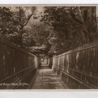
Before WWII, you can see why one might have wanted an underpass to cross between the two halves of the private garden on either side of Birdcage Walk.
Via Vaughan Postcard Collection, Bristol Archives.
Coffee, Coronation and Clift House Road
28 May 2021
Another dash to Greville Smyth Park for a coffee from Rich at Hopper, but at least this time I managed to divert a bit and knock off a small section of Cumberland Road I'd managed to miss on previous excursions. Along the way I muse on a strange residence in between a warehouse and a tannery, and wonder if the Mayor might be deliberately letting the Cumberland Road Flyover area go to seed...
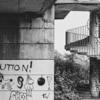
Though originally it was a revAlution, it seems. I think they missed a chance to turn the "A" into the anarchy symbol, which would have styled it out nicely...
I managed to knock off a reasonable chunk of the roads I had left to walk around the University at the north-eastern extremity of my mile on this nice sunny walk. As well as being impressed by the number of big townhouses now occupied by various departments, I took some time on my way there to check out a war memorial, and some time on the way back to do a little extra wandering of Berkeley Square.
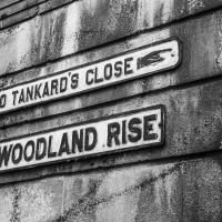
Woodland Road really has got some grand houses, but they've got such big gardens and trees that it's hard to get a decent snap
A Longer-than-it-looks Walk With Lisa
06 Jun 2021
The track on the map doesn't tell the whole story of this walk with Lisa around and about Clifton, Berkeley Square, Brandon Hill and the harbourside, because the batteries on my GPS ran out while we were on the roof of Trenchard Street car park, it seems. Oh well. I think I did most of the area I was interested in finishing off around the University; there were only a few new bits around Brandon Hill that won't be on the track, and I can easily do them again.
Still, technology woes aside it was a nice walk, albeit a bit warm for climbing all those hills, and sat on the harbourside watching the world go by for a while, too. It was good to see the Bristol Ferry Boats carrying people around again, especially.
Library, Bookshop, Coffee
03 Jul 2021
I was headed into town to return RA Gilbert's biography of AE Waite to the library and along the way I noticed that Dreadnought had finished their refurbishment, but wouldn't be open until midday. That left me some time to kill, so I bimbled around the old St Augustine's/Gaunt's area for a while, then headed up Park Street for a coffee and a snack to eat on Brandon Hill before heading home the way I'd came so I could pop in and buy a pamphlet on the Hot Well I'd been interested in for a while.
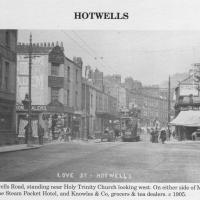
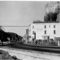
Circa 1905. See the previous photo for the modern-day version. Several of the houses on display were destroyed during the blitz of 24 November, 1940.
I'd never heard of this being called Love Street before. It does seem that it was, though: I just searched through all the various digital research materials I've gathered during this project and found this tidbit in A Bristol Miscellany:
It is proposed to drain the whole of this district by means of a low level sewer commencing at the bottom of Woodwelllane or Jacobs Wells road nearly opposite Woodwell crescent passing along the whole length of the Hotwell road and Love street to Dowry square continuing along in front of Dowry Parade and the Gloster Hotel passing the bottom of Granby Hill in front of Ashton place to Saint Vincent's Parade at which point it will receive the sewage from the Royal York Crescent, the West Mall and Caledonia Place, from which point it will continue along in front of Hotwell House underneath the rocks to the towing path in front of Point House at the Round Point to the present outlet of the High Level Sewer District being about 1,100 yards below the Hotwell House.
...but no other mentions than that one. Looking around the web, I can see a few more references, including this delightful business card for Hotwells gardener John Waldron.
I did idly wonder if "Love Street" might've been a euphemism for something, at some point? There were an awful lot of sailors coming off boats nearby! But perhaps it was simply a nice name for a nice stretch of road...
Photo from Hotwells and the City Docks, ISBN 9781899388288
A Long Wander Of Miscellany and Magick
08 Aug 2021
This was a wide-ranging wander. I started off crossing the river to Bedminster, to walk a single little cul-de-sac, Hardy Avenue, that I'd managed to miss on at least one previous walk. Then, pausing only to explore a few back alleyways, I headed for a few destinations related mostly by the Hughes family, who I've been researching a little as part of background for a possible novel, as several of them were involved in the Stella Matutina.
However, mostly it's the artistic side of the family I wanted to explore today, as that's where most of their public history lies (as you might expect, there's often not much in the public record about the workings of an occult organisation.) First I visited College Green, where the façade of the Catch 22 Fish & Chip shop still bears the work of Catherine Edith Hughes. Then I wandered up to the top of Park Street to pop into the Clifton Arts Club's annual exhibition, as Catherine, her half-brother Donald, his wife Hope and at least two other Hugheses were members. Donald was chairman for 40 solid years; Hope was Secretary for eight, and Ellard and Margaret Hughes, two more Hughes siblings, were members along with Catherine.
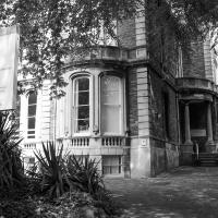
Finally I walked home with a small diversion to Berkeley Square, to confirm the location of Donald Hughes's house by checking for a particular plaque by the front door.
I must admit I'm not entirely sure where all this research is really leading me, but I'm finding it quite interesting to bump across the faint lines of history that link the Hermetic Order of the Golden Dawn, founded in 1888, to modern, quotidian Bristol.
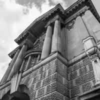
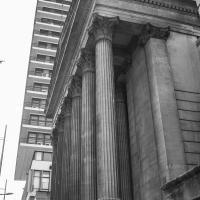
City Museum and Art Gallery. Though when it was donated by Henry Wills (you can just see The Gift of... in the inscription) it was just The Bristol City Art Gallery.
Docks Heritage Weekend Day One
09 Oct 2021
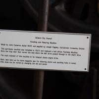
I could spend a lot of time at the Docks Heritage Weekend, poking my nose into industrial places along the harbourside that are usually closed off, but throw open their doors once a year to show off a bit of the backstage area of Bristol's floating harbour. In fact, I warn you: the next wander is a long one, and will have quite a few photos.
However, for today's wander, on the Saturday, my friend Lisa needed a shorter walk than our usual long rambles, as she's recovering from an operation and still a little under the weather, so we just wandered into town for some food and back, with me making mental notes of the places I wanted to come back to on the Sunday... We walked through Underfall Yard, along to the L Shed (this is the warehouse next to the M Shed museum, where they still have the kind of fun old industrial stuff that used to be crammed into the M Shed's predecessor, the old Industrial Museum), through the street food market in town to Ahh Toots for cake and then back home. So, still quite a walk, but no hills and not so much of Lisa having to hang around waiting for me to fool around taking photos as usual, at least...
Of course, it's not on the quay any more, because they moved the quay. However, St Mary's Facebook page has at least one picture of it from when this strip of the city centre was still the river.
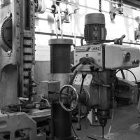
I'm afraid that this is a bit of a badly-curated wander, where I mostly just popped out to find out a little of the history of Underfall Yard and poke around the various open workshops, and, in hindsight, really didn't take pictures in any kind of coherent order. So there's a lot of pictures, but they don't really tell the story that, in hindsight, I seem to have been trying to tell, of the unusual electrical substation in Avon Crescent, the Bristol Electricity that predates the National Grid but is still in use, the history of the hydraulic power house... It's a bit of a mess.
But I suppose sometimes these wanders—always chronologically presented in the order I walked and took photos—simply will sometimes be a bit of a mess. Let's hope you still get something out of it, anyway...
Fresh Fields
17 Oct 2021
For the first time in a while, I had the time and energy to go further afield and knock off some new roads from my "to do" list. I headed through the first Hotwells Festival to Ashton and Bedminster to cross off a few of the suburban roads south of North Street.
First, though, I decided to try to reproduce an old photo of the now-demolished Rownham Hotel just around the corner from where I live...
Here's the view I wanted to take a stab at reproducing. Bristol's Lost Pubs—a great website, which sadly currently seems to be lost itself—said:
Originally known as the Hotwells Tavern. Around 1873 when the entrance to Cumberland Basin was enlarged, a pub named the Rownham Tavern was demolished and Rownham ferry moved downstream towards the Hotwells Tavern, not long afterwards the name was changed to the Rownham Hotel. The pub was removed in 1969 for road Widening.
This particular image is from Brewerypedia; I'm afraid I don't know its original provenance.
A Wide Angle View
30 Oct 2021
I had an unsuccessful wander last week, on Tuesday afternoon: my GPS died within about five minutes of leaving the house, and I didn't notice, plus I found hardly anything I'd been looking for. On the plus side, as I was wandering around Park Street I decided to nip into London Camera Exchange on the offchance they had a secondhand Canon 17-40mm lens. I've been thinking of buying one for around a year, I think.
Long story short: not only did they have one, but due to a mistake with their price labelling which they kindly honoured, I now have a shiny new (to me) wide-angle lens and it cost me less than £300, which is a very good price for one of these in good condition (and including a lens hood.)
So, rather than try to salvage Tuesday's walk, here's a walk where I basically just bimbled up to Clifton Village for a coffee and wandered around taking photos of as many wide views as I could find. I took a lot more photos than these seventeen, but as you might expect, a new lens takes some practice getting used to, so most of them ended up in the "outtakes" pile.
