Tagged: morning
Nothing New
02 Dec 2020
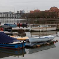
This may be the very first time I've gone for a One Mile Matt wander and not actually gone down any new roads, trod any new steps. I just wanted a coffee, frankly, so I went the same old way to Imagine That in the marina and back again.
Cliftonwood and a Secret Garden
03 Dec 2020
I love the isolation of Cliftonwood -- the geography of it, with its solid boundary of Clifton Vale to the west and Jacob's Wells Road to the east mean that you tend not to be in Cliftonwood unless you've got a reason to be there. It's not a cut-through to anywhere, at least not from side-to-side, and you can only really exit to the south on foot.
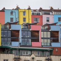
I sense that I'd be happy living in Cliftonwood -- like my bit of Hotwells, it's a quiet little area with a sort of quirky feel to it. Plus it contributes the colourful houses that are the backdrop of about half of all Bristol postcards ever made :)
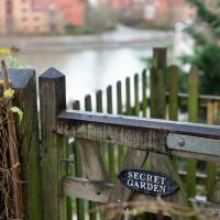
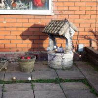
I found the "secret" garden especially interesting, just for the fact that it really does feel quite secret, despite the obvious name on the gate. I've lived a half-mile from it for twenty years and I don't think I've ever noticed it before, despite exploring the area a few times.

More Cliftonwood
05 Dec 2020
Back to Cliftonwood for a wander that included some of the belle views of Bellevue Crescent and other bits of the easternmost part. Highlights included watching someone bump-starting an elderly Nissan Micra in the narrow confines of Bellevue Crescent.
Bedminster, Ashton, Ashton Court sunset walk
12 Dec 2020
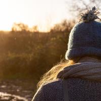
A walk with Sarah focusing on Ashton and the surrounds, taken on a day with really nice light around sunset. Just what I needed.
Drained Basin
15 Dec 2020
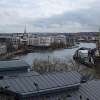
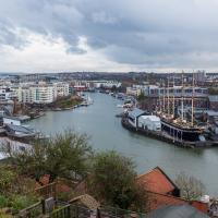
On the down side, I got to Bedminster and found long enough queues at both Mark's Bread and Hopper Coffee that I gave up on the idea of buying a drink and a pasty (from the former) or a mince pie flapjack (from the latter.) On the up side, I got to take some pictures of Cumberland Basin being drained and sluiced out, part of its regular maintenance cycle.
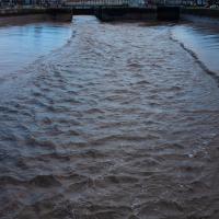
This is the next stage of the Cumberland Basin cleaning cycle. In the earlier pictures, you could see they'd emptied the basin. Now, with the Entrance Lock gates open, they sluice out the basin with an inrush of fresh water. This helps wash out accumulated silt and also freshens the water—it's usually done just before the occasional traithlon that takes place here, otherwise the swimmers would be even more at risk from E. Coli and other things than they are!
Sunday Bedmo
20 Dec 2020
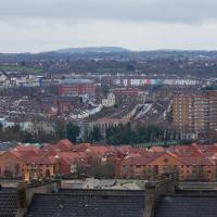
A long meander around bits of Bedminster, from the river to the north to Winterstoke Road to the south, taking a few roads I've seen before, and a few I haven't. The Christmas decorations were an extra bonus.
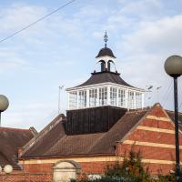
Part of BS3, the Southville Community Centre. Formerly Ashton Park Lower School, built c1895, according to the listing.
Solstice Rain
21 Dec 2020
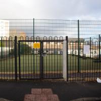
Despite the weather, Sarah and Vik and I wandered around Ashton Court a bit as the sun rose. Not that you could really tell. Sadly, the bit we wanted to watch the sunrise from was closed, because people hadn't been treating the deer with appropriate respect. Ah well, at least it was some exercise.
I went to have a peep at the giant sinkhole that's opened up in Canynge Square—ironically, having recently discovered the gardens were public I'd had the (triangular!) square on my list to re-visit for a few days, but now there's no entrance to the gardens due to the danger. The area was well fenced-off for safety, but I tried to get a couple of photos from behind the barriers.
I also explored the area around Camp Road, an real melange of architectures, one of the most mixed-up areas I've seen in Clifton, in fact, and confirmed my friend Claire's suspicion that an earlier snap of a sign from Manilla Road was in fact for a fire hydrant. Nice.
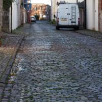
Though those are technically setts rather than cobbles, I think. Not that it makes any difference to the average person.
My historical research took a wander underground recently, partly inspired by the Canynge Square sinkhole, partly by St Vincent's (Ghyston's) cave and its tunnel to the Observatory, and I was surprised to find that there might be an intact tunnel from the Bristol Port Railway and Pier still just sitting there under Bridge Valley Road. A quick search turned up this recent video by an intrepid explorer, so it's definitely still there.
I went looking for the entrances today, and definitely found the south entrance, at the start of the Bridge Valley Path, the footpath that starts with steps at the bottom of Bridge Valley Road. It's easy to miss if you're not looking for it. I think I've figured out where the north entrance is, too, but it was getting dark at that stage and the Portway was still busy enough that crossing the road was still the normal nuisance, so I thought I'd leave further explorations for another day.
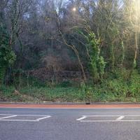
I didn't cross the road to check—it was still quite busy on the Portway and would have been hard to dash across. However, I turned out to be right on later walks; this is the hard-to-spot place where you can cross the road and walk beside wall you can see to the concealed entrace to Portnalls Number One Railway Tunnel.
You can barely make it out in the picture unless you know it's there but theres actually some decaying old steps and a handrail to help you up there from the kerb of the portway, roughly a fifth of the way into the photo from the left-hand side.
Northern Clifton
16 Jan 2021
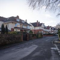
A raggedy wander with my friend Lisa, picking up a few stray streets and venturing only briefly onto Whiteladies Road, where it was too damn busy, given the current pandemic. We retreated fairly quickly. Found a couple of interesting back alleys, and got a very pointed "can I help you?" from a man who was working in his garage in one of the rather run-down garage areas behind some posh houses, and clearly didn't want us just wandering around there.
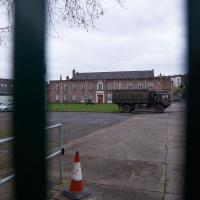
The Artillery Grounds, Whiteladies Road. The Royal Engineers have a troop here as well as the Royal Artillery.