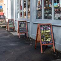
Tagged: public-space
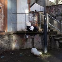
I went to have a peep at the giant sinkhole that's opened up in Canynge Square—ironically, having recently discovered the gardens were public I'd had the (triangular!) square on my list to re-visit for a few days, but now there's no entrance to the gardens due to the danger. The area was well fenced-off for safety, but I tried to get a couple of photos from behind the barriers.
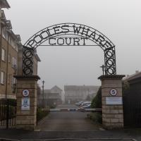
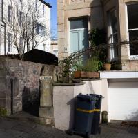
I also explored the area around Camp Road, an real melange of architectures, one of the most mixed-up areas I've seen in Clifton, in fact, and confirmed my friend Claire's suspicion that an earlier snap of a sign from Manilla Road was in fact for a fire hydrant. Nice.
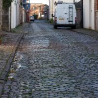
Though those are technically setts rather than cobbles, I think. Not that it makes any difference to the average person.
Tiny Houses, Crocodiles and Views
05 Jan 2021
I didn't really intend to record my walk today, but once I was out and about I couldn't really resist taking some pictures. The sun was lovely, but it was cold...
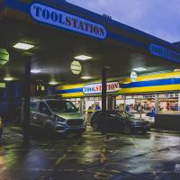
It wasn't there the last time. Gawd knows where it would have come from; it's not like there's a lot of big retail in Hotwells.
Prince's Lane
06 Jan 2021
The International Grotto Directory website says:
Prince’s Lane might have been one of the original ancient tracks from Hotwells to Clifton, in the Avon Gorge. The site later formed part of Rownham Woods which comprised some thirteen acres. By the end of the 18th century and the early 19th century, the Society of Merchant Venturers granted to Samuel Powell a building lease, for The Colonnade (1786), St. Vincent’s Parade (1790), Prince’s Buildings (1796), and Rock House. Rock House is generally considered to be the oldest surviving building associated with the Hotwell (see Chapter 20). John Power conveyed part of the woods to William Watts for the construction of Windsor Terrace (1790-1808).
The above development of the Avon Gorge cleared Rownham Woods, and created a triangle of land on the north side of the gorge, that became enclosed as a result, by Mansion Houses, whose garden walls all entered on to Prince’s Lane. The Lane started at the bottom of the gorge, at the base rock of Windsor Terrace, and came out half way up Sion Hill. It is clearly shown as a public footpath, dotted with trees, in Ashmead’s map of 1828. Some of the gardens were quite steep in parts and therefore, had to be terraced, because of the gradient of the gorge.
I've passed Prince's Lane literally thousands of times in my life, every time I've walked past the Avon Gorge Hotel, which itself started (in 1898) as the Grand Clifton Spa and Hydropathic Institution and pumped water up from the Hot Well for its hydropathic treatments. I've never actually ventured down it until today, or at least nothing like as far down it as I did this afternoon—I may have poked my head around the back of the hotel to see the original pump rooms at some point in the past.
This was a great wander, though it does very much feel like a private road, and frankly I may have been pushing my luck a bit by winding my way between the astoundingly big back gardens of the houses of some presumably very wealthy Cliftonites, but I felt vaguely justified in exploring the history of one of the oldest footpaths in my part of Bristol...
This was a pretty astounding space, by all accounts, in the style of a Georgian "long room" or assembly room, with the added bonus of a fountain of the Hot Well water being pumped up from the spring below. There are some pictures here of the interior.
It seems someone ignominious for it to end up boarded over with cars and portaloos scattered around it.
A Little Local Wander
07 Jan 2021
Which included a literal "local", the Pump House, to try out their shop/deli/cafe. A flat white, some apples and a New York Deli toastie. Eleven quid, mind, but the Pump House was never a cheap pub...
I enjoyed the fog, and wandering down a few more out-of-the-way back alleys and what-have-you on the Hotwell Road.
I'm thinking of getting up early and going for a morning walk tomorrow, weather-depending, but at the moment my motivation to do things like this seems to be much strong in the evenings when I'm just thinking about it rather than in the morning when I actually have to do it. But it's going to be cold, and low tide is quite early, so there's always a chance of getting some footage of the hot well actually being visibly hot; you never know...
It's a private estate, but I figured nobody would object too much if I wandered straight through. I don't push my way into private areas too much on these walks—my intention in the first place was to only walk down public roads—but sometimes my curiosity about a place I've walked past for decades but never set foot on gets the better of me.
It helps, I'm sure, that I'm white, approaching middle age and have a vaguely RP accent. Plus I do my best to look as un-furtive as possible and only wander through private areas in broad daylight and carrying a big obvious camera, which might be helping rather than hindering. In all the years I've been walking around places and poking my nose in I've never been asked to leave anywhere, anyway, so I've been taking that as a sign that my hopefully-repectful approach is working.
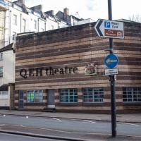
Mirror Maze
10 Jan 2021
Went for a wander with my friend Lisa—the current lockdown rules seem to be that one local walk for exercise per day with a maximum of one person not in one's "bubble" is fine—up to the University of Bristol area right at the edge of my one-mile perimeter to see the Jeppe Hein Mirror Maze, among other things. On the way we mused about Merchant Venturers, the slave and tobacco trades, and dating in the time of Covid.
I don't visit St. Michael's Hill very often these days, but I used to enjoy the electic collection of shops. Not too fond of the current select—I don't have much need for a barbershop and I can't stand bubble tea—but it's nice to see it's still here.
Northern Clifton
16 Jan 2021
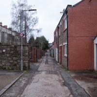
A raggedy wander with my friend Lisa, picking up a few stray streets and venturing only briefly onto Whiteladies Road, where it was too damn busy, given the current pandemic. We retreated fairly quickly. Found a couple of interesting back alleys, and got a very pointed "can I help you?" from a man who was working in his garage in one of the rather run-down garage areas behind some posh houses, and clearly didn't want us just wandering around there.
Snowy Leigh Wander
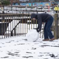
24 Jan 2021
I started this wander with my "support bubble" Sarah and Vik, after Sarah texted me to say "SNOW!" We parted ways on the towpath and I headed up into the bit of Leigh Woods that's not actually the woods—the village-like part in between Leigh Woods and Ashton Court, where I'd noticed on a map a church I'd not seen before. I found St Mary the Virgin and quite a few other things I'd never experienced, despite having walked nearby them many, many times over many years, including a castellated Victorian water tower that's been turned into a house...

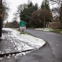
There's something quite pleasant about being able to walk to a different county. I've always liked passing the sign.
In EH Young's Chatterton Square, Rosamund describes a similar escape-to-the-countryside feeling when crossing the Suspension Bridge and heading for "Monks' Pool", which surely must be Abbot's Pool at Abbots Leigh in real life. I've actually swum there, I think the only time I've been "wild swimming" in the UK.
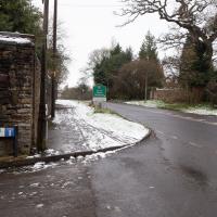
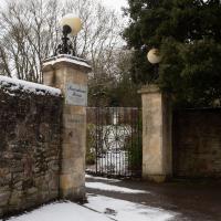
Between them, the old signs on the left and right pillar say ROWNHAM LODGE, but the modern metal sign says Rownham House. Are these the gates for both, or has it changed names?
Jacob's Well Wander
01 Feb 2021
I just wanted to get some exercise, really, so I set out to knock off the lower bit of Jacobs Wells Road that I'd not managed to walk up yet. I set the new signboard that the community association had had erected as my destination, after reading about it on their blog.
As it turned out, I couldn't even read it, as the building that houses the actual Jacob's Well had water flooding out onto the pavement. I wonder if it was actual Jacob's Well water? Have the soles of my walking shoes been mystically blessed now?
You can't see much of the flood in the photos I snapped, but I did shoot a little video, too. Ed on Twitter said:
I spoke to the seller at the time with a view to buying it - I mentioned an old friend who grew up nearby remembers it flooding regularly. He swore blind my friend was wrong.
Greville Smyth Path Completionism
02 Feb 2021
I needed to get away from my desk at lunchtime, and I saw a little segment of path in Greville Smyth Park that needed knocking off my "to walk down" list, so that gave me a target. Sadly Hopper Coffee's little Piaggio Ape wasn't there to sell me a coffee. I hope Rich is all right, not seen him so far this year.
Anyway, a fairly uneventful walk. They're putting new boundary fencing up around Hotwell Primary School (I wandered down Albermarle Row to see what the pneumatic drilling was about), the house on Granby Hill that's been covered in scaffolding and swaddled in protective sheeting has finally been revealed in its cleaned and refurbished form, and they were doing something to the flyover that leads up from the end of the Portway/Hotwell Road to the Plimsoll Bridge. Nothing much else to report.
In Between
06 Feb 2021
A lovely walk in the early spring sunshine with my friend Lisa. We headed directly for Jacobs Wells Road, to start off around the scene of one of our earlier walks, but this time took in Jacobs Wells from QEH upward, stopping to snap some photos of a Bear With Me, some interesting areas between Park Street and Brandon Hill including a peculiarly quiet enclave with a ruined old build I'd never found before, then crossed the Centre to grab take-away pies from Pieminister (I had the Heidi Pie) and head back to my place down the harbourside.
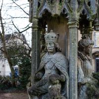
Berkeley Square's garden has the remaining part a replica of the Bristol High Cross. The original, erected in 1373, stood in the centre of Bristol, bearing four monarchs. These extra four were added as a later tier in 1663. Charles here would have faced down Broad Street, with Elizabeth looking down Corn Street.
It was moved in 1733 as it had become an obstruction to "modern" traffic, and a local man complained that it had become unstable and dangerous in high winds. It was taken down and later re-erected on College Green.
Later, prosperous visitors to the Hot Well wanted to promenade across College Green many-abreast and again complained that it was getting in the way. Eventually it was moved to the Stourhead estate in Wiltshire, and it remains there to this day.
This replica was created in the late 1800s and originally erected on College Green (where the statue of Victoria now stands), only to be moved to the middle, and then later taken down when College Green was lowered in 1950 (by around 4' 6", apparently better to set off the new City Hall building), with the upper stage of the cross being relocated here in Berkeley Square.
Quite the history!
Apparently her feast day is 21st January, my birthday. Venerated as foundress of the monastery of Oughter Ard in Ardclough County Kildare, according to Wikipedia. Long way from home.