Tagged: thoroughfare
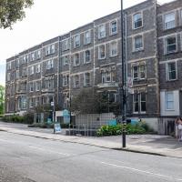
Shop Fronts of Regent Street
22 May 2021
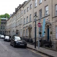
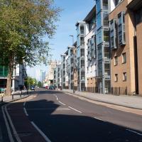
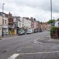
I didn't even think I'd manage to get out today, such was the weather forecast. As it turned out, it's been quite a nice day, and I managed to nip up to Clifton Village to pop to the Post Office. As with my last outing, I decided after snapping one shop-front on Regent Street that I might as well snap the whole row, and muse on a few of them, the only service I really offer over and above Google Street View for a lot of my pictures 😀
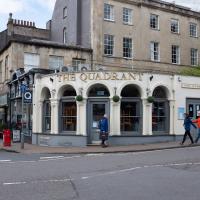
Named after its cross-section from above, I've always assumed. Anyway. That's the last shop on that side of the road, so apart from the one I missed on the starting corner, Awakn, that's snaps of all the shops on the west side of Regent Street for you.
Coffee, Coronation and Clift House Road
28 May 2021
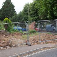
Another dash to Greville Smyth Park for a coffee from Rich at Hopper, but at least this time I managed to divert a bit and knock off a small section of Cumberland Road I'd managed to miss on previous excursions. Along the way I muse on a strange residence in between a warehouse and a tannery, and wonder if the Mayor might be deliberately letting the Cumberland Road Flyover area go to seed...
Another Day, Another 50 Metres
29 May 2021
I met my friends Sarah and Vik at Riverside Garden Centre today; I needed to buy some compost for repotting my wildly-overgrowing aloe vera, and I went a little bit out of my way to knock off a stretch of Ashton Road. It was a pleasant enough walk in the surprisingly warm (and surprising-not-tipping-it-down-on-a-Bank-Holiday-weekend) weather.
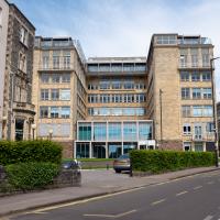
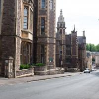
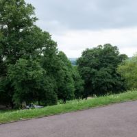
I managed to knock off a reasonable chunk of the roads I had left to walk around the University at the north-eastern extremity of my mile on this nice sunny walk. As well as being impressed by the number of big townhouses now occupied by various departments, I took some time on my way there to check out a war memorial, and some time on the way back to do a little extra wandering of Berkeley Square.
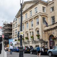
This used to be a big hotel, starting off as a single villa and gradually expanding to a 250-bedroom giant by the 1950s. Currently it's student accommodation. It was run by John Dingle, an English chef who dreamed of being as well-regarded as his French counterparts.
The University is planning on knocking it down and putting up a very modern-looking library. I rather like it.
A Longer-than-it-looks Walk With Lisa
06 Jun 2021
The track on the map doesn't tell the whole story of this walk with Lisa around and about Clifton, Berkeley Square, Brandon Hill and the harbourside, because the batteries on my GPS ran out while we were on the roof of Trenchard Street car park, it seems. Oh well. I think I did most of the area I was interested in finishing off around the University; there were only a few new bits around Brandon Hill that won't be on the track, and I can easily do them again.
Still, technology woes aside it was a nice walk, albeit a bit warm for climbing all those hills, and sat on the harbourside watching the world go by for a while, too. It was good to see the Bristol Ferry Boats carrying people around again, especially.
A Trip to the Library
08 Jun 2021
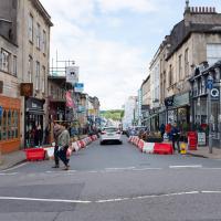
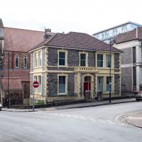
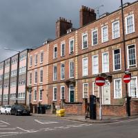
I had to return a book to the library—Ellic Howe's Magicians of the Golden Dawn, very interesting, thanks for asking—so I decided to pick the Central Library as my drop-off point and walk down a segment of Deanery Road that I've surprisingly overlooked so far. In any normal time I'd have been walking to work that way quite often, or heading through at the weekend on the way to do some shopping in the city centre, or for a coffee at St Nick's, but those excursions have been quite thin on the ground for the last year or so, for obvious reasons.
I've never been inside a single building on Deanery Road itself; the Library is technically on College Green and the rest is mostly student accommodation or Bristol College buildings, by the looks of things. It's a fairly mediocre street, used merely to get to other places. (St George's Road, which merges into it, at least has the distinction of several good shops verging from the practical and long-lived car radio fitters to the excellent little Dreadnought Books, sadly currently closed for refurbishment...)
After dropping off my book I came home via the harbourside, the better to enjoy the nice sunny blue skies of the day.
Or rather, a bit of St George's Road. At the corner there, St George's Road actually continues down the side street to the left. The road straight ahead, on the far side of the junction, is actually Deanery Road, which is the bit I've not walked yet.
Leigh Woods Solo
19 Jun 2021
I hadn't really planned to go out for a wander yesterday; I just got the urge and thought "why not?" (Well, the weather forecast was one possible reason, but I managed to avoid the rain, luckily.)
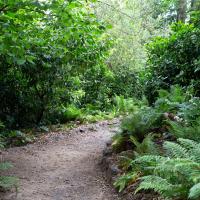
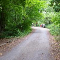
I wanted to finish off the A369—as it turns out I may still have a small section to go, but I've now walked the bulk of it out to my one-mile radius—and also a few random tracks in Leigh Woods. I'm still not really sure that I'm going to walk them all, especially after discovering today that "the map is not the territory" applies even more in the woods, where one of the marked tracks on the map wasn't really that recognisable as a track in real life... I'm glad I'd programmed the route into the GPS in advance!
Anyway. A pleasant enough walk, oddly bookended, photographically at least, by unusual vehicles. Leigh Woods was fairly busy, especially the section I'd chosen, which was positively dripping with teenage schoolkids with rah accents muttering opprobrium about the Duke of Edinburgh. I'm presuming the harsh remarks were more about taking part in his award scheme than the late Consort himself, but I didn't eavesdrop enough to be certain...
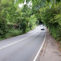
I think it was at this point I decided not to bother walking alongside the road up Rownham Hill and instead divert into Dead Badger's Bottom, which is a prettier alternative. That could be a slogan for this rather mundane strech: "The road up Rownham Hill: less attractive than a dead badger's bottom".
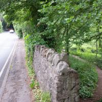
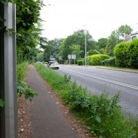
This might explain why I've put off this bit of the A369 for so long. It's mostly just a boring road, desgined for cars.
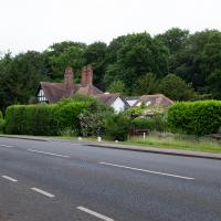
I guess it's more to reduce road noise than privacy, but it seems a shame these lovely-looking houses are all just peeping over giant hedges and walls.
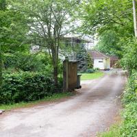
This looks like a road on the map; I just took a photo to remind myself that it's actually someone's driveway so I don't need to go back and walk it :D
Library, Bookshop, Coffee
03 Jul 2021
I was headed into town to return RA Gilbert's biography of AE Waite to the library and along the way I noticed that Dreadnought had finished their refurbishment, but wouldn't be open until midday. That left me some time to kill, so I bimbled around the old St Augustine's/Gaunt's area for a while, then headed up Park Street for a coffee and a snack to eat on Brandon Hill before heading home the way I'd came so I could pop in and buy a pamphlet on the Hot Well I'd been interested in for a while.
These nearest houses were originally called Chapel Row; they're an extension of the western end of Dowry Square, built 1725-1727. Most of the houses in this area were built from the 1720s onwards as the popularity of the Hot Well caused a demand for lodging space closer than College Green, where people generally stayed before.
Number 262 here, the closest, is presumably owned by the same people who own the little plot of ground that's for sale, given that it's basically at the end of their back garden.
It was called Chapel Row because a chapel used to stand in the middle of this terrace, long before Carrick House was built at the far end.
On the ever-helpful Church Crawler you can see some pictures of the original chapel Dowry Chapel, and its successor, St-Andrew-the-Less. St Andrew (-the-Greater) was of course St Andrew's in Clifton Village.
Pevsner apparently said of St-Andrew-the-Less:
is an unforgiveable crime against the architecture of Dowry Square and chapel Row. Of no value either in its own Gothic forms. The spire is particularly nasty.
Personally, I thought it looked rather nice, but I'm used to Bristol's jumbletechture. It definitely lasted until c. 1963 as there's a picture of it around then (in the background of the devastation wrought by the demolition to clear the way for the Cumberland Basin Flyover System) in Hotwells - Spa to Pantomime.
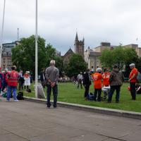
A protest was starting to form on College Green on my way past. As well as this one, there was also a Kill the Bill march that closed the M32 followed by "delirious" England fans having a mass celebration in the city centre, so I'm glad I wandered home pretty early. I wouldn't fancy being the Bristol Waste cleaning team as I write this, on Sunday morning...
A dull alley, but an interesting number plate, at least. It's SSS 666; I've just checked on the DVLA website.
Coffee Under Pressure seems to have a bit of a Greek theme for its food, so I took a slice of spanakopita up to Brandon Hill with my flat white, to cool down in whatever breeze I could find. It's been a muggy weekend in Bristol. There's not exactly a great view from this bench, but I wanted to be a bit further away from the crowds at the top of the hill.
At what was apparently, at some point, called Love Street, but is now just another section of Hotwell Road. See next picture for the c. 1905 view and more information on "Love Street".
A Cliftonwood Revisit with Lisa
10 Jul 2021
Lisa had a couple of hours to spare before going up in a hot air balloon (exciting!) so we went for a quick local walk, revisiting a bit of Cliftonwood we've seen before, exploring the secret garden I'd visited before that I thought she'd enjoy (I didn't take any new photos there) and then pushing on to another garden, Cherry Garden. Last time we passed this way, I'd noticed the gate, but we hadn't gone in as I'd assumed it was private. I'd since found it on CHIS's list of communal gardens in Clifton, so I wanted to have a look inside this time, and try to figure out whether it was private-communal or public, and possibly Council-owned, like several of the other gardens in Clifton.
Okay, I don't think there have actually been any changes to this plot. I just figured I'd snap a different angle on it before it gets turned into a house.
Lunchtime Zig Zag Climb
13 Jul 2021
A snappy little trip up the Zig Zag to the shops. It's a steep old route, the Zig Zag, going from just over river level to about the height of the suspension bridge (101 metres) in a compact switchback of a footpath.
I was too busy struggling to breathe to take many snaps of the actual Zig Zag (I've been trying to make it up all the way without stopping the last few times, but I've not quite managed it yet). I did at least take a few snaps either side on this quick lunchtime jaunt to fetch coffee (Coffee #1) and a sarnie (Parsons) from Clifton Village...
One of many fine old lamp posts in Clifton Village. The late, great Maggie Shapland apparently used to keep an eagle eye on them and make sure they were returned if they were ever carted off for repair. The Clifton Club lurks grandly in the background.
Although you may immediately think "gas lamp", here's an extract from Electric Arc Lamps in Bristol by Peter Lamb, published as a supplement to the Histelec News, newsletter of the Western Power Electricity Historical Society:
In looking at old photographs of late Victorian or early Edwardian scenes, many of you may have noticed very decorative street lights gracing the foregrounds. These lamp standards had long cylindrical shapes above the lamp, which distinguished them as being electric arc lamps. You may have wondered, like me, what was inside these housings. These cylinders, known colloquially at the turn of the century as “chimneys” were not chimneys at all, but housed the complex mechanisms regulating the carbon electrodes. Only two lamp standards of this distinctive design remain as street furniture on the Bristol streets and these are situated at The Mall, Clifton Village.