Tagged: thoroughfare
Fresh Fields
17 Oct 2021
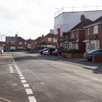
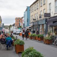
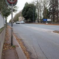
For the first time in a while, I had the time and energy to go further afield and knock off some new roads from my "to do" list. I headed through the first Hotwells Festival to Ashton and Bedminster to cross off a few of the suburban roads south of North Street.
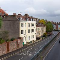
First, though, I decided to try to reproduce an old photo of the now-demolished Rownham Hotel just around the corner from where I live...
A Wide Angle View
30 Oct 2021
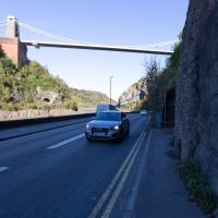
I had an unsuccessful wander last week, on Tuesday afternoon: my GPS died within about five minutes of leaving the house, and I didn't notice, plus I found hardly anything I'd been looking for. On the plus side, as I was wandering around Park Street I decided to nip into London Camera Exchange on the offchance they had a secondhand Canon 17-40mm lens. I've been thinking of buying one for around a year, I think.
Long story short: not only did they have one, but due to a mistake with their price labelling which they kindly honoured, I now have a shiny new (to me) wide-angle lens and it cost me less than £300, which is a very good price for one of these in good condition (and including a lens hood.)
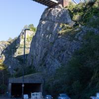
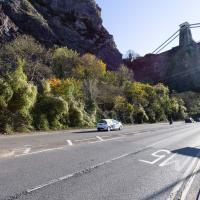
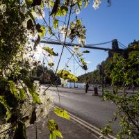
So, rather than try to salvage Tuesday's walk, here's a walk where I basically just bimbled up to Clifton Village for a coffee and wandered around taking photos of as many wide views as I could find. I took a lot more photos than these seventeen, but as you might expect, a new lens takes some practice getting used to, so most of them ended up in the "outtakes" pile.
It's hard to snap this view, perhaps because nothing can convey the emotional context for me: the "nearly at home" feeling of wandering down from Clifton Village into Hotwells.
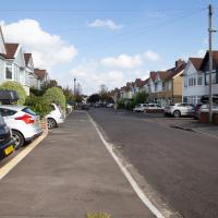
Ticking Off a Few Streets in Bedminster
31 Oct 2021
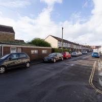
There were only a few streets left to wander in the more residential bit of Bedminster, so I thought I should target those today. The streets themselves weren't that notable, though Balfour Road has a contrasting mix of old and new housing. I tried to snap a few more interesting things along the way there and back, snapping all three of the familiar bond warehouses, nipping onto North Street to find some new street art, and finding a few pumpkins for good measure. It is hallowe'en, after all...
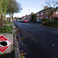
There were quite a few signs that Frobisher Road is a sanctuary for hedgehogs. We've actually seen a similar sign at the far end, on an earlier wander that went past the end of the road.
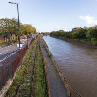
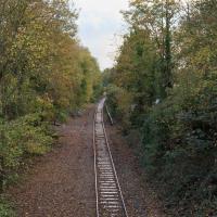
It wasn't that long ago that there were trains running down here, and pedestrians enjoying the chocolate path to the right of the line. One day, hopefully, they'll both be back...
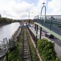
Just as well there wasn't a steam train running over it when half the path fell into the river, I suppose.
Recreating a Loxton Drawing on a Lunchtime Jaunt
05 Nov 2021
I did do a much longer wander earlier in the week, but that'll take me some time to process (and cast a plethora of photos into the "out-takes" pile!) In the meantime, here's my lunchtime jaunt, taken to give myself a break from doing the company bookkeeping to send to my accountant so the taxman doesn't sling me in chokey.
I've recently bought a slightly creased secondhand copy of Redcliffe Press's 1992 collection of Samuel Loxton drawings, Loxton's Bristol: The city's Edwardian years in black and white. It's a nice selection of Bristol Library's collection of the drawings. I'd noticed a drawing of 25 Royal York Crescent, a house I pass quite often, so I thought I'd wander up the crescent on the way to pick up some lunch and try to reproduce it.
On the way back I took a few photos of Clifton Hill Bank as the crowdfunder to make quite a lot of it into a wildflower meadow has just hit its target, so I figured some "before" shots might be a good investment for the future...
I went out simply wanting to knock off the very last little unwalked section of Clanage Road, over by Bower Ashton, which has been annoying me for a while as it's quite close by and I've walked the other bits of it several times. So, my plan was to nip over to Greville Smyth Park via a slightly unusual route to wander Clanage Road and tick it off.
Along the way, though, I inevitably got a bit distracted. I took a few photos of Stork House, a grand Hotwell Road building that's recently been done up a bit (I imagine it's student lets, though I'm not sure) and which I found a reference to in a book about the Port Railway and Pier the other week, and also tried to match up a historical photo of Hotwells before the Cumberland Basin Flyover System laid it waste, which included some interesting markers I'll have to do a bit more digging into...
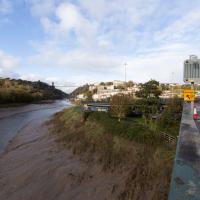
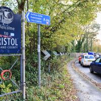
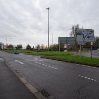
Because yes, we have just had a little excursion into Somerset, technically. So welcome back to Bristol, home of traffic jams.
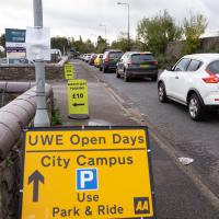
So that's why all the cars are there—not for the Open Day, it turned out; it's the other signs that are the giveaway. Somewhere, some people are committing a sport.
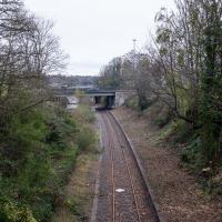
The more I research it, the more I find that Hotwells had far better transport links back in Victorian and Edwardian times than it has today. Along with buses that went to more useful places than the City Centre, there were trams, the funicular up to Clifton, the landing stage for paddle steamer services and two railway stations all within easy walking distance of me.
Today I took a day off work as preparation for doing the bookkeeping for my tax return1, and took a wander along to the site of what would have been my nearest station, Hotwells (or Clifton, as it started out in life), nestled in the shadow of the suspension bridge, the Bristol terminus of the Bristol Port Railway and Pier.
From there I wandered down the Portway, following the original line, until I got to the area around Sneyd Park Junction, where the tunnel from the slightly later Clifton Extension Railway joined up with this originally-isolated BPR line. Then I headed up to Clifton through the "goat gully" at Walcombe Slade, seeing the few above-ground bits of evidence of the tunnel (which is still in regular use) along the way.
It was a lovely day, and a good walk, and it was interesting to daydream of the times when I could have walked a few minutes from my flat down to Dowry Parade, caught a short tram ride to Hotwells Stations, and then headed from there to Avonmouth, perhaps even to board a transatlantic passenger service. The completion of the Clifton Extension Railway that linked the Avonmouth station with Temple Meads made relatively direct transatlantic travel from London via Bristol possible, with passengers travelling up from Paddington to Temple Meads, on to Avonmouth on the Clifton Extension Railway and Port Railway and Pier line, then perhaps catching a Cambpell's paddle steamer—which sometimes acted as tenders for large steamers—to a larger ship that was headed out for Canada, say.
1 I've learned that the best approach is to take two days off and deliberately do something that's not my bookkeeping on the first day, as otherwise I just inevitably end up procrastinating and feeling guilty on the first day no matter what. I have an odd brain, but at least I'm learning strategies for dealing with its strange ways as I get older...
2 Information mostly gleaned from Colin Maggs' The Bristol Port Railway & Pier and the Clifton Extension Railway, The Oakwood Press, 1975.
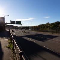
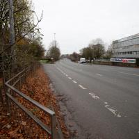
One of the many problems with the Hotwell Road and Portway is the complete dearth of places to safely cross this road, with a varying number of lanes and a speed limit that hits 50mph for stretches.
You can stand for a very long time looking both ways before taking your life into your hands and scurrying across. It took me quite some time to dash to the other pavement at the point where this one runs out and your only choice is to head up the Zig Zag or cross.
From the other angle. It was a single short platform, squeezed in to this little inset in the cliff face. Here you'd have been looking at the station wall, with the entrance and office at the far end. In this photo on Pinterest you can see the three tracks—the main platform track, a run-around loop so the engine could make its way around the carriages and onto the other end of the train, and a siding. At the far end is the station master's house, just behind a turntable that would have been used to turn the engine fully around for the return journey.
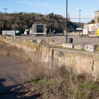
Here we see the Portway road, presumably fairly shiny and new, after many, many things, including the railway line from Hotwells to Sea Mills, were removed to make way for it. As you can see, they've done a splendid job of redeveloping the space where the station was into a little mini-park area, back in the day when the traffic wasn't a constant rush of noise and fumes and you didn't have to scamper across like you were playing a game of Frogger. It might well have been a pleasant place to sit. It certainly wouldn't be now.
Also, guess what there is fencing in the park area? Yes, some nice iron railings. I have no idea whether these are same ones I found—today's seem in surprisingly good nick considering this photo would have likely been taken almost a hundred years ago, and also how many railings were torn up during WWII.
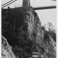
This photo was taken before the war, as you can see a tram still running in the background—a Luftwaffe bomb took the tram system down in 1941 and it was never replaced. It also was obviously taken after 1926, as the Portway opened to traffic on 2 July 1926, having cost £800,000 to build, about £47m in today's money. So, that fixes it to a 15-year period, I think, but I'm not enough of a historian to be able to pin it down further.
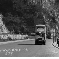
Bottom section of the postcard. I like the way there's a bus and a tram in it, but I'd quite like the bus not to be there so we can see the whole of the former station site. Motion blur makes it hard to figure out the bus and tram details.
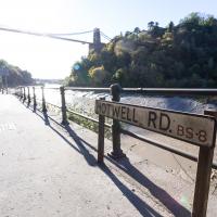
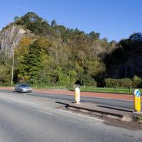
Not many people realise that it's still the Hotwell Road even out this far. It only becomes the Portway at the junction with Bridge Valley Road.
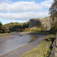
That's Sneyd Park up in the distance. We're heading that way to join up with the nearest extant bit of the Port Railway.
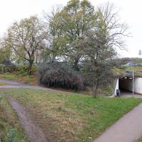
We'll be over there in a bit, at the entrance to the Gully. Before that, though, we'll just head to the other side of the quarry on the left.
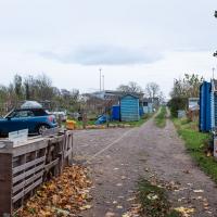
Bower Ashton is an interesting little area just south of the river from me—in fact, the Rownham Ferry used to take people over from Hotwells to Bower Ashton, operating from at least the twelfth century to around the 1930s.
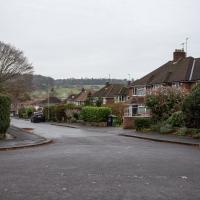
It's a strangely contradictory little area, with a cluster of old and new houses sandwiched in between the busy A-roads and significantly more industrial area of Ashton and the bucolic country estate of Ashton court roughly east to west, and also between Somerset and Bristol, north to south.
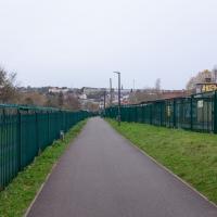
I've been around here before, mostly poking around Bower Ashton's arguably most well-known bit, the Arts faculty campus of the University of the West of England, but I'd missed at least Parklands Road and Blackmoors Lane, so I initially planned just to nip across briefly and wander down each in turn. On a whim, though, I texted my friends Sarah and Vik in case they were out and about, and ended up diverting to the Tobacco Factory Sunday market first, to grab a quick flat white with them, extending my journey a fair bit.
To start with, though, I nipped to a much more local destination, to see something that you can't actually see at all, the Gridiron...
(I also used this wander as a test of the cameras in my new phone. I finally upgraded after a few years, and the new one has extra, separate wide and telephoto lenses compared to the paltry single lens on my old phone. Gawd. I remember when speed-dial was the latest innovation in phones...)
You can still see some ladders in place, I can only presume they were there to get you down to the gridiron, but that is just a guess; information on it seems quite hard to find.
Okay, diversion to Tobacco Factory for a flat white complete, now it's time to figure out how to find Blackmoor Lane or Parklands Road from this direction.
Trying to get somewhere around here is a bit like following the White Rabbit, except when you pop back up again there's more industrial estates and fewer hookah-smoking caterpillars.
“Cat: Where are you going?
Alice: Which way should I go?
Cat: That depends on where you are going.
Alice: I don’t know.
Cat: Then it doesn’t matter which way you go.”
This happens to me all the time in this area. I try to get somewhere by aiming in the most obvious direction, and the pavement just peters out leaving me with the options of either going back the way I came or dashing across four or five lanes of traffic.
The entire area is very pedestrian-hostile. I assume the parents and kids making their way to the school opposite know all the right routes to avoid this kind of problem, but as a visitor it's very annoying.
As-was. I'm standing on the bridge pictured in the main photo on the Wikipedia article, looking back to the A370 flyover that that photo was taken from.
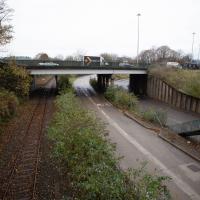
As with Clifton Bridge Station, the next stop "down", there's not much to be seen these days.
Apparently there's some pressure to re-open the station as part of the MetroWest scheme, at which point I'd presumably be able to walk to a station that would get me on a train to Portishead on this old branch line, which would be a nice way of going on a day out. I've hardly ever been to Portishead, but I quite enjoyed the couple of trips I've taken there... I won't hold my breath, though.
Wikipedia notes that it was renamed temporarily in 1914 to Bristol International Exhibition, traces of which we've previously seen—it was the halls being constructed of white plasterboard and mouldings made from fibre and gypsum that led to its nickname of "White City", which is the name of the allotments that stand there now.
The Gridiron and Bower Ashton Part Two
03 Dec 2021
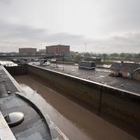
On my last wander, to Bower Ashton, I was intending to knock Blackmoors Lane off my list "to-do" list, but got a bit diverted. I also took a little look into the history of the Gridiron, once a cheaper alternative to dry dock that was nestled just south of North Entrance Lock.
Today I had to go to send a parcel off somewhere, so I decided on going to the North Street Post Office via Blackmoors Lane. I didn't have much intention of anything else, but as luck would have it I walked out both at low tide and also as some lockkeepers seemed to be having a bit of a training session, and one of the more senior people was (a) happy to answer a few random questions on the Gridiron and (b) actually knew a lot about it, as Gridiron maintenance had been one of his jobs, more than twenty years ago...
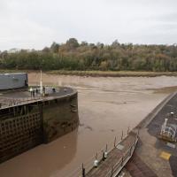
If you look at the lock wall, about halfway between the lock gates and the inset ladder, you'll see a little square hole. I had no idea what it was for until today, and I had no idea I was going to find out...
There were various people on the other side, I got the impression it was some kind of training session, perhaps. Later I'll have a quick chat with the man in the high-vis jacket over there.
In the meantime, I do always enjoy seeing the giant gridded lock gates uncovered by a low tide.
The delights of the Bower Ashton roundabout. Here's a picture of it under construction in the 1960s from the Bristol Archives. Don't tell me I don't know how to show you a good time.
Although we're heading towards the trafficky roar of the A370, it's still more of a subdued hum from here, and you could almost convince yourself that you were on the outskirts of a little town in the country.
Opposite Country Gates, which is the rather aspirational name for the office block there.
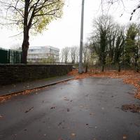
Out of sight to my right is Ashton Park School, which accounts for quite a few things that look like roads on the map, but which aren't public and which I'm not going to wander down.
As usual around here, I want to go that way but there's no crossing and no pavement, so we'll head back through this little green and head for that bridge you can see that spans the left-hand lane here.
Considering I didn't know there was a historical photo to copy when I shot this, it's not too far off the same viewpoint.
A Water-Based Wander
11 Dec 2021
I woke up on this Saturday with a headache, feeling like I'd not slept at all. As well as that, I'm still in some pain from the wisdom tooth extraction I had a few weeks ago. I moped about the flat for a while and then decided that the best thing to do was to force myself out on at least a small walk to get some fresh air and coffee.
Was there anywhere I could walk locally that I'd never been? Actually, yes! Although it's not a road, and I didn't walk it, there is actually one route that I've not travelled so far in my wanders. And it even had coffee near its far end...
My friend Lisa texted me to see if I wanted to pop down and take a photo or two of the event she was taking part in: Santa SUP. SUP Bristol organise stand-up paddleboarding on the floating harbour, and their annual Santas-on-paddlboards event is quite the sight.
On the way there, I grabbed a historical photo I'd been wanting to recreate for a while of the shiny and new Cumberland Basin flyovers back in 1965, because I reckoned I could fit finding the same viewpoint into my outbound journey. Also, after having only used it on a wander for the very first time yesterday, I managed two crossings in the cross-harbour ferry today to get to the best locations for snapping the paddleboarders...
So, then, this wander is mostly a bunch of photos of paddleboarding Santas. Tis the season... Enjoy!
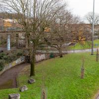
And here's the site today. The weathered concrete and tagging doesn't really improve things, but at least it looks like one of the original trees has thrived.
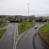
It's less so much the look of the road system, perhaps, and more that on a busy day it's just an urban hellscape of traffic and noise. On a Sunday like this you could actually believe that children could play here (there was originally a playground to go with the fountain and other features I'm mentioned in the past...)
However, most of the time, just like with the Portway, the sheer weight and (acoustic) volume of the traffic and its accompanying fumes and danger has clearly increased beyond anything the original planners ever envisaged.