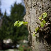
Tagged: twig
Bedminster Trip for New Walking Shoes
26 Feb 2022
I needed to buy new walking shoes—my old ones were squeaking and it was driving me up the wall—so I ordered some for collection from Taunton Leisure on East Street in Bedminster, and decided to make picking them up an official wander.
I didn't cover any new ground within my mile, but I did take advantage of the trip to take in a few interesting things just outside my normal radius, mostly New Gaol-related. Along the way there are a couple of sanitation-related diversions, including a visit to a rare manhole cover. You can hardly wait, I can tell!
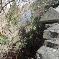
Well, it slopes down to the riverside at the top of the slipway. I presume there are still steps under there.
In Which We Begin and End with Love
05 Mar 2022
I had a lot to get done around the house, so as soon as I heard there might be a shiny new piece of street art near me, under the Cumberland Basin flyovers, I immediately decided that was all the excuse I needed to set off on a round-the-harbour lunchtime walk to get some fresh air and see if I could spot it. So, here's a circular wander that takes in graffiti, boats, wildlife and graffiti again...
Leigh Woods Purple Path
12 Mar 2022
There's a few tracks in Leigh Woods that lie within my mile and show up on my map but that I've not walked yet, so I decided to take one of my traditional big long walks through the woods on this nice crisp sunny morning.
For years—decades, even—I've been doing a similar route from my place, along the towpath to the far woods entrance, up the hill for a varied walk on one of the marked tracks and then across the Suspension Bridge to Clifton Village for a coffee-based reward. It's my default "long walk", really, and I almost always enjoy it. Today, at last, spring actually seemed to be springing, which made for some extra positivity...
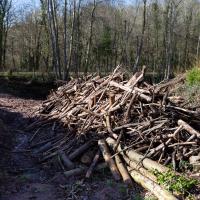
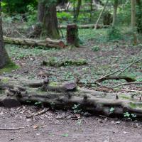
There's been a lot of logging in Leigh Woods recently. Some of it is to control Ash Dieback, some of it to make way for the reintroduction of native trees.
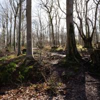
Approaching what amounts to the "main road" through Leigh Woods, that runs along the crest of the slope down to the towpath.
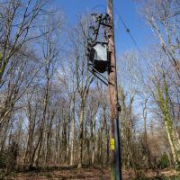
Presumably, at some point in the past, the electric lines rising out of the ground here were actually connected to somewhere else from this post.
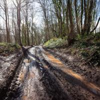
The going is normally a little firmer here. I guess that tractor's been going back and forth a lot, and the recent near-continuous rain probably hasn't helped.
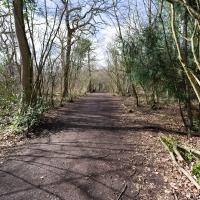
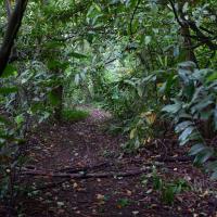
I knew that bits of the Purple Path in the woods were on my map but as-yet-unwalked, so I figured I'd do the loop. I couldn't easily check any maps as Leigh Woods is pretty much a black spot for mobile data. That's one of the reasons I like it, really: you're surprisingly out-of-touch in these woodlands. A shortish walk out of the city and you're in a forest with no access to Instagram or Twitter or what-have-you.
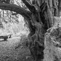
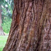
One of my two favourite trees in the woods, the other being the giant redwood in the Leigh Court arboretum area.
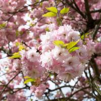
Easter Monday Gardens and Flowers
18 Apr 2022
I didn't really set out with a theme of flowers and gardens in mind for this walk. I just fancied heading up to Clifton Village to get lunch. As it turned out, though, Spring was springing, so a minor theme emerged as I started off with the graveyard flowers of Hope Chapel and wandered up to see the beginnings of the new wildflower garden at Clifton Hill Meadow.
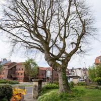
On a previous wander I posted a historical photo of the church including this tree, and one from the modern day.
It's grown up quite a lot in the last hundred years...
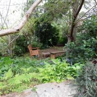
This is the south end of Camden Terrace's little private garden, seeing as I seem to be on a bit of a garden and flower theme at the mo.

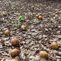
It didn't seem likely that there was a large scattering of windfall apples in Victoria Square. In April. Under a pine tree. On closer inspection, they had plastic supermarket stickers on them, so I think they're unlikely to have fallen from anywhere local...
Ticking Off a Pocket of Paths in Leigh Woods
03 Jun 2022
I managed to go for a wander a while ago that was meant to finish off a little tangle of paths in Leigh Woods, or at the very least finish off my wandering of the Purple Path there. And I managed to miss doing either of those things through some kind of navigational incompetence.
Today I woke up with a bit of a headache, feeling a bit knackered as soon as I dragged myself out of bed, but at least with the energy to realise that I'd be better off (a) going for a walk in what looked likely to be the last of the Jubilee weekend sunshine than (b) moping around the flat until it started raining, at which point I could mope more thoroughly.
I had a look at my map, considered going to Ashton Court, but remembered that there was a music festival there today, and instead found these little leftovers of Leigh Woods and decided to have one more try at walking them.
There's a viewpoint "Quarry 5 Viewpoint" marked somewhere along here on OpenStreetMap. I think pretty much all the viewpoints on this stretch have gradually been overcome by forest growth. Here you can just make out the cliffs on the far side of the gorge through trees.
At this point I had gone back and forth a fair bit, following my little satnav pointer, including heading down a couple of paths only to come straight back up them once I was sure I'd completed the un-done parts of the track.
I was a little weird, following this complicated little route. I felt a bit like a bee doing the waggle dance, or something.
A Quick Swing Past Ashton Court
05 Jun 2022
Another day not dissimilar to my last wander: I'm feeling a bit tired and rather than just moping around the house I thought I'd find some tiny bit of somewhere that I'd not yet walked and get outdoors. This time I headed for the Tobacco Factory Market in Bedminster, as I often do, but went the long way around via Ashton Court Mansion as I knew there were some footpaths and a small section of road I'd not ticked off up there. Finishing all the Ashton Court footpaths will be quite a long job, but you've got to start somewhere...
I did feel rather better by the time I got home, and, pretty much astoundingly given the weather forecast, managed to avoid the rain completely.
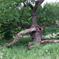
Hard to do this tree justice, as it was both wider and taller than the widest angle of my camera, and any further back the fence gets in the way.
Of course, if I'd brought a full-frame camera with a wide-angle lens, this is exactly the moment when a peregrine falcon would land on a branch at the same time a magnificent stag wandered past in the middle distance. You never have the right lens...
Well, it's giant, it's got a definite red hue and it's made of wood. I wonder what it could be...
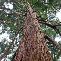
A batch of giant redwood seeds arrived at the Veitch nursery in Exeter in 1855, and the Smythe family bought quite a few of them, apparently. Many of the sequoia around Bristol date from around then, including the lovely tree in Paradise Bottom in Leigh Woods, which would then have been Leigh Court's arboretum.
I got a bit distracted by a tempting little entrance into a little network of paths in the little patch of trees just north of the UWE campus. There wasn't much of note in there.