Tagged: cloud
Whistle Stop Tour Via a Hansom
12 May 2021
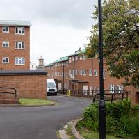
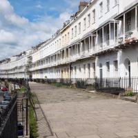
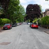
I wanted to take another snap of an interesting Gothic Revival place in Clifton, having found out a bit more about the owner. On the way I walked through the Clifton Vale Close estate, idly wondering again whether it might've been the site of Bristol's Vauxhall Pleasure Gardens (I've not researched further yet.) On the way back I knocked off the last remaining bit of Queens Road I had yet to walk and tried to find the bit of communal land that Sarah Guppy bought so as not to have her view built on...
It's an odd little nook. I imagine there's a quite expensive property back there. I've also never noticed the "OTF" carved into the near door pillar before.
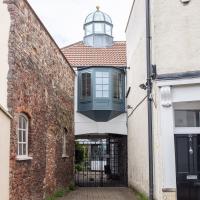
Between the gate and the oriel, the keystone reads "The Mew House 1995".
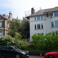
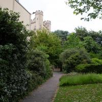
The bricked-up door to the left seems to be an outbuilding in the incredibly grand-looking back garden of the Bishop's House. Speaking of which, here's a bonus pic of the Vicar of Clifton standing at the front door.
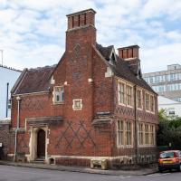
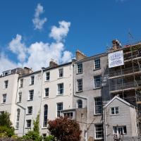
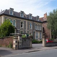
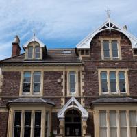
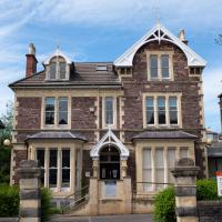
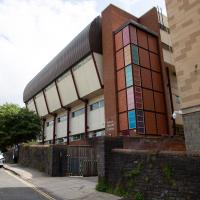
I love this Gothic Revival pile. I've snapped it before, but I recently found out something interesting...
Bocye's Avenue Windows
19 May 2021
I just nipped up to Clifton Village to get a coffee, though I did manage to walk down a little alleyway I'd not really noticed before. Or perhaps I had noticed it and it looked private, but today I felt like wandering up its twenty or so feet anyway... The reflections in the shop windows on Boyce's Avenue gave me the idea to take a few snaps of them, so that's the majority of my small amount of snapping today.
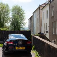
I'd quite likely been down this little alleyway (that leads to the back of the Clifton Medi-spa where I used to have acupuncture) before, but it's so nondescript I coudln't remember. Better safe than sorry. It has a view of some cars and the back of Royal York Villas
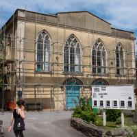
Well, not now it isn't. The church was demolished (after spending some post-war time deconsecrated as St Andrew's Hall) to make way for flats in 1975. There are some photos of how it used to look on ChurchCrawler.
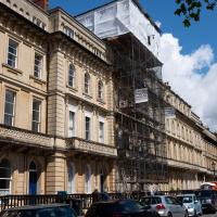
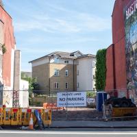
Not that you can get much of a view of it with a little camera and with it behind a bunch of netting. Looks rather friable. Apparently it was part of a scheme to attract Queen Victoria to visit that never came to fruition.
Shop Fronts of Regent Street
22 May 2021
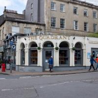
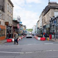
I didn't even think I'd manage to get out today, such was the weather forecast. As it turned out, it's been quite a nice day, and I managed to nip up to Clifton Village to pop to the Post Office. As with my last outing, I decided after snapping one shop-front on Regent Street that I might as well snap the whole row, and muse on a few of them, the only service I really offer over and above Google Street View for a lot of my pictures 😀
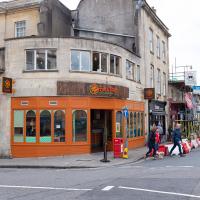
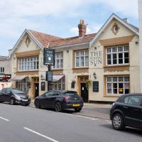
I've not been in since it changed from a Boston Tea Party, but I may have to try it just to sit upstairs and watch the world go by like I used to...
Named after its cross-section from above, I've always assumed. Anyway. That's the last shop on that side of the road, so apart from the one I missed on the starting corner, Awakn, that's snaps of all the shops on the west side of Regent Street for you.
So the Paragon kids play football? I'd sort of assumed there would be miniature Rugby posts, or perhaps a fives court.
Coffee, Coronation and Clift House Road
28 May 2021
Another dash to Greville Smyth Park for a coffee from Rich at Hopper, but at least this time I managed to divert a bit and knock off a small section of Cumberland Road I'd managed to miss on previous excursions. Along the way I muse on a strange residence in between a warehouse and a tannery, and wonder if the Mayor might be deliberately letting the Cumberland Road Flyover area go to seed...
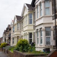
This is the bit of Coronation Road I came to wander down specifically, one of the little bits of road I'd missed on previous walks. It features the same nice Victorian terraces as much of the rest of Bedminster, including individual house names. I imagine the constant traffic reduces the appeal of this stretch, though.
Another Day, Another 50 Metres
29 May 2021
I met my friends Sarah and Vik at Riverside Garden Centre today; I needed to buy some compost for repotting my wildly-overgrowing aloe vera, and I went a little bit out of my way to knock off a stretch of Ashton Road. It was a pleasant enough walk in the surprisingly warm (and surprising-not-tipping-it-down-on-a-Bank-Holiday-weekend) weather.
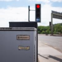
Traffic light control box, I assume. It's about as far from home as I am, as Plessey's headquarters were in Ilford, not far from where I grew up. Guessing this might be original gear from the late 1960s, when the flyover system was built.
It looked pretty amazing back in the day; it was a double-decker swing bridge with a control tower raised over the swing point. Here's another old snap, this one from a more similar viewpoint to mine.
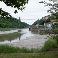
When I moved to Hotwells, it was a pedestrian-only bridge, though one half of it still had the overgrown rail tracks from when it was a bottom-deck railway and top-deck road bridge. Since then it's been refurbished and is now combined pedestrian and Metrobus, with a guided channel for the buses. Amusingly, when it was first put in, they managed to make it too narrow for the buses. In fact, it's closed right now for "works on the guideway" so presumably they're still having problems.
Interesting mixture. Behind Ashton Road, to the right and behind me in this pic, is Ashton Gate stadium, home to Bristol City, which goes some way to explaining the two big pubs (next two photos) on this stretch.
There's an arguably better snap of it on an earlier wander, but at least you get a glimpse of the cool street art on the end of Baynton Road with this one. I still need to walk down Baynton Road, so perhaps I'll save talking about that piece for later...
I managed to knock off a reasonable chunk of the roads I had left to walk around the University at the north-eastern extremity of my mile on this nice sunny walk. As well as being impressed by the number of big townhouses now occupied by various departments, I took some time on my way there to check out a war memorial, and some time on the way back to do a little extra wandering of Berkeley Square.
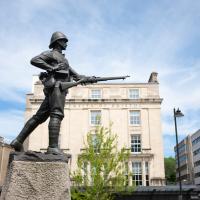
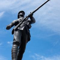
With a Lee-Metford rifle. The Lee Enfield was already in production when the Second Boer War started, but clearly this fella was still on the previous issue...
You'll notice he's also wearing puttees. They'd mostly died out as military wear by the end of WWII.
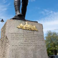
What's Egypt got to do with South Africa, you ask? It's the badge of the Gloucester Regiment.
The Glosters were the only regiment in the British Army to wear a cap badge on both the front and the back of their caps, and it's unsurprising that it references Egypt. At the Battle of Alexandria in 1801:
The front and rear ranks of the 28th were simultaneously engaged, whereby the soldiers received the order "Front rank stay as you are, rear rank about turn" and in commemoration the regiment later adopted a second cap badge, the 'Back Number,' worn at the back of their head-dress.
The Glosters were later merged with a couple of other regiments, but their successors, the Rifles, still wear the back badge.
An economist, and one of the first people to take the Tripos at Cambridge. She and Alfred Marshall, her former tutor, founded the teaching of economics at University College, Bristol.
Bank Holiday Street Art
31 May 2021
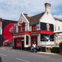
A nice warm Bank Holiday Monday saw me walk back over to Bedminster to do justice to something we glimpsed on my last wander. Along the way I spotted a couple of new pieces of street art tucked away on the south side of the Cumberland Basin Flyover system, so this turned into a micro-graffiti walk.
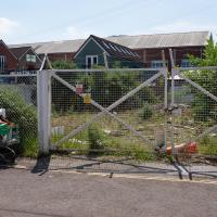
I imagine this derelict site would be worth quite a lot. Odd that it's just sitting there mouldering.
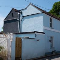
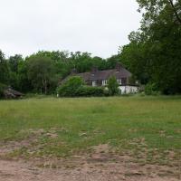
Set back behind the shops on the main road is this little pair of houses. All well-kept and tidy, and not quite as odd a place to be as the one that's isolated in the car park behind them, but still quite a strange location.
A Longer-than-it-looks Walk With Lisa
06 Jun 2021
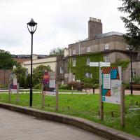
The track on the map doesn't tell the whole story of this walk with Lisa around and about Clifton, Berkeley Square, Brandon Hill and the harbourside, because the batteries on my GPS ran out while we were on the roof of Trenchard Street car park, it seems. Oh well. I think I did most of the area I was interested in finishing off around the University; there were only a few new bits around Brandon Hill that won't be on the track, and I can easily do them again.
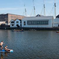
Still, technology woes aside it was a nice walk, albeit a bit warm for climbing all those hills, and sat on the harbourside watching the world go by for a while, too. It was good to see the Bristol Ferry Boats carrying people around again, especially.
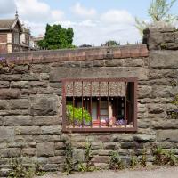
No idea why there's a window in this wall. The wall looks a lot older than everything surrounding it, so perhaps it's just some historical vestige leftover in between bits of University development.
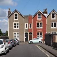
We're just outside my mile radius here, but Osborne Villas Looked too tempting to just walk past.
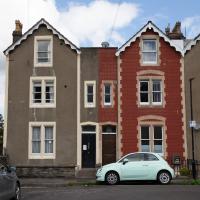
Looked a bit to me like number 16 had tilted over to the left a bit since it was built...
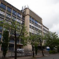
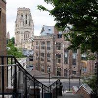
Between University Walk and Woodland Road. Quite the view. I don't get up this way often, so I've rarely seen this side of the Wills Tower.
A Trip to the Library
08 Jun 2021
I had to return a book to the library—Ellic Howe's Magicians of the Golden Dawn, very interesting, thanks for asking—so I decided to pick the Central Library as my drop-off point and walk down a segment of Deanery Road that I've surprisingly overlooked so far. In any normal time I'd have been walking to work that way quite often, or heading through at the weekend on the way to do some shopping in the city centre, or for a coffee at St Nick's, but those excursions have been quite thin on the ground for the last year or so, for obvious reasons.
I've never been inside a single building on Deanery Road itself; the Library is technically on College Green and the rest is mostly student accommodation or Bristol College buildings, by the looks of things. It's a fairly mediocre street, used merely to get to other places. (St George's Road, which merges into it, at least has the distinction of several good shops verging from the practical and long-lived car radio fitters to the excellent little Dreadnought Books, sadly currently closed for refurbishment...)
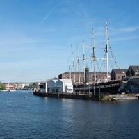
After dropping off my book I came home via the harbourside, the better to enjoy the nice sunny blue skies of the day.
The last time we saw this bit of waste ground, I wondered if I was remembering correctly that it used to be a garage. Well, it's now being cleared out, and the skipful of old tyres would seem to be a clue that I was probably right...
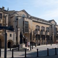
The arch on the left is the Great Gatehouse of St Augustine's Abbey, precursor to the Cathedral; you can see the Library entrance just behind the Ram Mohan Roy statue.
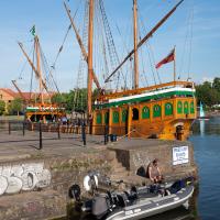
A fifteenth century caravel replica and a very modern RIB. Odd neighbours. I think the bloke leaning out over the gunwales at the prow of the RIB was trying to encourage fish onto the line. Not your typical patient fishermen :D
Leigh Woods Solo
19 Jun 2021
I hadn't really planned to go out for a wander yesterday; I just got the urge and thought "why not?" (Well, the weather forecast was one possible reason, but I managed to avoid the rain, luckily.)
I wanted to finish off the A369—as it turns out I may still have a small section to go, but I've now walked the bulk of it out to my one-mile radius—and also a few random tracks in Leigh Woods. I'm still not really sure that I'm going to walk them all, especially after discovering today that "the map is not the territory" applies even more in the woods, where one of the marked tracks on the map wasn't really that recognisable as a track in real life... I'm glad I'd programmed the route into the GPS in advance!
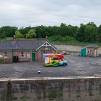
Anyway. A pleasant enough walk, oddly bookended, photographically at least, by unusual vehicles. Leigh Woods was fairly busy, especially the section I'd chosen, which was positively dripping with teenage schoolkids with rah accents muttering opprobrium about the Duke of Edinburgh. I'm presuming the harsh remarks were more about taking part in his award scheme than the late Consort himself, but I didn't eavesdrop enough to be certain...
I'm not sure what's being delivered to the lock-keepers' house, but it looks like they'll probably all be a lot happier afterwards.
I took this as a comparison shot for this non-OMM photo I snapped the other night, to show how much difference the right conditions can make to a photograph :D
I believe this is "the plain"; the only surviving bit of this particular neck of the woods that was all once pasture that's not turned into forest. The main bit of the woods, to the east of the parish wall, is mostly ancient growth, I think.