Tagged: cloud
Coffee, Pirates and a Spitfire
15 Apr 2021
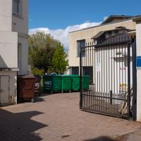
Just a quick trip to Imagine That for a flat white and a date ball (they're really nice), snapping the general sights along the way. No new roads, as has rapidly become the default on my lunchtime wanders, but as I'm in the routine of this project it almost seems strange not to pop my wanders up on the site.
Desultory Coffee Wander
16 Apr 2021
Another day, another quick dash out for a coffee. I did at least try to take a different route from normal, especially on the way back, where I yet again got a bit lost in the strange paths, flyovers and underpasses that make up the odd maze of pedestrian "infrastructure" among the concrete jungle between the west of Greville Smyth and my neck of the woods in Hotwells. I swear one day I'll take a turn I've not tried before and end up being gored by a Bristolian minotaur.
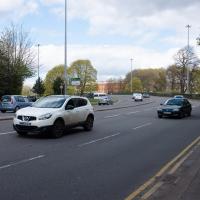
Even on a quieter day, the roar of the traffic is pretty amazing. I was listening to a podcast about electric cars on noise-cancelling headphones, while wishing there were already a few more on the roads...
I think I should have gone back down into the park to come back up my normal path, that leads to a place where you can walk under the flyover and get back on the bridge to Hotwells. As it is I just tried heading north and ended up having to cross four lanes of busy traffic.
That seems to be the failure of the pedestrian paths around here: if you know where you're going really well, the best you can hope for is not to make a wrong turn, and then you can end up going all the way around the houses, including quite often back the way you came, and might manage to use some of the provided underpasses and crossings and avoid the most dangerous traffic. But if you don't know them like the back of your hand and just try heading for the place you want to get to, that you can actually see, you'll be led entirely astray and end up in a variety of dead-ends.
Man on a Mission
17 Apr 2021
I went rather outside my area today, as I went to pick something up from the Warhammer shop on Wine Street (Games Workshop as-was, and before that I think perhaps a rare retail outlet for Her Majesty's Stationery Office? I may be mis-remembering...) Anyway, a friend of mine wanted something picking up and posting to him, so I figured I'd knock some streets off my list along the way.
I first headed for the St George's Road area, walking down the narrow Brandon Steps and finding some strange wall art on Brandon Steep, then headed to the Old City via Zed Alley. The Warhammer shop visit was friendly and efficient, and, mission accomplished, I treated myself to a sausage roll and a flat white from Spicer + Cole, to take away and eat in Queen Square with its current decoration of hearts. I finished off with a detour up Park Street, looking out for St John's Conduit markers, before finally crossing Brandon Hill on the way home.
Quite a long wander, all told, and I'm a bit knackered today...
Recently decorated with hearts to kick off the #LoveBristol campaign. It looks amazing from above in this drone footage.
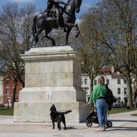
The dog was very unhappy about the statue. To be fair, from the dog's perspective, William III is basically holding a stick above him while refusing to acknowledge his frenzied barking.
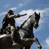
The statue was erected in 1736 to demonstrate Bristol Whig support for Crown and Parliament Recognition Act 1689.
Personally I don't think Bristol will have fully returned to normal until the customary traffic cone has been reimplaced upon the royal bonce by a drunken student.
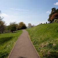
I may have trod some new paths on Brandon Hill. I wasn't sure, as the network of routes is quite complicated and I was too eager to get home to muck around checking my map.
The Mall Gardens
19 Apr 2021
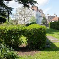
Just a quick errand to the Post Office to send off Mollog's Mob, but afterwards I bought a flat white and a new plant from Foliage Cafe and headed for The Mall Gardens to enjoy sitting in the sun and reading a book on the first day this year that's been properly warm enough for it. Nice.
The Mall Gardens does actually have some signs up letting people know it's a public garden, but I think it was only my researches for this project that brought the number of public gardens there are in Clifton to my attention, and reminded me that I could make use of this space in Clifton Village, a little closer to the coffee shops and a little more sheltered than Clifton Down.
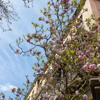
Hard to capture how nice this big magnolia in the Cornwallis Crescent back garden is on camera.
A New Wander, a New Cafe
21 Apr 2021
Obviously, I was trying to connect to the industrial history of the Canon's Marsh area, to the old gasworks, the docks railway, the warehouses they blew up to make way for all the rather soulless modern stuff (though I do like the Lloyds building, at least.) But what I mostly got out of today's walk is a new cafe to go to for my lunchtime outings. It's perhaps a little closer than both Imagine That and Hopper Coffee; not quite as close as Foliage and Twelve up in Clifton Village, but also not at the top of a steep hill.
No, not the mediocre Costa, but only a little way away from there: Rod and Ruby's, which opened in 2018 and which I've seen in passing several times but never popped into until today. What can I say? I was foolish. Great flat white, lovely interior, astoundingly good cannoli.
Sometimes you just have to get your head out of history and enjoy a pastry.
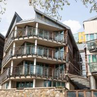
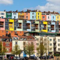
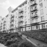
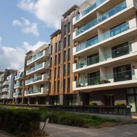
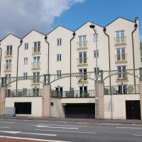
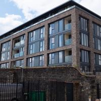
I actually quite like this one, especially the pointed fronts of the living spaces. Decent size balconies, too.
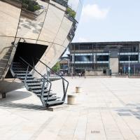
I've still never been inside. This mirrorball is one of the most photographed things in Bristol, and rightly so. A fun bit of architecture in the corner of Millennium Square.
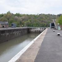
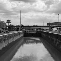
Howard's Lock
27 Apr 2021
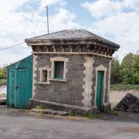
Bits of Entrance Lock have been coned off for ages, mostly the area with the lockkeepers' house on it. My friends Sarah and Vik mentioned at the weekend that it had recently been un-coned, so I wandered that way to cross the outermost lockgates for the first time this year. I don't know whether it's just my mood today or the weather, but it seemed a day for pushing a couple of photos in a more experimental direction in the post-processing...
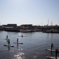
Canons Marsh Coffee Trip
29 Apr 2021
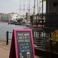
Another quick excursion to Canon's Marsh, tempted back by Rod & Ruby's cannoli and flat white. This time I poked around some bits of the modern flats I'd not really experienced before, mused on the old gasworks, and headed back down the Hotwell Road, spotting a re-opening gallery and finishing off at the Adam & Eve, for which some locals are currently rushing to launch a bid to turn it into a community business rather than have a developer turn it into yet-more flats.
I was in a bouncy, positive mood, helped out by Life Without Buildings' Live at the Annandale Hotel album1. Note to self, though: the album is nearly an hour long, so if you hear the encore starting and you're still halfway down the Hotwell Road, you'll probably be late back from lunch...
1 That review's well worth a read. Music journalists tend to go extra-dreamy when trying to describe Sue Tompkins. See what I mean:
She circles her limber tongue-twisters, feints, and attacks from unexpected angles, dicing and rearranging them with the superhuman brio of an anime ninja and a telegraphic sense of lexical rhythm.
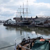
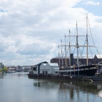
This is the stern of MV Balmoral, previously owned by P&A Campbell, the steamship operators, who I've mentioned once or twice before.
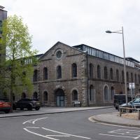
So new it doesn't seem to be on Google or Bing Maps yet, at least on the actual map bit, this is the one new build that stands alongside the two historic-building-conversion jobs (Purifier House and Engine House) at Brandon Yard, basically the site of the old gasworks.
They were one of the last sites to be regenerated, after some failed attempts to turn them into offices, including by the Soil Association. I don't know much about what they do in a gasworks, but I heard that the ground was highly polluted and needed a lot of remedial work before anything new could be put there.
Another of the old gasworks buildings (or at least the shell of it.) The modern flat conversion stands on Lime Kiln Road—before this site was flats, it was a gasworks, before it was gasworks it was a timber yard, and before it was a timber yard, starting in the 17th century, it was a lime kiln glassworks, demolished 1838.
I suppose it's possible that purifier house was the reason for the ground pollution I heard about that made the site hard to redevelop, but I'm only guessing, based on the idea that if you remove the impurities from the gas at your gasworks, you probably end up with a whole lot impure stuff you've got to put somewhere...
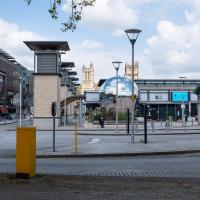
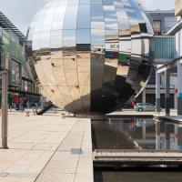
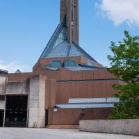
A mirrorball planetarium, an Augustinian cathedral, some underground car park vents, a roundabout, a casino and an exploratory science centre. It's a bit of a mix.
Leftovers with Lisa
01 May 2021
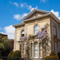
I didn't get to all the little leftover streets around the northeastern part of my area in today's wander, but I definitely knocked a few off the list, plus Lisa and I enjoyed the walk, and didn't get rained on too badly. We spotted the hotting-up of Wisteria season, checked out Birdcage Walk (both old and new), ventured onto the wrong side of the tracks1 and generally enjoyed the architecture.
1 Well, technically we probably shouldn't have been on the grounds of those retirement flats, but nobody started chasing us around the garden with a Zimmer frame
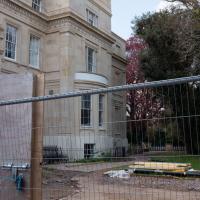
A peek through the building site railings at the back of Worcester House, the grand house at the end of Worcester Terrace.
Aforementioned pub. I've also visited in its former incarnation, Roo Bar, when it had an Australian theme.
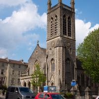
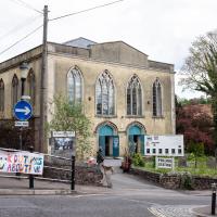
The places of worship are looking rather splendid in the sun today. The clock's right, too!
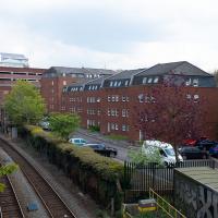
Alma Court, this time from my normal viewpoint, above the railway tracks on St John's Road.
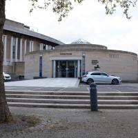
Now the Everyman cinema, restored to its former use a few years back. It's pricey, but you get an armchair or sofa to sit on and they'll bring you food or a gin & tonic while you're there. Very civilised.
Originally put up in 1920, the ballroom and restaurant are now offices and pub.
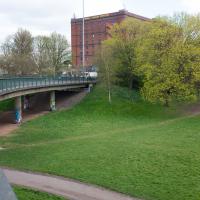
Victoria Square Underpass
06 May 2021
I'm meant to be taking a little break from this project, but in my Victoria Square researches after my last walk I noticed a curiosity I wanted to investigate. The community layer on Know Your Place has a single photograph captioned, "The remains of an 'underpass' in Victoria Square".
Looking back through the maps, I could see that there really did used to be an underpass across what used to be Birdcage Walk. I can only guess that it was there to join the two halves of the square's private garden that used to be separated by tall railings that were taken away during WWII. Maybe it was a landscaping curiosity, maybe it was just to save them having to un-lock and re-lock two gates and risk mixing with the hoi polloi on the public path in the middle...
Anyway. Intrigued, I popped up to Clifton Village this lunchtime for a post-voting coffee, and on the way examined the remains of the underpass—still there, but only if you know what you're looking for, I'd say—and also visited a tiny little road with a cottage and a townhouse I'd never seen before, just off Clifton Hill, and got distracted by wandering the little garden with the war memorial in St Andrew's churchyard just because the gate happened to be open.
EDIT: Aha! Found this snippet when I was researching something completely different, of course. From the ever-helpful CHIS website:
When there were railings all round the garden and down the central path, in order that the children could play together in either garden there was a tunnel for them to go through. This was filled in during the 1970s but almost at the south east end of the path if one looks over the low wall the top of the arches can still be seen.
At some point, the local polling station stopped being at Holy Trinity and moved here.
Speaking of elections, one of the four elections happening today is the Bristol mayoral election; current enumbent Marvin Rees, an Evangelical of some variety, met church leaders here on the first day of his first term: “We prayed, and we invited the spirit of God into the city."
And opposite Prospect Cottage, as if to give some direct contrast, the modern and anything-but-quaint goods entrance to the Nuffield Hospital.
Up until WWII, anyway. The outline of the church remains around this square of land; the stones you can see bottom left are one of its walls. Among the many interesting images accompanying Bristol 24/7's story about the Bristol Blitz you can see an image of St Andrew's Church after the bombing raid of November 1940. I'd call it an interior shot, but most of the interior had become the exterior by that point...
Sequel Injection
07 May 2021
I saw this tweet the other day and started thinking of my second Covid-19 vaccination as my "Sequel Injection" (to a geek, it's funny. You'll have to take my word for it.) Whatever you call it, this morning I went and got it.
It was in the same place I got my initial injection—my left arm! No, okay, it was at the Clifton College Prep School. I didn't take any photos of the event itself; the NHS production line is so efficient you barely have time to do anything else, even if the privacy of other patients wasn't a factor.
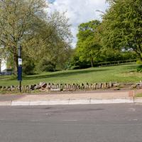
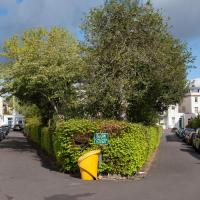
Along the way I mused at all the road resurfacing going on in Clifton, and also discovered a secret (okay, not-well-known and possibly slightly trespassey) way into Canynge Square, and on the way back I knocked off a few streets from my "leftovers list" of north-east Clifton. I've got much of Clifton done now, with the only obvious "to dos" on the east side of Whiteladies Road...
It was quite a long walk, and I'm feeling pretty tired now, though that might be the effects of the jab too, I suppose. Anyway. Tomorrow and Monday I'm walking outside Bristol, I think, and I imagine my feet will need some recovery time on Sunday, so it might be a while before I post another Wander.
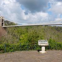
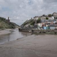
The Fujifilm X100T that I mostly use for these trips is a great camera, but it's also a fixed lens, approximately that of a 35mm focal length on a full-frame camera. So I quite often can't fit in whole buildings, whole terraces, or whole suspension bridges :D
I tried to figure out what this used to be—didn't have a lot of luck, but the next snap is taken from an old OS map showing that this area has been a stand for public transport since long before the modern bus stop here.
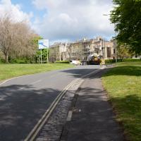
There were a lot of closed roads in Clifton this morning. I watched the white van at the end make its way carefully around the ROAD CLOSED signs at the village end of Observatory Road, drive past me, and get to where you can see it in the distance here before the driver was sent back with a flea in his ear from the workman on "stop the idiots driving through the newly-laid tarmac" duty.
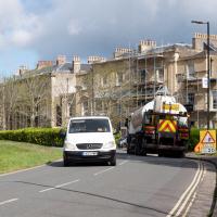
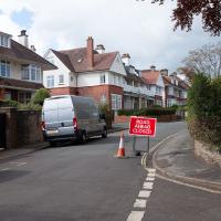
Told you they were doing a lot of resurfacing.
Here's a related fun fact to go with a dull picture, at least: the "greatest advance in road construction since Roman times" is the process of "Macadamisation": crushed stone bound with gravel on a firm base of large stones, with a camber, raised above the surrounding ground. It was invented by Bristol Turnpike Trust surveyor John McAdam, and was later refined by the addition of tar as a binding agent, giving us tarmacadam, or "tarmac", as we generally call it today.
So, basically, this ROAD CLOSED AHEAD sign, due to resurfacing, can be traced back to 1820s Bristol, where the very idea of surfacing roads was invented.
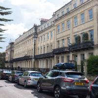
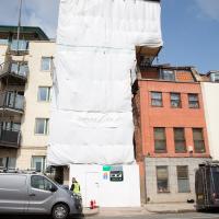
I vaguely remembered having "get better picture of Worcester Terrace" on my "to-do" list, so of course it's got scaffolding up now.