Tagged: stone-wall
A Little Local Wander
07 Jan 2021
Which included a literal "local", the Pump House, to try out their shop/deli/cafe. A flat white, some apples and a New York Deli toastie. Eleven quid, mind, but the Pump House was never a cheap pub...
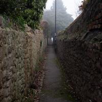
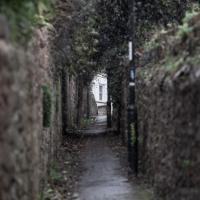
I enjoyed the fog, and wandering down a few more out-of-the-way back alleys and what-have-you on the Hotwell Road.
I'm thinking of getting up early and going for a morning walk tomorrow, weather-depending, but at the moment my motivation to do things like this seems to be much strong in the evenings when I'm just thinking about it rather than in the morning when I actually have to do it. But it's going to be cold, and low tide is quite early, so there's always a chance of getting some footage of the hot well actually being visibly hot; you never know...
From the article I was reading to accompany yesterday's Prince's Lane wander:
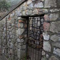
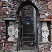
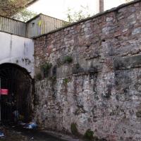
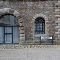
"In the 1970s, access to Prince’s Lane from Hotwell Road was walled off, and a gate was put in the wall on Hinton Lane, which was locked and prevented people from using it."
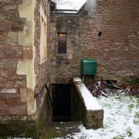
I think this is likely to be that gate. It's certainly close to the most likely path for Prince's Lane to shimmy between the back gardens of St Vincent's Parade and the back gardens of Windsor Terrace to emerge from the Clifton hillside onto Hinton Lane, anyway.
Mirror Maze
10 Jan 2021
Went for a wander with my friend Lisa—the current lockdown rules seem to be that one local walk for exercise per day with a maximum of one person not in one's "bubble" is fine—up to the University of Bristol area right at the edge of my one-mile perimeter to see the Jeppe Hein Mirror Maze, among other things. On the way we mused about Merchant Venturers, the slave and tobacco trades, and dating in the time of Covid.
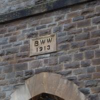
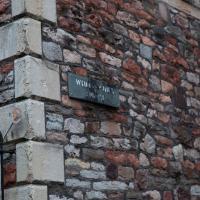
Bristol Water Works, I'm thinking. This grid square of Clifton is basically the reservoir and waterworks, both historic and modern.
Whenever I see a posthorn, I think of Pynchon's The Crying of Lot 49, but this one isn't muted.
Northern Clifton
16 Jan 2021
A raggedy wander with my friend Lisa, picking up a few stray streets and venturing only briefly onto Whiteladies Road, where it was too damn busy, given the current pandemic. We retreated fairly quickly. Found a couple of interesting back alleys, and got a very pointed "can I help you?" from a man who was working in his garage in one of the rather run-down garage areas behind some posh houses, and clearly didn't want us just wandering around there.
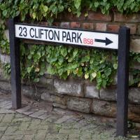
Presumably people were getting to what looked like the end of the road without finding number 23 and getting confused. I can see how that could happen.
There's more than one Whiteladies House in Bristol. Not sure what this one is, but I'd imagine it's residential.
Snowy Leigh Wander
24 Jan 2021
I started this wander with my "support bubble" Sarah and Vik, after Sarah texted me to say "SNOW!" We parted ways on the towpath and I headed up into the bit of Leigh Woods that's not actually the woods—the village-like part in between Leigh Woods and Ashton Court, where I'd noticed on a map a church I'd not seen before. I found St Mary the Virgin and quite a few other things I'd never experienced, despite having walked nearby them many, many times over many years, including a castellated Victorian water tower that's been turned into a house...
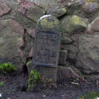
Some kind of electrical marker, I think -- BCED is most likely to be Bristol Corporation Electricity Department. Probably an underground cable marker.
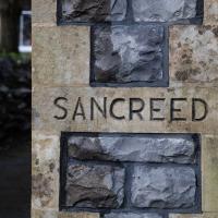
Never heard of the place before I looked it up just now, but apparently Sancreed is a village in Cornwall, 5km west of Penzance.
Unexpected Snow
31 Jan 2021
I just nipped out to post a blood test (not Covid-related) and check that my car was okay, because I've not driven it for weeks. I was just going to walk up to Clifton Village, but I spotted the opportunity to re-park the car on my street rather than up the hill around the corner where it was, so instead I got in, intending just to move a hundred metres, but it turned over slowly before it started, and then warned me that the battery was very low and I should go for a long drive to recharge it.
So, I did my best, zipping up the A4018 to the motorway junction and back again, dropping off my blood at a postbox along the way, and while I did that, it started snowing. I noticed it was low tide, too, so when I got back home I headed back out again, this time on foot and with a camera so I could see if I could find any evidence of the Hot Well steaming.
I saw not a single sign of the Hot Well steaming, but it was quite a nice quick outing and I enjoyed my brief walk in the snow. Iike Hinton Lane, too, and while it's all old ground I was re-treading, I did at least get a picture or two with a bit of snow and some of the cold winter atmosphere of the trip, I think.
In Between
06 Feb 2021
A lovely walk in the early spring sunshine with my friend Lisa. We headed directly for Jacobs Wells Road, to start off around the scene of one of our earlier walks, but this time took in Jacobs Wells from QEH upward, stopping to snap some photos of a Bear With Me, some interesting areas between Park Street and Brandon Hill including a peculiarly quiet enclave with a ruined old build I'd never found before, then crossed the Centre to grab take-away pies from Pieminister (I had the Heidi Pie) and head back to my place down the harbourside.
Apparently the service areas on this side of Park Street are no more attractive than Hill Street on the other side.
(Photographic Lack of) Worcester Terrace
09 Feb 2021
A nice walk, but something of a failure, photographically. I went to knock Worcester Terrace off my list, a not dissimilar terrace to Vyvyan Terrace, but one street further away from me. Like yesterday, it was very chilly but this time I went prepared with an extra layer and a winter coat. I think this may have been my downfall, as it may have been the X100T's control wheel brushing against the coat that put it in aperture priority mode at f/16, which I didn't notice at the time, and made most of my photos a little too blurry to use. Apparently in this mode, the X100 doesn't bump up the ISO if it can tell things might be a little too wobbly. Ah well.
So, a nice enough walk, and technically I did Worcester Terrace, but if you didn't take a photograph, were you really there? I'll have to go back...
I went to get my first dose of the Oxford/AstraZeneca Covid-19 vaccine today. Handily, the vaccination centre was Clifton College Prep School in Northcote road, next to Bristol Zoo, a road that's just within my 1-mile range that I hadn't visited before.
I parked up near Ladies Mile and tried to find a few of the tracks marked on the map I'm using, but couldn't see most of them. Whether that's just because they've disappeared over time, or with the recent lack of use or waterlogging from the 24 hours of rain we just had, I'm not sure. It was a pretty fruitless search, anyway.
The vaccine shot was virtually the same setup as when I got my winter flu jab back in November, except for the venue. I snapped a couple of pictures of the school while I was there, but I was in and out in five minutes, and you probably don't want to linger around a vaccination centre, I suppose.
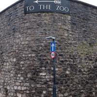
Instead I wandered around the compact block of the Zoo, now sadly scheduled for closure. By coincidence I finished E H Young's Chatterton Square this morning: set in Clifton (fictionalised as "Upper Radstowe") near the Zoo, the occasional roars of the lions that can be heard by the residents of the square (Canynge Square in real life) form part of the background of the novel. The book's set in 1938 (though written and published post-war, in 1947). It seems a shame that the incongruous sounds of the jungle will no longer be heard from 2022. All I heard today were some exotic birds and, I think, some monkeys.
I was told not to drive for fifteen minutes following the jab, so I wandered out of my area up to the top of Upper Belgrave Road to check out an interesting factoid I'd read while looking into the history of the reservoir at Oakfield Road, that the site of 46 Upper Belgrave Road was a bungalow, shorter than the adjacent houses, and owned by Bristol Water, kept specifically low so that the pump man at Oakfield Road could see the standpipe for the Downs Reservoir (presumably by or on the water tower on the Downs) and turn the pump off when it started overflowing. Sadly I couldn't confirm it. There is one particularly low house on that stretch, but it's number 44, and though small, it's two-storey, not a bungalow, so nothing really seems to quite fit in with the tale.
I'm writing this about nine hours after getting the jab, by the way, and haven't noticed any ill effects at all. My arm's not even sore, as it usually would be after the normal flu jab. In twelve weeks I should get an appointment to get the second dose.
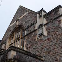
This is the building where I had the first AstraZeneca Covid-19 vaccine shot.
Not sure whose coat of arms it is; it's not Clifton College's. The motto, Nemo Sibi Nascitur, means "No one is born unto himself". This grand building isn't actually listed—well, it's on the local list, but that doesn't tell you much—and I can't see much in the way of information about it from a quick squint around the web.
I'm glad my friend Lisa joined me today; she drove in from Shirehampton and told me that the Portway was looking rather lovely, so we set off that way. She's also braver than I am when it comes to doing urbex stuff, so this was just the opportunity to take a peek into the Portnalls Number One Railway Tunnel/Bridge Road Deep Valley Shelter whose entrance I'd found on a previous wander.
It was definitely dark and spooky and impressively big, with a side tunnel that Lisa explored that leads to a little door I don't think I've previously noticed on the side of the Portway. I didn't get many photos—even my astoundingly powerful little torch (£) didn't do much to light things up, and you're not going to get much joy hand-holding a camera in that darkness—but I did shoot a little video, which I might edit and add later.
After plumbing the bowels of the earth, we went up Bridge Valley Path to Clifton, explored some bits around the College and Pembroke Road, then came home via Foliage Cafe for coffee. Nice.
Harbour Circumnavigation
01 Mar 2021
Normally I don't have enough time in my lunch hour to get all the way around the harbourside. This is a shame, as Wapping Wharf is a great place to get coffee and a snack, but it's pretty much diametrically (perimetrically?) opposite me on the harbour. Today I had the day off, so I decided to go and knock off a few streets around Anchor Road that I'd not covered, as well as visiting the site of the Read Dispensary (well, one of them) and dropping into Mokoko for one of their astounding almond croissants. From there I came back along the south side, checking out the views from as much of the Chocolate Path as you can venture down at the moment, and swapping from Cumberland Road to Coronation Road at Vauxhall Bridge.
There's a lot of meh photos on this walk—my chief output from this project could be politely described as "record shots"—but a few turned out well, especially those of Vauxhall Bridge from the Chocolate Path, which reminded me how much of a loss the current closure of the Chocolate Path is to walkers and cyclists in Bristol.
