Tagged: grassland
Fruitless Coffee Excursion
01 Dec 2020
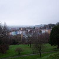
Unfortunately by the time I got to Greville Smyth Park I was already about halfway through my lunch-hour, and the queue was too long to wait to actually get a coffee. Is that a fruitless excursion? Presumably a coffee bean is technically a fruit...
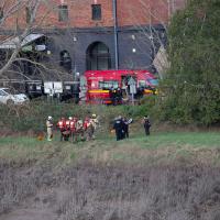
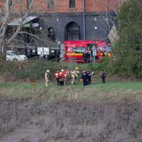
This kind of vague musing was sadly overshadowed by my delay at Ashton Avenue Bridge on the way back, where someone—hopefully still a someone, rather than a body—was being stretchered up the bank of the river, presumably having just been rescued from the water. As I made my way home the long way around, avoiding the cordoned-off area at the back of the CREATE centre and its car park, I saw an ambulance haring across the Plimsoll Bridge, siren running, presumably on its way to the BRI. I'd like to think that was a good sign.
Bedminster, Ashton, Ashton Court sunset walk
12 Dec 2020
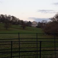
A walk with Sarah focusing on Ashton and the surrounds, taken on a day with really nice light around sunset. Just what I needed.
Rainy Clifton
13 Dec 2020
A long walk around Cliftonwood and Clifton with my friend Lisa, taking in some of the 12 Days of Christmas display at Queens Parade, picking up a take-away coffee from Pinkmans of Park Street, and poking our heads up against the glass of SS Peter and Paul Catholic Cathedral.
Drained Basin
15 Dec 2020
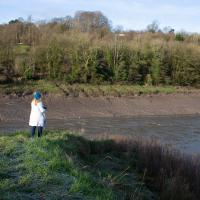
On the down side, I got to Bedminster and found long enough queues at both Mark's Bread and Hopper Coffee that I gave up on the idea of buying a drink and a pasty (from the former) or a mince pie flapjack (from the latter.) On the up side, I got to take some pictures of Cumberland Basin being drained and sluiced out, part of its regular maintenance cycle.
Sunday Bedmo
20 Dec 2020
A long meander around bits of Bedminster, from the river to the north to Winterstoke Road to the south, taking a few roads I've seen before, and a few I haven't. The Christmas decorations were an extra bonus.
Solstice Rain
21 Dec 2020
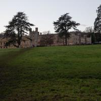
Despite the weather, Sarah and Vik and I wandered around Ashton Court a bit as the sun rose. Not that you could really tell. Sadly, the bit we wanted to watch the sunrise from was closed, because people hadn't been treating the deer with appropriate respect. Ah well, at least it was some exercise.
On Christmas Day in the Morning
25 Dec 2020
A Christmas Day walk with my friends Sarah and Vik, taking in the shipwrecked Shadow and a hilly chunk of Leigh Woods.
I went to have a peep at the giant sinkhole that's opened up in Canynge Square—ironically, having recently discovered the gardens were public I'd had the (triangular!) square on my list to re-visit for a few days, but now there's no entrance to the gardens due to the danger. The area was well fenced-off for safety, but I tried to get a couple of photos from behind the barriers.
I also explored the area around Camp Road, an real melange of architectures, one of the most mixed-up areas I've seen in Clifton, in fact, and confirmed my friend Claire's suspicion that an earlier snap of a sign from Manilla Road was in fact for a fire hydrant. Nice.
Prince's Lane
06 Jan 2021
The International Grotto Directory website says:
Prince’s Lane might have been one of the original ancient tracks from Hotwells to Clifton, in the Avon Gorge. The site later formed part of Rownham Woods which comprised some thirteen acres. By the end of the 18th century and the early 19th century, the Society of Merchant Venturers granted to Samuel Powell a building lease, for The Colonnade (1786), St. Vincent’s Parade (1790), Prince’s Buildings (1796), and Rock House. Rock House is generally considered to be the oldest surviving building associated with the Hotwell (see Chapter 20). John Power conveyed part of the woods to William Watts for the construction of Windsor Terrace (1790-1808).
The above development of the Avon Gorge cleared Rownham Woods, and created a triangle of land on the north side of the gorge, that became enclosed as a result, by Mansion Houses, whose garden walls all entered on to Prince’s Lane. The Lane started at the bottom of the gorge, at the base rock of Windsor Terrace, and came out half way up Sion Hill. It is clearly shown as a public footpath, dotted with trees, in Ashmead’s map of 1828. Some of the gardens were quite steep in parts and therefore, had to be terraced, because of the gradient of the gorge.
I've passed Prince's Lane literally thousands of times in my life, every time I've walked past the Avon Gorge Hotel, which itself started (in 1898) as the Grand Clifton Spa and Hydropathic Institution and pumped water up from the Hot Well for its hydropathic treatments. I've never actually ventured down it until today, or at least nothing like as far down it as I did this afternoon—I may have poked my head around the back of the hotel to see the original pump rooms at some point in the past.
This was a great wander, though it does very much feel like a private road, and frankly I may have been pushing my luck a bit by winding my way between the astoundingly big back gardens of the houses of some presumably very wealthy Cliftonites, but I felt vaguely justified in exploring the history of one of the oldest footpaths in my part of Bristol...
Mirror Maze
10 Jan 2021
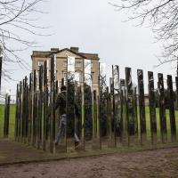
Went for a wander with my friend Lisa—the current lockdown rules seem to be that one local walk for exercise per day with a maximum of one person not in one's "bubble" is fine—up to the University of Bristol area right at the edge of my one-mile perimeter to see the Jeppe Hein Mirror Maze, among other things. On the way we mused about Merchant Venturers, the slave and tobacco trades, and dating in the time of Covid.
Not many people know there's a giant reservoir in the middle of Clifton. I found a fascinating tidbit in 'To Keep Open and Unenclosed':
The Management of Durdham down since 1861, by Gerry Nichols, that also explains why the toilets and changing rooms on Durdham down are where they are (right next to the giant water tower):
Bristol Water Works Company (BWW) was incorporated by Act of Parliament in 1846 and its first engineering works included three service reservoirs: Bedminster Down for the area south of the River Avon; Victoria Reservoir at Oakfield Road for the lower areas north of the Avon; and the Durdham Down Reservoir for the higher districts. The water flowed from the Barrow Reservoir to Oakfield Road by gravity where there was a pump driven by a steam engine to raise the water to the Downs level. Land was purchased from the Lords of the Manor of Henbury for the Durdham Down Reservoir free of any covenants or restrictions on building. As noted above, the requirement in the 1861 Act for the Downs to be 'open and unenclosed' has always been interpreted as a ban on permanent buildings on the Downs. Thus BWW land has been used for public toilets (1893) and Dressing Rooms (1932 and 1994) to avoid challenges under the 1861 Act.
The Royal in question being Prince Rupert, who was named Governor of Bristol in 1643, after taking the city for the Royalists during the Civil War.
The thing I came here to see was disappointingly small, frankly, but the effect of walking through it was pretty interesting.
