Tagged: grassland
A Door, a Square, a Few Night Shots
04 Dec 2021
I didn't take many pictures on this quite long wander, partly because Lisa and I wandered across to Bedminster via Bower Ashton, which I've snapped quite a lot of on the last couple of walks, and also because we lost the light fairly quickly, though spending a half-hour drinking mulled wine in the Ashton might have had a little to do with that...
Before we left Hotwells I wanted to visit a door I'd heard about on Cornwallis Crescent and also take a little look at a couple of houses in Dowry Square to consider the 1960s regeneration of Hotwells.
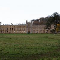
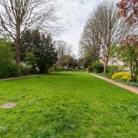
Site of a manor house since the 11th Century. Last time I was in there it was also with Lisa, my companion for this walk, as a team of storytellers from Red Rope Theatre read us ghost stories just before Halloween. It was excellent.
They should form a pub. This is just over the road from The Ashton, so there's perhaps a little too much local competition. Lisa and I popped in for a mulled wine.
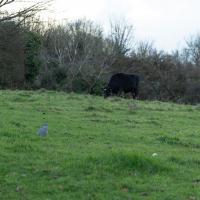
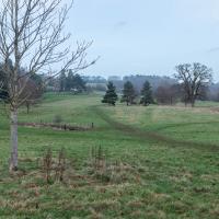
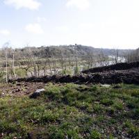
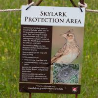
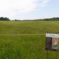
This is arguably better than the last time I tried to snap a cow in this field, but it's still terrible. Maybe next time I'll have a longer lens, or the cow will be closer...
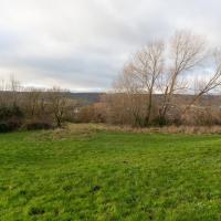
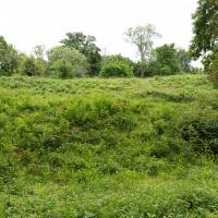
This field is called St John's Chapel. On the oldest map I can find, from somewhere between 1844 and 1888 it's marked as the "Site of St John's Chapel" but with no sign of the chapel, so it must be very long-gone. "The Chapel was dedicated as St. John or St. James depending on the source consulted, and it presumably fell into decay after the village was deserted, in the 13th or 14th century. No trace remains above ground level today, and the site is just a field" says The Churches of Britain and Ireland.
I can see on the same map that there's clearly been a pub where The Ashton is for a very long time. It was called The Smyth Arms back then.
A Constitutional to Burwalls and Back
21 Dec 2021
The recent lack of posts here is mostly due to my feeling very run down following having a couple of wisdom teeth extracted. Having had an emergency appointment yesterday1, hopefully I'll be on the mend now, though it does mean I'm on the kind of antibiotics where you can't touch alcohol for the whole of the Christmas period. I have tried to keep myself a little distracted from the pain by working on the nuts and bolts of this website—you should notice that the front page loads rather faster now than it used to, and that there's a shiny new statistics page that I'll probably be continuing to work on. Oh, and you should find that the tags below the photos are now clickable and will take you to a page of all other wanders that have photos with the same tag.
Today I felt like I needed to drag myself out of the house, but I didn't want to go too far, and I needed to get to the Post Office up in Clifton Village to post a Christmas card (spoiler for my parents: it's going to be late. Sorry.) As luck would have it, idly looking at the map I spotted that I'd missed off a section of Burwalls Road in the past, and that's basically one of the long-ways-round to Clifton Village, crossing the river to Rownham and walking up the hill on the Somerset side before coming back across the Suspension Bridge.
As I was heading for Burwalls Road I decided to make Burwalls itself the focal point of the walk, but unfortunately the mansion grounds are private and the place is hard to snap. Still, at least it gave me a destination. Burwalls was the mansion built by Bristol press magnate Joseph Leech, who I've mentioned before after buying a vintage book he wrote on a previous wander. There's a good article about the house on House and Heritage which has some photos from angles I couldn't ever get to. (Well, maybe with a drone, but it seems like the kind of area where they may be kitted out for clay pigeon shooting, so I probably wouldn't risk it.)
1 My dentist admitted that she probably needed to keep her internal monologue a bit more internal after we started the appointment with her staring into my mouth and immediately saying, "oh, *that's* weird." These are words one doesn't want to hear from a medical professional.
I was just about starting to feel better—the antibiotics seemed to have kicked in for my dental issues, and it had been some days since I'd left the house, and I was at last starting to get itchy feet. So, a wander. But where? Well, there were a few industrial bits near Winterstoke Road in the Ashton/Ashton Vale areas of Bristol that needed walking. I knew they were likely to be quite, well, unattractive, frankly. So why not do them while I wasn't feeling exactly 100% myself? Maybe it would fit my mood. Hopefully you're also in the mood for a bit of post-industrial wasteland, for that's what some of this feels like...
Then, at the last minute, I thought again about the Bristol International Exhibition—I've got a book about it on the way now—and that gave me another goal, which could just about be said to be in the same direction, and I decided to walk significantly further than my normal 1-mile limit and try recreating another historical photo...
Sadly I don't know much about the Ashton area; it's just on the edges of my mile and I rarely have cause to go there. It's brimming with history, I'm sure: the whole South Bristol area rapidly developed from farmland to coal mines to factories to its current interesting mixture of suburbs and industrial work over the last few hundred years. As a more working class area less attention was paid to it by historians, at least historically-speaking, than the Georgian heights of Clifton, and much of it has been knocked down and reinvented rather than listed and preserved. I see here and there some of this lack is being addressed, but I'm afraid I'll be very light on the history myself on this wander, as most of my usual sources aren't throwing up their normal reams of information as when I point them at Clifton, Hotwells or the old city.
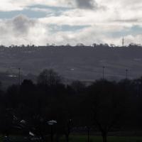
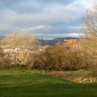
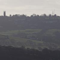
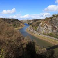
These are some hills I'm not heading for today, but I love the distant view of Dundry from Hotwells. The silhouetted church towards the left is St MIchael's Church, Dundry, whose tower was built in 1481.
The other towers around Dundry have more recent heritage. I believe Dundry East transmitter still sends out the analogue signal for BBC Radio 4, and lets me listen to The Archers on an old Roberts radio when I'm doing my cleaning on a Sunday morning. Some bits of my life are still quite old-fashioned.
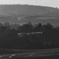
This is near the view I'm trying to recreate. Here are the fringes of Bedminster Down.
A Random New Year's Day Wander
01 Jan 2022
I picked a fairly arbitrary reason for a wander today. Really, I just wanted to do a New Year's Day wander just to get out of the house and to set a precedent for the year to come.
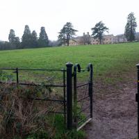
My ostensible reason was to investigate what looked like a road on my map that quartered the lawn in front of the Ashton Court mansion. As it turned out, this is just a muddy footpath/desire line similar to a half-dozen other tracks nearby, and must be some kind of bug or misclassification with the mapping system I'm using, but that's not important. What's important is that I went for a little walk on the first day of the year. As a bonus, I did happen to wander down a couple of sections of new footpath, so technically I broke some new ground too, which is nice.
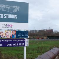
I still have no really clear idea what this place is, and their website's not much enlightenment, either. They seem to think this is ten minutes' walk from the city centre; I'd love to know what kind of space/time warp technology they're using. Seven-league boots, perhaps?
Though this isn't the allegedly main-ish road I was trying to find, so I didn't pop through it.
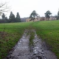
This bit that's marked on my map in the same style as a normal, tarmac road. Clearly it's not. I think perhaps I need to figure out what's going on with the mapping on this website, as the main openstreetmap site, which is where I'm getting my data from, does seem to have it as a simple track.
A small challenge for the new year, I suppose... Perhaps a refresh of the way the map looks on the site would be a nice start to the year anyway!
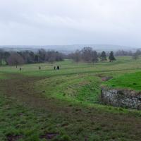
There were quite a lot of people about; I think a New Year's Day walk is still quite the tradition. Good.
Near and Far
05 Jan 2022
I took advantage of a rare recent day where it wasn't tipping down with rain to get away from my desk on a lunchtime workday and head up to Clifton Village. I'd hoped to snap a reproduction of historical photo which I'd worked out had been taken from the Suspension Bridge, but the gods were not smiling on me. Still, taking only a nice long lens with me worked out very well as the lovely haze of the day made more distant views quite dramatic...
Bedminster Trip for New Walking Shoes
26 Feb 2022
I needed to buy new walking shoes—my old ones were squeaking and it was driving me up the wall—so I ordered some for collection from Taunton Leisure on East Street in Bedminster, and decided to make picking them up an official wander.
I didn't cover any new ground within my mile, but I did take advantage of the trip to take in a few interesting things just outside my normal radius, mostly New Gaol-related. Along the way there are a couple of sanitation-related diversions, including a visit to a rare manhole cover. You can hardly wait, I can tell!
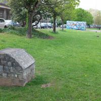
Back in the days of the Bristol International Exhibition we'd have been standing about where the replica of Bristol Castle was, looking toward the Dominions Pavilion and a bandstand.
Leigh Woods Purple Path
12 Mar 2022
There's a few tracks in Leigh Woods that lie within my mile and show up on my map but that I've not walked yet, so I decided to take one of my traditional big long walks through the woods on this nice crisp sunny morning.
For years—decades, even—I've been doing a similar route from my place, along the towpath to the far woods entrance, up the hill for a varied walk on one of the marked tracks and then across the Suspension Bridge to Clifton Village for a coffee-based reward. It's my default "long walk", really, and I almost always enjoy it. Today, at last, spring actually seemed to be springing, which made for some extra positivity...
Easter Monday Gardens and Flowers
18 Apr 2022
I didn't really set out with a theme of flowers and gardens in mind for this walk. I just fancied heading up to Clifton Village to get lunch. As it turned out, though, Spring was springing, so a minor theme emerged as I started off with the graveyard flowers of Hope Chapel and wandered up to see the beginnings of the new wildflower garden at Clifton Hill Meadow.
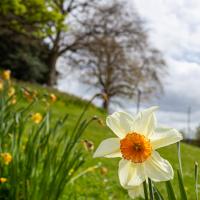
I left it a bit too late for a host of golden daffodils, most are on the turn. So here's a close-up of a selected still-perky individual.
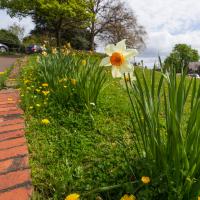
I bought a fantastic sausage roll in The Mall Deli and decided to have it here in the Mall Gardens, seeing as it's finally become warm enough to eat outside...
A Swing of the Plimsoll Bridge
24 Apr 2022
I was originally going to head over to the Ashton area to see if I'd missed any bits around the football stadium—and also to grab some lunch from the Tobacco Factory Market—but in the end I got a little distracted by having accidentally chosen exactly the right time to see the Plimsoll Bridge swing on one of the first busy days of Spring, where a lot of pleasure trips tend to head out down the Avon (and possibly the New Cut) from Hotwells.
In the end I mostly snapped that, and just a couple of photos from the Ashton area where I grabbed some lunch but didn't do any new exploring.
This is a plaque to the Cumberland Basin Stabilisation Works, completed in 1991, about which I can find virtually nothing on the internet. The face is too crumbled to read all the words, but I seem to remember that it's a lot more legible at certain times of year/day when the sunlight slants across its face. I'll keep an eye out for a better photo opportunity.
In the meantime, there's a picture of this entire area being resurfaced while the basin is drained and dredged on this selection of 1991 photos on the Evening Post site, which I'm assuming might have been part of this project.
Ticking Off a Pocket of Paths in Leigh Woods
03 Jun 2022
I managed to go for a wander a while ago that was meant to finish off a little tangle of paths in Leigh Woods, or at the very least finish off my wandering of the Purple Path there. And I managed to miss doing either of those things through some kind of navigational incompetence.
Today I woke up with a bit of a headache, feeling a bit knackered as soon as I dragged myself out of bed, but at least with the energy to realise that I'd be better off (a) going for a walk in what looked likely to be the last of the Jubilee weekend sunshine than (b) moping around the flat until it started raining, at which point I could mope more thoroughly.
I had a look at my map, considered going to Ashton Court, but remembered that there was a music festival there today, and instead found these little leftovers of Leigh Woods and decided to have one more try at walking them.
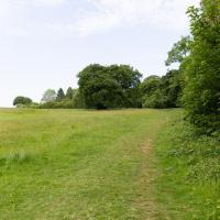
To the left is the edge of the golf course. I'm looking to wander along the edge and the behind the railway, which is behind those trees.
I think I'm pretty much a mile away from my house right here. Nice of someone to erect a marker.
I'm reminded why I like living in Hotwells. In a pretty leisurely hour's walk I can be in the countryside, basically. Or in the centre of town, or Temple Meads station, or shopping on Whiteladies Road, or on North Street... There's a lot of possibility, but it's generally a very quiet area to live in.
So, I finished off my route along the uncompleted sections of the paths, and by then felt a bit lost, with all the turning around and circling. I headed in what I hoped was the right direction, wondering if I'd spot a landmark, and then realised that the giant hill I was right next to was the man-made iron age fort of Stokeleigh Camp, and of course I knew where I was. D'oh. Sometimes you really can't see the wood for the trees.
I was put into something of an altered state by the little pilgrimage to this random little area of the woods and my backwards-and-forwards wandering. This kind of state has been used, apparently, as a form of divination, which is something I've been researching a bit recently.
It took me a while to find the right term. At first I thought that divination through walking along my map routes might be cartomancy, by comparison with cartography, but of course the "cart" comes from the Latin for "card", so cartomancy covers divination by cards, like the Tarot. Then I thought perhaps geomancy, what with it being somewhat geographical, but the "geo" bit is "earth" in Greek, and geomancy covers, as Chambers says, "divination by shapes formed, eg when earth is thrown down onto a surface".
In the end I tripped over the right name: ambulomancy—"any of various forms of divination that involve walking, often in circles", according to Wictionary. Lexico puts its appearance as early 19th century.
Of course, presumably one actually has to divine something to be an ambulomancer, and the main thing I was divining was that there was coffee and and sandwich in my future now I knew I was near the Leigh Woods exit that would take me across the bridge to Clifton Village.