Tagged: urban-area
Bedminster Trip for New Walking Shoes
26 Feb 2022
I needed to buy new walking shoes—my old ones were squeaking and it was driving me up the wall—so I ordered some for collection from Taunton Leisure on East Street in Bedminster, and decided to make picking them up an official wander.
I didn't cover any new ground within my mile, but I did take advantage of the trip to take in a few interesting things just outside my normal radius, mostly New Gaol-related. Along the way there are a couple of sanitation-related diversions, including a visit to a rare manhole cover. You can hardly wait, I can tell!
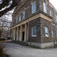
I'm sure I must have seen/noticed this giant pile on the corner of the New Cut and Bedminster Parade before, but It's quite well-hidden from the road.
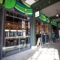
I didn't know this was here, in the dark corner of the covered bit of Bedminster Parade. I had to pop in, and procured a small selection of excellent beers.
My colleague Helen says she's a regular at the place, often stopping in for a beer.
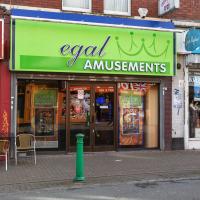
I'm glad that you can tell from the other signs that this should say "Regal Amusements" and not "Illegal Amusements", as I'd originally assumed.
In Which We Begin and End with Love
05 Mar 2022
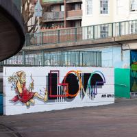
I had a lot to get done around the house, so as soon as I heard there might be a shiny new piece of street art near me, under the Cumberland Basin flyovers, I immediately decided that was all the excuse I needed to set off on a round-the-harbour lunchtime walk to get some fresh air and see if I could spot it. So, here's a circular wander that takes in graffiti, boats, wildlife and graffiti again...
I mostly went out to hang out with my friends Sarah and Vik in Bedminster, but along the way I thought I'd take a closer look at something a little nearer home: the last crossing point of the Rownham Ferry.
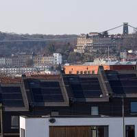
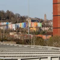
It's interesting to be able to look pretty much a mile back and see the familiar buildings of home. Descending from the top right in the distance we can just see the Observatory on Observatory Hill, then the end of Royal York Crescent, then the Paragon just eclipsing the suspension bridge, then below the bridge on the left there's Windsor Terrace and the more modern Windsor Court flats just visible behind the Bedminster foreground.
Getting back to the Rownham Ferry, the Ashton Avenue Bridge is one of the reasons it was closed. On the excellent Bristol City Docks website you can find a photo called "Rownham Ferry c1906 with Ashton Avenue Bridge nearly built.".
As you'll see in that photo, at low tide the Rownham Ferry was basically just a bridge made out of boats, so it probably still seemed a quick shortcut compared to walking all the way to Ashton Avenue Bridge. I imagine the foot traffic gradually migrated to the new bridge as the ferry was a more daunting prospect at high tide, from what I can gather. Also, the combined road/rail bridge would have allowed people to get the train across the river, rather than stopping at Clifton Bridge Station and using the ferry, I think.
A Quick Swing Past Ashton Court
05 Jun 2022
Another day not dissimilar to my last wander: I'm feeling a bit tired and rather than just moping around the house I thought I'd find some tiny bit of somewhere that I'd not yet walked and get outdoors. This time I headed for the Tobacco Factory Market in Bedminster, as I often do, but went the long way around via Ashton Court Mansion as I knew there were some footpaths and a small section of road I'd not ticked off up there. Finishing all the Ashton Court footpaths will be quite a long job, but you've got to start somewhere...
I did feel rather better by the time I got home, and, pretty much astoundingly given the weather forecast, managed to avoid the rain completely.
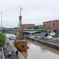
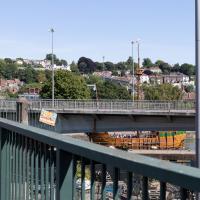
Fairly typical Bristol scene here, as the traffic is held up for a bridge swing caused by a replica of a 15th century caravel.
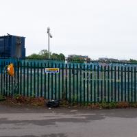
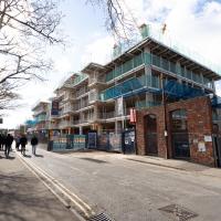
Looks like work has finally started on the new flats on the site of the former railway depot/concrete factory/Bristol International Exhibition site.
I'm in the habit of going over to the Tobacco Factory Market on a Sunday. I think I've walked all the routes around that way, but as a Plimsoll Bridge swing let me cross the road to the far side of Brunel Way on my return journey and I took a couple of photos of the brownfield development at the old Ashton Gate Depot site I thought I'd call it a Wander and pop some photos up.