Tagged: automotive-lighting
Sunday Bedmo
20 Dec 2020
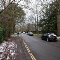
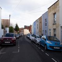
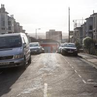
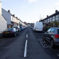
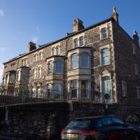
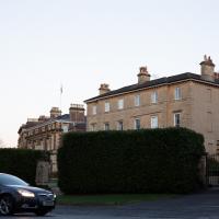
A long meander around bits of Bedminster, from the river to the north to Winterstoke Road to the south, taking a few roads I've seen before, and a few I haven't. The Christmas decorations were an extra bonus.
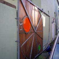
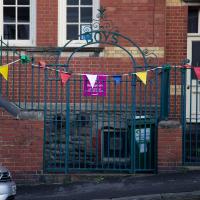
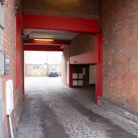
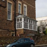
I'd love to see this in action. I'm guessing it pivots around the top centre, but I imagine that the circular bit also does something quite cool.
EDIT: I went back and had another look a few months later and tracked down a newspaper article with some video of the gate being opened while it was under construction.
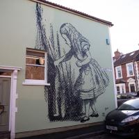
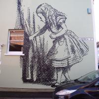
The original artist is John Tenniel (whose name I can never remember.) It was Stewy and homeowner Alison Larkman who did the work of putting it on the wall here, though.
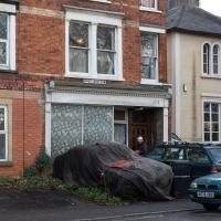
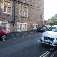
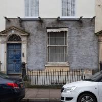
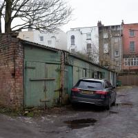
I presume it used to be a shop. Under the ragged tarpaulin is, I think, a Ford Consul Capri, and in the past there's been a later Ford—actual—Capri parked next to it, so the owner clearly has a bit of a think for Capris.
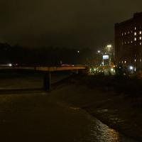
Solstice Rain
21 Dec 2020
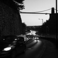
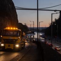
Despite the weather, Sarah and Vik and I wandered around Ashton Court a bit as the sun rose. Not that you could really tell. Sadly, the bit we wanted to watch the sunrise from was closed, because people hadn't been treating the deer with appropriate respect. Ah well, at least it was some exercise.
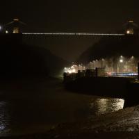
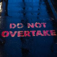
Sadly we couldn't take photos from the usual spots at the ends of the Suspension Bridge; it's all railinged off, presumably to stop people gathering in any significant numbers. The pedestrian footways are now also one-way, and have these signs on to remind people of the rules to keep everyone apart as much as possible.
I went to have a peep at the giant sinkhole that's opened up in Canynge Square—ironically, having recently discovered the gardens were public I'd had the (triangular!) square on my list to re-visit for a few days, but now there's no entrance to the gardens due to the danger. The area was well fenced-off for safety, but I tried to get a couple of photos from behind the barriers.
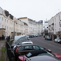
I also explored the area around Camp Road, an real melange of architectures, one of the most mixed-up areas I've seen in Clifton, in fact, and confirmed my friend Claire's suspicion that an earlier snap of a sign from Manilla Road was in fact for a fire hydrant. Nice.
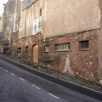
A homeless guy used to live in that doorway. I don't know if the boarding up coincided with the religious order that used to run Emmaus House as a retreat centre moving to Whitchurch or not...
Well, I suppose there's not much call for moving fire hydrants around, so it's still 24 feet in front of the sign.
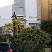
This probably worked better when people kept their coaches in the mews garages rather than leaving them scattered untidily in the road
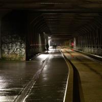
My historical research took a wander underground recently, partly inspired by the Canynge Square sinkhole, partly by St Vincent's (Ghyston's) cave and its tunnel to the Observatory, and I was surprised to find that there might be an intact tunnel from the Bristol Port Railway and Pier still just sitting there under Bridge Valley Road. A quick search turned up this recent video by an intrepid explorer, so it's definitely still there.
I went looking for the entrances today, and definitely found the south entrance, at the start of the Bridge Valley Path, the footpath that starts with steps at the bottom of Bridge Valley Road. It's easy to miss if you're not looking for it. I think I've figured out where the north entrance is, too, but it was getting dark at that stage and the Portway was still busy enough that crossing the road was still the normal nuisance, so I thought I'd leave further explorations for another day.
I have other pictures of the Bridge Valley Path from other days; it's not entirely photogenic, though it is a nice walk if you're okay with hills. I skipped the photos this time until I emerged at the top, in Clifton.
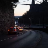
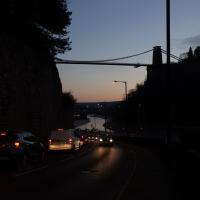
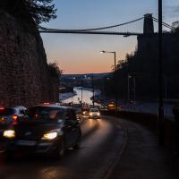
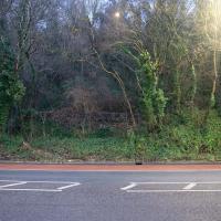
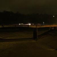
I didn't cross the road to check—it was still quite busy on the Portway and would have been hard to dash across. However, I turned out to be right on later walks; this is the hard-to-spot place where you can cross the road and walk beside wall you can see to the concealed entrace to Portnalls Number One Railway Tunnel.
You can barely make it out in the picture unless you know it's there but theres actually some decaying old steps and a handrail to help you up there from the kerb of the portway, roughly a fifth of the way into the photo from the left-hand side.
Prince's Lane
06 Jan 2021
The International Grotto Directory website says:
Prince’s Lane might have been one of the original ancient tracks from Hotwells to Clifton, in the Avon Gorge. The site later formed part of Rownham Woods which comprised some thirteen acres. By the end of the 18th century and the early 19th century, the Society of Merchant Venturers granted to Samuel Powell a building lease, for The Colonnade (1786), St. Vincent’s Parade (1790), Prince’s Buildings (1796), and Rock House. Rock House is generally considered to be the oldest surviving building associated with the Hotwell (see Chapter 20). John Power conveyed part of the woods to William Watts for the construction of Windsor Terrace (1790-1808).
The above development of the Avon Gorge cleared Rownham Woods, and created a triangle of land on the north side of the gorge, that became enclosed as a result, by Mansion Houses, whose garden walls all entered on to Prince’s Lane. The Lane started at the bottom of the gorge, at the base rock of Windsor Terrace, and came out half way up Sion Hill. It is clearly shown as a public footpath, dotted with trees, in Ashmead’s map of 1828. Some of the gardens were quite steep in parts and therefore, had to be terraced, because of the gradient of the gorge.
I've passed Prince's Lane literally thousands of times in my life, every time I've walked past the Avon Gorge Hotel, which itself started (in 1898) as the Grand Clifton Spa and Hydropathic Institution and pumped water up from the Hot Well for its hydropathic treatments. I've never actually ventured down it until today, or at least nothing like as far down it as I did this afternoon—I may have poked my head around the back of the hotel to see the original pump rooms at some point in the past.
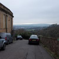
This was a great wander, though it does very much feel like a private road, and frankly I may have been pushing my luck a bit by winding my way between the astoundingly big back gardens of the houses of some presumably very wealthy Cliftonites, but I felt vaguely justified in exploring the history of one of the oldest footpaths in my part of Bristol...
Or the first sight of them in the distance, anyway. The terrace on the left is Prince's Buildings; we'll be walking being their gardens in a bit...
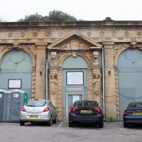
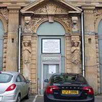
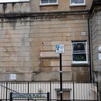
This was a pretty astounding space, by all accounts, in the style of a Georgian "long room" or assembly room, with the added bonus of a fountain of the Hot Well water being pumped up from the spring below. There are some pictures here of the interior.
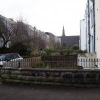
It seems someone ignominious for it to end up boarded over with cars and portaloos scattered around it.
A Little Local Wander
07 Jan 2021
Which included a literal "local", the Pump House, to try out their shop/deli/cafe. A flat white, some apples and a New York Deli toastie. Eleven quid, mind, but the Pump House was never a cheap pub...
I enjoyed the fog, and wandering down a few more out-of-the-way back alleys and what-have-you on the Hotwell Road.
I'm thinking of getting up early and going for a morning walk tomorrow, weather-depending, but at the moment my motivation to do things like this seems to be much strong in the evenings when I'm just thinking about it rather than in the morning when I actually have to do it. But it's going to be cold, and low tide is quite early, so there's always a chance of getting some footage of the hot well actually being visibly hot; you never know...
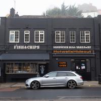
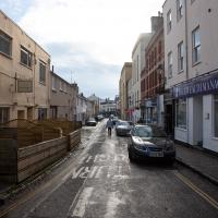
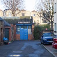
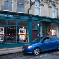
I understand that the man who first wanted to open this as a fish & chip shop suffered a heart attack not long before the planned opening. That was a couple of years back. Hopefully he recovered and is now running the place, but either way, it's nice to have a fish shop in the area again. The owner of the combined Chinese/Fish & Chip shop closer to me up the road retired a few years ago, and I've been missing it.
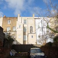
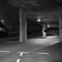
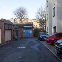
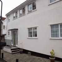
I didn't realise this was just a car park and an entrance to a couple of the flats. I exited quite quickly once I'd worked that out. I did spot a gate that looked like it might lead through to the rest of the estate, but I didn't try it.
Morning Walk
08 Jan 2021
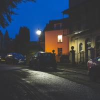
Tempted by a hopeful repeat of yesterday's weather, I got up early this morning and went for a short walk up into Clifton Village, around Observatory Hill, back down the Zig Zag and home. Instead of beautiful and mysterious fog and crisp freezing brightness I got some murk and slight dampness which included witnessing a road-raging van driver and finding that it still wasn't cold enough for the hot well to be even gently steaming when I got down there. I've still never seen it steaming, but I've been told it does, on colder days.
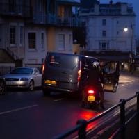
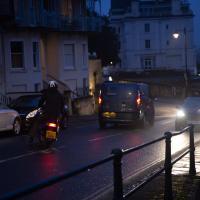
The van driver, who'd nearly driven into the side of the motorcyclist while doing a three-point turn just this side of the blind bend at the top of Sion Hill, became increasingly aggressive in the ensuing "discussion", including pointedly shouting that it didn't matter who was right, because he was in a van and the other man was on a bike, "so who'd be working afterwards?" in the event of a crash.
I'd stopped to make sure nothing terrible happened; when he got out of his van, walked right up to the motorcyclist and started shouting in his face, I started walking back towards them, taking the occasional photograph in the hopes that realising his actions were being witnessed and documented might make him think twice about turning physically violent. I don't know whether it helped, whether it was the car coming up behind us, or something else that made him get back in the van. Whatever, he got back in and screamed off far too quickly down the hill.
As you can tell, I didn't have time to change the camera settings. Getting the monopod back unfolded was also not much of an option :)
Mirror Maze
10 Jan 2021
Went for a wander with my friend Lisa—the current lockdown rules seem to be that one local walk for exercise per day with a maximum of one person not in one's "bubble" is fine—up to the University of Bristol area right at the edge of my one-mile perimeter to see the Jeppe Hein Mirror Maze, among other things. On the way we mused about Merchant Venturers, the slave and tobacco trades, and dating in the time of Covid.

Northern Clifton
16 Jan 2021
A raggedy wander with my friend Lisa, picking up a few stray streets and venturing only briefly onto Whiteladies Road, where it was too damn busy, given the current pandemic. We retreated fairly quickly. Found a couple of interesting back alleys, and got a very pointed "can I help you?" from a man who was working in his garage in one of the rather run-down garage areas behind some posh houses, and clearly didn't want us just wandering around there.
Here's an interesting sinkhole-related snippet:
"In September 2007, Peter Insole of Bristol City Council visited no.52 Clifton Park Road, Clifton to investigate the report of a mine shaft in the rear garden that had been exposed during gardening work. In the southwestern corner of the garden a rough rock cut shaft approximately 1m in diameter was observed. It was not possible to fully survey the feature for health and safety reasons, but it appeared to be excavated through sandstone or Dolomitic Conglomerate and was at least 2m deep. The shaft opened out into tunnels or chambers beneath the rear gardens of the Canynge Square properties. It is possible that this feature was associated with a previously observed cellar or chamber beneath the rear garden of 22 Canynge Square, although there are no known cartographic or documentary records for mining activity in the area."
23 Clifton Park. This is so hidden away that it gets its own street sign, which we'll see in a minute.

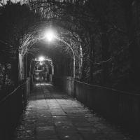
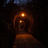
This is Lime Walk, a well-known path through St Andrew's Churchyard.
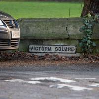
A lot of people call it Birdcage Walk now, and I think that's even on Google Maps, which just goes to show that places are called what people call them. The original Birdcage Walk is just opposite, running across the centre of Victoria Square, and I think it might even still have a sign up with its name on. But something that just looks as Birdcage Walk-ey as this is likely to claim the name in the long run, I'd've thought.
Snowy Leigh Wander
24 Jan 2021
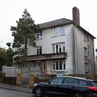
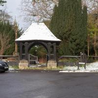
I started this wander with my "support bubble" Sarah and Vik, after Sarah texted me to say "SNOW!" We parted ways on the towpath and I headed up into the bit of Leigh Woods that's not actually the woods—the village-like part in between Leigh Woods and Ashton Court, where I'd noticed on a map a church I'd not seen before. I found St Mary the Virgin and quite a few other things I'd never experienced, despite having walked nearby them many, many times over many years, including a castellated Victorian water tower that's been turned into a house...
...was my first thought.
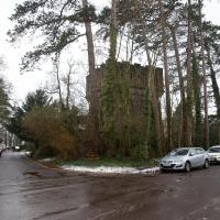
There appears to be, with no obvious explanation, a giant defensive structure in someone's back garden here.
Having looked it up, it seems that it's a "castellated Victorian water tower", built 1868, now turned into a residence. Fancy that!
Mr West said: 'In fact it was one of the first towers of its kind in Britain. It was built to provide water for the Cadburys and Wills and their retainers, including two gigantic family Victorian houses for the Wills. So it's in this exclusive gentlemen's residential area and as water towers go, it's posh.'