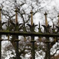
Tagged: fence
Clifton Village Mini Wander
20 Nov 2020
Just a quick wander up the hill to get a flat white from Twelve. I really enjoyed the spooky mannequin (?) in the window.
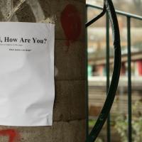
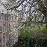
I'm not sure what's going on in this fanlight on Richmond Terrace. Maybe it's space for a lamp?
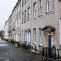
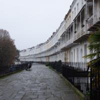
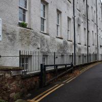
From what I can work out, this terrace that starts in the road called Richmond Terrace itself continues around the corners to Clifton Road and here, Queens Road, while still being called Richmond Terrace.
Bedmo and Ashton Court
21 Nov 2020
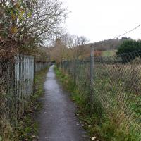
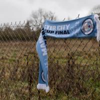
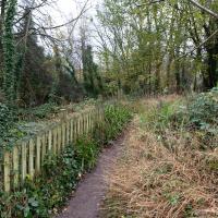
A rather more wide-ranging weekend wander with Sarah and Vik, taking in some mock Tudor bits of Bedmo (I should note that I've subsequently been corrected to "Bemmie", but I'm an outsider and have been calling it "Bedmo" for short for decades...), a chunk of Ashton, a path up Rownham Hill called Dead Badger's Bottom(!), The Ashton Court estate, a bit of the UWE campus at Bower Ashton, and some of the Festival Way path.

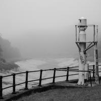
I have no idea how anyone managed to smack this street furniture so hard, or what direction they came from to do it. It's a pretty straight 30mph road right there, and this is only one side of the dual carriageway. Never seen so much as a near-miss there.
Underpass
25 Nov 2020
A quick lunchtime jaunt for coffee. I've often wondered about the dots on the wall of the underpass. Apparently they're not intelligible Braille. Maybe it's Marain :D
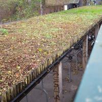
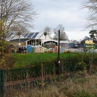
Given that it's on an unwalled bike shed, I doubt it's there for insulation. The CREATE centre my just have it there as an example of what an eco-friendly roof can look like, though.
Avoiding the Accounts
26 Nov 2020
I took the day off my day job to do my accounts—or at least do enough bookkeeping to send them to my accountant. I hate doing the books. I woke up late, tired and with a headache and decided to bunk off for a walk around Cliftonwood, Clifton Village and Clifton instead, taking in a couple of good coffees along the way. Thanks, Foliage Café, and Twelve for the flat whites.
A month after I took this picture, a 40-foot sinkhole opened up inside the square's garden, along the edge of this side of the square, apparently into vaulted chambers below. Makes you wonder exactly what was built below Canynge Square and why! Maybe it's where the Merchant Venturers sacrificed the poor to Cthulu...
The Long Lunchtime at the End of the World
27 Nov 2020
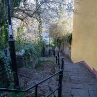
I took an extra-long break at lunchtime today as I'd taken the day off my normal day-job to do the accounts for my previous side-job, which is still generating paperwork, though not much in the way of money. This took me through some undiscovered bits of Cliftonwood, including Worlds End Lane, which unexpectedly leads to White Hart Steps. That's certainly not where I expected the end of the world to lead to...
A long ramble, starting with trying to find the Hot Well of Hotwells and leading up the side of the Avon Gorge to the Downs and then through Clifton for coffee.
There've been quite a lot of outdoor exercise classes on display during the pandemic, as you'd imagine.
Ten O'Clock Shop and Can't Dance Coffee
30 Nov 2020
I had to return a faulty AirPod Pro to Apple (there's a first-world problem!) so I just took a quick trip up the hill to the nearest UPS drop-off point, The Ten O'Clock Shop, which is famously open until 11pm. Unfortunately it's a fairly cramped little place and neither of the staff were wearing masks, so I made it a very quick drop indeed and got out of there as quickly as I could.
I grabbed a quick coffee from Can't Dance, a stall that's—as of yesterday—in a tiny converted cargo container on the edge of Victoria Square; up until this week they were running from a little trike parked in the same place. Hopefully the new premises will let them see out the winter without worrying quite so much about the weather.
I tried to fit in a few extra streets from the surrounding area on my there and back, but that was basically my wander today: a quick little shopping trip.
Looking down onto Hanover Lane, which I often use as a cut-through when heading for the Triangle. In the Beforetimes I'd often walk between Waitrose and home via that route.
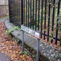
I'm sure I've walked the length of Hanover Lane many times without ever taking in the fact that it's called Hanover Lane. It's not like there's anything down it, other than the backs of gardens on one side and an electrical substation on the other—I wonder it has a name at all.
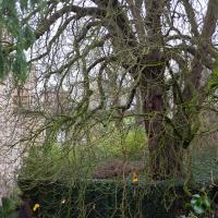
It's a pretty impressive tree, as is the fact that a giant building like Manor Hall is so unobtrusive that you could wander past it at this level without ever paying it much attention. I did, for years.

Got your work cut out making that window look good. They were actually working around the corner.
Fruitless Coffee Excursion
01 Dec 2020
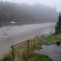
Unfortunately by the time I got to Greville Smyth Park I was already about halfway through my lunch-hour, and the queue was too long to wait to actually get a coffee. Is that a fruitless excursion? Presumably a coffee bean is technically a fruit...
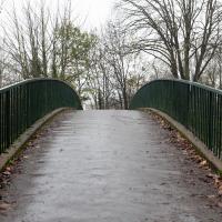
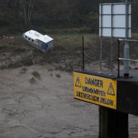
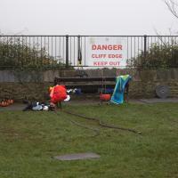
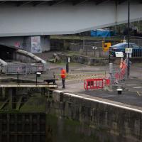
This kind of vague musing was sadly overshadowed by my delay at Ashton Avenue Bridge on the way back, where someone—hopefully still a someone, rather than a body—was being stretchered up the bank of the river, presumably having just been rescued from the water. As I made my way home the long way around, avoiding the cordoned-off area at the back of the CREATE centre and its car park, I saw an ambulance haring across the Plimsoll Bridge, siren running, presumably on its way to the BRI. I'd like to think that was a good sign.
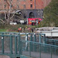
One thing I didn't know existed until this moment: Avon Fire & Rescue Service's specialist Animal and Water Rescue Units. They "...carry specialist equipment such as inflatable rescue paths, mud lances, animal rescue strops and harnesses, and a winch..." and "...have attended a range of incidents including the rescue of a woman from a car trapped in flood water and a donkey trapped in mud".
I don't know why there were here today, but that doesn't look like an animal on that stretcher/sled thingy. It looks to me rather like they're retrieving a body from the water. The police were in attendance, too, and the whole area was cordoned off.
I know from talking to the ferry crews that rather more bodies are pulled from the harbour every year than you'd imagine from any newspaper reports you might see. I'm guessing the same goes for the river.
Nothing New
02 Dec 2020
This may be the very first time I've gone for a One Mile Matt wander and not actually gone down any new roads, trod any new steps. I just wanted a coffee, frankly, so I went the same old way to Imagine That in the marina and back again.
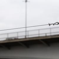
I'm always a little worried that one day a swan's going to get garotted by this wire strung across the bit of Cumberland Basin behind the little causeway. It's used by the water football (?) people to string their goal up.