Tagged: residential-area
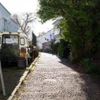
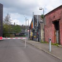
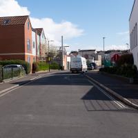
I noticed I'd missed a bit of Circular Road and Ladies Mile, and it was a nice evening for a sunset wander up to Clifton. There was something I recorded along the way, not photographically but in video.
Bristol Zoo, the world's oldest provincial zoo, has recently decided to close its Clifton site after 185 years of occupation, which means that the sounds of wild animals will no longer drift incongruously through this leafy Georgian area. They're moving everything up to their existing second site, The Wild Place Project near Cribbs Causeway. As I was wandering the Downs, I heard some fierce roaring noises, so I decided to see if I could get a little closer while they were still going on and record a sound that's soon to disappear.
I don't have a way yet to put video directly on this site, so here's a link to the video of my attempt to catch a bit of the zoo noises that I just popped on YouTube. It's sad that this might be the last time I hear such noises in Clifton.
An Evening Wander to the Gallows
06 Apr 2021
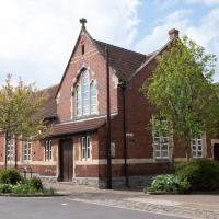
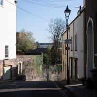
I'd originally intended just to pop up to the area around Alma Road, where I'd missed a few streets on earlier wanders. It was such a nice evening, though, I decided to extend my walk up to the very top of Pembroke Road, just outside my one mile radius, to take a few snaps of something intriguing I'd found in my researches.
I've driven, walked and jogged past the little triangle of land at the top of Pembroke road a great deal in my time in Bristol, but I didn't know that it used to be the site of a gibbet, in fact that the road itself there used to be called Gallows Acre Lane. According to the Durdham Down history trail, by Francis Greenacre (an excellent name for a Downs researcher!) among other sources:
...it was below this quarry near the top of Pembroke Road, once called Gallows Acre Lane, that a gibbet stood. It was sometimes occupied by those who had committed robberies on the Downs and was last used in 1783 to hang Shenkin Protheroe for the murder of a drover. Stories quickly spread that he descended from the gibbet at midnight every night and stalked through Clifton. Such was the alarm that his body was cut down and buried.
Also very close to this little triangle of land was one of the gates of the extensive turnpike system...
Anyway. Along the way I encountered a wooden tortoise and a real squirrel, among other things. It was a good walk, and more light in the evenings means I can move my wanders out of the ticking countdown clock of work lunch-hours and be a bit more leisurely.
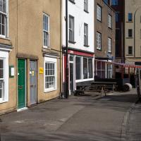
I came across this photo of 5 Wellington Terrace back when it was the Gaping Goose, two doors down from the Portcullis, and decided to snap the site as it is today. Interesting comparison!
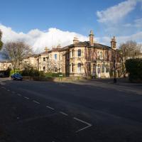
I knew I'd missed a street! This wasn't my destination tonight, though, and there was a children's party going on in the street, by the sound of it, so I decided to come back here another day.
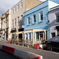
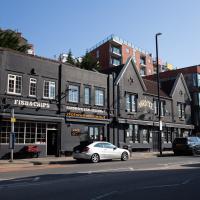
A great fish restaurant, clearly gearing up for some al fresco dining once the lockdown eases up a bit.
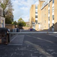
I only snapped this so I'd remember that I didn't miss this "street", but that it was a private car park.
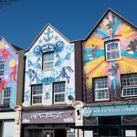
Clifton Village Lunchtime Coffee
07 Apr 2021
Unusually for my recent lunchtime coffee trips, I managed to find a new road to walk down: Caledonia Mews, which has a little entrance off Princess Victoria Street and runs between it and Caledonia Place. I've noticed it before a couple of times—if you look up from Princess Victoria Street you can see some of it, standing tall above the low buildings on the street itself—but until last night I'd not set foot in it, I think.
As well as focusing on this charming little mews, I looked in on the demolished site of the old WH Smith, and spotted what I think is part of the now-private-houses St Vincent Rocks Hotel that I'd not really noticed before, tucked away between Sion Lane and Sion Hill.
A London Wander in Southville
10 Apr 2021
There's a bit of Southville that I've been meaning to get to for some time, where the streets seem to take some strong inspiration from London. There's a Camden Road that crosses with an Islington Road, and a Dalston Road, even an Edgeware Road. For me these names are more evocative than the rather more exotic names I passed by to get there—Sydney Row or Hanover Place, say, because I've actually been to the places in London. The last time I was in Islington I saw Monkey Swallows the Universe play at The Angel, and I can't think of Camden without remembering a gondola trip with my friend Tara where a cheery youth played Beatles music for us on a saz...
I really liked this little area, with its mostly well-kept pretty houses and hints here and there of the creative side of the residents. It's arty and down-to-earth at the same time, and I wouldn't mind living there, I think.
On the way there I got the chance to walk through Underfall Yard for the first time in a while, and on the way back I had my first take-away hot food for many months, grabbing some crispy fried squid from the excellent Woky Ko at Wapping Wharf.
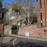
The former stone mason's place. Geograph has a good photo of what it looked like before. From what I can see from the planning website, it might be becoming offices, rather than the flats I'd assumed would emerge. I may have been mis-reading the vast array of planning applications, though; I suppose we'll see...
The door across this is normally closed. You can just about see Wallace and Gromit smiling on the side of the building, presumably not coincidentally, given that Aardman Animations' office is down there and up the driveway to the left.
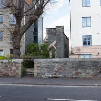
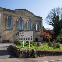
I think this may be a remnant of St Raphael's Church, whose adjacent almshouses for aged seamen are now the site of the flats at Perret's Court, just to the left there.
Ah! Yes, according to ChurchCrawler:
1853-9 by Henry Woodyer, closed 1878 following disapproval of the bishop and not reopened until 1893. Some war damage, the church was again closed and became part of a factory in 1953 and demolished 1954. Part of the W front still stands in the garden between two blocks of flats.
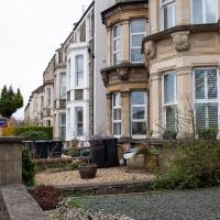
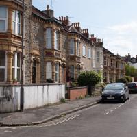
There are some sturdy and pleasantly-proprotioned houses along the Coronation Road. I don't imagine they're enjoying the extra levels of traffic since Cumberland Road has been so impacted by bits of it falling into the river; it wasn't exactly quiet before. Maybe the reduction in general traffic since the pandemic has at least mitigated things.
I think it's a guesthouse. There are several on this stretch of Coronation Road. Nice big place, and that stonework would probably clean up a treat. I imagine we'll see less of this once electric vehichles become more of a thing.
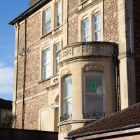
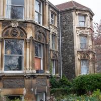
This reminded me of my favourite terrace in Clifton, Manilla Road. This is a lot less showy, but I really like the decorative architecture, and the quoins, which I've managed to miss almost completely from the photo. D'oh.
There's a lot of villas in the Bedminster house names. One of the definitions in Chambers has "A superior middle-class house", and there's a lot of superior middle-class people in Southville, so...
(I jest; it's a lovely area.)
Long Bemmie Wander with Lisa
11 Apr 2021
My friend Lisa joined me again, this time for a long wander through "Bemmie". In fact, I tweeted recently using "Bedmo" as my abbreviation for Bedminster, and apparently there's something of a culture war going on. From what I can glean, the longer-term residents call it "Bemmie" and consider "Bedmo" a name made up by hipster gentrifiers.
I had no idea, but then I didn't grow up around here, and I don't live in Bedminster, and I'm not a hipster. I'm not sure I've ever gentrified anywhere, either; Hotwells was already quite gentrified by the time I arrived. I probably just lowered the tone a bit.
Anyway. Lisa and I entered Bemmie by the traditional toll gate (though actually you'd only have paid if you were coming from the Long Ashton direction, not merely nipping across from Hotwells) and then almost literally combed the streets to knock several new roads off my list of targets. Along the way we saw lots of street art, as you'd expect, and admired the area's panoply of gorgeous knockers.
The reason Ashton Gate is called Ashon Gate is because it's the site of the former turnpike gate between Bristol and Ashton (now known as Long Ashton.) This is the actual toll house, still standing. "The Toll House closed in 1866 and was incorporated c1980 with Toll House Court", says the listing.
Toll House Court is now used by Second Step, a mental health charity, as part of their High Support Accommodation programme to combat homelessness.
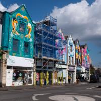
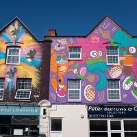
Work continues on the Six Sisters project, the "UK's largest female-led street art project".
We'll see a Cromwell House in a minute. Clearly they're New Model Army fans around here. Nice path.
Normally when you're looking at a date on the side of a building in Bristol it's a little further in the past. It's interesting to see one so recent. I wonder if in a hundred years time people will stand here thinking about the dim and distant past.

Not sure what this collection of buildings around a courtyard is at the end of Exmoor Street. This didn't seem to be its front entrance. Maybe I've seen it from the other side at some point, but I can't put two and two together...
Aha! After a bit of searching on a map, yes, I found them: this is actually the back of the houses in the elbow of Grenville Road, in the distance on this pic. It's just called The Mews, I think.
Or I'm assuming so, given the look of the place and the number of mobility scooters there were parked up near some other front doors.
Better Look at an Extension
14 Apr 2021
Apart from a lovely coffee and a slice of Victoria sponge from Twelve, there weren't any new sights on this little lunchtime jaunt except for a slightly better look at the long raised extension at the back of the St Vincent's Rocks Hotel, where I at least got to see the arches it's raised up on. I also got a fair bit of exercise by walking up the Zig Zag to get there, and saw far more people out than I have in months, what with the lockdown having just been significantly lifted. As I walked past The Mall pub they were turning people away from their already-full garden, and the (outdoor) cafe tables were pretty full up.
I only found out that this was a raised extension when I read the listing after snapping the last photo. Today I ventured as close as I could and got to glimpse a bit of the rather nice support arches.
Coffee, Pirates and a Spitfire
15 Apr 2021
Just a quick trip to Imagine That for a flat white and a date ball (they're really nice), snapping the general sights along the way. No new roads, as has rapidly become the default on my lunchtime wanders, but as I'm in the routine of this project it almost seems strange not to pop my wanders up on the site.
Desultory Coffee Wander
16 Apr 2021
Another day, another quick dash out for a coffee. I did at least try to take a different route from normal, especially on the way back, where I yet again got a bit lost in the strange paths, flyovers and underpasses that make up the odd maze of pedestrian "infrastructure" among the concrete jungle between the west of Greville Smyth and my neck of the woods in Hotwells. I swear one day I'll take a turn I've not tried before and end up being gored by a Bristolian minotaur.
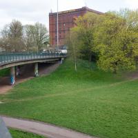
I think I should have gone back down into the park to come back up my normal path, that leads to a place where you can walk under the flyover and get back on the bridge to Hotwells. As it is I just tried heading north and ended up having to cross four lanes of busy traffic.
That seems to be the failure of the pedestrian paths around here: if you know where you're going really well, the best you can hope for is not to make a wrong turn, and then you can end up going all the way around the houses, including quite often back the way you came, and might manage to use some of the provided underpasses and crossings and avoid the most dangerous traffic. But if you don't know them like the back of your hand and just try heading for the place you want to get to, that you can actually see, you'll be led entirely astray and end up in a variety of dead-ends.
Man on a Mission
17 Apr 2021
I went rather outside my area today, as I went to pick something up from the Warhammer shop on Wine Street (Games Workshop as-was, and before that I think perhaps a rare retail outlet for Her Majesty's Stationery Office? I may be mis-remembering...) Anyway, a friend of mine wanted something picking up and posting to him, so I figured I'd knock some streets off my list along the way.
I first headed for the St George's Road area, walking down the narrow Brandon Steps and finding some strange wall art on Brandon Steep, then headed to the Old City via Zed Alley. The Warhammer shop visit was friendly and efficient, and, mission accomplished, I treated myself to a sausage roll and a flat white from Spicer + Cole, to take away and eat in Queen Square with its current decoration of hearts. I finished off with a detour up Park Street, looking out for St John's Conduit markers, before finally crossing Brandon Hill on the way home.
Quite a long wander, all told, and I'm a bit knackered today...
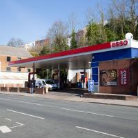
Who was it that decided that petrol stations had to be ugly? It's not like oil companies don't have money...
I came down Brandon Steps, but I also needed to walk along Brandon Steep from the same place. I figured I might as well do a little circuit to knock this one off the list while I was here, so it's back up here to the top of the steps I go...
A New Wander, a New Cafe
21 Apr 2021
Obviously, I was trying to connect to the industrial history of the Canon's Marsh area, to the old gasworks, the docks railway, the warehouses they blew up to make way for all the rather soulless modern stuff (though I do like the Lloyds building, at least.) But what I mostly got out of today's walk is a new cafe to go to for my lunchtime outings. It's perhaps a little closer than both Imagine That and Hopper Coffee; not quite as close as Foliage and Twelve up in Clifton Village, but also not at the top of a steep hill.
No, not the mediocre Costa, but only a little way away from there: Rod and Ruby's, which opened in 2018 and which I've seen in passing several times but never popped into until today. What can I say? I was foolish. Great flat white, lovely interior, astoundingly good cannoli.
Sometimes you just have to get your head out of history and enjoy a pastry.
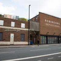
I know very little about the history of these buildings. There's a removals firm called Robinsons with some links to Bristol, and a building in Brimingham with an old sign saying "Robinsons Furniture Depositories", so I suppose it's possible this is a long-defunct furinture repository for a removals firm. Last planning application I can find is from 1998, before I even moved to Hotwells, granting permission to demolish "two storey office building and single storey store", which very much sounds like these two buildings.
The bit on the right still has a sign up saying it's Gnodal and Bioinduction—the firms whose car park is around the back—though Gnodal is defunct and Bioinduction sadly don't have any pictures from the Bristol office on the one-page website.
I really must poke my nose in and see if there's anything more than the apparently-tiny couryard back there.
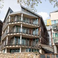
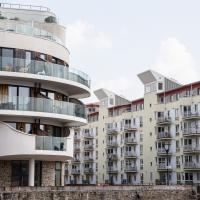
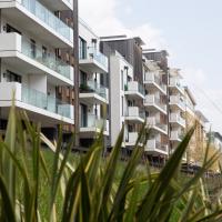
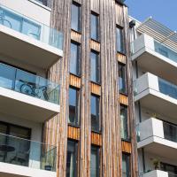
I actually quite like this one, especially the pointed fronts of the living spaces. Decent size balconies, too.