Tagged: vehicle
Lunchtime Reproduction (of an old photo...)
17 Jan 2022
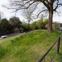
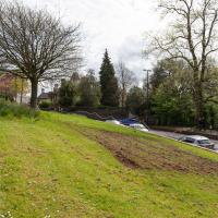
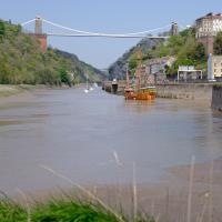
This was basically the quick lunchtime jaunt I tried to do at the beginning of January, only this time I actually managed to get to roughly the viewpoint I'd been hoping for to recreate a historical photo of the Bristol International Exhibition.
I did this walk about a month ago, but I've been a bit poorly and not really up to doing much in my spare time, and it's taken me this long to even face processing even these few photos. Hopefully normal service will be resumed at some point and I can carry on trying to walk any roads and paths that I need to do to make this project feel complete...
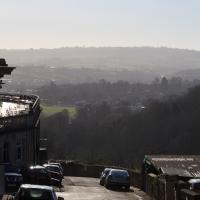
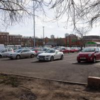
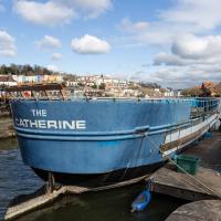
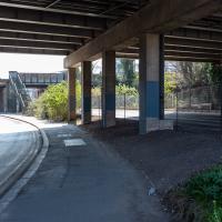
We've been as far as we can go down there on an earlier wander. From the top you'd just think it led to the Hotel car park.
The Colonnade, the Rock House, St Vincent's Parade and the old landing stages for Campbell's paddle steamers. The leftover fruit of bygone boom years.
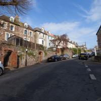
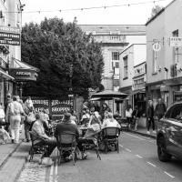
Lunchtime Cliftonwood Wander
18 Jan 2022
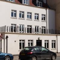
Another workday, another quick lunchtime trip to get me out of the house. This time my flimsy pretext is a tiny bit of Clifton Vale Close that I'd apparently not walked, and the fact that although I'd walked down Church Lane at least once before I still hadn't taken a single photo of it. Really I just fancied a mosey through Cliftonwood in the sunshine, with the promise of a coffee from Clifton Village at the top of the hill.
I really do like these little houses. Hate to think how much you'd have to pay for them, though.
Ouch. Just looked it up. Apparently the average property sale price over the last year was £750,000. I suppose the Tesla parked to the left there should have given away the income level; the Model S sells for about £75,000 in the UK.
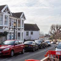
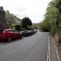
It's a perfectly nice street, but there's nothing too photogenic in it. I suppose that's why I didn't feel the need to raise the camera too much on previous occasions.
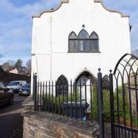
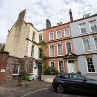
Mid-to-late 18th century, in the "gothick" style according to the listing. I approve of their spelling. This is definitely the right listing, as here's exactly what we see:
Symmetrical end has an elaborate Dutch gable with a 2-centred arched doorway with panelled door, and matching windows each side with lattice leaded lights. Above is a tripartite window with 2-centred arched heads, central casement with interlacing upper glazing bars and blind outer ones.
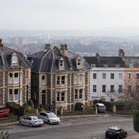
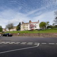
I've always really liked the big mansard-roofed houses along this stretch. There's something big and dignified about them.
And that's the end of another lunchtime jaunt. I don't know if there's any trips left in the backlog. Hopefully at some point the weather will let up a bit (we've just been through Storm Eunice and there's more heavy weather on the way, apparently) and I'll feel like heading out for a wander again.
Bedminster Trip for New Walking Shoes
26 Feb 2022
I needed to buy new walking shoes—my old ones were squeaking and it was driving me up the wall—so I ordered some for collection from Taunton Leisure on East Street in Bedminster, and decided to make picking them up an official wander.
I didn't cover any new ground within my mile, but I did take advantage of the trip to take in a few interesting things just outside my normal radius, mostly New Gaol-related. Along the way there are a couple of sanitation-related diversions, including a visit to a rare manhole cover. You can hardly wait, I can tell!
Anyway, on to happier contemplations. Here we see the Merchant's Road bridge (Junction Bridge, to give it its official title) swinging closed behind the Pride of Bristol.
This is about the only circumstance that can slow me down on a harbourside walk, but the bridge swings are normally over fairly quickly and there's usually an alternative crossing not far away, too.
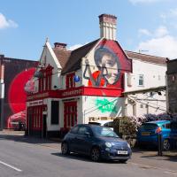
The Bedminster branch of Asda—pronounced as "Asdawl" by proper Bristolians including my friend Cindy—is enormous and pretty much always busy. It used to be my local supermarket when I lived at Baltic Wharf; I now have a couple of smaller "metro"-style supermarkets I tend to visit now I live in Hotwells. I think the last time I came here I was after something from the pharmacy that my local place didn't have.
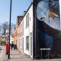
This place has both astoundingly good reviews and a gallery, apparently. According to the website, it's run by "Annie, a well-known celebrity on the Street Art scene".
I may have to pop in at some point, though I'm rarely at a loose end in this bit of town.
I couldn't find out why it's called the Rope Walk, but it does seem to be the starting point for the Blood and Butchery in Bedminster walking tour, so that might be a way of finding a local historian who knows...
The traditional double-doors-in-the-pavement-and-vent-pillar combo that marks a subterranean electrical substation in Bristol.
In Which We Begin and End with Love
05 Mar 2022
I had a lot to get done around the house, so as soon as I heard there might be a shiny new piece of street art near me, under the Cumberland Basin flyovers, I immediately decided that was all the excuse I needed to set off on a round-the-harbour lunchtime walk to get some fresh air and see if I could spot it. So, here's a circular wander that takes in graffiti, boats, wildlife and graffiti again...
Not much change since the last time I saw her, but certainly a heck of a difference from the start of the "refit".
Leigh Woods Purple Path
12 Mar 2022
There's a few tracks in Leigh Woods that lie within my mile and show up on my map but that I've not walked yet, so I decided to take one of my traditional big long walks through the woods on this nice crisp sunny morning.
For years—decades, even—I've been doing a similar route from my place, along the towpath to the far woods entrance, up the hill for a varied walk on one of the marked tracks and then across the Suspension Bridge to Clifton Village for a coffee-based reward. It's my default "long walk", really, and I almost always enjoy it. Today, at last, spring actually seemed to be springing, which made for some extra positivity...
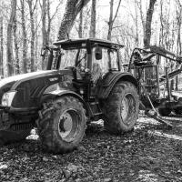
There's been some footage doing the rounds on Twitter recently that's apparently of a Ukrainian farmer towing some Russian military equipment away, with a panicked Russian soldier in foot pursuit, which sprang to mind as soon as I saw this tractor sitting in the woods.
My food varies a bit on these forest walks, but I'm quite set in my ways on the drink: lapsang souchong, brewed straight in the Thermos flask at home, with two ice cubes dropped into it before I seal it up. This ensures that the tea is at a perfectly drinkable temperature at this point on the walk. Some rituals are worth experimenting with and perfecting.
I mostly went out to hang out with my friends Sarah and Vik in Bedminster, but along the way I thought I'd take a closer look at something a little nearer home: the last crossing point of the Rownham Ferry.
That reminds me; I must re-read Iain M Banks's Use of Weapons again. In the novel he used the name Size Isn't Everything for one of the Culture's General System Vehicles, a spacecraft approximately 80km long... In the Culture, spacecraft are sentient and Culture ships choose their own names, often ironically.
He we have something of the opposite size of craft.
If you were following this route you'll have noticed I just magically took a shortcut through a bunch of houses. That's because I've elided the bit of the route that goes to Sarah and Vik's place and stays there for an hour or two.
In the distance is EE's temporary cell tower, which I've mentioned before, put up in November 2020.
Inflating in the field behind Ashton Court mansion, by the looks of it, the usual venue for the Balloon Fiesta.
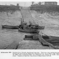
And here's the picture that inspired this little local visit today. A week or so back I was browsing the boxes of books at Rachel's and Michael's Antiques on Princess VIctoria Street, and flipping through their collection of Reece Winstone books. Winstone's famous Bristol As It Was series are an amazing documentary source created by a man who loved both photography and Bristol and effectively became Bristol's foremost documentary photographer for decades. A lot more of Bristol's history is visible today because of him.
In the Bristol As It Was 1939 - 1914 book I saw this picture of the Rownham Ferry. Unfortunately the book was a first edition and priced at £20, so I ordered a cheaper edition from an independent dealer in Stockport when I got home! (Let's consider that as me leaving the rare first edition for the true connoisseurs, rather than just being cheap.)
Here we see the ferry just five days before its closure on the last day of 1932. Looking closely, it seems to be perhaps operating as a reaction ferry, with the boat tethered to a static line across the river, and the ferryman using the rudder to turn the boat and use the power of the flowing water to shuttle the boat from side to side. Clever!
Photo © Reece Winstone Archive. (I recommend buying the books if you like old photos of Bristol. They're amazing!)
A Coffee and a Curve
27 Mar 2022
I wanted to have a wander along to the Tobacco Factory Market for some shopping, and checking the map for any leftover nearby streets I noticed a tiny curve of road on the way into the modern flats at Paxton Drive that it didn't look like I'd walked down before. I wouldn't take me too far out of my way, so I decided to head there first and then across to North Street to get my groceries and a coffee...
It looks on the map like there are little side streets off Paxton Drive. There really aren't, just these little car parking areas. Hence I didn't walk down any of them.
I headed here for a take-away flat white for the walk home. I may have to come here for brunch one day soon; I saw a pair of amazing looking brunch plates being delivered as I was waiting for my coffee. Looking at the brunch menu it could have been the Bubble and Bacon, and the Turkish Tagine.
At some point, the Council say that the Chocolate path will finally be repaired and I can at last add one of my favourite paths in Bristol to my One Mile Matt project.
Here's hoping.
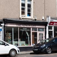
I noticed I had a few things on my "potential wanders" list that could all be done relatively close to home, and in a fairly straight line, so I set off at lunchtime to recreate a photo of a now-defunct pub, wander behind a Spar (which turned out to be more interesting than I'd expected, but I admit it's a low bar) and spend some time browsing in Dreadnought Books before coming home via a coffee from Spoke & Stringer, a little diversion up Gasworks Lane and a tiny bit of the Rownham Mead estate I'd somehow previously skipped.
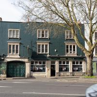
Here's the Spring Garden(s)/Durty Nelly's/La Demi Lune as it looks today. Rather dull modern accommodation, sadly. I understand they may have extended the building back into the garden to make it roomy enough to be flats.
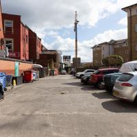
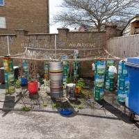
Here we are at the end of Pembroke Place, wandering a little alleyway I'd not previously filled in on the map. I didn't have high hopes for much of interest in this parking area behind Spar and Marcruss Stores. However, I did find something interesting, as we'll see in a couple of photos' time.
I can only guess that the Raj Bari restaurant has been trying to grow their own herbs and spices. Doesn't look that successful at the moment, to be honest, but maybe I'm looking at things that aren't in season...
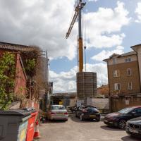
Not much to be seen in this direction except the crane on the site where they're busily filling a gap with new flats. We'll see the front in a little while.
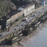
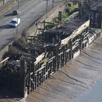
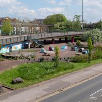
Remnants of the docks railway. These ran around the harbour to Ashton Avenue Bridge to the west, and along to the main Goods Depot at Anchor Lane to the east.
I think this may be the last visible remnant of the harbour railway on this entire stretch of the Hotwell Road. There may still be some tracks around Canons March—that whole area south of Anchor Road had a lot of rail lines—but I've not seen any others west of Jacobs Wells Road.
Interesting to think that this street art will presumably be sitting as a layer in between Marcruss Stores and the new-build flats for ever...
Here's a snap from before the cover-up.
Having checked the planning application it seems these may be going to be called the Black Horse Apartments, echoing the former name of Pembroke Place, which is a nice little touch.
On St George's Road. This is where I ended up spending most of my stopping time on the walk. I managed to resist most temptations and came away having only spent £2 on a paperback of The Mill on the Floss. I read Silas Marner a while back and really liked it, so I've been wanting to try some more Eliot.
I shall add it to my tsundoku collection.
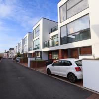
See what I mean? Without the trees and shrubs this would be a very dull little red-brick estate, but everywhere you look there are lovely little touches like these trees.
Easter Monday Gardens and Flowers
18 Apr 2022
I didn't really set out with a theme of flowers and gardens in mind for this walk. I just fancied heading up to Clifton Village to get lunch. As it turned out, though, Spring was springing, so a minor theme emerged as I started off with the graveyard flowers of Hope Chapel and wandered up to see the beginnings of the new wildflower garden at Clifton Hill Meadow.
I thought I'd come and see how the wildflower garden was getting along. It's its first year, after a crowdfunder last year raised nearly £2000 to buy seeds, plug plants and signage.
Although the sign earlier said that you'd still be able to picnic here, I've never actually seen much picnicking. I think that's likely because of the danger of any round picnic items—around here more likely croquettes de foie gras than sausage rolls—escaping down the hill.
They're never open on Easter Monday, are they? Answer in two pic's time. Don't hold your breath.
I reckon this has recently been repainted. It definitely caught my eye in the spring sunshine.
Boyce's Avenue, named for Thomas Boyce, according to Veronica Smith's excellent The Street Names of Bristol (I'm borrowing the Clifton Library copy at the mo):
In 1763, Thomas Boyce, a wig-maker, kept lodging houses here for visitors to the Spa. Within ten years he was bankrupt.
I wonder if the building of nearer lodgings down in Hotwells might have been part of the cause? The street I live in was one of those!
As you can see, it's fair bustling these days, especially on a bank holiday with the cafes doing a good trade. Despite the giant SUV in the picture, which was presumably doing a shop delivery, the street is pedestrianised and mostly car-free these days, at least at certain hours.
This has led to a spreading of pavement cafe culture in Clifton Village, with Princess Victoria Street being the latest (somewhat controversial) experiment.
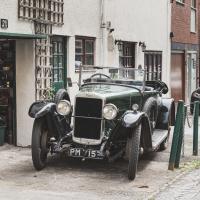
Made by the Sunbeam Motor Car Company, this was first registered in 1925, according to the DVLA's online enquiry system. Looking pretty good for its age. The mechanic working on it looked to be of similar vintage.
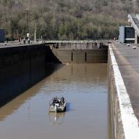
A Swing of the Plimsoll Bridge
24 Apr 2022
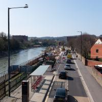
I was originally going to head over to the Ashton area to see if I'd missed any bits around the football stadium—and also to grab some lunch from the Tobacco Factory Market—but in the end I got a little distracted by having accidentally chosen exactly the right time to see the Plimsoll Bridge swing on one of the first busy days of Spring, where a lot of pleasure trips tend to head out down the Avon (and possibly the New Cut) from Hotwells.
In the end I mostly snapped that, and just a couple of photos from the Ashton area where I grabbed some lunch but didn't do any new exploring.
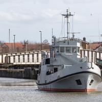
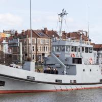
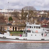
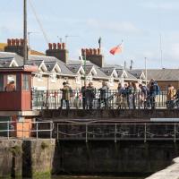
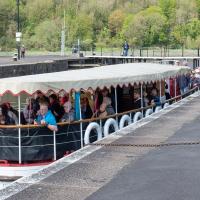
My first hint that there might be something interesting to look at was that the lock gates that I was planning on walking over were open rather than closed. Then I spotted the pleasure boat in the lock, just behind the descending steps from the footbridge there.
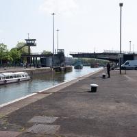
The Plimsoll Bridge is definitely not the oldest swinger in town. In fact, it may be the youngest swinger in town. I think the only other functioning swing bridges on the floating harbour (side-to-side rather than up-down like Redcliffe Bascule) are Junction Bridge (hidden in this picture, it's on the far side of the Cumberland Basin, carrying Merchants Road) and Prince Street Bridge, built in 1925 and 1879 respectively. The Plimsoll Bridge is mid-1960s.
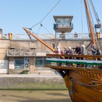
The brutalist bridge abutment is the old bit, of course, as it's mid-1960s. The boat that looks like John Cabot's 15th century caravel is the new bit. This replica was made in the 1990s, and replicated the original's 1497 trip to Newfoundland in 1997, arriving in June at Bonavista, to be greeted by Queen Elizabeth.
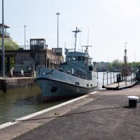
She's just had her annual inspection in the Albion dry dock, so I suppose this is one of her first gorge trips of the summer season.
Pikto's piece on the side of the Coopers Arms was looking particularly eye-catching in the sunshine...
This is a plaque to the Cumberland Basin Stabilisation Works, completed in 1991, about which I can find virtually nothing on the internet. The face is too crumbled to read all the words, but I seem to remember that it's a lot more legible at certain times of year/day when the sunlight slants across its face. I'll keep an eye out for a better photo opportunity.
In the meantime, there's a picture of this entire area being resurfaced while the basin is drained and dredged on this selection of 1991 photos on the Evening Post site, which I'm assuming might have been part of this project.
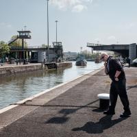
Can't spot any music or a cafe in this photo? I don't blame you. But, if you look mid-left, you'll see a circular concrete plinth where the cafe used to stand near the children's playground in the heyday of the Cumberland Basin. And behind it is what caught my ear as I was crossing the lock gates—a saxophonist is practising his scales.
I've come across practising musicians in this area before. Presumably they've come away from home to avoid annoying the neighbours (or the rest of the family!) The traffic noise covers even unmuted brass quite well—by the time I was at the other end of the footbridge, on the far side of the flyover, I could barely hear him.