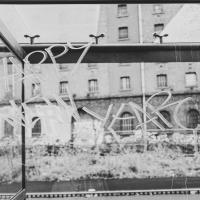
Tagged: window
Ticking Off a Few Streets in Bedminster
31 Oct 2021
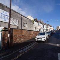
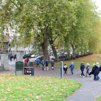
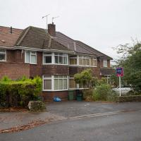
There were only a few streets left to wander in the more residential bit of Bedminster, so I thought I should target those today. The streets themselves weren't that notable, though Balfour Road has a contrasting mix of old and new housing. I tried to snap a few more interesting things along the way there and back, snapping all three of the familiar bond warehouses, nipping onto North Street to find some new street art, and finding a few pumpkins for good measure. It is hallowe'en, after all...

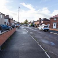
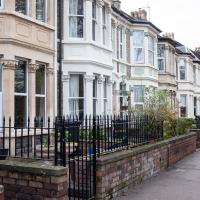
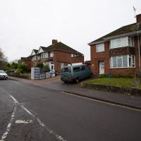
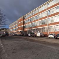
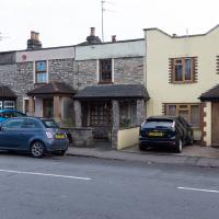
One of the three roads I needed to knock off my list. Just a fairly average slice of suburbia, really.
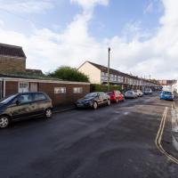
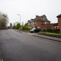
There's still a few houses on Duckmoor Road (this is the corner of Duckmoor and Frobisher) that use their gardens for gardening rather than just to park cars on, and some of them even have quite big veg gardens growing.
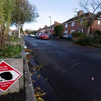
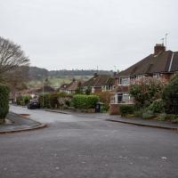
There were quite a few signs that Frobisher Road is a sanctuary for hedgehogs. We've actually seen a similar sign at the far end, on an earlier wander that went past the end of the road.
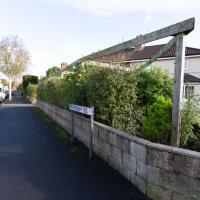
I'd been looking at the map and wondering if I needed to walk down this, as it looked like a road. I'd say it's private, though.
Again, pretty sure this isn't a public road, and frankly it didn't look like I'd see anything interesting even if I did risk venturing to the end...
Recreating a Loxton Drawing on a Lunchtime Jaunt
05 Nov 2021
I did do a much longer wander earlier in the week, but that'll take me some time to process (and cast a plethora of photos into the "out-takes" pile!) In the meantime, here's my lunchtime jaunt, taken to give myself a break from doing the company bookkeeping to send to my accountant so the taxman doesn't sling me in chokey.
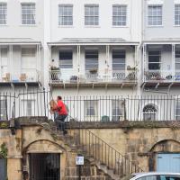
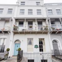
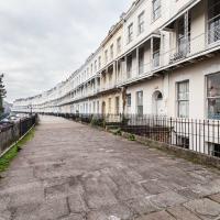
I've recently bought a slightly creased secondhand copy of Redcliffe Press's 1992 collection of Samuel Loxton drawings, Loxton's Bristol: The city's Edwardian years in black and white. It's a nice selection of Bristol Library's collection of the drawings. I'd noticed a drawing of 25 Royal York Crescent, a house I pass quite often, so I thought I'd wander up the crescent on the way to pick up some lunch and try to reproduce it.
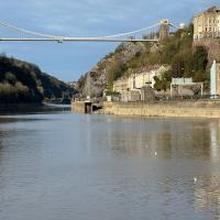
On the way back I took a few photos of Clifton Hill Bank as the crowdfunder to make quite a lot of it into a wildflower meadow has just hit its target, so I figured some "before" shots might be a good investment for the future...
I tried to capture something of the feeling of the Loxton drawing by snapping a busy postman as part of the general scene :)

I went out simply wanting to knock off the very last little unwalked section of Clanage Road, over by Bower Ashton, which has been annoying me for a while as it's quite close by and I've walked the other bits of it several times. So, my plan was to nip over to Greville Smyth Park via a slightly unusual route to wander Clanage Road and tick it off.
Along the way, though, I inevitably got a bit distracted. I took a few photos of Stork House, a grand Hotwell Road building that's recently been done up a bit (I imagine it's student lets, though I'm not sure) and which I found a reference to in a book about the Port Railway and Pier the other week, and also tried to match up a historical photo of Hotwells before the Cumberland Basin Flyover System laid it waste, which included some interesting markers I'll have to do a bit more digging into...
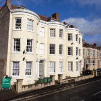
I've always loved the bow windows; if you look closely you'll see the window frames are slightly curved to match the curvature of the walls. Must be quite pricey to have repairs done, I'll wager.
Stork House was the Stork Hotel back when the Bristol Port Railway and Pier, which connected Hotwells with a deep-water pier at Avonmouth, was in its heyday.
The Stork Family Hotel at Hotwells sought custom by advertising to seamen on ships arriving at Avonmouth, a combined rail ticket to Bristol and meal in this hotel. The same concern also advertised bed, breakfast, hot evening meal and seven days’ ticket to Avonmouth by BPR for sixteen shillings a week.
— Colin Maggs, The Bristol Port Railway & Pier, Oakwood Press, 1975
I imagine this would have been quite an attractive deal to a sailor, who could stay in Hotwells with its vast plethora of pubs and other entertainments and pop back to his ship in the comparative wastelands of Avonmouth when necessary. (There would also have been plenty of sailors who were already quite used to hanging around in Hotwells while their ship was in town rather than waiting around at the new pier at Avonmouth, and familiar with the local facilities. Thinking about what other "facilities" there may have been for sailors makes me wonder again if the bit of the Hotwell Road that ended up being called "Love Street" might've been a bit of euphemism at some stage or other...)
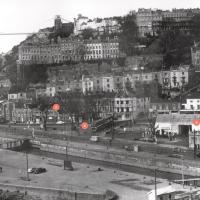
I found this image on Pinterest and as usual for that site it was annoyingly uncredited, but it seems to be from the book Hotwells, Spa to Pantomime, which I've just ordered direct from Bristol Books. Hopefully I'll be able to update the credit a bit when it arrives.
There's quite a lot in here that I didn't know about and will be researching a bit more, especially the Spa Assembly Rooms, which I think later turned into a school before being demolished for the flyover system, and also Anderson's workshop, a last vestige of the figurehead-carving industry.
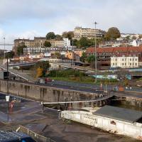
I was trying to recreate the angle of the old, pre-Cumberland Road Flyover System photo that comes next. I couldn't get the angle, mostly because of the height, but this seems to be shot from about the right direction.
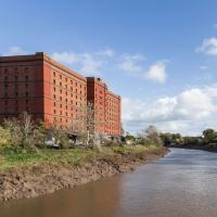
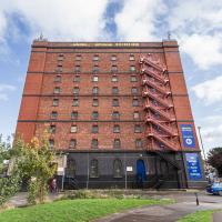
That historical photo seems to have been taken from a higher vantage point. The most likely place seems to be the B Bond, perhaps from that fire escape, or maybe the roof? Something tells me it's unlikely they'd let me up there, but you never know, maybe one day I'll ask an archivist; I think that area's part of the Bristol Archives stores...
They didn't seem to be footballers. I asked Rich at the coffee van and he said it was a Rugby match. I don't know much about sportsball.
The more I research it, the more I find that Hotwells had far better transport links back in Victorian and Edwardian times than it has today. Along with buses that went to more useful places than the City Centre, there were trams, the funicular up to Clifton, the landing stage for paddle steamer services and two railway stations all within easy walking distance of me.
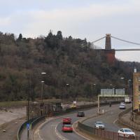
Today I took a day off work as preparation for doing the bookkeeping for my tax return1, and took a wander along to the site of what would have been my nearest station, Hotwells (or Clifton, as it started out in life), nestled in the shadow of the suspension bridge, the Bristol terminus of the Bristol Port Railway and Pier.
From there I wandered down the Portway, following the original line, until I got to the area around Sneyd Park Junction, where the tunnel from the slightly later Clifton Extension Railway joined up with this originally-isolated BPR line. Then I headed up to Clifton through the "goat gully" at Walcombe Slade, seeing the few above-ground bits of evidence of the tunnel (which is still in regular use) along the way.
It was a lovely day, and a good walk, and it was interesting to daydream of the times when I could have walked a few minutes from my flat down to Dowry Parade, caught a short tram ride to Hotwells Stations, and then headed from there to Avonmouth, perhaps even to board a transatlantic passenger service. The completion of the Clifton Extension Railway that linked the Avonmouth station with Temple Meads made relatively direct transatlantic travel from London via Bristol possible, with passengers travelling up from Paddington to Temple Meads, on to Avonmouth on the Clifton Extension Railway and Port Railway and Pier line, then perhaps catching a Cambpell's paddle steamer—which sometimes acted as tenders for large steamers—to a larger ship that was headed out for Canada, say.
1 I've learned that the best approach is to take two days off and deliberately do something that's not my bookkeeping on the first day, as otherwise I just inevitably end up procrastinating and feeling guilty on the first day no matter what. I have an odd brain, but at least I'm learning strategies for dealing with its strange ways as I get older...
2 Information mostly gleaned from Colin Maggs' The Bristol Port Railway & Pier and the Clifton Extension Railway, The Oakwood Press, 1975.
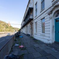
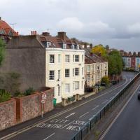
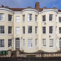
St Vincent's Parade looking a bit more run-down than normal. This street, like the one I live in, was built as lodging houses for visitors to the hot wells. I imagine it was quite a pleasant aspect before later developments like the building of the Portway.
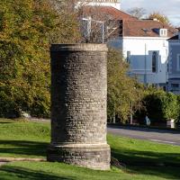
This is the Pembroke Road ventilation tower, sometimes known as the "pound tower", as it's next to the pound the Downs maintenance people use for equipment storage.
From To Keep Open and Unenclosed, the Management of the Durdham Down Since 1861, Bristol Branch of the Historical Association, 2005:
...construction of the tunnel began immediately at Cooks Folly Wood, the top of Pembroke Road and two other points. The Pembroke Road shaft was subsequently retained to ventilate the tunnel. The sinking of this shaft had reached rail level by May 1872 when Captain Beaumont's compressed air diamond drilling machine came into use. Most of the machinery associated with the diamond drilling machine was on the surface: the machine had a 4" diameter compressed air service from a 50 hp steam engine at the surface. By comparison, the engine to lift spoil and water from the tunnel was only 20 hp. The drill had to be cooled by water which was run into trucks and presumably wound to the surface. Dynamite charges were set in the holes after the dynamite had been softened by steam before use! On 10th May 1872 four pounds of dynamite exploded while being 'softened' at 2.30 a.m. blowing off the engine-house roof and smashing windows in the three houses facing the Downs at the top of Pembroke Road. Fortunately no-one was injured and when the glazier called at one house he found that the occupant had slept through the whole episode!
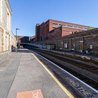
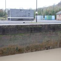
I think this is the very first time I've set foot on Clifton Down Station platform. I believe this is the platform for the "up" trains, if I'm getting my terminology right, but I think it's a fairly arbitrary choice, as much of the line is single track.
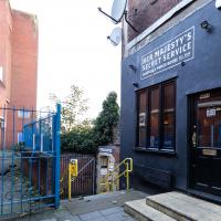
I have, however, spent an evening in there. They do a good Old Fashioned and an excellent Manhattan, from (somewhat hazy) memory.
Bower Ashton is an interesting little area just south of the river from me—in fact, the Rownham Ferry used to take people over from Hotwells to Bower Ashton, operating from at least the twelfth century to around the 1930s.
It's a strangely contradictory little area, with a cluster of old and new houses sandwiched in between the busy A-roads and significantly more industrial area of Ashton and the bucolic country estate of Ashton court roughly east to west, and also between Somerset and Bristol, north to south.
I've been around here before, mostly poking around Bower Ashton's arguably most well-known bit, the Arts faculty campus of the University of the West of England, but I'd missed at least Parklands Road and Blackmoors Lane, so I initially planned just to nip across briefly and wander down each in turn. On a whim, though, I texted my friends Sarah and Vik in case they were out and about, and ended up diverting to the Tobacco Factory Sunday market first, to grab a quick flat white with them, extending my journey a fair bit.
To start with, though, I nipped to a much more local destination, to see something that you can't actually see at all, the Gridiron...
(I also used this wander as a test of the cameras in my new phone. I finally upgraded after a few years, and the new one has extra, separate wide and telephoto lenses compared to the paltry single lens on my old phone. Gawd. I remember when speed-dial was the latest innovation in phones...)
I decided to try out the three lenses on my new iPhone camera. This is the "telephoto" lens. It does a reasonably creditable job, though the phone is oversharpening things a bit and I'm not sure I like the colours much.
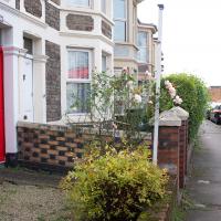
Most of the front gardens on this little stretch retain what's presumably the original garden walls, all rather nicely put together in a chequerboard pattern of bricks.
It's a nice little terrace, but given that it backs onto the city ground, I'd imagine you have to be a football fan to really enjoy it here.
At this point I've already abandoned my original plan of heading straight to Parklands Road, as some friends had texted me to say there were at the tobacco factory market and would I like to join them for a coffee? Best laid plans, so forth...
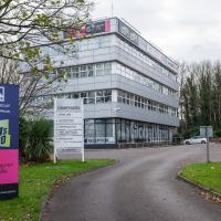
The South West Broadcast Centre for Celador Radio, it says. That certainly explains the big dipole antenna on the roof. I haven't heard of Hits Radio, but I suppose I'm generally more your Radio 4 type.
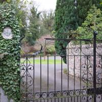
The original entrance to the Ashton Court Estate, apparently. The Clifton Lodge entrance is rather grander.
I'm not sure I've ever walked or even driven past the Ashton before, and it's only a mile away from me—in fact, my mile radius line divides it roughly in half. Tripadvisor suggests that its solid 3-star review average is made up of people having either one-star or five-star experiences, which is sometimes the hallmark of a great place that's happy to be rude to idiots...
Maybe this is the place to have a celebratory meal when I finally decide I've actually walked all the roads within my mile...
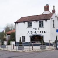
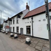
It's got the grazing field at the front and school playing fields at the back, and the road it's on isn't manic. Does this count as a Somerset "country" pub I can walk to?
This used to be called The Dovecote, but was gutted by fire in 2014 and re-opened under the new name the following year.
It's quite the change, over the course of only about ten minutes. Busy five-lane city roads to rather rustic country lanes.
Not sure what's gong on with the sky in the top left. Looks like Apple are doing some kind of strange job of applying HDR and trying to paint some blue into the sky. I've had a look and sadly there doesn't seem to be a "just stop pissing about with HDR and colour manipulation and record basically what your sensor sees" button unless I want to enable Apple's ProRAW format, which seems a bit heavyweight for general phone snapping.
It really is quite countrified all of a sudden. There used to be a couple of barns next to this house; the Bower Ashton Website has some interesting old pictures up.
Jersey Cottage is, unsurprisingly, the place the "cow man" used to live, according to this interesting bit of oral history you can listen to on the Ashton Gate House site.
Away from the A road it's very quiet, the loudest sound along this lane was the squabbling of the hosts of sparrows and other tiny bramble-dwelling birds.
The Gridiron and Bower Ashton Part Two
03 Dec 2021
On my last wander, to Bower Ashton, I was intending to knock Blackmoors Lane off my list "to-do" list, but got a bit diverted. I also took a little look into the history of the Gridiron, once a cheaper alternative to dry dock that was nestled just south of North Entrance Lock.
Today I had to go to send a parcel off somewhere, so I decided on going to the North Street Post Office via Blackmoors Lane. I didn't have much intention of anything else, but as luck would have it I walked out both at low tide and also as some lockkeepers seemed to be having a bit of a training session, and one of the more senior people was (a) happy to answer a few random questions on the Gridiron and (b) actually knew a lot about it, as Gridiron maintenance had been one of his jobs, more than twenty years ago...
This used to be a view of the Gridiron, the structure I mentioned on yesterday's wander.
I got curious and went back to ask one of the lockkeepers about it. As it turned out, he knew lots about it as he'd previously been responsible for cleaning it! More about that when I come back (including a historical photo of a boat on the Gridiron for some context) as some of the things he told me needed me to retrace my steps for some more photos.
First, though, we'll nip over to Bower Ashton and North Streeet for a quick bit of shopping and to knock Blackmoors Lane of my "to do" list.
Here it is: my target road to tick off the list.
These are the houses in that archive photo.
Some of the houses along here are definitely 1950s, as you can hear in this oral history, where Eileen Pimm describes the process of watching the house she still lives in being built in 1957.
Although we're heading towards the trafficky roar of the A370, it's still more of a subdued hum from here, and you could almost convince yourself that you were on the outskirts of a little town in the country.
Bigger than Sunday's nearby semi, today's is a four-bedroom (it's the left-hand house) and has just sold for £725,000. It all looks very well-put-together and modernised throughout, mind.
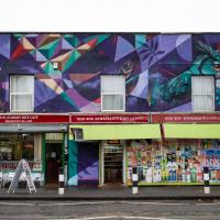
I've snapped this before; it just looked particularly attractive today. Al's Tikka Grill has some rave reviews on TripAdvisor. Maybe I'll give it a try one day.
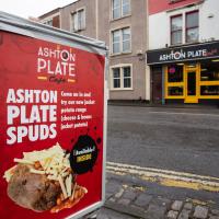
Dear fellow photographers: If you're going to take a picture like this, you could at least whack the potato through the microwave first, so it at least looks like once in its life it's been warm enough to melt cheese.
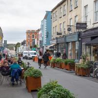
This isn't so much of a photo as a reminder to talk about the amazing malty smell that wafts out and inhabits this whole stretch of North Street when there's some brewing going on. Presumably it's the days when they're boiling wort.
You can see how this sluice channel entrance in the side of the Entrance Lock wall is about level with the control wheel we saw on the far side—if you look closely, you can see it immediately to the left of and behind the modern building in the background. Given what the lockkeeper described to me, I'm confident that this is where the water for sluicing the Gridion clean of silt came from—they fill Entrance lock, then open the sluice to carry water—which must be under reasonable pressure with a full lock—across to the far side where the Gridiron is, washing off the accumulated silt.
Clever, these Bristol engineers: no actual pumping required. Just tides and gravity.
And that's the last of my musing on the Gridiron. I'm not sure why I became so fascinated by a giant Victorian boat-sieve, but I did!
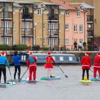
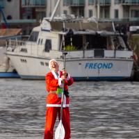
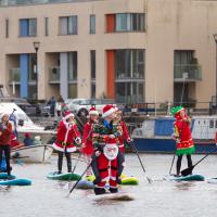
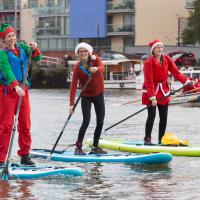
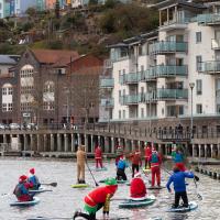
My friend Lisa texted me to see if I wanted to pop down and take a photo or two of the event she was taking part in: Santa SUP. SUP Bristol organise stand-up paddleboarding on the floating harbour, and their annual Santas-on-paddlboards event is quite the sight.
On the way there, I grabbed a historical photo I'd been wanting to recreate for a while of the shiny and new Cumberland Basin flyovers back in 1965, because I reckoned I could fit finding the same viewpoint into my outbound journey. Also, after having only used it on a wander for the very first time yesterday, I managed two crossings in the cross-harbour ferry today to get to the best locations for snapping the paddleboarders...
So, then, this wander is mostly a bunch of photos of paddleboarding Santas. Tis the season... Enjoy!


They do make it look quite easy. I'd have definitely fallen in about a hundred times by now.

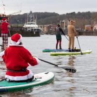
Apparently there was quite a headwind on this bit. I think keeping closer to the side helps.
A Constitutional to Burwalls and Back
21 Dec 2021
The recent lack of posts here is mostly due to my feeling very run down following having a couple of wisdom teeth extracted. Having had an emergency appointment yesterday1, hopefully I'll be on the mend now, though it does mean I'm on the kind of antibiotics where you can't touch alcohol for the whole of the Christmas period. I have tried to keep myself a little distracted from the pain by working on the nuts and bolts of this website—you should notice that the front page loads rather faster now than it used to, and that there's a shiny new statistics page that I'll probably be continuing to work on. Oh, and you should find that the tags below the photos are now clickable and will take you to a page of all other wanders that have photos with the same tag.
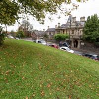
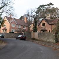
Today I felt like I needed to drag myself out of the house, but I didn't want to go too far, and I needed to get to the Post Office up in Clifton Village to post a Christmas card (spoiler for my parents: it's going to be late. Sorry.) As luck would have it, idly looking at the map I spotted that I'd missed off a section of Burwalls Road in the past, and that's basically one of the long-ways-round to Clifton Village, crossing the river to Rownham and walking up the hill on the Somerset side before coming back across the Suspension Bridge.
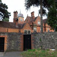
As I was heading for Burwalls Road I decided to make Burwalls itself the focal point of the walk, but unfortunately the mansion grounds are private and the place is hard to snap. Still, at least it gave me a destination. Burwalls was the mansion built by Bristol press magnate Joseph Leech, who I've mentioned before after buying a vintage book he wrote on a previous wander. There's a good article about the house on House and Heritage which has some photos from angles I couldn't ever get to. (Well, maybe with a drone, but it seems like the kind of area where they may be kitted out for clay pigeon shooting, so I probably wouldn't risk it.)
1 My dentist admitted that she probably needed to keep her internal monologue a bit more internal after we started the appointment with her staring into my mouth and immediately saying, "oh, *that's* weird." These are words one doesn't want to hear from a medical professional.
As my plan was to knock off the remaining section of Burwalls Road, my first photo is the small segment of Burwalls itself that you can see from near my house. Burwalls is the mansion on the hilltop, peeping out about halfway from the left edge of the photo and the Suspension Bridge.
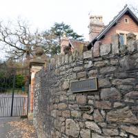
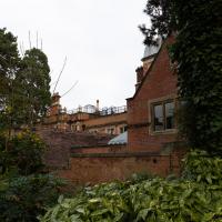
The Burwalls site is split into two halves, according to some of the estate agents' details I've looked at. This read section has some more modern-looking places where you can buy an entire house, if you're rich.
The mansion itself has been divided up into "lateral apartments". If you don't know what those are, you probably can't afford one.
Maybe if I'd got interested in this project before the university sold the place, I'd have been able to pop in and have a look around. Still, I can't blame them; when the estate was on the market in 2012 it was Bristol's most expensive house, valued at £5m, according to the Daily Mail.
That was for the main house and the old stables and lodge, which have been converted to the housing we're looking at. Given that by 2017, just a single one of the five aforementioned lateral apartments in the main manor house was on the market for £1.5, I think the developers probably did quite well...
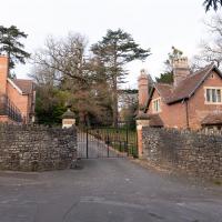
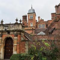
Our first close-up sight. Sadly the main building is disappointingly hard to take a photo of. Still, I suppose if I'd just bought a flat for one-and-a-half million quid I'd probably not want some plebe with a camera being nosy around the place.
The manor was originally built by Joseph Leech, a fascinating man who was owner of the Bristol Times. Among other fun things, he used to be the "Bristol Church-goer", publishing an anonymous and apparently quite funny column as a "mystery shopper"-style reviewer of church services.
There's a bit more about him on my blog, prompted by my buying a lovely old book by him in a secondhand shop on a previous wander.
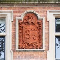
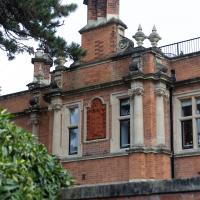
Joseph Leech doesn't appear to have had a coat of arms, and it's not the University of Bristol's (they were another former owner), but I struck lucky with my third guess: the Wills family crest apparently features three martlets around a chevron, as on the right, and three wyverns, as on the left... Can't find anything that's exactly like this one, but them I'm not exactly au fait with heraldry.
George Wills, of the Wills Tobacco family, was Burwalls' owner after Joseph Leech.
I was just about starting to feel better—the antibiotics seemed to have kicked in for my dental issues, and it had been some days since I'd left the house, and I was at last starting to get itchy feet. So, a wander. But where? Well, there were a few industrial bits near Winterstoke Road in the Ashton/Ashton Vale areas of Bristol that needed walking. I knew they were likely to be quite, well, unattractive, frankly. So why not do them while I wasn't feeling exactly 100% myself? Maybe it would fit my mood. Hopefully you're also in the mood for a bit of post-industrial wasteland, for that's what some of this feels like...
Then, at the last minute, I thought again about the Bristol International Exhibition—I've got a book about it on the way now—and that gave me another goal, which could just about be said to be in the same direction, and I decided to walk significantly further than my normal 1-mile limit and try recreating another historical photo...
Sadly I don't know much about the Ashton area; it's just on the edges of my mile and I rarely have cause to go there. It's brimming with history, I'm sure: the whole South Bristol area rapidly developed from farmland to coal mines to factories to its current interesting mixture of suburbs and industrial work over the last few hundred years. As a more working class area less attention was paid to it by historians, at least historically-speaking, than the Georgian heights of Clifton, and much of it has been knocked down and reinvented rather than listed and preserved. I see here and there some of this lack is being addressed, but I'm afraid I'll be very light on the history myself on this wander, as most of my usual sources aren't throwing up their normal reams of information as when I point them at Clifton, Hotwells or the old city.
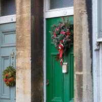
I think the whole of (admittedly-short) Albemarle Terrace had wreathes on the doors. Nice.
This may be somewhere around my actual destination today, though perhaps a little too much toward the east.
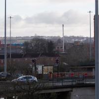
The buildings and green space on the hill in the background are the Knowle West Health Park. I'm pleased to have figured this out by using an OS map and a ruler and projecting a line from where I'm standing through the Tobacco Factory flag that you can just see poking up from Bedminster (you can see it on the corner of the building in this earlier pic](https://omm.gothick.org.uk/image/7175), then looking for densely-packed contour lines further out of town. Very old-school, but it worked!
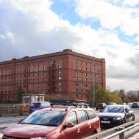
I'm probably heading in more of a Bedminster Down direction. It's a similarly elevated green space further west, which is hidden behind the bond warehouse on the right in this pic.
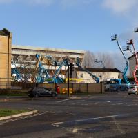
"Hello? Yes, I'd like to order a cubic mile of bland industrial building, please. No, anything'll do."
Here's a working office that I'd heard of: V Cars are one of Bristol's biggest cab firms, and the only one whose phone number I have memorised. On my first trip in one, back in 1999 (in a differently-named, earlier incarnation, I think), the driver said to remember the number as "Christmas Day, Boxing Day, Boxing Day". Most (all?) central Bristol phone numbers were prefixed with a 9 back then, so you just needed to add 25, 26, 26...
There was even a cab dispatcher at work behind the window, from what I could see. It reminded me of my childhood, when my mum worked as a dispatcher at Radio Cars in Ilford.
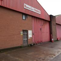
I do at least appreciate the fact that Bristol City Timber has a traditional wooden front door.
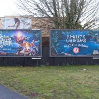
The plethora of advertising billboards in this area is depressingly predictable, but at least this advertising is both local and well-thought-out. Local heroes Aardman Animation are advertising their new feature Robin Robin on the left, but have a related Christmas message to the "Robins", whose stadium is just around the corner. Bristol City apparently earned the nickname by playing in a strip with a red top and white shorts.
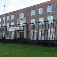
If one tried to conjure an image from just the phrase "HMS Flying Fox", this probably isn't what would spring to mind, is it? It's not a ship, it's not flying, and it's not a fox, for starters.
Royal Navy Reserves HQ for Wales & South West of England, I think it says on the sign at the far end.
Note the Egyptian kings on pillars at the top of the pilasters bracing the doorway. No earthly clue what they're doing there. As usual, Bristol's historical sources seem to peter out south of the river.
Wikipedia says on Egyptian Revival Architecture:
By the end of the 19th century, the style had very nearly disappeared, but in 1922 with Howard Carter's discovery of Tutankhamun's tomb the style underwent a dramatic revival it was used particularly for cinema architecture and sometimes for factory buildings.
...and given the surroundings it wouldn't entirely surprise me to find that this was originally a factory, at least, though the 1940 date in between the Egyptians suggests they were a little late with the styling.
Redpoint climbing centre. Used to be an art deco cinema, apparently. At the far end you can see a sop to that in the style of the CAFE BAR sign. It looks rather swanky and modern inside from the pics on their website.
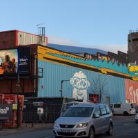
At this end of the building is a giant digital advertising board. I'm with Adblock Bristol on this one, but then I've never been a fan of public advertising.
A Random New Year's Day Wander
01 Jan 2022
I picked a fairly arbitrary reason for a wander today. Really, I just wanted to do a New Year's Day wander just to get out of the house and to set a precedent for the year to come.
My ostensible reason was to investigate what looked like a road on my map that quartered the lawn in front of the Ashton Court mansion. As it turned out, this is just a muddy footpath/desire line similar to a half-dozen other tracks nearby, and must be some kind of bug or misclassification with the mapping system I'm using, but that's not important. What's important is that I went for a little walk on the first day of the year. As a bonus, I did happen to wander down a couple of sections of new footpath, so technically I broke some new ground too, which is nice.
It didn't take long for someone to scrawl the sentiments of the season on a bus shelter.
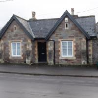
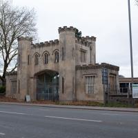
...and this is the Kennel Lodge itself. Presumably you'd want to keep your hounds a fair distance from the house just to keep the racket out of earshot.
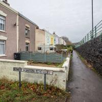
Which seems a bit odd, given that it's not in Hotwells wouldn't really lead there in either direction. Looks like a fairly modern development; maybe it's just one of those roads where the developers picked a roughly local name of out a hat.
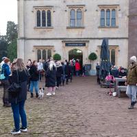
I was tempted up by the thought of a mulled wine stall, or something, but in the end the lengthy queue for anything immediately put me off the idea.
I don't think I noticed this when passing the Ashton pub the last couple of times, but this time a family emerged from it as I was walking in the other direction. It doesn't lead anywhere spectacular, but it was a footpath I'd managed to miss, and the start of it is pleasingly intriguing, at least.
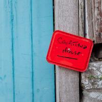
It's quite a dramatic sign, colour wise. Given that it seems to be written in Sharpie on the lid of an old tub and drawing pinned to the post I imagine it's a temporary measure :D
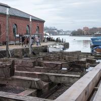
We'll leave today's wander with a snap of the Patent Slip. I wonder if the newer timber closest to the camera is the greenheart that they're renewing some of the structure with? Hardy stuff, as Wikipedia says:
The wood is extremely hard and strong, so hard that it cannot be worked with standard tools. It is durable in marine conditions, so it is used to build docks and other structures... The Fram and the Endurance, made famous in the polar expeditions of Amundsen and Shackleton, were the two strongest wooden ships ever constructed and were sheathed in greenheart to prevent them from being crushed by ice.