Tagged: property
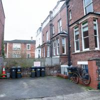
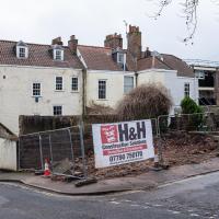
I went to have a peep at the giant sinkhole that's opened up in Canynge Square—ironically, having recently discovered the gardens were public I'd had the (triangular!) square on my list to re-visit for a few days, but now there's no entrance to the gardens due to the danger. The area was well fenced-off for safety, but I tried to get a couple of photos from behind the barriers.
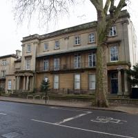
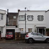
I also explored the area around Camp Road, an real melange of architectures, one of the most mixed-up areas I've seen in Clifton, in fact, and confirmed my friend Claire's suspicion that an earlier snap of a sign from Manilla Road was in fact for a fire hydrant. Nice.
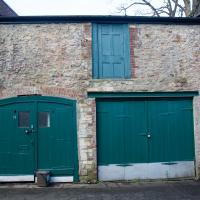
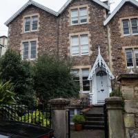
A stables, later used as a coach house built to serve No. 16 Vyvyan Terrace (qv), c.1840. Built from rough rubble Pennant stone and brick with a felt roof. It is orientated north-east to south-west and is roughly square in plan.
Shame I could only see the back, according to the listing:
the garden elevation is a quaint and attractive, gothic-revival composition with later classical remodelling Intactness: it retains many interior features and fittings associated with its original use as a stable, and is a rare survival of an unconverted service building in an urban setting Historic interest: it illustrates the early C19 social division of staff and the family though its disguised garden-facing elevation and blind windows
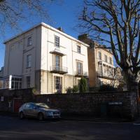
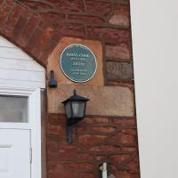
Given the dates, this must be the Beryl Cook, though her Wikipedia entry doesn't mention her living in Bristol.
"A man of most extraordinary and diverse talents", apparently. Reading his obit in the Quarterly Journal of the Royal Astronomical Society, I'd diagnose ADHD. Apparently he started off as an engineer specialising in vacuum and electrical engineering, then suddenly pivoted into optics and became brilliant at that, too:
“How a man can in such a short space of time become the master not only of the theory, but also of the sometimes tedious practical details of the discipline is something which even his close friends found impossible to understand.”
Fascinating.
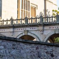
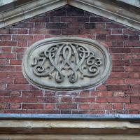
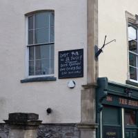
Nobody knows much about this motto on the side of the covered walkway here.
Saint Vincent's Spring
28 Dec 2020
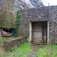
Fractionally outside my one-mile zone, but I got curious about Saint Vincent's spring, whose last remnants you can see in a defunct drinking fountain on the Portway. Along the way I passed Gyston's cave, sometimes called St Vincent's cave, in the sheer wall of the gorge. It's now accessible by a tunnel from the observatory—I tried it about twenty years ago, I think, and still recall the vertiginous moment of looking down from the protruding balcony and realising that you could see straight through the grille floor to the drop below—but from what I can work out the tunnel is relatively recent. Before the tunnel was dug it was accessible only by access across the cliff face, which must have been even more terrifying.
This cave was first mentioned as being a chapel in the year AD 305 and excavations, in which Romano-British pottery has been found, have revealed that it has been both a holy place and a place of refuge at various times in its history.
A few different sources say that the cave became a hermitage and chapel to St Vincent following Bristol's early trading in Iberian wines; St Vincent of Saragossa is Lisbon's patron saint, and a lot of nearby things bear the name.
I'm not sure where the crossover of Vincent and Ghyston happens, though. On the giants Goram and Vincent (or Ghyston), Wikipedia says:
The name Vincent for one of the giants rests on the fact that at Clifton, at the narrowest point of the Avon Gorge, there was formerly an ancient hermitage and chapel dedicated to St Vincent, at or near the present cave in the cliff-face which bears his name. Another (apparently modern) version of the story calls the Clifton giant Ghyston, which is in fact the name, of obscure origin, for the whole of the cliff-face of the Avon Gorge at least as early as the mid-fifteenth century, in the detailed description of the Bristol area by William Worcestre. The place-name was personified to produce the giant's name. Vincent's Cave is called Ghyston cave or The Giant’s Hole in an article in the July 1837 issue of Felix Farley’s Bristol Journal.
In my research on the original Hot Well House, I've seen quite a few contemporary paintings which state their viewpoint as "from St. Vincent's Rock", so in the 16th century it seems the cliff-face name was typically St Vincent Rock rather than Ghyston's Rock, perhaps.
I am, as you can tell, no historian!
On the way, I also wandered around the base of the popular climbing area, which I think is the site of the old Black Rock quarry.
A Promenade on New Year's Day
01 Jan 2021
I wandered along the gorge today and found the entrance to the disused Portnalls Number 1 railway tunnel of the Bristol Port Railway and Pier. The door was unlocked, but as soon as I opened it I felt a sense of current habitation and decided discretion was the best option. There's a lot of people homeless in Bristol at the moment, and they don't need disturbing. For the same reason, I've omitted posting some pictures of a little encampment somewhat off the beaten track of the new Zig Zag, where I reversed direction as soon as I realised I'd come across a current habitation of some sort.
Up in Clifton it took me a little while to work out that the picture of the Promenade I was trying to reproduce was taken from the viewpoint I'd thought, it was just that the Alderman's fountain was moved from the top of Bridge Valley Road to the other side of the promenade in 1987, so trying to use it as my initial landmark wasn't very helpful!
Finally I swung past the Society of Merchant Venturers, who presumably still own most of Clifton, having bought the entire manor, including Clifton Down, in 1676, and I imagine aren't in much danger of running out of money. That's true to their motto: indocilis pauperiem pati is apparently from the Odes of Horace, and translates as "will not learn to endure poverty"...
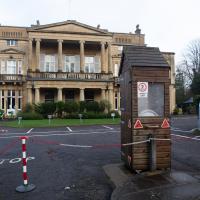
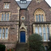
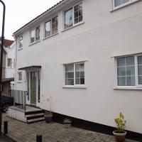
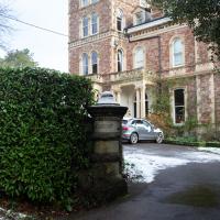
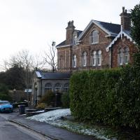
Engineer's House, built for Charles Pinney, who became mayor of Bristol. "t is now used as offices, a training centre and a conference venue." I love the little sentry box.
Apparently it was previously known as Camp House. I'd guess that may relate to the Iron Age camp on Observatory Hill.
Mirror Maze
10 Jan 2021
Went for a wander with my friend Lisa—the current lockdown rules seem to be that one local walk for exercise per day with a maximum of one person not in one's "bubble" is fine—up to the University of Bristol area right at the edge of my one-mile perimeter to see the Jeppe Hein Mirror Maze, among other things. On the way we mused about Merchant Venturers, the slave and tobacco trades, and dating in the time of Covid.
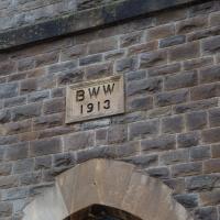
Bristol Water Works, I'm thinking. This grid square of Clifton is basically the reservoir and waterworks, both historic and modern.
I once did a segment on how to photograph lightning from an editing suite at the BBC, which I think was somewhere up there. It was for a programme called Wild Weather of the West, I think, presented by BBC weatherman Ian Fergusson.
I'm not entirely sure where I was as the BBC complex behind this fairly normal-looking buiilding is actually a very large facility that takes up most of the block behind this road, and has a canteen building, the Points West studio and all sorts. I've been in there a few times, for various reasons, including, improbably, having a Greek lesson with Chris Searle, who himself presented the BBC's Greek Language and People decades before...
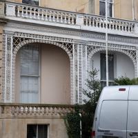
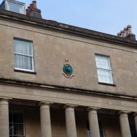
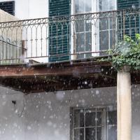
I just liked the filigree(?) edging of the.. Er... balcony? Portico? Can you tell I don't know much about architecture?
If it's trying to blend in with the neighbourhood, what on earth are the green windowframes about?
Northern Clifton
16 Jan 2021
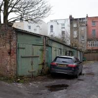
A raggedy wander with my friend Lisa, picking up a few stray streets and venturing only briefly onto Whiteladies Road, where it was too damn busy, given the current pandemic. We retreated fairly quickly. Found a couple of interesting back alleys, and got a very pointed "can I help you?" from a man who was working in his garage in one of the rather run-down garage areas behind some posh houses, and clearly didn't want us just wandering around there.
Here's an interesting sinkhole-related snippet:
"In September 2007, Peter Insole of Bristol City Council visited no.52 Clifton Park Road, Clifton to investigate the report of a mine shaft in the rear garden that had been exposed during gardening work. In the southwestern corner of the garden a rough rock cut shaft approximately 1m in diameter was observed. It was not possible to fully survey the feature for health and safety reasons, but it appeared to be excavated through sandstone or Dolomitic Conglomerate and was at least 2m deep. The shaft opened out into tunnels or chambers beneath the rear gardens of the Canynge Square properties. It is possible that this feature was associated with a previously observed cellar or chamber beneath the rear garden of 22 Canynge Square, although there are no known cartographic or documentary records for mining activity in the area."
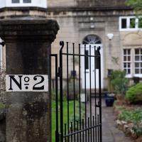
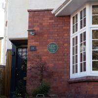
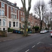
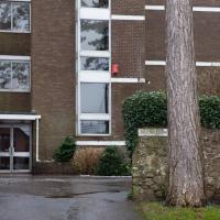
23 Clifton Park. This is so hidden away that it gets its own street sign, which we'll see in a minute.
Coffee and Graff
22 Jan 2021
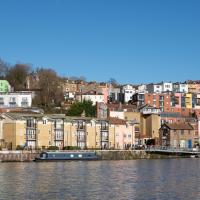
Took myself around the harbour to Imagine That's horsebox cafe and treated myself to a flat white and a sourdough cheese toastie. On the way there and back I encountered some local flooding and various bit of graffiti, from some ugly tagging on someone's front windows to a large new piece being added to Cumberland Piazza in the ongoing attempts to cheer the place up.
Snowy Leigh Wander
24 Jan 2021
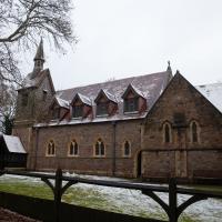
I started this wander with my "support bubble" Sarah and Vik, after Sarah texted me to say "SNOW!" We parted ways on the towpath and I headed up into the bit of Leigh Woods that's not actually the woods—the village-like part in between Leigh Woods and Ashton Court, where I'd noticed on a map a church I'd not seen before. I found St Mary the Virgin and quite a few other things I'd never experienced, despite having walked nearby them many, many times over many years, including a castellated Victorian water tower that's been turned into a house...
I decided to retrace my steps, as North Road was predictably quite busy near the entrance to Leigh Woods
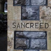
Never heard of the place before I looked it up just now, but apparently Sancreed is a village in Cornwall, 5km west of Penzance.
Another Lunchtime, Another Quick Coffee Trip
28 Jan 2021
With very little photography, and no new streets. Still, I did manage to buy milk at the "Simple Cow" vending machine—and "simple" is very definitely false advertising; it took me bloody ages to work out how to use the thing—and snap the new ACER/SEPR piece down in Cumberland Piazza.
This was just a little car park, presumably for the house behind? Probably going to be turned into half a dozed bijou flats, or something...
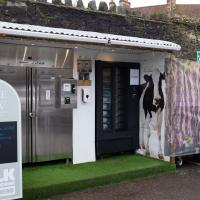
It was not simple. But now I have some clue what I'm doing I might manage it better next time.
Unexpected Snow
31 Jan 2021
I just nipped out to post a blood test (not Covid-related) and check that my car was okay, because I've not driven it for weeks. I was just going to walk up to Clifton Village, but I spotted the opportunity to re-park the car on my street rather than up the hill around the corner where it was, so instead I got in, intending just to move a hundred metres, but it turned over slowly before it started, and then warned me that the battery was very low and I should go for a long drive to recharge it.
So, I did my best, zipping up the A4018 to the motorway junction and back again, dropping off my blood at a postbox along the way, and while I did that, it started snowing. I noticed it was low tide, too, so when I got back home I headed back out again, this time on foot and with a camera so I could see if I could find any evidence of the Hot Well steaming.
I saw not a single sign of the Hot Well steaming, but it was quite a nice quick outing and I enjoyed my brief walk in the snow. Iike Hinton Lane, too, and while it's all old ground I was re-treading, I did at least get a picture or two with a bit of snow and some of the cold winter atmosphere of the trip, I think.
Greville Smyth Path Completionism
02 Feb 2021
I needed to get away from my desk at lunchtime, and I saw a little segment of path in Greville Smyth Park that needed knocking off my "to walk down" list, so that gave me a target. Sadly Hopper Coffee's little Piaggio Ape wasn't there to sell me a coffee. I hope Rich is all right, not seen him so far this year.
Anyway, a fairly uneventful walk. They're putting new boundary fencing up around Hotwell Primary School (I wandered down Albermarle Row to see what the pneumatic drilling was about), the house on Granby Hill that's been covered in scaffolding and swaddled in protective sheeting has finally been revealed in its cleaned and refurbished form, and they were doing something to the flyover that leads up from the end of the Portway/Hotwell Road to the Plimsoll Bridge. Nothing much else to report.
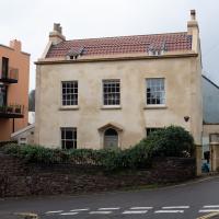
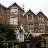
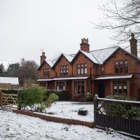
Freshly refurbished, this is the first time I've seen it not covered in scaffolding, and it looks like they've done a sympathetic job. Historic England's listing says:
House. c1790. Stucco with limestone dressings, gable stacks and a pantile mansard roof. Double-depth plan. Late Georgian style. 2 storeys and attic; 3-window range. A symmetrical front has pilaster strips to a moulded coping; semicircular-arched doorway has a plate-glass fanlight and 6-panel door with flush lower panels. 2/2-pane ground-floor sashes with margin panes, 8/8-pane first-floor sashes, the middle one blocked and replaced with a small C20 casement; 2 small raking dormers.
Note the "middle one blocked and replaced with a small C20 casement". You can see it in the picture on the listing website, a weird small modern window in the bricked-up middle of the centre top-floor window. Here, now, it's been restored to match the other two windows and looks a lot better. Nice one.