Tagged: bedrock
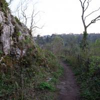
I wasn't going to take a very long walk on this nice spring evening; it just happened. I was going to knock off a path or two on Brandon Hill, home over centuries to hermits and windmills, cannons and Chartists, and then just wander home, stopping only to fill up my milk bottle at the vending machine in the Pump House car park.
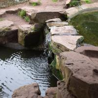
However, when I heard a distant gas burner I stayed on the hill long enough to see if I could get a decent photo of both the hot air balloon drifting over with Cabot Tower in the same frame (spoiler: I couldn't. And only having the fixed-focal-length Fuji with me didn't help) and then, on the way home, bumped into my "support bubble", Sarah and Vik, and extended my walk even further do creep carefully down the slipway next to the old paddle steamer landing stage and get some photos from its furthest extreme during a very low tide...
Towpath Evening
25 Mar 2021
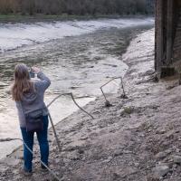
I was honestly just about to do the homework from my oh-so-thrilling ITIL course when my friends Sarah and Vik asked me if I'd like to come out for a wander down the towpath with them. I enjoyed the company, the evening light and the delicate clouds.
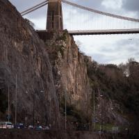
I noticed I'd missed a bit of Circular Road and Ladies Mile, and it was a nice evening for a sunset wander up to Clifton. There was something I recorded along the way, not photographically but in video.
Bristol Zoo, the world's oldest provincial zoo, has recently decided to close its Clifton site after 185 years of occupation, which means that the sounds of wild animals will no longer drift incongruously through this leafy Georgian area. They're moving everything up to their existing second site, The Wild Place Project near Cribbs Causeway. As I was wandering the Downs, I heard some fierce roaring noises, so I decided to see if I could get a little closer while they were still going on and record a sound that's soon to disappear.
I don't have a way yet to put video directly on this site, so here's a link to the video of my attempt to catch a bit of the zoo noises that I just popped on YouTube. It's sad that this might be the last time I hear such noises in Clifton.
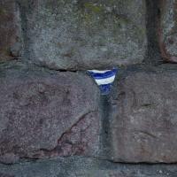
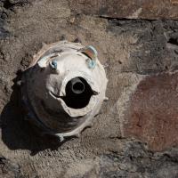
Is it still a potsherd if it's from a plate? (I just checked the dictionary, and apparently it is...) This one's embedded in a wall on Windsor Place.
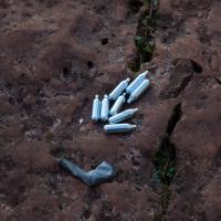
So named because they're often extracted from whipped cream cans.
Nitrous oxide is a common recreational drug. It was Thomas Beddoes and Humphrey Davy who pioneered its use, at the Pneumatic Institute on Dowry Square, coining the name "laughing gas" and inviting friends like Samuel Taylor Coleridge to give it a go, so I don't suppose we can criticise the local youth too much...
I wonder how many generations of mildly disreputable youth have got up to no good on this rock?
There was barbecue smells and Michael Jackson from around the corner, plus I'm scared of heights, so coming back seemed like the better choice. Don't want do gatecrash any socially-distanced parties right now...
Man on a Mission
17 Apr 2021
I went rather outside my area today, as I went to pick something up from the Warhammer shop on Wine Street (Games Workshop as-was, and before that I think perhaps a rare retail outlet for Her Majesty's Stationery Office? I may be mis-remembering...) Anyway, a friend of mine wanted something picking up and posting to him, so I figured I'd knock some streets off my list along the way.
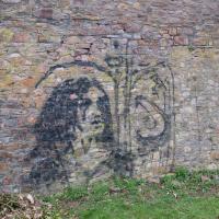
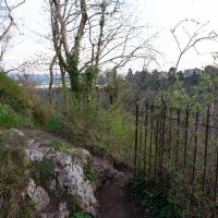
I first headed for the St George's Road area, walking down the narrow Brandon Steps and finding some strange wall art on Brandon Steep, then headed to the Old City via Zed Alley. The Warhammer shop visit was friendly and efficient, and, mission accomplished, I treated myself to a sausage roll and a flat white from Spicer + Cole, to take away and eat in Queen Square with its current decoration of hearts. I finished off with a detour up Park Street, looking out for St John's Conduit markers, before finally crossing Brandon Hill on the way home.
Quite a long wander, all told, and I'm a bit knackered today...
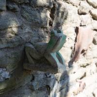
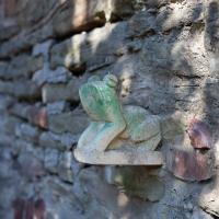
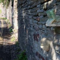
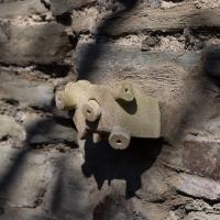
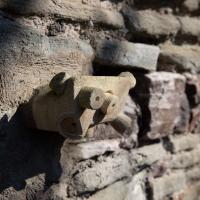
I don't know what I was expecting to see on Brandon Steep, but a sculpted stone frog sticking out of the wall would have been pretty low on the list.
Victoria Square Underpass
06 May 2021
I'm meant to be taking a little break from this project, but in my Victoria Square researches after my last walk I noticed a curiosity I wanted to investigate. The community layer on Know Your Place has a single photograph captioned, "The remains of an 'underpass' in Victoria Square".
Looking back through the maps, I could see that there really did used to be an underpass across what used to be Birdcage Walk. I can only guess that it was there to join the two halves of the square's private garden that used to be separated by tall railings that were taken away during WWII. Maybe it was a landscaping curiosity, maybe it was just to save them having to un-lock and re-lock two gates and risk mixing with the hoi polloi on the public path in the middle...
Anyway. Intrigued, I popped up to Clifton Village this lunchtime for a post-voting coffee, and on the way examined the remains of the underpass—still there, but only if you know what you're looking for, I'd say—and also visited a tiny little road with a cottage and a townhouse I'd never seen before, just off Clifton Hill, and got distracted by wandering the little garden with the war memorial in St Andrew's churchyard just because the gate happened to be open.
EDIT: Aha! Found this snippet when I was researching something completely different, of course. From the ever-helpful CHIS website:
When there were railings all round the garden and down the central path, in order that the children could play together in either garden there was a tunnel for them to go through. This was filled in during the 1970s but almost at the south east end of the path if one looks over the low wall the top of the arches can still be seen.
Looks to me like there's still at least a partial cavity. I wonder when and why it was filled in? I imagine it became dangerous at some point after the railings were taken down during the war, and there wasn't such a need for it anyway, as people could get from one side to the other at ground level quite easily.
EDIT: Aha! Found this snippet when I was researching something completely different, of course. From the ever-helpful CHIS website:
When there were railings all round the garden and down the central path, in order that the children could play together in either garden there was a tunnel for them to go through. This was filled in during the 1970s but almost at the south east end of the path if one looks over the low wall the top of the arches can still be seen.
This is more convincing as a walled-off underpass entrance. You can see there's a sheet of steel that's been placed in front of what looks like an entrance before it's been buried with earth.
Sequel Injection
07 May 2021
I saw this tweet the other day and started thinking of my second Covid-19 vaccination as my "Sequel Injection" (to a geek, it's funny. You'll have to take my word for it.) Whatever you call it, this morning I went and got it.
It was in the same place I got my initial injection—my left arm! No, okay, it was at the Clifton College Prep School. I didn't take any photos of the event itself; the NHS production line is so efficient you barely have time to do anything else, even if the privacy of other patients wasn't a factor.
Along the way I mused at all the road resurfacing going on in Clifton, and also discovered a secret (okay, not-well-known and possibly slightly trespassey) way into Canynge Square, and on the way back I knocked off a few streets from my "leftovers list" of north-east Clifton. I've got much of Clifton done now, with the only obvious "to dos" on the east side of Whiteladies Road...
It was quite a long walk, and I'm feeling pretty tired now, though that might be the effects of the jab too, I suppose. Anyway. Tomorrow and Monday I'm walking outside Bristol, I think, and I imagine my feet will need some recovery time on Sunday, so it might be a while before I post another Wander.
This is my normal view of South Parade, so it's unsurprising I'd never really noticed the little terrace before.
Another Day, Another 50 Metres
29 May 2021
I met my friends Sarah and Vik at Riverside Garden Centre today; I needed to buy some compost for repotting my wildly-overgrowing aloe vera, and I went a little bit out of my way to knock off a stretch of Ashton Road. It was a pleasant enough walk in the surprisingly warm (and surprising-not-tipping-it-down-on-a-Bank-Holiday-weekend) weather.
Leigh Woods Solo
19 Jun 2021
I hadn't really planned to go out for a wander yesterday; I just got the urge and thought "why not?" (Well, the weather forecast was one possible reason, but I managed to avoid the rain, luckily.)
I wanted to finish off the A369—as it turns out I may still have a small section to go, but I've now walked the bulk of it out to my one-mile radius—and also a few random tracks in Leigh Woods. I'm still not really sure that I'm going to walk them all, especially after discovering today that "the map is not the territory" applies even more in the woods, where one of the marked tracks on the map wasn't really that recognisable as a track in real life... I'm glad I'd programmed the route into the GPS in advance!
Anyway. A pleasant enough walk, oddly bookended, photographically at least, by unusual vehicles. Leigh Woods was fairly busy, especially the section I'd chosen, which was positively dripping with teenage schoolkids with rah accents muttering opprobrium about the Duke of Edinburgh. I'm presuming the harsh remarks were more about taking part in his award scheme than the late Consort himself, but I didn't eavesdrop enough to be certain...
Shops, Hedgehogs and Cows
06 Jul 2021
I really only took the GPS and camera on a "just in case" basis, as I knew I was only going for a coffee in Greville Smyth Park along a well-trodden path this lunchtime. Still, I saw a few new things along the way, so I figured it was worth uploading the handful of photos I took...
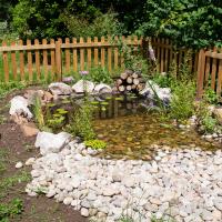
When I passed the (then-empty) fencing back in March I wondered what this would turn out to be. I had no idea it would be a miniature nature reserve...
According to the Friends Of Greville Smyth (FROGS!) Facebook page it's a hedgehog oasis, which is rather sweet.
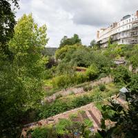
Green Squares and Secret Gardens
31 Jul 2021
At the end of July I went to have a look around some of the private gardens opened up by the annual Green Squares and Secret Gardens event. Sadly it was compressed into a single day this year, for various Covid-related reasons, it seems, so I didn't get to poke around too many places. I went to:
- A talk by the oldest resident of Victoria Square
- The St Vincent's Rocks Hotel garden
- The Paragon garden
- Cornwallis Crescent gardens, both east and west
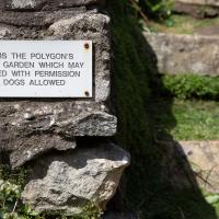
- The Polygon garden
And snapped a few things in between, too. It was a lovely day—a bit too hot, if anything—and it was interesting to get into a few places I'd only ever seen from the outside, especially The Paragon and Cornwallis gardens, which are the least visible to passing strangers of all of them.