Tagged: building
Shiny New Hope
24 Sep 2021
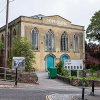
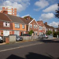
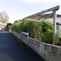
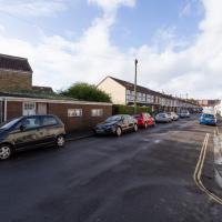
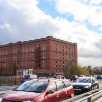
A quick lunchtime jaunt to Clifton Village. Along the way I admired the new sign on Hope Chapel and added to my tsundoku collection.
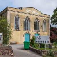
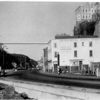
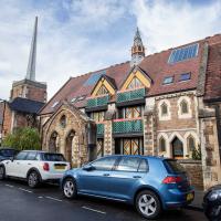
The scaffolding is down and there's a nice new sign (reminiscent of a historical one, I think,but I can't find the photo at the moment because Know Your Place Bristol is down) and you can just see the newly-installed solar panels on the roof behind it.
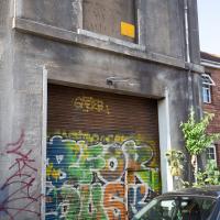
There's a mason at work on the carved pilaster tops on the frontage of the old Coventry (and before then, Stroud and Swindon) Building Society. They've moved everything to a central branch in town in the interests of efficiency, so now I have to go to bloody Broadmead to do anything.
(Yes, I actually went into town to get a cheque out of the building society just the other day, in 2021. I know I should chuck this old-fashioned malarkey in for a shiny electronic account, but it's for the management committee of the house I live in, so there's complexity and inertia involved...)
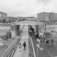
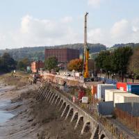
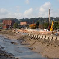
Among the many arguments about this pedestrianisation experiment, there has been quite the sub-debate over the delightfully modern COR-TEN steel steel/hideously ugly rusty* planters.
- Delete as applicable
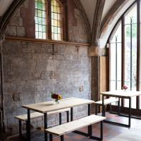
A Morning of Research and a Cafe in a Castle
25 Sep 2021
I needed to pop to the library, as they'd kindly dug a book out of the reserve store at the B Bond warehouse for me and emailed me to let me know it was ready. So, I took a little trip to town, straight down the Hotwell Road, and spent a few hours reading before stretching my legs with a walk to a new cafe in the actual castle (or remnants thereof, anyway) of Castle Park, before heading back home down the other side of the harbour. As well as books and coffee, I bumped into a remote-controlled pirate ship, which isn't something you see every day, even in Bristol.
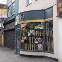
It's nice to see a new business open up on this stretch of the Hotwell Road. Since Asia Channel disappeared (and took with it my favourite local source of crispy beef) and the Hotwells Pine folks retired, it's all been looking a bit tatty.
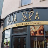
This place has already garnered several good reviews from locals on Nextdoor and Google Reviews. I must try it at some point.
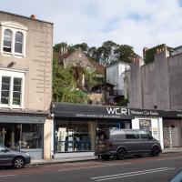
Have I ever looked up and noticed the view above Western Car Radio, which looks like perhaps the terraced back garden of St George's Primary? If I have, I don't seem to have snapped it before.
There are some unexpected links between Triodos Bank and some of the magical stuff I've been researching. I first found out when I checked the upcoming events at the Bristol Theosophical Lodge and saw a director of the bank would be giving a talk there. Apparently the bank is rooted in the ideas of Rudolf Steiner's anthroposophy. The Guardian says:
Its roots (like the UK bank Mercury Provident, which it took over in 1995), are in the anthroposophy movement. This refers to the ideas of the Austrian spiritualist thinker Rudolf Steiner, who died in 1925 and whose interests included education, 'biodynamic' agriculture, eurythmy (movement as art) and therapeutic medicine.
Triodos Bank's statutes committed it to anthroposophical principles until 1999, when this formal link was dropped, and in recent years the bank, under its current head Peter Blom, has embarked on a policy of reaching out beyond Steiner adherents and of broadening its appeal. Nevertheless, Triodos's origins are reflected in the fact that most of the Dutch directors come from within anthroposophy, and it is banker for many Steiner-inspired projects.
Bristol boasts one of the quietest rooms in the world. That one's in the Ultra-Low Noise Labs at the University of Bristol, where "Losing all auditory references does funny things to your balance, and I lurch slightly as the double doors open to let me out. It's a relief to hear the faint underlying buzz that indicates life as we know it."
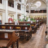
Sadly, although it looks the part, the reading room in the Reference section of Bristol Central Library is usually a caophony of irritations. I'm not sure what took the prize today: the burglar alarm going off outside for ages, the stertorous snoring, the queues of people trying to get 10p pieces for the photocopier like it was still 1985, the angry researcher trying to get a porter along to rouse and tick off the stertorous snorer...
In between all this I read through the letters of the Reverend W A Ayton, alchemist of the Golden Dawn, once described by W B Yeats as "the most panic-stricken person" he had ever known. I think he'd have had to read in Bristol Central Library it might have tipped him over the edge...
(I should temper this critique by at least oberving that the librarians are themselves uniformly friendly and helpful.)

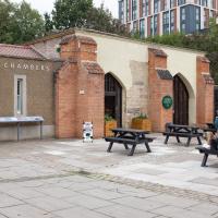
The chambers were apparently once the entrance to the castle's great hall. Historic England has this section of the castle at 13-14th century
I was interested to see it, but a little underwhelmed, if I'm honest. A fairly bland interior and a perfectly adequate flat white—not much "wow" factor.
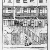
I recently indulged myself by buying a little piece of history. I've mentioned Samuel Loxton and featured and linked to his drawings before, often in the eminently browsable Loxton Collection albums that Bristol Libraries has on Flickr. So when I saw a Loxton drawing of Hotwells pop up on eBay, I decided to get myself a little treat.
I don't think there's any Loxton drawing that features the road I actually live in—it's not very visible from anywhere else, not being one of these Clifton terraces that's perched at the top of a hill, or anything like that, and it's invisible in most views of the area. However, this Loxton drawing, Hotwells, Looking across the river from near the Clifton Bridge station, is probably the closest near-miss I've seen.
I decided to wander out one morning and see if I could reproduce the picture, and also take a photo or two of what's now become of the Clifton Bridge Station, which is still just about discernible in places.
(Then on an even stranger whim I decided to check out a possible little cut-through from Cumberland Road to the harbourside I'd been eyeing up on my commute to work, so walked to Wapping Wharf for a croissant via this potential new route, but that bit's not quite as interesting...)
I'd broadly planned to figure out the vantage point Loxton had used for his drawing by lining up Windsor Terrace with The Paragon, so I started taking bearings fairly early.
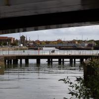
Every now and again some speedboat pops under Merchants Road Bridge and does a few quick loops of the Cumberland Basin. I guess that either they're allowed to go fast on the basin or they know they can get away with it...
I think this was about my best attempt to match the Loxton angle. The fact that my photo still has the edge of Entrance Lock in it suggests that Loxton's drawing was taken from a little further downstream, but there are trees there now, obscuring the view.
Much of the buildings further back are unchanged, as you can see, especially Windsor Terrace to the left and The Paragon middle top. The diagonal rise of Freeland Place is still there, too. What's mostly changed is the closer road, where a chunk of Hotwells, including the houses and Cumberland Hall you can see in the Loxton drawing, was swept away for the Cumberland Road flyover system. This probably also explains why there aren't so many pedestrians just enjoying the scenery—it's much noisier there now.
Here's a similar angle to my earlier attempt at recreating the Loxton view, only with a framing that gives a bit more detail of the buildings.
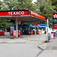
Here's a sign of the times: a petrol station that's out of petrol. According to the BBC, the current petrol supply crisis is still biting in the south of England, but easing elsewhere in the country.
I've got about 50 miles' worth of petrol in my Mini right now, but my car is a luxury rather than a necessity, and that amount could last me months at my current average rate of consumption, so I'm not planning on panic-buying, personally...
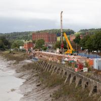
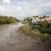
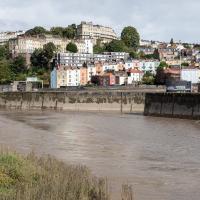
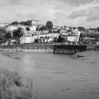
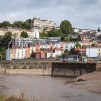
Hurrah! Cumberland Road is fully closed again, this time apparently for stabilisation works on the Chocolate Path, one of my favourite footpaths in Bristol, whcih has been closed since even before part of it actually fell into the river.
That there is an actual plan to re-open the path, that it's got funding, and that work is being done are all good signs, but I'm still trying not to hold my breath. This path's been closed since 2016. (And the entire new cut didn't take this long to dig in the first place...)
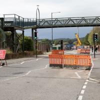
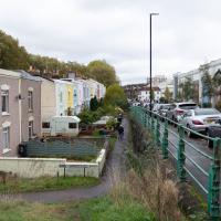
Which is why swapping to this side of the river seemed like a good plan. Coronation Road is bloody noisy at the best of times, and it's currently got all of Cumberland Road's traffic diverted down it.
Docks Heritage Weekend Day One
09 Oct 2021
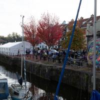
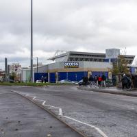
I could spend a lot of time at the Docks Heritage Weekend, poking my nose into industrial places along the harbourside that are usually closed off, but throw open their doors once a year to show off a bit of the backstage area of Bristol's floating harbour. In fact, I warn you: the next wander is a long one, and will have quite a few photos.
However, for today's wander, on the Saturday, my friend Lisa needed a shorter walk than our usual long rambles, as she's recovering from an operation and still a little under the weather, so we just wandered into town for some food and back, with me making mental notes of the places I wanted to come back to on the Sunday... We walked through Underfall Yard, along to the L Shed (this is the warehouse next to the M Shed museum, where they still have the kind of fun old industrial stuff that used to be crammed into the M Shed's predecessor, the old Industrial Museum), through the street food market in town to Ahh Toots for cake and then back home. So, still quite a walk, but no hills and not so much of Lisa having to hang around waiting for me to fool around taking photos as usual, at least...
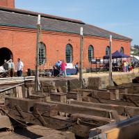
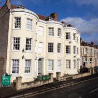
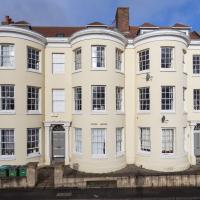
The Patent Slip is actually a grade II listed building. Personally I live in a II*-graded building myself; not sure I'd want to slum it down here.
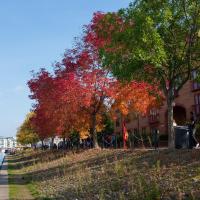
They're among the first to show autumn colour in Bristol, so by early October they're in full effect.
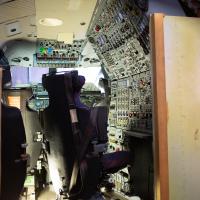
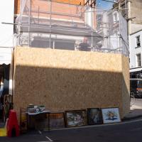
I thought it was a real Concorde nose at first, because I'm sure they used to have one in the Industrial Museum that was replaced by the M Shed. Lisa quickly pointed out the plywood shell. Apparently it was used for prototyping cockpit layouts. One day I may pop along to Aerospace Bristol to have a (big, white, pointy) nose around the real thing.
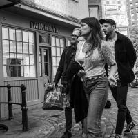
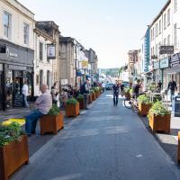
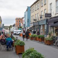
I figured I'd try a bit of street photography, seeing as there were actually people around. This isn't bad for a from-the-hip shot, but I'm a bit out of practice, as you'd expect.
Of course, it's not on the quay any more, because they moved the quay. However, St Mary's Facebook page has at least one picture of it from when this strip of the city centre was still the river.
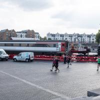
I wasn't expecting to see a train carriage in the Lloyds amphitheare. Apparently it's got something to do with Stephen Merchant's new drama The Outlaws. They're filming some of it down at my end of the harbour soon, too; I've had a letter through the door about night shoots that'll be closing sections of the Hotwell Road.
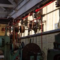
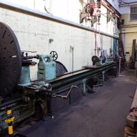
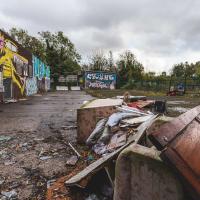
I'm afraid that this is a bit of a badly-curated wander, where I mostly just popped out to find out a little of the history of Underfall Yard and poke around the various open workshops, and, in hindsight, really didn't take pictures in any kind of coherent order. So there's a lot of pictures, but they don't really tell the story that, in hindsight, I seem to have been trying to tell, of the unusual electrical substation in Avon Crescent, the Bristol Electricity that predates the National Grid but is still in use, the history of the hydraulic power house... It's a bit of a mess.
But I suppose sometimes these wanders—always chronologically presented in the order I walked and took photos—simply will sometimes be a bit of a mess. Let's hope you still get something out of it, anyway...
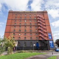
It's very hard to get a decent look at this building. This is the top half of the back of it.
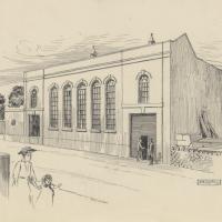
And here's the Loxton picture of the exterior, from the Bristol Libraries collection. Seems such a shame to have bricked up those lovely windows.
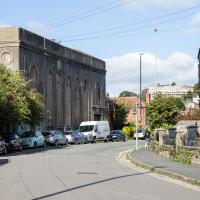
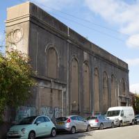
You can see this once apparently bright and airy building has had every window bricked up.
I understand that something in or around this building still supplies the odd electrical requirements (specifically, 360V "Bristol voltage") for some bits of Underfall Yard, which is our next stop, so more about that when we get there.
While it's not a listed building, is is notable: it's one of the earliest reinforced concrete buildings in the UK, apparently, construction starting in 1905. I assume it was up by 1907, as that's when Undefall Yard installed their electric pumps.
This oddity of history predates the National Grid and was originally fed from Feeder Road power station (well, Avonbank, on Feeder Road, to be precise. We've seen a bit of that history before, as a line marker for the line from Portishead to Feeder Road.) It was connected to Feeder Road by 1906, with a 6,600V line.
I've added a couple of historic views of the building as the next two photos in the wander, but I'll also pop this link to a Loxton drawing of the Avonbank electricity works, 1908 here.
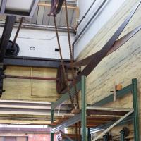
Most of the gear in this docks machine room is belt driven from a motor we'll see in a bit. The motor is electric but the drive system is pretty much the same as it was in the days of steam.
Fresh Fields
17 Oct 2021
For the first time in a while, I had the time and energy to go further afield and knock off some new roads from my "to do" list. I headed through the first Hotwells Festival to Ashton and Bedminster to cross off a few of the suburban roads south of North Street.
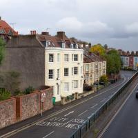
First, though, I decided to try to reproduce an old photo of the now-demolished Rownham Hotel just around the corner from where I live...
Here's the view I wanted to take a stab at reproducing. Bristol's Lost Pubs—a great website, which sadly currently seems to be lost itself—said:
Originally known as the Hotwells Tavern. Around 1873 when the entrance to Cumberland Basin was enlarged, a pub named the Rownham Tavern was demolished and Rownham ferry moved downstream towards the Hotwells Tavern, not long afterwards the name was changed to the Rownham Hotel. The pub was removed in 1969 for road Widening.
This particular image is from Brewerypedia; I'm afraid I don't know its original provenance.

Here's my version. I couldn't get to the exact original viewpoint without the railings on the far left being in the way of the picture, but this is pretty close.
So, presumably the house (or possibly two?) on the end of Freeland Place, which looks to my eye just as Georgian as the rest of the terrace, must've been built after the Rownham Hotel was demolished for the road widening in 1969...
I wasn't in a particularly festive mood, so I decided mostly to bypass the Hotwells Festival. On a different day it might have been right up my street.
Apparently the repair of the Chocolate Path itself is now underway here. I won't hold my breath. Shame, as it's within my mile and one of my favourite walks and I've had no chance to walk down it since long before I started this little project.
To give you an idea of what it's like down on the path, here's a photo from 2017 from behind where I'm standing on Vauxhaull Bridge here.
I've taken a few photos of the similar place around the corner, but I hadn't noticed there's another one of these odd mansion-mansard-bungalow-what-the-hell places here, too.
A Wide Angle View
30 Oct 2021
I had an unsuccessful wander last week, on Tuesday afternoon: my GPS died within about five minutes of leaving the house, and I didn't notice, plus I found hardly anything I'd been looking for. On the plus side, as I was wandering around Park Street I decided to nip into London Camera Exchange on the offchance they had a secondhand Canon 17-40mm lens. I've been thinking of buying one for around a year, I think.
Long story short: not only did they have one, but due to a mistake with their price labelling which they kindly honoured, I now have a shiny new (to me) wide-angle lens and it cost me less than £300, which is a very good price for one of these in good condition (and including a lens hood.)
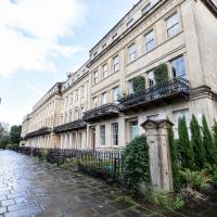
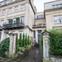
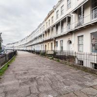
So, rather than try to salvage Tuesday's walk, here's a walk where I basically just bimbled up to Clifton Village for a coffee and wandered around taking photos of as many wide views as I could find. I took a lot more photos than these seventeen, but as you might expect, a new lens takes some practice getting used to, so most of them ended up in the "outtakes" pile.
Pretty sure I couldn't have snapped the whole length of this terrace with my previous-widest lens, the 24-70. Fits fine in the 17-40.
Set back on the end of Worcester Terrace is Worcester House. I've never succeeded in getting a good snap of it. Today does not seem to be an exception. Oh well.
One of several odd short-cuts and alternative routes I worked out to vary my commute to work, when work was at the top of Whiteladies Road.
Ticking Off a Few Streets in Bedminster
31 Oct 2021
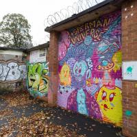
There were only a few streets left to wander in the more residential bit of Bedminster, so I thought I should target those today. The streets themselves weren't that notable, though Balfour Road has a contrasting mix of old and new housing. I tried to snap a few more interesting things along the way there and back, snapping all three of the familiar bond warehouses, nipping onto North Street to find some new street art, and finding a few pumpkins for good measure. It is hallowe'en, after all...
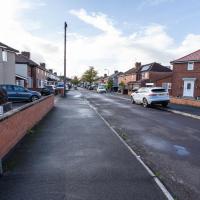
One of the three roads I needed to knock off my list. Just a fairly average slice of suburbia, really.
There's still a few houses on Duckmoor Road (this is the corner of Duckmoor and Frobisher) that use their gardens for gardening rather than just to park cars on, and some of them even have quite big veg gardens growing.
There were quite a few signs that Frobisher Road is a sanctuary for hedgehogs. We've actually seen a similar sign at the far end, on an earlier wander that went past the end of the road.
I'd been looking at the map and wondering if I needed to walk down this, as it looked like a road. I'd say it's private, though.
Again, pretty sure this isn't a public road, and frankly it didn't look like I'd see anything interesting even if I did risk venturing to the end...
Recreating a Loxton Drawing on a Lunchtime Jaunt
05 Nov 2021
I did do a much longer wander earlier in the week, but that'll take me some time to process (and cast a plethora of photos into the "out-takes" pile!) In the meantime, here's my lunchtime jaunt, taken to give myself a break from doing the company bookkeeping to send to my accountant so the taxman doesn't sling me in chokey.
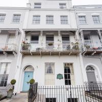
I've recently bought a slightly creased secondhand copy of Redcliffe Press's 1992 collection of Samuel Loxton drawings, Loxton's Bristol: The city's Edwardian years in black and white. It's a nice selection of Bristol Library's collection of the drawings. I'd noticed a drawing of 25 Royal York Crescent, a house I pass quite often, so I thought I'd wander up the crescent on the way to pick up some lunch and try to reproduce it.
On the way back I took a few photos of Clifton Hill Bank as the crowdfunder to make quite a lot of it into a wildflower meadow has just hit its target, so I figured some "before" shots might be a good investment for the future...
Loxton drawing from Bristol Library collection via Loxton's Bristol, Redcliffe Press, 1995 ISBN 1 872971 86 5.
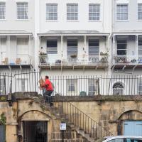
I tried to capture something of the feeling of the Loxton drawing by snapping a busy postman as part of the general scene :)

I went out simply wanting to knock off the very last little unwalked section of Clanage Road, over by Bower Ashton, which has been annoying me for a while as it's quite close by and I've walked the other bits of it several times. So, my plan was to nip over to Greville Smyth Park via a slightly unusual route to wander Clanage Road and tick it off.
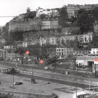
Along the way, though, I inevitably got a bit distracted. I took a few photos of Stork House, a grand Hotwell Road building that's recently been done up a bit (I imagine it's student lets, though I'm not sure) and which I found a reference to in a book about the Port Railway and Pier the other week, and also tried to match up a historical photo of Hotwells before the Cumberland Basin Flyover System laid it waste, which included some interesting markers I'll have to do a bit more digging into...
I've always loved the bow windows; if you look closely you'll see the window frames are slightly curved to match the curvature of the walls. Must be quite pricey to have repairs done, I'll wager.
Stork House was the Stork Hotel back when the Bristol Port Railway and Pier, which connected Hotwells with a deep-water pier at Avonmouth, was in its heyday.
The Stork Family Hotel at Hotwells sought custom by advertising to seamen on ships arriving at Avonmouth, a combined rail ticket to Bristol and meal in this hotel. The same concern also advertised bed, breakfast, hot evening meal and seven days’ ticket to Avonmouth by BPR for sixteen shillings a week.
— Colin Maggs, The Bristol Port Railway & Pier, Oakwood Press, 1975
I imagine this would have been quite an attractive deal to a sailor, who could stay in Hotwells with its vast plethora of pubs and other entertainments and pop back to his ship in the comparative wastelands of Avonmouth when necessary. (There would also have been plenty of sailors who were already quite used to hanging around in Hotwells while their ship was in town rather than waiting around at the new pier at Avonmouth, and familiar with the local facilities. Thinking about what other "facilities" there may have been for sailors makes me wonder again if the bit of the Hotwell Road that ended up being called "Love Street" might've been a bit of euphemism at some stage or other...)
I found this image on Pinterest and as usual for that site it was annoyingly uncredited, but it seems to be from the book Hotwells, Spa to Pantomime, which I've just ordered direct from Bristol Books. Hopefully I'll be able to update the credit a bit when it arrives.
There's quite a lot in here that I didn't know about and will be researching a bit more, especially the Spa Assembly Rooms, which I think later turned into a school before being demolished for the flyover system, and also Anderson's workshop, a last vestige of the figurehead-carving industry.
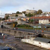
I was trying to recreate the angle of the old, pre-Cumberland Road Flyover System photo that comes next. I couldn't get the angle, mostly because of the height, but this seems to be shot from about the right direction.
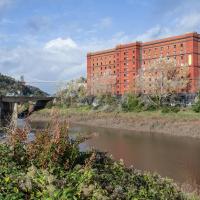
That historical photo seems to have been taken from a higher vantage point. The most likely place seems to be the B Bond, perhaps from that fire escape, or maybe the roof? Something tells me it's unlikely they'd let me up there, but you never know, maybe one day I'll ask an archivist; I think that area's part of the Bristol Archives stores...
View into the car park of the former stables/kennels. I just poked my camera through a big hole in the gate.
...and I was right.
Incidentally, a brief aside for a rant: why the hell are self-storage places just like sodding gyms? You can't get a straight answer about how much storage costs from any of their websites. They just take your details and then you have to talk to some bloody salesman, and play each site off against each other to get what's alleged to be the best price. I think it must be some kind of price-fixing racket.
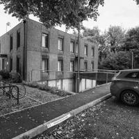
I find something intrinsically nice about this modest little terrace sandwiched in among the rather more industrial surroundings.