Tagged: gas
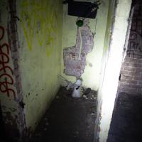
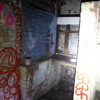
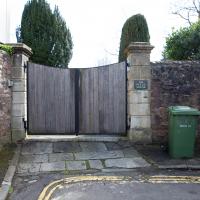
I'm glad my friend Lisa joined me today; she drove in from Shirehampton and told me that the Portway was looking rather lovely, so we set off that way. She's also braver than I am when it comes to doing urbex stuff, so this was just the opportunity to take a peek into the Portnalls Number One Railway Tunnel/Bridge Road Deep Valley Shelter whose entrance I'd found on a previous wander.
It was definitely dark and spooky and impressively big, with a side tunnel that Lisa explored that leads to a little door I don't think I've previously noticed on the side of the Portway. I didn't get many photos—even my astoundingly powerful little torch (£) didn't do much to light things up, and you're not going to get much joy hand-holding a camera in that darkness—but I did shoot a little video, which I might edit and add later.
After plumbing the bowels of the earth, we went up Bridge Valley Path to Clifton, explored some bits around the College and Pembroke Road, then came home via Foliage Cafe for coffee. Nice.
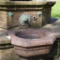
A Bristol estate agent would probably sell this as having an excellent view, too.
Harbour Circumnavigation
01 Mar 2021
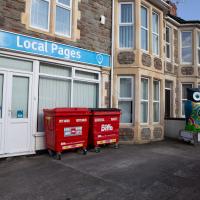
Normally I don't have enough time in my lunch hour to get all the way around the harbourside. This is a shame, as Wapping Wharf is a great place to get coffee and a snack, but it's pretty much diametrically (perimetrically?) opposite me on the harbour. Today I had the day off, so I decided to go and knock off a few streets around Anchor Road that I'd not covered, as well as visiting the site of the Read Dispensary (well, one of them) and dropping into Mokoko for one of their astounding almond croissants. From there I came back along the south side, checking out the views from as much of the Chocolate Path as you can venture down at the moment, and swapping from Cumberland Road to Coronation Road at Vauxhall Bridge.
There's a lot of meh photos on this walk—my chief output from this project could be politely described as "record shots"—but a few turned out well, especially those of Vauxhall Bridge from the Chocolate Path, which reminded me how much of a loss the current closure of the Chocolate Path is to walkers and cyclists in Bristol.
I dream of a future like the past, where we just had one bin, but where everything from robots to enzymes at the recycling centre nevertheless manage to pull everything back apart.
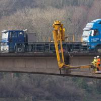
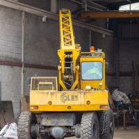
Okay, never seen how they inspect the bridge before. This was triggering my vertigo even watching from the distance of Ashton Avenue Bridge.
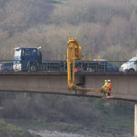
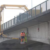
I'm not sure what they were inspecting or how, but then I'm not a structural engineer.
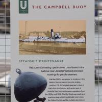
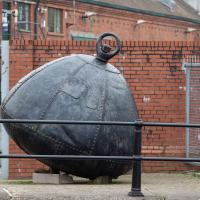
Of Bridges and Buoys
04 Mar 2021
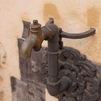
A trip to Imagine That coffee, so no fresh roads knocked off my list, but I stopped off to snap a couple of the engineering-related bits of the docks: the Campbell Buoy (used by P&A Campbell for mooring their paddle steamers) and Brunel's "other" bridge, the foot/horse swing bridge that now sits sadly disused in the shadow of the Plimsoll Bridge at Howard's Lock.
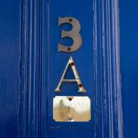
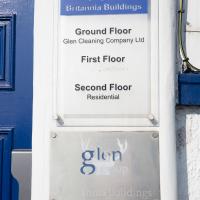
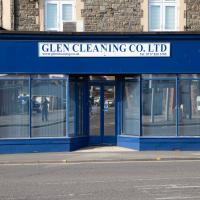
I headed to Bedminster to do a crossword with my support bubble today. On the way I delved into a couple of bits of Hotwells history, first of all snapping a "now" shot to go with a historical photo of Holy Trinity I happened across recently, and second of all to snap the Britannia Buildings.
The Britannia Buildings are a little strip of offices on a corner of the Hotwell Road. They've mostly been the headquarters of a cleaning company for years, but I've often wondered what this distinctive curve of offices, its ground floor standing proudly out from the upper floors, used to be. Well, after my last wander, where I poked about the landing stage just down the road, I found out! Researching the paddleboat company P&A Campbell I came across this nugget in The A-Z of Curious Bristol, by Maurice Fells (£):
The firm of P & A Campbell was the main steamer operator in the Bristol Channel, with its local headquarters in offices close to the Hotwells pier and overlooking the harbour at the Cumberland Basin. Campbell's named their offices Britannia Buildings, after one of the ships in their White Funnel Fleet.
So! Turns out the Britannia Buildings were named after a paddle steamer—you can see some pictures of Britannia here.
In related news, I've now bought three of Maurice Fells' local history books, and they were hand-delivered by the author on Sunday, a half-hour after I ordered them online (through a message exchange on Nextdoor!) Not even Amazon Prime has managed to deliver me anything that quickly...
"I'd like to buy an owl, please." "We don't sell owls." "Someone told me you did." "Who?" "See! I just heard one!"
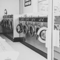
I've never used Staffords Launderette on North Street (the Park Launderette on Park Place is my preferred option) but it always looks shiny and tidy, which is a good start.
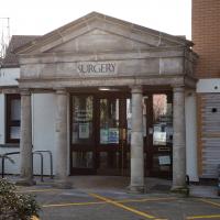
I couldn't find any historical reason why this surgery on the ground floor of a 1960s tower block has an entrance that looks like this. Might be one to ask my more local friends about. I'm guessing this was here on the site when they built the tower block and they wanted to keep it, but it's only a guess.
Leigh Woods Walk
14 Mar 2021
An enormous walk today, or at least it felt enormous. My feet are sore, anyway. I started off recreating a couple of local historical photos in Hotwells, but then headed for my traditional walk along the towpath in the Avon Gorge to the far extreme of Leigh Woods, up and through the woods to the height of the Suspension Bridge, finally crossing into Clifton Village for a well-deserved vanilla latte.
I say "traditional" because this used to be a very regular route for me, first walking, years and years ago, and later jogging—this route combined with a circuit of the Downs on the other side used to be my way of making sure I was fit to do a half-marathon (I did six of them in total, between 2010 and 2014).
I miss the routine of this walk, even though it's a long way and it used to pretty much wipe me out when I did it—I'd come back home and collapse and do very little for the rest of the day. But perhaps that's what Sundays are for, and I should try to remember that.
Doing this walk regularly was quite a meditative experience. Not so much of that today, but once I got to the further extreme of the towpath, where the roar of the Portway traffic on the other side of the river dwindles and I turned into Leigh Woods to climb ever closer to birdsong and further from rushing cars, I did seem to recapture a little of the feeling of previous walks. (I would say my mind cleared, but I was mentally singing along to Life Without Buildings' The Leanover for most of the wander. There are worse songs to have stuck in one's head, though; it's a great track...)
Anyway. Apparently the walk made me more likely to ramble in words, too. I'll stop now :)
It's at about this point that the traffic on the Portway starts fading down to a more quiet level, just because of the width of the river.
John Carr's Terrace
16 Mar 2021
I wanted a nice simple lunch-hour walk that took me past a cafe today, and I managed to find the perfect road to knock off my list of targets to do it. Situated just off Jacobs Wells Road, right next to Queen Elizabeth's Hospital, John Carr's Terrace, and Rosebery terrace above it, which I'd completely forgotten existed, are a little cul-de-sac that many Bristolians will have wandered past a thousand times without ever seeing.
There's a reason it's next to QEH:
Known traditionally as "The City School", Queen Elizabeth's Hospital was founded by the will of affluent merchant John Carr in 1586, gaining its first royal charter in 1590.
John Carr's terrace itself isn't much to write home about, architecturally, but I like the secluded feel of it, and I really liked Rosebery Terrace with its little houses, commanding position and friendly, slightly tumbledown feel.
On the way home I popped into Foliage Cafe for a coffee and a very pleasant nutella and banana pastry, then walked home past the refurbishment of the old Thali Cafe into a new and interesting clinic...
At the end of John Carr's Terrace. Apparently it's a 5 bedroom semi and is ranked as the most expensive property in BS8 1DW, with a valuation of nearly two million quid. I couldn't see much of it. I wonder if it's owned by QEH's headmaster, or something...
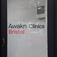
The old Thali Cafe will, according to the Guardian, be re-opening as "the first UK high-street clinic offering psychedelic-assisted therapy":
Though alcoholism is a focus, Awakn will also offer psychedelic-assisted therapy to treat depression, anxiety, eating disorders and most addictions.
On a Monday in late February, the Bristol clinic is abuzz with builders and workmen. Formerly the site of an Indian restaurant, it sits in a 19th-century building on the corner of Regent Street and Hensmans Hill in Bristol’s chi-chi Clifton area. Its position, next to a barber shop and cocktail bar, and overlooking a small park, was picked for its ordinariness. As Awakn’s CEO Anthony Tennyson explains, “Our strategy is to normalise the industry; we want to integrate into the mainstream, so that popping in for mental health treatment is as normal as… ” he trails off. Getting your teeth whitened? “Something like that,” he laughs.
Harbourside Milestone
17 Mar 2021
The other day I realised (hello, Maggie!) that my next walk would be my hundredth, and that I'd done 393.4km so far. I figured it would be nice to get to 100 walks and 400km on the same walk, so I went for a nice long harbourside wander after work, rather than dashing out at lunchtime. As it turned out, we're just coming up to the time of year where I can leave the house at 5:30 in the evening and there's still just enough light to take photos by the time I've made it around the harbourside. Though only just, and mostly because I've got a full-frame camera that's not bad in low light...
Still, the evening light made a lovely change, and some of the photos turned out to be pretty good photos per se, rather than just record shots of my walk. I'm looking forward to more evening walks like this as summer approaches.
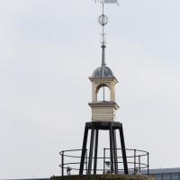
On the way around this evening I wandered through one of the oldest bits of the city to extend my walk and snapped some interesting bits of architecture, including an NCP car park(!) and a nighttime shot of one of my favourite subjects, the clock tower at the Albion dockyard.
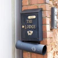
Cheeky. I also run a Cafe Signs Tumblr so I'm always on the lookout for good signage.
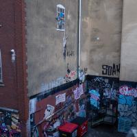
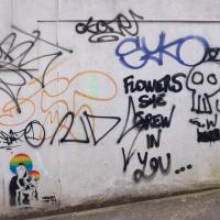
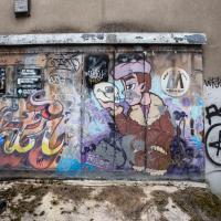
This is actually a Banksy work, not as well-known as many. Oddly, it seems like this loading bay may have been added after the graffiti was put there, and the graffit carefully transferred. I'll have to find out whether that's what actually happened...
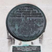
From Wikipedia:
William Friese-Greene (born William Edward Green, 7 September 1855 – 5 May 1921) was a prolific English inventor and professional photographer. He is principally known as a pioneer in the field of motion pictures, having devised a series of cameras in 1888–1891, with which he shot moving pictures in London. He went on to patent an early two-colour filming process in 1905. His inventions in the field of printing – including photo-typesetting and a method of printing without ink – brought him wealth, as did his chain of photographic studios. However, he spent everything he earned on inventing, went bankrupt three times and was jailed once, before dying in poverty.
This year there's apparently a year-long celebration of his life and work.
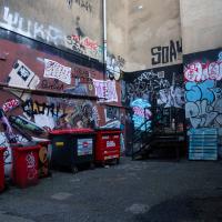
Oddly, everyone in Bristol knows the wall above this little alleyway/loading bay, but probably woudln't recognise this bit down here.
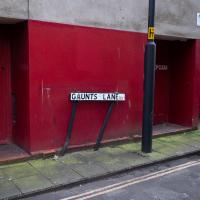
If you were able to walk directly down Guants Lane on a straight line through to Park Street, you'd end up walking through St Mark's Church, also known as the Lord Mayor's Chapel, and formerly known as Gaunt's Chapel. It was built as the chapel to the adjacent Gaunt's Hospital, now demolished, founded in 1220. Something tells me there's a strong possibility that it stood hereabouts. From Wikipedia:
In 1220 Maurice de Gaunt (d.1230), a grandson of Robert Fitzharding (d.1170), first feudal baron of Berkeley, Gloucestershire, founded a hospital, that is to say a mediaeval charitable residential institution, next to his grandfather's foundation of St Augustine's Abbey, to provide relief for the sick and poor. It was to be called the "Hospital of St Mark of Billeswyke-by-Bristol" and was housed in the Abbey's almonry.
This is yet another example (like QEH) of the meaning of the word "hospital" changing over time. It comes from "hospes", Latin for "guest" or "stranger", and "hospital", "hostel", and "hospitality" all share the same root. (And there's another connection with QEH: QEH was originally housed at Gaunt's Hospital mansion house, Unity Street, just around the corner.)
I'd heard her approach, but I hadn't expected her to pose for me. Those are actually peace-style "V" signs she's flicking, believe it or not :)
I'm not sure about the signage here. It doesn't seem that appealing. On the other hand, if this place was in Crete (where my parents live) I'd have no problem believe that the food was amazing. Strange thing, context.
I wasn't going to take a very long walk on this nice spring evening; it just happened. I was going to knock off a path or two on Brandon Hill, home over centuries to hermits and windmills, cannons and Chartists, and then just wander home, stopping only to fill up my milk bottle at the vending machine in the Pump House car park.
However, when I heard a distant gas burner I stayed on the hill long enough to see if I could get a decent photo of both the hot air balloon drifting over with Cabot Tower in the same frame (spoiler: I couldn't. And only having the fixed-focal-length Fuji with me didn't help) and then, on the way home, bumped into my "support bubble", Sarah and Vik, and extended my walk even further do creep carefully down the slipway next to the old paddle steamer landing stage and get some photos from its furthest extreme during a very low tide...
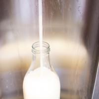
Well, one mission, anyway. I popped out for milk, taking my reusable bottle along to the vending machine in the Pump House car park.
Towpath Evening
25 Mar 2021
I was honestly just about to do the homework from my oh-so-thrilling ITIL course when my friends Sarah and Vik asked me if I'd like to come out for a wander down the towpath with them. I enjoyed the company, the evening light and the delicate clouds.
I got interested in Bristol's medieval water supplies after poking around near Jacobs Wells Road and Brandon Hill. It was during that research I found out about a pipe that's still there today, and, as far as I know, still actually functioning, that was originally commissioned by Carmelite monks in the 13th century. They wanted a supply of spring water from Brandon Hill to their priory on the site of what's now the Bristol Beacon—Colston Hall, as-was. It was created around 1267, and later, in 1376, extended generously with an extra "feather" pipe to St John's On The Wall, giving the pipework its modern name of "St John's Conduit".
St John's on the Wall is still there, guarding the remaining city gate at the end of Broad Street, and the outlet tap area was recently refurbished. It doesn't run continuously now, like it did when I first moved to Bristol and worked at the end of Broad Street, in the Everard Building, but I believe the pipe still functions. One day I'd like to see that tap running...
There are a few links on the web about the pipe, but by far the best thing to do is to watch this short and fascinating 1970s TV documentary called The Hidden Source, which has some footage of the actual pipe and also lots of fantastic general footage of Bristol in the seventies.
On my walk today I was actually just going to the building society in town, but I decided to trace some of the route of the Carmelite pipe, including visiting streets it runs under, like Park Street, Christmas Street, and, of course, Pipe Lane. I also went a bit out of my way to check out St James' Priory, the oldest building in Bristol, seeing as it was just around the corner from the building society.
There are far too many pictures from this walk, and my feet are now quite sore, because it was a long one. But I enjoyed it.
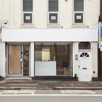
Looks like something's getting spruced up ready for opening. Good. This bit of the Hotwell Road needs some nice new shops, of any and all varieties.
This place was joined up with the shop to the left as a hot tub sales showroom, and before that it was the View art gallery. Before that it was a brothel for a while, oddly, but I think the general community reaction was a bit too hostile for it to survive. Looks like it's now been separated from the next door shop.
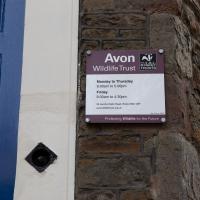
It's the home of the Avon Wildlife Trust now, but back in the day it was Brandon Hill Police Station. It's marked on maps as recent as the 1950s Bristol Town Plans. An interesting tidbit from Bristol Then and Now on Facebook:
One of the first police stations in Bristol, it was opened in 1836 - policemen from the station used the building housing the Jacob's Well as a bicycle store and many old bicycle lamp batteries were found in excavating the small entrance to the mikveh. The Police Station closed in 1967 and it is now the base of Avon Wildlife Trust.
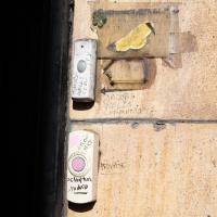
Some of us are old enough to know why that logo goes with the number 45. In face, I probably have a couple of those somewhere in this room...
Just to remind myself that although it's on the map, I couldn't really have walked down it.
Apparently St John's conduit is currently in working order, having been painstakingly fixed on many occasions over the centuries since 1267, including very recently, so presumably there's a tap head somewhere in the church that could turn it on and give you a taste of water from the spring all the way up Park Street.
This is quite a feat of medieval engineering, as the pipes run both down and uphill in places, using a siphoning action to carry the water back uphill around the Pipe Street area (which is, indeed, named for the original water pipe.)
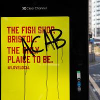
Some signs of Bristol's recent civic disturbances in the wake of the "Kill The Bill" protests.
I think these sodding animated advertising hoardings at these city centre bus stops are a form of urban vandalism in themselves.
Do I think "ACAB"? No. Hardly any sweeping generalisations about groups of people are true. But I think that the Police, Crime, Sentencing and Court Bill is draconian in places and probably a danger to the right to peaceful protest, which is worth protesting about, and that Bristol's police aren't exactly covering themselves in glory at the moment, especially considering the reasonable lightness of touch they used when handling the whole Colston statue thing last year.