Tagged: clifton
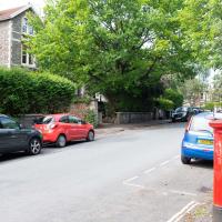
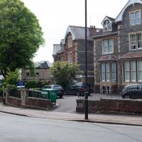
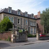
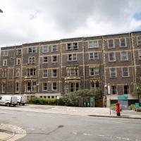
I managed to knock off a reasonable chunk of the roads I had left to walk around the University at the north-eastern extremity of my mile on this nice sunny walk. As well as being impressed by the number of big townhouses now occupied by various departments, I took some time on my way there to check out a war memorial, and some time on the way back to do a little extra wandering of Berkeley Square.
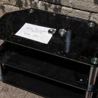
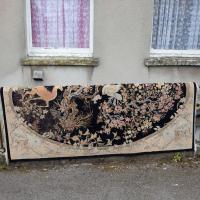
Assuming the home appreciates terrifying 1990s furniture, anyway. I assume TV tables will go the way of telephone tables. Maybe someone will be restoring these as retro side-chairs in the year 2055?
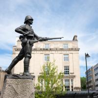
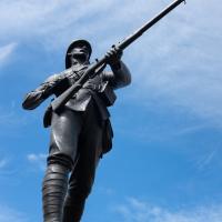
With a Lee-Metford rifle. The Lee Enfield was already in production when the Second Boer War started, but clearly this fella was still on the previous issue...
You'll notice he's also wearing puttees. They'd mostly died out as military wear by the end of WWII.
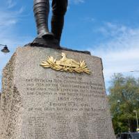
What's Egypt got to do with South Africa, you ask? It's the badge of the Gloucester Regiment.
The Glosters were the only regiment in the British Army to wear a cap badge on both the front and the back of their caps, and it's unsurprising that it references Egypt. At the Battle of Alexandria in 1801:
The front and rear ranks of the 28th were simultaneously engaged, whereby the soldiers received the order "Front rank stay as you are, rear rank about turn" and in commemoration the regiment later adopted a second cap badge, the 'Back Number,' worn at the back of their head-dress.
The Glosters were later merged with a couple of other regiments, but their successors, the Rifles, still wear the back badge.
A Longer-than-it-looks Walk With Lisa
06 Jun 2021
The track on the map doesn't tell the whole story of this walk with Lisa around and about Clifton, Berkeley Square, Brandon Hill and the harbourside, because the batteries on my GPS ran out while we were on the roof of Trenchard Street car park, it seems. Oh well. I think I did most of the area I was interested in finishing off around the University; there were only a few new bits around Brandon Hill that won't be on the track, and I can easily do them again.
Still, technology woes aside it was a nice walk, albeit a bit warm for climbing all those hills, and sat on the harbourside watching the world go by for a while, too. It was good to see the Bristol Ferry Boats carrying people around again, especially.
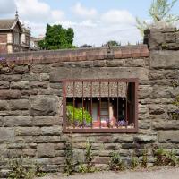
No idea why there's a window in this wall. The wall looks a lot older than everything surrounding it, so perhaps it's just some historical vestige leftover in between bits of University development.
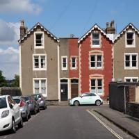
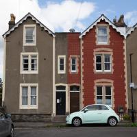
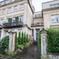
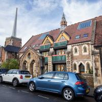
We're just outside my mile radius here, but Osborne Villas Looked too tempting to just walk past.
Looked a bit to me like number 16 had tilted over to the left a bit since it was built...
The rose is an ancient symbol of secrecy, hence "sub rosa". From Wikipedia:
In Hellenistic and later Roman mythology, roses were associated with secrecy because Cupid gave a rose to Harpocrates (the Hellenistic silence god) so that he would not reveal the secrets of Venus. Banquet rooms were decorated with rose carvings, reportedly as a reminder that discussions in the rooms should be kept in confidence. This was inherited in later Christian symbolism, where roses were carved on confessionals to signify that the conversations would remain secret.
I only found that out this morning; it came up in a book I was reading on a secret society. I could tell you which one, but then I'd have to kill you.
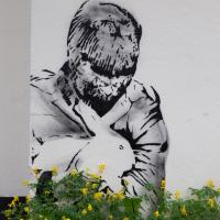
At some point Twitter might tell me who this is, at which point I may update this description...
Lunchtime Zig Zag Climb
13 Jul 2021
A snappy little trip up the Zig Zag to the shops. It's a steep old route, the Zig Zag, going from just over river level to about the height of the suspension bridge (101 metres) in a compact switchback of a footpath.
I was too busy struggling to breathe to take many snaps of the actual Zig Zag (I've been trying to make it up all the way without stopping the last few times, but I've not quite managed it yet). I did at least take a few snaps either side on this quick lunchtime jaunt to fetch coffee (Coffee #1) and a sarnie (Parsons) from Clifton Village...
One of many fine old lamp posts in Clifton Village. The late, great Maggie Shapland apparently used to keep an eagle eye on them and make sure they were returned if they were ever carted off for repair. The Clifton Club lurks grandly in the background.
Although you may immediately think "gas lamp", here's an extract from Electric Arc Lamps in Bristol by Peter Lamb, published as a supplement to the Histelec News, newsletter of the Western Power Electricity Historical Society:
In looking at old photographs of late Victorian or early Edwardian scenes, many of you may have noticed very decorative street lights gracing the foregrounds. These lamp standards had long cylindrical shapes above the lamp, which distinguished them as being electric arc lamps. You may have wondered, like me, what was inside these housings. These cylinders, known colloquially at the turn of the century as “chimneys” were not chimneys at all, but housed the complex mechanisms regulating the carbon electrodes. Only two lamp standards of this distinctive design remain as street furniture on the Bristol streets and these are situated at The Mall, Clifton Village.
A Long Wander Of Miscellany and Magick
08 Aug 2021
This was a wide-ranging wander. I started off crossing the river to Bedminster, to walk a single little cul-de-sac, Hardy Avenue, that I'd managed to miss on at least one previous walk. Then, pausing only to explore a few back alleyways, I headed for a few destinations related mostly by the Hughes family, who I've been researching a little as part of background for a possible novel, as several of them were involved in the Stella Matutina.
However, mostly it's the artistic side of the family I wanted to explore today, as that's where most of their public history lies (as you might expect, there's often not much in the public record about the workings of an occult organisation.) First I visited College Green, where the façade of the Catch 22 Fish & Chip shop still bears the work of Catherine Edith Hughes. Then I wandered up to the top of Park Street to pop into the Clifton Arts Club's annual exhibition, as Catherine, her half-brother Donald, his wife Hope and at least two other Hugheses were members. Donald was chairman for 40 solid years; Hope was Secretary for eight, and Ellard and Margaret Hughes, two more Hughes siblings, were members along with Catherine.
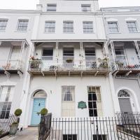
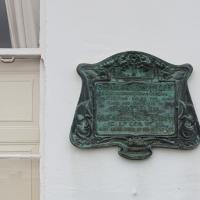
Finally I walked home with a small diversion to Berkeley Square, to confirm the location of Donald Hughes's house by checking for a particular plaque by the front door.
I must admit I'm not entirely sure where all this research is really leading me, but I'm finding it quite interesting to bump across the faint lines of history that link the Hermetic Order of the Golden Dawn, founded in 1888, to modern, quotidian Bristol.
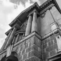
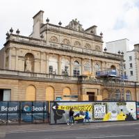
City Museum and Art Gallery. Though when it was donated by Henry Wills (you can just see The Gift of... in the inscription) it was just The Bristol City Art Gallery.
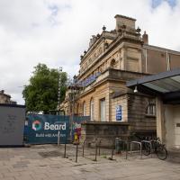
The RWA is having extensive work done, including fitting a new lift on the outside (on the far side from here) so people who have trouble with stairs don't have to use the frankly terrifying freight lift.
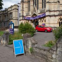
It's almost like I planned this in advance. This is the 111th annual open exhibition of the Clifton Arts Club, founded 1906.
The Clifton Arts Club featured several members of the Hughes family. The three I'm interested in are Catherine Huges, of the earlier pomegranates, her brother Donald Hughes, and his wife Hope Hughes. They were all at some point members of the Stella Matutina as well as various arts groups in the city. Donald was a member of the Bristol Savages—ahem, sorry, Bristol 1904 Arts, as they've recently rebranded—and apparently something of a leading light on the Bristol art scene.
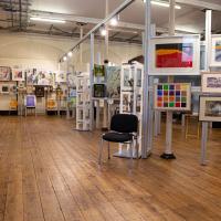
There really was a lot. I didn't like to snap inside, but I thought one shot would give a flavour. There was a lot of good stuff. I shall be going back next year.
Back past the RWA again, on our way to Berkeley Square. I'll see if I can get another snap once all the hoardings are down.
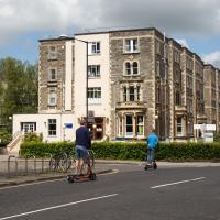
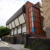
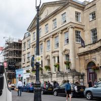
Currently the University of Bristol's Beacon House, it was originally the Queens Hotel, built by William Bateman Reed, who also built a stretch of Victoria Square, among other things. Every Bristolian older than thirty probably still thinks of it as "the old Habitat building", though. I've got curtains in this very room that were bought there...
Continuing with my magical/Hughes related theme: the last time I was in Berkeley Square, I was trying to figure out where the vault of the Hermes Temple might have been destroyed; a passing mention of its destruction in Ithell Colquhoun's Sword of Wisdom says it was stored in Berkeley Square and destroyed in 1964.
The Vault would have been a septagonal wooden room with esoteric symbols painted on every surface. The Museum of Witchcraft in Boscastle have a picture of one towards the bottom of this page. That one, in Havelock North, New Zealand, would have looked very similar to the Bristol Hermes vault, I think, as they were contemporary Stella Matutina vaults and they were probably each at least partly designed by Robert Felkin, who emigrated from Bristol to New Zealand to form the Smaragdum Thalasses temple there.
Shiny New Hope
24 Sep 2021
A quick lunchtime jaunt to Clifton Village. Along the way I admired the new sign on Hope Chapel and added to my tsundoku collection.
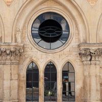
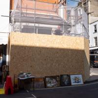
There's a mason at work on the carved pilaster tops on the frontage of the old Coventry (and before then, Stroud and Swindon) Building Society. They've moved everything to a central branch in town in the interests of efficiency, so now I have to go to bloody Broadmead to do anything.
(Yes, I actually went into town to get a cheque out of the building society just the other day, in 2021. I know I should chuck this old-fashioned malarkey in for a shiny electronic account, but it's for the management committee of the house I live in, so there's complexity and inertia involved...)
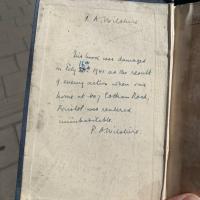
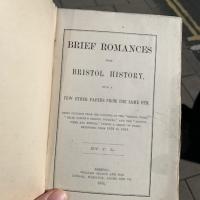
I have since blogged about this little find in the boxes of books outside Rachel’s and Michael’s Antiques.
Apologies for the poor picture quality; it was a quick snap from the iPhone. There's a better picture on t'blog. It's notable that this book was written by "J L", Joseph Leech, former Bristol newspaper magnate and the man who had Burwalls Mansion built, just the other side of the Suspension Bridge.
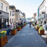
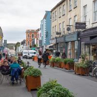
Among the many arguments about this pedestrianisation experiment, there has been quite the sub-debate over the delightfully modern COR-TEN steel steel/hideously ugly rusty* planters.
- Delete as applicable
A Wide Angle View
30 Oct 2021
I had an unsuccessful wander last week, on Tuesday afternoon: my GPS died within about five minutes of leaving the house, and I didn't notice, plus I found hardly anything I'd been looking for. On the plus side, as I was wandering around Park Street I decided to nip into London Camera Exchange on the offchance they had a secondhand Canon 17-40mm lens. I've been thinking of buying one for around a year, I think.
Long story short: not only did they have one, but due to a mistake with their price labelling which they kindly honoured, I now have a shiny new (to me) wide-angle lens and it cost me less than £300, which is a very good price for one of these in good condition (and including a lens hood.)
So, rather than try to salvage Tuesday's walk, here's a walk where I basically just bimbled up to Clifton Village for a coffee and wandered around taking photos of as many wide views as I could find. I took a lot more photos than these seventeen, but as you might expect, a new lens takes some practice getting used to, so most of them ended up in the "outtakes" pile.
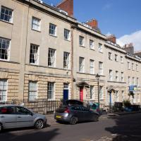
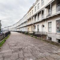
Pretty sure I couldn't have snapped the whole length of this terrace with my previous-widest lens, the 24-70. Fits fine in the 17-40.
Set back on the end of Worcester Terrace is Worcester House. I've never succeeded in getting a good snap of it. Today does not seem to be an exception. Oh well.
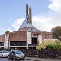
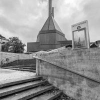
I've mentioned the spire before, I'm sure: colloquially known as the "three pin plug", it's apparently meant to represent the Holy Trinity.
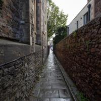
One of several odd short-cuts and alternative routes I worked out to vary my commute to work, when work was at the top of Whiteladies Road.
Recreating a Loxton Drawing on a Lunchtime Jaunt
05 Nov 2021
I did do a much longer wander earlier in the week, but that'll take me some time to process (and cast a plethora of photos into the "out-takes" pile!) In the meantime, here's my lunchtime jaunt, taken to give myself a break from doing the company bookkeeping to send to my accountant so the taxman doesn't sling me in chokey.
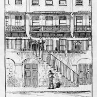
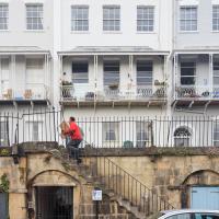
I've recently bought a slightly creased secondhand copy of Redcliffe Press's 1992 collection of Samuel Loxton drawings, Loxton's Bristol: The city's Edwardian years in black and white. It's a nice selection of Bristol Library's collection of the drawings. I'd noticed a drawing of 25 Royal York Crescent, a house I pass quite often, so I thought I'd wander up the crescent on the way to pick up some lunch and try to reproduce it.
On the way back I took a few photos of Clifton Hill Bank as the crowdfunder to make quite a lot of it into a wildflower meadow has just hit its target, so I figured some "before" shots might be a good investment for the future...
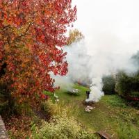
Autumn's a busy season in Royal York Crescent Gardens.
(This is also the reason the photos of Royal York Crescent that come along in a minute look slightly hazy! It's not my lens, honest...)
Loxton drawing from Bristol Library collection via Loxton's Bristol, Redcliffe Press, 1995 ISBN 1 872971 86 5.
I tried to capture something of the feeling of the Loxton drawing by snapping a busy postman as part of the general scene :)
There's a plan to cover this with wildflowers, and I just heard that it has achieved funding, so I figured I'd take a chance on taking a few "before" photos, even though I didn't know where the planting will take place!
As it turns out, having read the crowdfunder info, this is roughly the "westernmost third" where the wildflower meadow will be planted.
The crowdfunding effort has blown past its original £1400 target and stands at £1775 so far. The original target was to cover:
- £300 for wildflower seed to sow in the next few weeks
- £100 for non-plastic signage explaining what’s happening – crucial for public support
- £1,000 for plug plants to go in next spring
They also say that most of the existing popular daffodils will stay, which is nice, as that was my favourite spring feature of the bank.
The more I research it, the more I find that Hotwells had far better transport links back in Victorian and Edwardian times than it has today. Along with buses that went to more useful places than the City Centre, there were trams, the funicular up to Clifton, the landing stage for paddle steamer services and two railway stations all within easy walking distance of me.
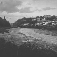
Today I took a day off work as preparation for doing the bookkeeping for my tax return1, and took a wander along to the site of what would have been my nearest station, Hotwells (or Clifton, as it started out in life), nestled in the shadow of the suspension bridge, the Bristol terminus of the Bristol Port Railway and Pier.
From there I wandered down the Portway, following the original line, until I got to the area around Sneyd Park Junction, where the tunnel from the slightly later Clifton Extension Railway joined up with this originally-isolated BPR line. Then I headed up to Clifton through the "goat gully" at Walcombe Slade, seeing the few above-ground bits of evidence of the tunnel (which is still in regular use) along the way.
It was a lovely day, and a good walk, and it was interesting to daydream of the times when I could have walked a few minutes from my flat down to Dowry Parade, caught a short tram ride to Hotwells Stations, and then headed from there to Avonmouth, perhaps even to board a transatlantic passenger service. The completion of the Clifton Extension Railway that linked the Avonmouth station with Temple Meads made relatively direct transatlantic travel from London via Bristol possible, with passengers travelling up from Paddington to Temple Meads, on to Avonmouth on the Clifton Extension Railway and Port Railway and Pier line, then perhaps catching a Cambpell's paddle steamer—which sometimes acted as tenders for large steamers—to a larger ship that was headed out for Canada, say.
1 I've learned that the best approach is to take two days off and deliberately do something that's not my bookkeeping on the first day, as otherwise I just inevitably end up procrastinating and feeling guilty on the first day no matter what. I have an odd brain, but at least I'm learning strategies for dealing with its strange ways as I get older...
2 Information mostly gleaned from Colin Maggs' The Bristol Port Railway & Pier and the Clifton Extension Railway, The Oakwood Press, 1975.
A Random New Year's Day Wander
01 Jan 2022
I picked a fairly arbitrary reason for a wander today. Really, I just wanted to do a New Year's Day wander just to get out of the house and to set a precedent for the year to come.
My ostensible reason was to investigate what looked like a road on my map that quartered the lawn in front of the Ashton Court mansion. As it turned out, this is just a muddy footpath/desire line similar to a half-dozen other tracks nearby, and must be some kind of bug or misclassification with the mapping system I'm using, but that's not important. What's important is that I went for a little walk on the first day of the year. As a bonus, I did happen to wander down a couple of sections of new footpath, so technically I broke some new ground too, which is nice.
Near and Far
05 Jan 2022
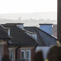
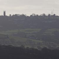
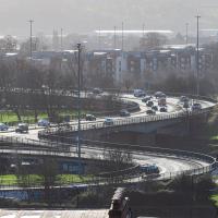
I took advantage of a rare recent day where it wasn't tipping down with rain to get away from my desk on a lunchtime workday and head up to Clifton Village. I'd hoped to snap a reproduction of historical photo which I'd worked out had been taken from the Suspension Bridge, but the gods were not smiling on me. Still, taking only a nice long lens with me worked out very well as the lovely haze of the day made more distant views quite dramatic...
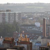
The Nova Scotia pub bottom right, then behind it the chimney of the previously coal-fired pump house at Underfall Yard. In the background behind that and to the right is the Tobacco Factory, with what looks like a little red shed on its roof that I presume is actually a stairwell exit to the roof. On the left-hand side at about the same distance away is the large council block of Little Cross House. It always seems quite calm and tidy when I pass it, which is very regularly, but the Bristol Post painted a different picture in 2019 in their story headlined "Residents of 'forgotten' tower block demand council action over 'nightmare' living conditions":
People living in Little Cross House, a 13-storey council tower block in Southville, said their lives are plagued by poor living conditions, damp and mould, and neighbours from hell, drug dealers, discarded needles, vandalism and anti-social behaviour.
In the far distance, across the Southville rooftops, are the green hills of the Knowle West Health Park, I think.
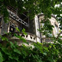
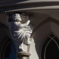
I swear this caryatid must've been modelled on Stephen Fry. This is St Vincent's Priory, a very strange building on Sion Hill that's just been renovated. Next time I pop up I'll try and get a photo of it looking clean and shiny now the scaffolding's down, but I only took a telephoto lens with me on this trip.
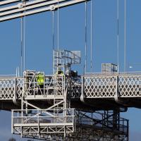
If I'd really considered it, the fact that there was a bloke in high vis standing on the bit of the bridge I wanted to take a photograph of might have warned me what was going to happen...
Damn it. That's the bit I wanted to take my photo from. Still, at least on the way here I got some nice pics that I probably wouldn't have tried if I hadn't taken long lens out specially.
