Tagged: interior-design
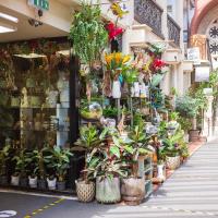
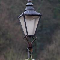
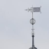
Clifton Hill
23 Nov 2020
I've just got to the bit in Fanny Burney's Evelina where our eponymous heroine visit a grand house on Clifton Hill during her stay in Hotwells. It was interesting to wonder if it could be any of the places I passed in my lunchtime jaunt, which took in both Clifton Hill and Lower Clifton Hill.
From Evelina (1778):
"Yes, Ma'am; his Lordship is coming with her. I have had certain information. They are to be at the Honourable Mrs. Beaumont's. She is a relation of my Lord's, and has a very fine house upon Clifton Hill."
Saint Vincent's Spring
28 Dec 2020
Fractionally outside my one-mile zone, but I got curious about Saint Vincent's spring, whose last remnants you can see in a defunct drinking fountain on the Portway. Along the way I passed Gyston's cave, sometimes called St Vincent's cave, in the sheer wall of the gorge. It's now accessible by a tunnel from the observatory—I tried it about twenty years ago, I think, and still recall the vertiginous moment of looking down from the protruding balcony and realising that you could see straight through the grille floor to the drop below—but from what I can work out the tunnel is relatively recent. Before the tunnel was dug it was accessible only by access across the cliff face, which must have been even more terrifying.
This cave was first mentioned as being a chapel in the year AD 305 and excavations, in which Romano-British pottery has been found, have revealed that it has been both a holy place and a place of refuge at various times in its history.
A few different sources say that the cave became a hermitage and chapel to St Vincent following Bristol's early trading in Iberian wines; St Vincent of Saragossa is Lisbon's patron saint, and a lot of nearby things bear the name.
I'm not sure where the crossover of Vincent and Ghyston happens, though. On the giants Goram and Vincent (or Ghyston), Wikipedia says:
The name Vincent for one of the giants rests on the fact that at Clifton, at the narrowest point of the Avon Gorge, there was formerly an ancient hermitage and chapel dedicated to St Vincent, at or near the present cave in the cliff-face which bears his name. Another (apparently modern) version of the story calls the Clifton giant Ghyston, which is in fact the name, of obscure origin, for the whole of the cliff-face of the Avon Gorge at least as early as the mid-fifteenth century, in the detailed description of the Bristol area by William Worcestre. The place-name was personified to produce the giant's name. Vincent's Cave is called Ghyston cave or The Giant’s Hole in an article in the July 1837 issue of Felix Farley’s Bristol Journal.
In my research on the original Hot Well House, I've seen quite a few contemporary paintings which state their viewpoint as "from St. Vincent's Rock", so in the 16th century it seems the cliff-face name was typically St Vincent Rock rather than Ghyston's Rock, perhaps.
I am, as you can tell, no historian!
On the way, I also wandered around the base of the popular climbing area, which I think is the site of the old Black Rock quarry.
A Promenade on New Year's Day
01 Jan 2021
I wandered along the gorge today and found the entrance to the disused Portnalls Number 1 railway tunnel of the Bristol Port Railway and Pier. The door was unlocked, but as soon as I opened it I felt a sense of current habitation and decided discretion was the best option. There's a lot of people homeless in Bristol at the moment, and they don't need disturbing. For the same reason, I've omitted posting some pictures of a little encampment somewhat off the beaten track of the new Zig Zag, where I reversed direction as soon as I realised I'd come across a current habitation of some sort.
Up in Clifton it took me a little while to work out that the picture of the Promenade I was trying to reproduce was taken from the viewpoint I'd thought, it was just that the Alderman's fountain was moved from the top of Bridge Valley Road to the other side of the promenade in 1987, so trying to use it as my initial landmark wasn't very helpful!
Finally I swung past the Society of Merchant Venturers, who presumably still own most of Clifton, having bought the entire manor, including Clifton Down, in 1676, and I imagine aren't in much danger of running out of money. That's true to their motto: indocilis pauperiem pati is apparently from the Odes of Horace, and translates as "will not learn to endure poverty"...
A wander to knock off a couple of bits around Clifton Park that I'd missed out on previous excursions. This one took in the drinking fountain near Sion Hill and explained a little of how the Seven Years War, which ended in 1763, still has some history on display near Manilla Road.
Very Brief Hotwells Wander
18 Feb 2021
Really just a quick loop of the Cumberland Basin. I was going to go further, and it was a nice early spring day, but I hadn't slept that well and I wasn't really in the mood. Ah well. Not every walk is great. At least I got out of the house for a bit.
Harbour Circumnavigation
01 Mar 2021
Normally I don't have enough time in my lunch hour to get all the way around the harbourside. This is a shame, as Wapping Wharf is a great place to get coffee and a snack, but it's pretty much diametrically (perimetrically?) opposite me on the harbour. Today I had the day off, so I decided to go and knock off a few streets around Anchor Road that I'd not covered, as well as visiting the site of the Read Dispensary (well, one of them) and dropping into Mokoko for one of their astounding almond croissants. From there I came back along the south side, checking out the views from as much of the Chocolate Path as you can venture down at the moment, and swapping from Cumberland Road to Coronation Road at Vauxhall Bridge.
There's a lot of meh photos on this walk—my chief output from this project could be politely described as "record shots"—but a few turned out well, especially those of Vauxhall Bridge from the Chocolate Path, which reminded me how much of a loss the current closure of the Chocolate Path is to walkers and cyclists in Bristol.
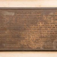
I got interested in Bristol's medieval water supplies after poking around near Jacobs Wells Road and Brandon Hill. It was during that research I found out about a pipe that's still there today, and, as far as I know, still actually functioning, that was originally commissioned by Carmelite monks in the 13th century. They wanted a supply of spring water from Brandon Hill to their priory on the site of what's now the Bristol Beacon—Colston Hall, as-was. It was created around 1267, and later, in 1376, extended generously with an extra "feather" pipe to St John's On The Wall, giving the pipework its modern name of "St John's Conduit".
St John's on the Wall is still there, guarding the remaining city gate at the end of Broad Street, and the outlet tap area was recently refurbished. It doesn't run continuously now, like it did when I first moved to Bristol and worked at the end of Broad Street, in the Everard Building, but I believe the pipe still functions. One day I'd like to see that tap running...
There are a few links on the web about the pipe, but by far the best thing to do is to watch this short and fascinating 1970s TV documentary called The Hidden Source, which has some footage of the actual pipe and also lots of fantastic general footage of Bristol in the seventies.
On my walk today I was actually just going to the building society in town, but I decided to trace some of the route of the Carmelite pipe, including visiting streets it runs under, like Park Street, Christmas Street, and, of course, Pipe Lane. I also went a bit out of my way to check out St James' Priory, the oldest building in Bristol, seeing as it was just around the corner from the building society.
There are far too many pictures from this walk, and my feet are now quite sore, because it was a long one. But I enjoyed it.
A London Wander in Southville
10 Apr 2021
There's a bit of Southville that I've been meaning to get to for some time, where the streets seem to take some strong inspiration from London. There's a Camden Road that crosses with an Islington Road, and a Dalston Road, even an Edgeware Road. For me these names are more evocative than the rather more exotic names I passed by to get there—Sydney Row or Hanover Place, say, because I've actually been to the places in London. The last time I was in Islington I saw Monkey Swallows the Universe play at The Angel, and I can't think of Camden without remembering a gondola trip with my friend Tara where a cheery youth played Beatles music for us on a saz...
I really liked this little area, with its mostly well-kept pretty houses and hints here and there of the creative side of the residents. It's arty and down-to-earth at the same time, and I wouldn't mind living there, I think.
On the way there I got the chance to walk through Underfall Yard for the first time in a while, and on the way back I had my first take-away hot food for many months, grabbing some crispy fried squid from the excellent Woky Ko at Wapping Wharf.
Leftovers with Lisa
01 May 2021
I didn't get to all the little leftover streets around the northeastern part of my area in today's wander, but I definitely knocked a few off the list, plus Lisa and I enjoyed the walk, and didn't get rained on too badly. We spotted the hotting-up of Wisteria season, checked out Birdcage Walk (both old and new), ventured onto the wrong side of the tracks1 and generally enjoyed the architecture.
1 Well, technically we probably shouldn't have been on the grounds of those retirement flats, but nobody started chasing us around the garden with a Zimmer frame
Apparently they're a London-based multimedia production house and this is their first "regional facility". Which presumably explains why they're just over the road from the BBC; I imagine they want to provide outsourcing to Auntie.
Victoria Square Underpass
06 May 2021
I'm meant to be taking a little break from this project, but in my Victoria Square researches after my last walk I noticed a curiosity I wanted to investigate. The community layer on Know Your Place has a single photograph captioned, "The remains of an 'underpass' in Victoria Square".
Looking back through the maps, I could see that there really did used to be an underpass across what used to be Birdcage Walk. I can only guess that it was there to join the two halves of the square's private garden that used to be separated by tall railings that were taken away during WWII. Maybe it was a landscaping curiosity, maybe it was just to save them having to un-lock and re-lock two gates and risk mixing with the hoi polloi on the public path in the middle...
Anyway. Intrigued, I popped up to Clifton Village this lunchtime for a post-voting coffee, and on the way examined the remains of the underpass—still there, but only if you know what you're looking for, I'd say—and also visited a tiny little road with a cottage and a townhouse I'd never seen before, just off Clifton Hill, and got distracted by wandering the little garden with the war memorial in St Andrew's churchyard just because the gate happened to be open.
EDIT: Aha! Found this snippet when I was researching something completely different, of course. From the ever-helpful CHIS website:
When there were railings all round the garden and down the central path, in order that the children could play together in either garden there was a tunnel for them to go through. This was filled in during the 1970s but almost at the south east end of the path if one looks over the low wall the top of the arches can still be seen.