Tagged: asphalt
A Morning of Research and a Cafe in a Castle
25 Sep 2021
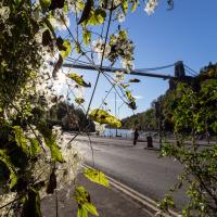
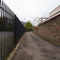
I needed to pop to the library, as they'd kindly dug a book out of the reserve store at the B Bond warehouse for me and emailed me to let me know it was ready. So, I took a little trip to town, straight down the Hotwell Road, and spent a few hours reading before stretching my legs with a walk to a new cafe in the actual castle (or remnants thereof, anyway) of Castle Park, before heading back home down the other side of the harbour. As well as books and coffee, I bumped into a remote-controlled pirate ship, which isn't something you see every day, even in Bristol.
There are some unexpected links between Triodos Bank and some of the magical stuff I've been researching. I first found out when I checked the upcoming events at the Bristol Theosophical Lodge and saw a director of the bank would be giving a talk there. Apparently the bank is rooted in the ideas of Rudolf Steiner's anthroposophy. The Guardian says:
Its roots (like the UK bank Mercury Provident, which it took over in 1995), are in the anthroposophy movement. This refers to the ideas of the Austrian spiritualist thinker Rudolf Steiner, who died in 1925 and whose interests included education, 'biodynamic' agriculture, eurythmy (movement as art) and therapeutic medicine.
Triodos Bank's statutes committed it to anthroposophical principles until 1999, when this formal link was dropped, and in recent years the bank, under its current head Peter Blom, has embarked on a policy of reaching out beyond Steiner adherents and of broadening its appeal. Nevertheless, Triodos's origins are reflected in the fact that most of the Dutch directors come from within anthroposophy, and it is banker for many Steiner-inspired projects.
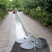
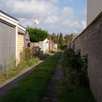
I like this little watery installation at Castle Park, so I try to cut through here if it's on my way.
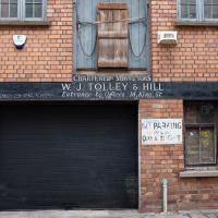
Rear of King Street. I would say "interesting frontage", but presumably this is interesting backage.
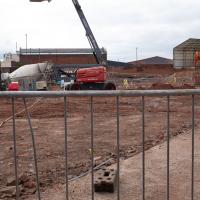
On the site of the old warehouse next to Albion Dock, whose canopy you can see top right. It will, inevitably, be some more posh flats.
It's bad enough that the terrace opposite was demolished, without some hurriedly-qualified HGV reversing into the new1 buildings on this side...
1 I suppose "new" is relative. But on most of the maps I've been looking at recently these flats don't exist yet. I think the earlier buildings included a smithy and at one stage what looks like a tap-room, the Stork Tap, for the larger Stork pub that used to occupy what's now Stork House on the main road below. You basically couldn't move in Hotwells without falling into a pub throughout most of its history. The modern-day suburb seems positively teetotal in comparison...
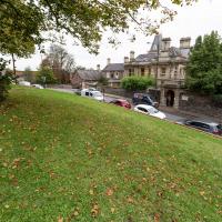
I recently indulged myself by buying a little piece of history. I've mentioned Samuel Loxton and featured and linked to his drawings before, often in the eminently browsable Loxton Collection albums that Bristol Libraries has on Flickr. So when I saw a Loxton drawing of Hotwells pop up on eBay, I decided to get myself a little treat.
I don't think there's any Loxton drawing that features the road I actually live in—it's not very visible from anywhere else, not being one of these Clifton terraces that's perched at the top of a hill, or anything like that, and it's invisible in most views of the area. However, this Loxton drawing, Hotwells, Looking across the river from near the Clifton Bridge station, is probably the closest near-miss I've seen.
I decided to wander out one morning and see if I could reproduce the picture, and also take a photo or two of what's now become of the Clifton Bridge Station, which is still just about discernible in places.
(Then on an even stranger whim I decided to check out a possible little cut-through from Cumberland Road to the harbourside I'd been eyeing up on my commute to work, so walked to Wapping Wharf for a croissant via this potential new route, but that bit's not quite as interesting...)
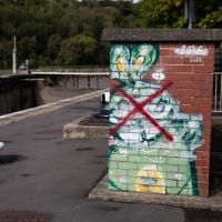
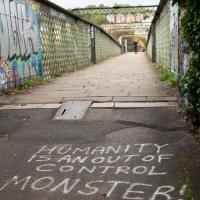
There's a frankly disturbing and gruesome reason why this rabbit has been crossed out. I'll tell you why in a few photos time.
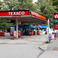
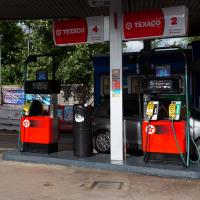
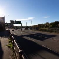
Here's a sign of the times: a petrol station that's out of petrol. According to the BBC, the current petrol supply crisis is still biting in the south of England, but easing elsewhere in the country.
I've got about 50 miles' worth of petrol in my Mini right now, but my car is a luxury rather than a necessity, and that amount could last me months at my current average rate of consumption, so I'm not planning on panic-buying, personally...
Well, they may have a point. This is Vauxhall Bridge, previously the site of Vauxhall Ferry. People seem to guess it must have had some connection with Bristol's Vauxhall Pleasure Gardens, but that seems unlikely to me, given that they were not long-lived and closed down before the New Cut was dug, so they woudln't have needed a ferry here...
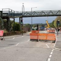
Which is why swapping to this side of the river seemed like a good plan. Coronation Road is bloody noisy at the best of times, and it's currently got all of Cumberland Road's traffic diverted down it.
Most days on my way to work I pass, at a little distance, an intriguing-looking set of steps that run from the back of the modern housing development on the harbourside to somewhere around here. I've been getting increasingly curious about whether they're a way from the harbourside through to Cumberland Road that I've never discovered. So here I am, on the Cumberland Road side, about to find out.
Docks Heritage Weekend Day One
09 Oct 2021
I could spend a lot of time at the Docks Heritage Weekend, poking my nose into industrial places along the harbourside that are usually closed off, but throw open their doors once a year to show off a bit of the backstage area of Bristol's floating harbour. In fact, I warn you: the next wander is a long one, and will have quite a few photos.
However, for today's wander, on the Saturday, my friend Lisa needed a shorter walk than our usual long rambles, as she's recovering from an operation and still a little under the weather, so we just wandered into town for some food and back, with me making mental notes of the places I wanted to come back to on the Sunday... We walked through Underfall Yard, along to the L Shed (this is the warehouse next to the M Shed museum, where they still have the kind of fun old industrial stuff that used to be crammed into the M Shed's predecessor, the old Industrial Museum), through the street food market in town to Ahh Toots for cake and then back home. So, still quite a walk, but no hills and not so much of Lisa having to hang around waiting for me to fool around taking photos as usual, at least...
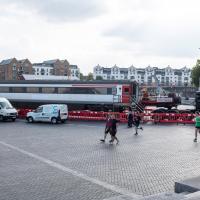
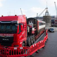
I wasn't expecting to see a train carriage in the Lloyds amphitheare. Apparently it's got something to do with Stephen Merchant's new drama The Outlaws. They're filming some of it down at my end of the harbour soon, too; I've had a letter through the door about night shoots that'll be closing sections of the Hotwell Road.
I'm afraid that this is a bit of a badly-curated wander, where I mostly just popped out to find out a little of the history of Underfall Yard and poke around the various open workshops, and, in hindsight, really didn't take pictures in any kind of coherent order. So there's a lot of pictures, but they don't really tell the story that, in hindsight, I seem to have been trying to tell, of the unusual electrical substation in Avon Crescent, the Bristol Electricity that predates the National Grid but is still in use, the history of the hydraulic power house... It's a bit of a mess.
But I suppose sometimes these wanders—always chronologically presented in the order I walked and took photos—simply will sometimes be a bit of a mess. Let's hope you still get something out of it, anyway...
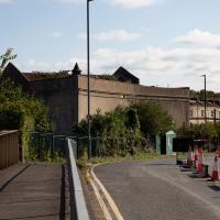
It's very hard to get a decent look at this building. This is the top half of the back of it.
This building is, or was, an electrical substation. I heard an unconfirmed rumour that the building itself is now actually empty, and that the entire substation guts are now in these boxes. I have no idea whether that's true or not.
I've mentioned before the suggestion (apparently from Pete Wills, senior electrical engineer) that this building is haunted by the ghost of a worker who fell from the roof into the building but whose body was never found... Maybe I should have waited until Hallowe'en to feature the substation!
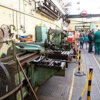
I should probably have started this little tour with a general view of the place, but I wasn't really thinking with a great sense of planning on this wander. I'm afraid the photos are all a bit randomly-ordered.
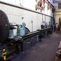

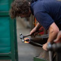
Talking of chains, I nipped back into the other half of the workshop building, where the forge lives, for a demonstration of chain-making. Here's a link in progress.
Fresh Fields
17 Oct 2021
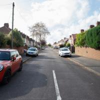
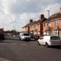
For the first time in a while, I had the time and energy to go further afield and knock off some new roads from my "to do" list. I headed through the first Hotwells Festival to Ashton and Bedminster to cross off a few of the suburban roads south of North Street.
First, though, I decided to try to reproduce an old photo of the now-demolished Rownham Hotel just around the corner from where I live...

Here's my version. I couldn't get to the exact original viewpoint without the railings on the far left being in the way of the picture, but this is pretty close.
So, presumably the house (or possibly two?) on the end of Freeland Place, which looks to my eye just as Georgian as the rest of the terrace, must've been built after the Rownham Hotel was demolished for the road widening in 1969...
I've taken a few photos of the similar place around the corner, but I hadn't noticed there's another one of these odd mansion-mansard-bungalow-what-the-hell places here, too.
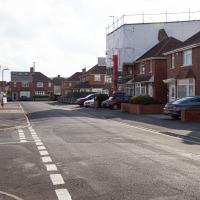
The rest of the road is just your normal-for-round-here brick boxes, really. At the end is the back of the little Winterstoke Road retail park, including PC World and Halfords, which I think are the only two shops I've ever been in there.
ODE says a "bower" is "a pleasant shady place under trees or climbing plants in a garden or wood." This road (in the Ashton district) is actually pointing in the direction of the UWE campus at Bower Ashton—I wonder if it was named because it led towards that bower?
A Wide Angle View
30 Oct 2021
I had an unsuccessful wander last week, on Tuesday afternoon: my GPS died within about five minutes of leaving the house, and I didn't notice, plus I found hardly anything I'd been looking for. On the plus side, as I was wandering around Park Street I decided to nip into London Camera Exchange on the offchance they had a secondhand Canon 17-40mm lens. I've been thinking of buying one for around a year, I think.
Long story short: not only did they have one, but due to a mistake with their price labelling which they kindly honoured, I now have a shiny new (to me) wide-angle lens and it cost me less than £300, which is a very good price for one of these in good condition (and including a lens hood.)
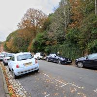
So, rather than try to salvage Tuesday's walk, here's a walk where I basically just bimbled up to Clifton Village for a coffee and wandered around taking photos of as many wide views as I could find. I took a lot more photos than these seventeen, but as you might expect, a new lens takes some practice getting used to, so most of them ended up in the "outtakes" pile.
One of several odd short-cuts and alternative routes I worked out to vary my commute to work, when work was at the top of Whiteladies Road.
Of course, one disadvantage of a wide-angle lens in Clifton is that you get even more cars in the shot. This is a problem with filming, too, from what I've seen of the various historically-set TV shows shot in Bristol: the exterior shots are always very tight angles, presumably because it'll give the game away if one zooms out on Sherlock Holmes to reveal nine identical giant black SUVs parked on the zig zags outside a private school.
It's hard to snap this view, perhaps because nothing can convey the emotional context for me: the "nearly at home" feeling of wandering down from Clifton Village into Hotwells.
Ticking Off a Few Streets in Bedminster
31 Oct 2021
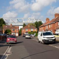
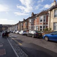
There were only a few streets left to wander in the more residential bit of Bedminster, so I thought I should target those today. The streets themselves weren't that notable, though Balfour Road has a contrasting mix of old and new housing. I tried to snap a few more interesting things along the way there and back, snapping all three of the familiar bond warehouses, nipping onto North Street to find some new street art, and finding a few pumpkins for good measure. It is hallowe'en, after all...
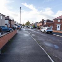
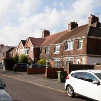
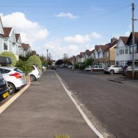
One of the three roads I needed to knock off my list. Just a fairly average slice of suburbia, really.
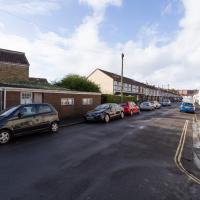
There's still a few houses on Duckmoor Road (this is the corner of Duckmoor and Frobisher) that use their gardens for gardening rather than just to park cars on, and some of them even have quite big veg gardens growing.
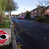
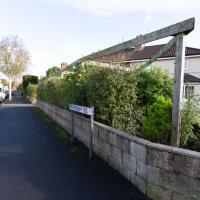
There were quite a few signs that Frobisher Road is a sanctuary for hedgehogs. We've actually seen a similar sign at the far end, on an earlier wander that went past the end of the road.
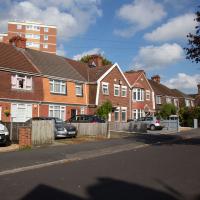
I like a lot of things about the streets of Bedminster. The view across to the rolling hills is one of them.
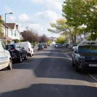
Why yes, I'm still trying out the new wide-angle lens. Never mind the quality, feel the width.
Recreating a Loxton Drawing on a Lunchtime Jaunt
05 Nov 2021
I did do a much longer wander earlier in the week, but that'll take me some time to process (and cast a plethora of photos into the "out-takes" pile!) In the meantime, here's my lunchtime jaunt, taken to give myself a break from doing the company bookkeeping to send to my accountant so the taxman doesn't sling me in chokey.
I've recently bought a slightly creased secondhand copy of Redcliffe Press's 1992 collection of Samuel Loxton drawings, Loxton's Bristol: The city's Edwardian years in black and white. It's a nice selection of Bristol Library's collection of the drawings. I'd noticed a drawing of 25 Royal York Crescent, a house I pass quite often, so I thought I'd wander up the crescent on the way to pick up some lunch and try to reproduce it.
On the way back I took a few photos of Clifton Hill Bank as the crowdfunder to make quite a lot of it into a wildflower meadow has just hit its target, so I figured some "before" shots might be a good investment for the future...
I'm embarrassed to admit how many times I walked down Cornwallis Avenue wondering what the overgrown garden was along the top without ever bothering to work out that it's the back garden of Cornwallis Crescent (east).

I went out simply wanting to knock off the very last little unwalked section of Clanage Road, over by Bower Ashton, which has been annoying me for a while as it's quite close by and I've walked the other bits of it several times. So, my plan was to nip over to Greville Smyth Park via a slightly unusual route to wander Clanage Road and tick it off.
Along the way, though, I inevitably got a bit distracted. I took a few photos of Stork House, a grand Hotwell Road building that's recently been done up a bit (I imagine it's student lets, though I'm not sure) and which I found a reference to in a book about the Port Railway and Pier the other week, and also tried to match up a historical photo of Hotwells before the Cumberland Basin Flyover System laid it waste, which included some interesting markers I'll have to do a bit more digging into...
Because yes, we have just had a little excursion into Somerset, technically. So welcome back to Bristol, home of traffic jams.
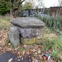
A milestone, perhaps? And there looks to be a benchmark on the bigger bit.
Aha! A quick look at the historic OS maps on Know Your Place finds a marker right on this spot marked "B.S.", which the National Library of Scotland's helpful abbreviations page translates as "Boundary Stone". With that in mind I then had a look on the wonderful geograph site and there it is:
The front stone appears to be an old boundary stone, delineating the Administrative County, Parliamentary County and Rural District boundaries that were part of the Bristol limits in the twentieth century, possibly dated 1897? Behind it is a larger block of stones that may have been part of the Smyth estate further up the hill. On the latter is a partly hidden benchmark.
So I spotted the partly hidden benchmark correctly, too :) There is, of course, a benchmarks directory with an entry for the benchmark itself. What did people do before the internet?
EDIT TO ADD Nearly a year later, I watching a DVD Bristol Railway Stations by Mike Oakley and found out what the larger bit behind the milestone actually is: it's the last remnant of the Clifton Bridge Station buildings, which once faced out onto the road here.
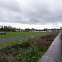
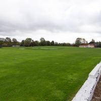
I think it's mostly used for sport, but the only thing I've ever used it for is the Clifton Car Boot Sale.
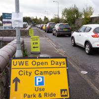
So that's why all the cars are there—not for the Open Day, it turned out; it's the other signs that are the giveaway. Somewhere, some people are committing a sport.
...and I was right.
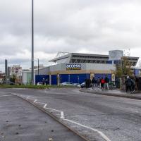
Incidentally, a brief aside for a rant: why the hell are self-storage places just like sodding gyms? You can't get a straight answer about how much storage costs from any of their websites. They just take your details and then you have to talk to some bloody salesman, and play each site off against each other to get what's alleged to be the best price. I think it must be some kind of price-fixing racket.
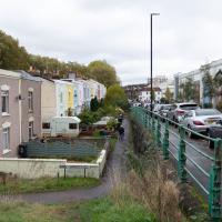
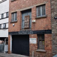
I find something intrinsically nice about this modest little terrace sandwiched in among the rather more industrial surroundings.
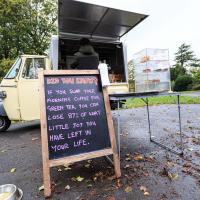
Apparently the proprietor's other half loves tea and can't stand coffee. I hope very much this turns into a sitcom where she runs a rival tea stall on the other side of the park with a big A-board that disses coffee.
The more I research it, the more I find that Hotwells had far better transport links back in Victorian and Edwardian times than it has today. Along with buses that went to more useful places than the City Centre, there were trams, the funicular up to Clifton, the landing stage for paddle steamer services and two railway stations all within easy walking distance of me.
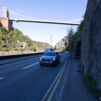
Today I took a day off work as preparation for doing the bookkeeping for my tax return1, and took a wander along to the site of what would have been my nearest station, Hotwells (or Clifton, as it started out in life), nestled in the shadow of the suspension bridge, the Bristol terminus of the Bristol Port Railway and Pier.
From there I wandered down the Portway, following the original line, until I got to the area around Sneyd Park Junction, where the tunnel from the slightly later Clifton Extension Railway joined up with this originally-isolated BPR line. Then I headed up to Clifton through the "goat gully" at Walcombe Slade, seeing the few above-ground bits of evidence of the tunnel (which is still in regular use) along the way.
It was a lovely day, and a good walk, and it was interesting to daydream of the times when I could have walked a few minutes from my flat down to Dowry Parade, caught a short tram ride to Hotwells Stations, and then headed from there to Avonmouth, perhaps even to board a transatlantic passenger service. The completion of the Clifton Extension Railway that linked the Avonmouth station with Temple Meads made relatively direct transatlantic travel from London via Bristol possible, with passengers travelling up from Paddington to Temple Meads, on to Avonmouth on the Clifton Extension Railway and Port Railway and Pier line, then perhaps catching a Cambpell's paddle steamer—which sometimes acted as tenders for large steamers—to a larger ship that was headed out for Canada, say.
1 I've learned that the best approach is to take two days off and deliberately do something that's not my bookkeeping on the first day, as otherwise I just inevitably end up procrastinating and feeling guilty on the first day no matter what. I have an odd brain, but at least I'm learning strategies for dealing with its strange ways as I get older...
2 Information mostly gleaned from Colin Maggs' The Bristol Port Railway & Pier and the Clifton Extension Railway, The Oakwood Press, 1975.
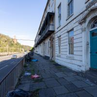
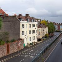
St Vincent's Parade looking a bit more run-down than normal. This street, like the one I live in, was built as lodging houses for visitors to the hot wells. I imagine it was quite a pleasant aspect before later developments like the building of the Portway.
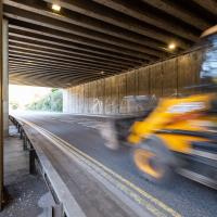
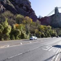
One of the many problems with the Hotwell Road and Portway is the complete dearth of places to safely cross this road, with a varying number of lanes and a speed limit that hits 50mph for stretches.
You can stand for a very long time looking both ways before taking your life into your hands and scurrying across. It took me quite some time to dash to the other pavement at the point where this one runs out and your only choice is to head up the Zig Zag or cross.
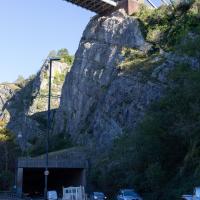
It's a (glass-fibre reinforced, I think) concrete roof to keep falling rocks from blocking the road at this particularly friable bit of the cliff face.
The acoustics are quite something. This is the traditional point on the Bristol Half Marathon where someone inevitably shouts "Oggy oggy oggy!" thus starting the familiar back-and-forth. Of course, it's closed to traffic on that morning, so you can actually hear yourselves shout.
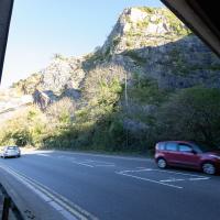
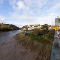
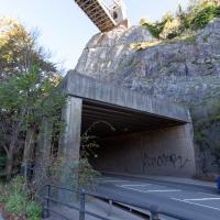
It doesn't look like much, because it isn't much any more. However, this used to be the site of Hotwells Station (formely Clifton Station, before the opening of Clifton Down and the continued existence of Clifton Bridge meant the proliferation of stations with "Clifton" in the name warranted some disambiguation.)
Nestled in this little nook underneath the suspension bridge, it was the Bristol terminus of the Port Railway and Pier, whose aim was to avoid increasingly big ships having to wait for the right tides to come into Bristol and unload. They ran a line from Hotwells Station, here, to a deep-water pier at Avonmouth so the ships could moor there regardless of the tide, and transport cargo and/or passengers to and from Bristol, with this being the Bristol terminus. Work started at Shirehampton in 1863.
Originally this was an isolated line, but it was later hooked up to the rest of the rail network by the Clifton Extension Railway, and a tunnel under Clifton. That's a connection we'll be exploring a bit today, at least with a few of its visible above-ground bits.
The line saw its biggest use during the First World War, as dockers, munition workers, hospital trains and so forth ran back and forth between Bristol and the port. They even added an entire extra platform, Hotwells Halt, just down the road, to cope with the increase in traffic, platform space being at something of a premium in this unexpandable little nook, which runs from the bridge to the first of two tunnels in the cliff face to head onward to Sea Mills.
From the other angle. It was a single short platform, squeezed in to this little inset in the cliff face. Here you'd have been looking at the station wall, with the entrance and office at the far end. In this photo on Pinterest you can see the three tracks—the main platform track, a run-around loop so the engine could make its way around the carriages and onto the other end of the train, and a siding. At the far end is the station master's house, just behind a turntable that would have been used to turn the engine fully around for the return journey.