Tagged: fluvial-landforms-of-streams
Bower Ashton is an interesting little area just south of the river from me—in fact, the Rownham Ferry used to take people over from Hotwells to Bower Ashton, operating from at least the twelfth century to around the 1930s.
It's a strangely contradictory little area, with a cluster of old and new houses sandwiched in between the busy A-roads and significantly more industrial area of Ashton and the bucolic country estate of Ashton court roughly east to west, and also between Somerset and Bristol, north to south.
I've been around here before, mostly poking around Bower Ashton's arguably most well-known bit, the Arts faculty campus of the University of the West of England, but I'd missed at least Parklands Road and Blackmoors Lane, so I initially planned just to nip across briefly and wander down each in turn. On a whim, though, I texted my friends Sarah and Vik in case they were out and about, and ended up diverting to the Tobacco Factory Sunday market first, to grab a quick flat white with them, extending my journey a fair bit.
To start with, though, I nipped to a much more local destination, to see something that you can't actually see at all, the Gridiron...
(I also used this wander as a test of the cameras in my new phone. I finally upgraded after a few years, and the new one has extra, separate wide and telephoto lenses compared to the paltry single lens on my old phone. Gawd. I remember when speed-dial was the latest innovation in phones...)
The Gridiron and Bower Ashton Part Two
03 Dec 2021
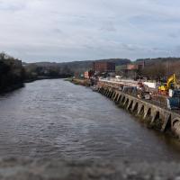
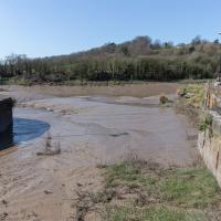
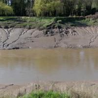
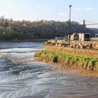
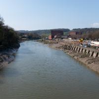
On my last wander, to Bower Ashton, I was intending to knock Blackmoors Lane off my list "to-do" list, but got a bit diverted. I also took a little look into the history of the Gridiron, once a cheaper alternative to dry dock that was nestled just south of North Entrance Lock.
Today I had to go to send a parcel off somewhere, so I decided on going to the North Street Post Office via Blackmoors Lane. I didn't have much intention of anything else, but as luck would have it I walked out both at low tide and also as some lockkeepers seemed to be having a bit of a training session, and one of the more senior people was (a) happy to answer a few random questions on the Gridiron and (b) actually knew a lot about it, as Gridiron maintenance had been one of his jobs, more than twenty years ago...
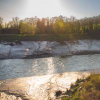
Yes, having compared it with old photos and the 1946 aerial view I posted on Sunday I'm sure that that's the end of the gridiron, all 200 feet of which is apparently still there beneath the silt.
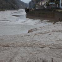
The lockkeeper told me that the gridiron was in use as recently as 2000, and that it used to be his job to wash the silt build-up away, using a sluicing system we'll get to in a moment.
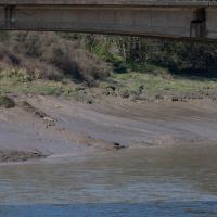
According to the lockkeeper, the last time a boat was on the gridiron was around the year 2000. He thought it might have been either the PS Waverley—a still-running paddle steamer I'm dying to have a go on at some point!—or the MV Balmoral, another vintage excursion ship. He had a recollection of the Balmoral needing to free something that had got tangled around its propeller.
Before then, he remembered the ship Samuel Plimsoll being on the gridiron in 1998.
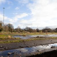
I was just about starting to feel better—the antibiotics seemed to have kicked in for my dental issues, and it had been some days since I'd left the house, and I was at last starting to get itchy feet. So, a wander. But where? Well, there were a few industrial bits near Winterstoke Road in the Ashton/Ashton Vale areas of Bristol that needed walking. I knew they were likely to be quite, well, unattractive, frankly. So why not do them while I wasn't feeling exactly 100% myself? Maybe it would fit my mood. Hopefully you're also in the mood for a bit of post-industrial wasteland, for that's what some of this feels like...
Then, at the last minute, I thought again about the Bristol International Exhibition—I've got a book about it on the way now—and that gave me another goal, which could just about be said to be in the same direction, and I decided to walk significantly further than my normal 1-mile limit and try recreating another historical photo...
Sadly I don't know much about the Ashton area; it's just on the edges of my mile and I rarely have cause to go there. It's brimming with history, I'm sure: the whole South Bristol area rapidly developed from farmland to coal mines to factories to its current interesting mixture of suburbs and industrial work over the last few hundred years. As a more working class area less attention was paid to it by historians, at least historically-speaking, than the Georgian heights of Clifton, and much of it has been knocked down and reinvented rather than listed and preserved. I see here and there some of this lack is being addressed, but I'm afraid I'll be very light on the history myself on this wander, as most of my usual sources aren't throwing up their normal reams of information as when I point them at Clifton, Hotwells or the old city.
I nearly didn't take this photo, having snapped this view so many times before, but I do find it almost completely irresistible.
I've often wondered about writing some kind of neural-computing based app that could look through all of my photos for snaps of this view and mash them all together into a time-lapse, or something, but that would be quite the project.
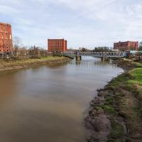
A better view of the ex-railway depot and part of the former Bristol International Exhibition site that I've mused about before. That's why we're on this wander, in fact: curiosity about an old photo of the site. But not a photo from round here: one taken from quite a ways beyond my normal mile radius. It's going to be a bit of a hike.
There will also be some terrifyingly industrial bits of south Bristol along the way, so be prepared for a bit of urban decay and industrial scenes.
Quick Clifton Jaunt Finishing with Southville
09 Jan 2022
It's been pretty dismal recently, weather-wise, so when Sarah called up to say that she and Vik had just left the swimming pool at the student union building up in Clifton, and would I like to join them for a trip to the Last Bookshop, also known as The £3 Bookshop, for reasons you can probably deduce, I leapt at the chance.
Not many photos on this walk, but I did manage to get down a little road I'd never been to before, basically just the access road to a car park at a block of flats, but it was on the map looking all tempting, so I figured I'd knock it off the list as we were passing.
Bedminster Trip for New Walking Shoes
26 Feb 2022
I needed to buy new walking shoes—my old ones were squeaking and it was driving me up the wall—so I ordered some for collection from Taunton Leisure on East Street in Bedminster, and decided to make picking them up an official wander.
I didn't cover any new ground within my mile, but I did take advantage of the trip to take in a few interesting things just outside my normal radius, mostly New Gaol-related. Along the way there are a couple of sanitation-related diversions, including a visit to a rare manhole cover. You can hardly wait, I can tell!
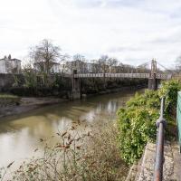
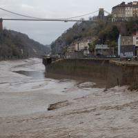
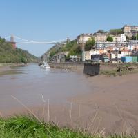
The bridge is in a pretty poor state at the moment, apparently. It's about to be closed for repairs until the end of 2022, though if I know anything about the quality of Council estimates for bridge repairs, I wouldn't expect to see it finished until the end of 2023...
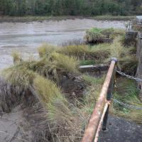
That can't really be anything other than a slipway for the old ferry, can it? Especially as there are steps down there from the road, albeit overgrown to the point of invisibility and with their entrance bricked up, as we'll see when we get to the other side.
This bridge was only put up to replace the ferry in the 1930s, so it's not surprising that the ferry facilities are still pretty obvious from this side.
We have, in fact, wandered down there on a previous walk.
You can see the New Gaol entrance there on the left, poking out incongruously from the modern flats, with the spire of St Mary's rising from behind it in the distance.
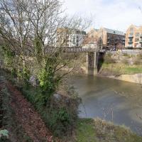
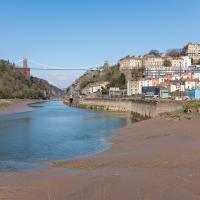
The old ferry crossing, the newer 1930s bridge that replaced it, and the shiny new flats and shops of Wapping Wharf on the far side.
On the left, B Bond, in the middle, A Bond, and on this side of the New Cut, the C Bond warehouse.
Leigh Woods Purple Path
12 Mar 2022
There's a few tracks in Leigh Woods that lie within my mile and show up on my map but that I've not walked yet, so I decided to take one of my traditional big long walks through the woods on this nice crisp sunny morning.
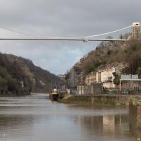
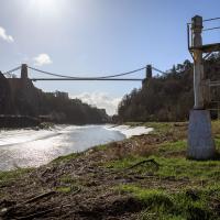
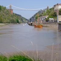
For years—decades, even—I've been doing a similar route from my place, along the towpath to the far woods entrance, up the hill for a varied walk on one of the marked tracks and then across the Suspension Bridge to Clifton Village for a coffee-based reward. It's my default "long walk", really, and I almost always enjoy it. Today, at last, spring actually seemed to be springing, which made for some extra positivity...
There have been new plans put forward by the council for the Western Harbour Development The previous plans would have put a bridge in between here and the suspension bridge. I've not looked at the new ones yet.
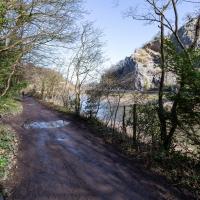
The towpath is a lovely stroll in weather like this. Waterproof walking shoes help, though, as the puddles are often wide enough to span the entire width. I baptised my new walking shoes on this trip.
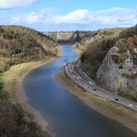
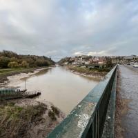
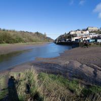
This is the point on the walk where I get to look at how far I've walked, by looking down on the towpath and seeing tiny things in the distance that I was right next to earlier, like the white navigation light you can just see toward the far end of the curving flood plain of the river down there.
I mostly went out to hang out with my friends Sarah and Vik in Bedminster, but along the way I thought I'd take a closer look at something a little nearer home: the last crossing point of the Rownham Ferry.
That reminds me; I must re-read Iain M Banks's Use of Weapons again. In the novel he used the name Size Isn't Everything for one of the Culture's General System Vehicles, a spacecraft approximately 80km long... In the Culture, spacecraft are sentient and Culture ships choose their own names, often ironically.
He we have something of the opposite size of craft.
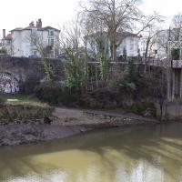
Yes, okay, it's quite the challenge to spot the hand-made historic artifact in this picture. In the next pic I'll zoom in a bit.
Again, the slipway is easy to miss. I like these little barely-visible curiosities that hide such heritage. The site of the crossing moved around—it's fairly obvious it wasn't right here in the 12th century, for example, because the river was only diverted into the New Cut, which the ferry crosses here, in the early 1800s. Earlier it was further downstream.
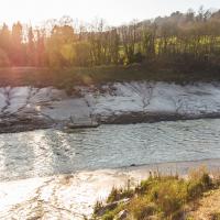
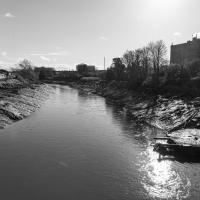
Although the tide's better now, the light was not great for taking documentary photos. Here we are heading towards sunset on the vernal equinox, so I decided to just try being a bit arty instead. I even took the lens hood off to try to encourage more flare. Just call me JJ Abrams.
Just trying to wring as much lens flare out of the camera as I could here, to be honest :D
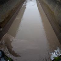
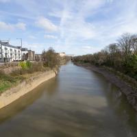
So, one more silt shot and it's time to go home. On this wander I actually walked 6.4km, though the stats won't reflect that as I cut out the section of the walk where I went to Sarah and Vik's house. My feet were definitely tired at this point!
Anyway, hope you've enjoyed the wander and some photos of the last visible vestiges of a ferry that probably ran for around a thousand years...
A Coffee and a Curve
27 Mar 2022
I wanted to have a wander along to the Tobacco Factory Market for some shopping, and checking the map for any leftover nearby streets I noticed a tiny curve of road on the way into the modern flats at Paxton Drive that it didn't look like I'd walked down before. I wouldn't take me too far out of my way, so I decided to head there first and then across to North Street to get my groceries and a coffee...
Work on the New Cut, this man-made diversion of the river to allow the harbour to float free of the tide, was officially started on 1st May 1804 and finished on 1st May 1809, with something of a party:
On 1 May 1809 the docks project was certified as complete and a celebratory dinner was held on Spike Island for a thousand of the navvies, navigational engineers who had worked on the construction, at which "two oxen, roasted whole, a proportionate weight of potatoes, and six hundredweight of plum pudding" were consumed, along with a gallon of strong beer for each man. When the beer ran out a mass brawl between English and Irish labourers turned into a riot which had to be suppressed by the press gang.
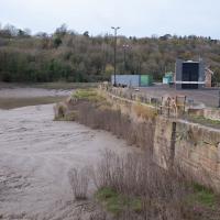
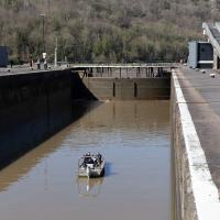
A Swing of the Plimsoll Bridge
24 Apr 2022
I was originally going to head over to the Ashton area to see if I'd missed any bits around the football stadium—and also to grab some lunch from the Tobacco Factory Market—but in the end I got a little distracted by having accidentally chosen exactly the right time to see the Plimsoll Bridge swing on one of the first busy days of Spring, where a lot of pleasure trips tend to head out down the Avon (and possibly the New Cut) from Hotwells.
In the end I mostly snapped that, and just a couple of photos from the Ashton area where I grabbed some lunch but didn't do any new exploring.
Ticking Off a Pocket of Paths in Leigh Woods
03 Jun 2022
I managed to go for a wander a while ago that was meant to finish off a little tangle of paths in Leigh Woods, or at the very least finish off my wandering of the Purple Path there. And I managed to miss doing either of those things through some kind of navigational incompetence.
Today I woke up with a bit of a headache, feeling a bit knackered as soon as I dragged myself out of bed, but at least with the energy to realise that I'd be better off (a) going for a walk in what looked likely to be the last of the Jubilee weekend sunshine than (b) moping around the flat until it started raining, at which point I could mope more thoroughly.
I had a look at my map, considered going to Ashton Court, but remembered that there was a music festival there today, and instead found these little leftovers of Leigh Woods and decided to have one more try at walking them.
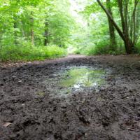
If it's rained for a few days in a row in Leigh Woods, some of the lower paths can get pretty muddy; in some past years I've even had to turn back and find another route, given that I mostly just wear ankle-high walking shoes. Today wasn't too bad.