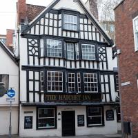
Tagged: house
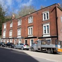
John Carr's Terrace
16 Mar 2021
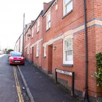
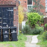
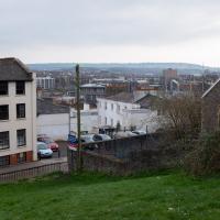
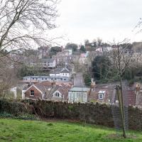
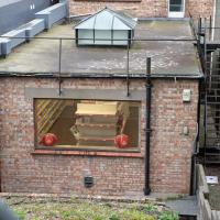
I wanted a nice simple lunch-hour walk that took me past a cafe today, and I managed to find the perfect road to knock off my list of targets to do it. Situated just off Jacobs Wells Road, right next to Queen Elizabeth's Hospital, John Carr's Terrace, and Rosebery terrace above it, which I'd completely forgotten existed, are a little cul-de-sac that many Bristolians will have wandered past a thousand times without ever seeing.
There's a reason it's next to QEH:
Known traditionally as "The City School", Queen Elizabeth's Hospital was founded by the will of affluent merchant John Carr in 1586, gaining its first royal charter in 1590.
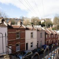
John Carr's terrace itself isn't much to write home about, architecturally, but I like the secluded feel of it, and I really liked Rosebery Terrace with its little houses, commanding position and friendly, slightly tumbledown feel.
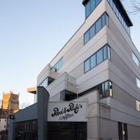
On the way home I popped into Foliage Cafe for a coffee and a very pleasant nutella and banana pastry, then walked home past the refurbishment of the old Thali Cafe into a new and interesting clinic...
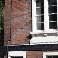
Just adjacent to QEH, John Carr's terrace is named for the 16th-century English merchant and founder of the school next door.
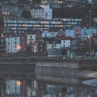
Harbourside Milestone
17 Mar 2021
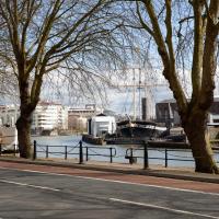
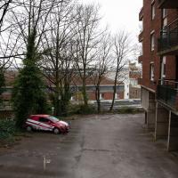
The other day I realised (hello, Maggie!) that my next walk would be my hundredth, and that I'd done 393.4km so far. I figured it would be nice to get to 100 walks and 400km on the same walk, so I went for a nice long harbourside wander after work, rather than dashing out at lunchtime. As it turned out, we're just coming up to the time of year where I can leave the house at 5:30 in the evening and there's still just enough light to take photos by the time I've made it around the harbourside. Though only just, and mostly because I've got a full-frame camera that's not bad in low light...
Still, the evening light made a lovely change, and some of the photos turned out to be pretty good photos per se, rather than just record shots of my walk. I'm looking forward to more evening walks like this as summer approaches.
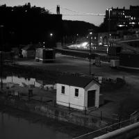
On the way around this evening I wandered through one of the oldest bits of the city to extend my walk and snapped some interesting bits of architecture, including an NCP car park(!) and a nighttime shot of one of my favourite subjects, the clock tower at the Albion dockyard.
Spoke & Stringer were a long indoor cafe in the Beforetimes. Now there's three separate vending areas: fish & chips, brunch & tacos; coffee & shakes.
No, it's not a massively distorting wide-angle lens I'm using, that's just not ninety degrees!
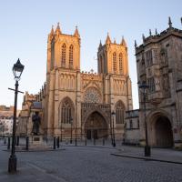
The Cathedral of the Holy and Undivided Trinity, in fact. An Augustinian abbey, given cathedral rank by Henry VIII in 1542. And also explaining why the row of shops on the Centre nearby is St Augustine's Parade, I imagine.
Augustinians follow the Rule of St Augustine:
The Rule of Saint Augustine, written about the year 400, is a brief document divided into eight chapters and serves as an outline for religious life lived in community.[1] It is the oldest monastic rule in the Western Church.[2]
The Rule, developed by Augustine of Hippo (354-430), governs chastity, poverty, obedience, detachment from the world, the apportionment of labour, the inferiors, fraternal charity, prayer in common, fasting and abstinence proportionate to the strength of the individual, care of the sick, silence and reading during meals. It came into use on a wide scale from the twelfth century onwards and continues to be employed today by many orders, including the Dominicans, Servites, Mercederians, Norbertines, and Augustinians.
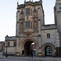
Archway for an Augustinian abbey, twelfth century. Apparently the upstairs has "rooms with Tudor-arched fireplaces, and oriels with tracery panels to the soffits; stone winder stair."
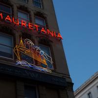
Some of the furnishings from the RMS Mauretania were installed in a bar/restaurant complex at the bottom of Park Street... The lounge bar was the library with mahogany panelling: above the first-class Grand Saloon with French-style gilding overlooks Frog Lane. The neon sign on the south wall still advertises the "Mauretania": installed in 1938 this was the first moving neon sign in Bristol. — Mauretania Public House, Wikipedia
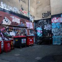
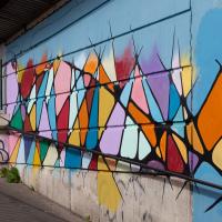
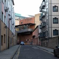
Oddly, everyone in Bristol knows the wall above this little alleyway/loading bay, but probably woudln't recognise this bit down here.
Mardyke then and Now
18 Mar 2021
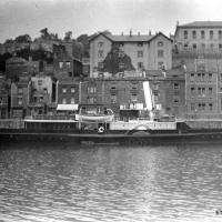
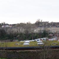
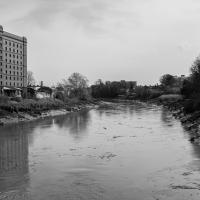
Reproducing historical photos seems to be a developing interest for me. On today's wander I just went for my normal coffee at Imagine That, but along the way I stopped at Baltic Wharf (the modern housing estate; historically-speaking, I was probably in between Canada Wharf and Gefle Wharf—about here, in fact) to reproduce a 1930s photo of the Mardyke area from the Tarring collection.
Mardyke, from what I can work out, means "a ditch along the margins". Before my researches, I only really knew the name from the Mardyke pub, a big place on the Hotwell Road. Everyone knows the Mardyke, partly because of its size and signage, but I've only been in once or twice, too long ago to remember much of what it was like. However, the wharf there used to be known as Mardyke Wharf, and the area in general as Mardyke. (I just found an 1826 painting by Thomas Leeson Rowbotham of "Mardyke seen from near Hilhouse's Dock, showing the 'Clifton Ark' floating chapel" that shows the area before much development had happened, incidentally, and now I feel like I need to find out a bit more about the floating chapel...)
I enjoyed snapping the "after" photo; the process involved moving a group of swans out of the place I needed to stand to get the photo; luckily I've started carrying waterfowl food along with my on my harbourside jaunts, so I could use bribery rather than a more confrontational approach. Not sure I'd fancy my chances against a swan, though I did once team up with another passerby to shoo a recalcitrant one off the Redcliffe bascule bridge so a busful of commuters could continue their journey to work...
Via Know Your Place Bristol/the Tarring Collection.
The Mardyke area—apparently Mardyke means a dyke on the margins, which would make sense for the location—in the 1930s. That's got to be a Campbell paddle steamer from their White Funnel fleet, but I don't know which one. Looks to be a similar configuration to the Princess May, though the paddles look a bit different. In the background, the Mardyke Pub still stands today, but the three largest buildings do not. They are:
Top right: the Clifton National School (there's a Loxton sketch uploaded to this Wander where you can see the name on the front.)
Directly in front and below the Clfiton National School, on the main Hotwell Road: The Clifton Industrial School, Mardyke building.
Standing halfway up the hill, more towards the middle of the picture: the Clifton Industrial School, Church Path Steps building.
Lots of info to be found on the Industrial Schools here:
In addition to their classroom lessons, the boys were employed in tailoring, shoemaking and brush-making, with basket making later added. The boys also assisted with the kitchen, laundry, and house work. In 1870, some additional rooms were rented in the locality for use as an infirmary if required. A School band was established.
I can't find so much on the National School (though apparently the Bristol Archives have some of their records) but the Clifton & Hotwells Character Appraisal suggest it was built in 1835 and, along with the Industrial School buildings, destroyed during WWII:
A bomb also largely destroyed the Clifton National School and Mardyke House School. The lack of bomb- proof shelters in Clifton led to the Clifton Rocks Railway to be used as shelter, which was prepared for occupation in 1940.
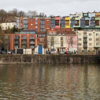
The colourful modern flats stand on School Road, presumably the last hint that the Clifton National Schools building was there before. It's nice to see both the Mardyke Pub and some of the ordinary houses from the terrace dead centre still there and looking much the same.
Quick Around-the-Harbour Wander with Lisa
20 Mar 2021
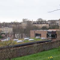
My friend Lisa was meeting another friend for a walk near the suspension bridge, so we fitted in a quick harbourside loop from my place first. We discussed gardening (we're both envious of the gardening skills of the Pooles Wharf residents; we can just about keep herbs alive, whereas they're growing heartily-fruiting lemon trees outdoors in England along with everything from bonsai to magnolias), cafes, work and architecture, among other things.
I've probably snapped this before, as it's just the kind of detail that catches my eye every time.
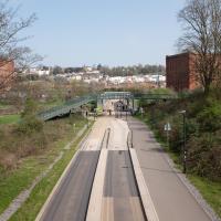
I wasn't going to take a very long walk on this nice spring evening; it just happened. I was going to knock off a path or two on Brandon Hill, home over centuries to hermits and windmills, cannons and Chartists, and then just wander home, stopping only to fill up my milk bottle at the vending machine in the Pump House car park.
However, when I heard a distant gas burner I stayed on the hill long enough to see if I could get a decent photo of both the hot air balloon drifting over with Cabot Tower in the same frame (spoiler: I couldn't. And only having the fixed-focal-length Fuji with me didn't help) and then, on the way home, bumped into my "support bubble", Sarah and Vik, and extended my walk even further do creep carefully down the slipway next to the old paddle steamer landing stage and get some photos from its furthest extreme during a very low tide...
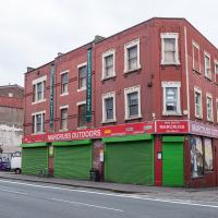
I've bought many things from Marcuss over the years. A pair of secondhand German para boots got me started, I think, and I've bought snowboarding gear, camping gear, winter coats and sundry other things like the Opinel No. 06 knife I use for hunting and skinning the geek's natural prey: Amazon parcels.
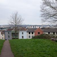
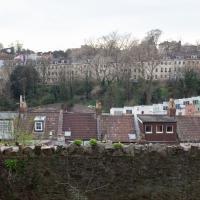
Looking this way you get to see the rear of the rooves of Rosebery Terrace first, which we saw the front of on an earlier wander.
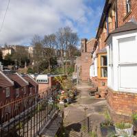
More rooves. If a dormer window has patio doors and takes up the entire roof, presumably it's not a dormer window any more...
I guess one thing Bellevue (the terrace in the distance) has a belle vue of is Brandon Hill.
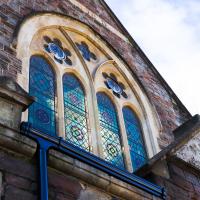
This is clearly the modern corner of QEH, though the turrets at the far right are from the 1847 Tudor Gothic Revival building. QEH was founded in 1586, but was originally housed in Gaunt's Hospital mansion house, Unity Street. (There's more information on the name Gaunt in an earlier photo of Gaunts Lane)...
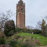
Built in the 1890s, funded by public subscription, to commemorate the 400th anniversary of the journey of John Cabot from Bristol to Newfoundland in my namesake, the Matthew.
From Wikipedia:
The site of the tower was occupied in the Middle Ages by a chapel which may have belonged to St James' Priory. During the 16th century the chapel was replaced by a windmill.
Perhaps in the aftertimes I'll be able to drag myself once more up its narrow staircase and take a snap from the balcony at the top.
Towpath Evening
25 Mar 2021
I was honestly just about to do the homework from my oh-so-thrilling ITIL course when my friends Sarah and Vik asked me if I'd like to come out for a wander down the towpath with them. I enjoyed the company, the evening light and the delicate clouds.
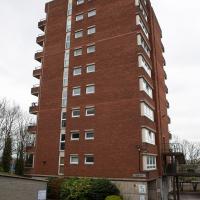
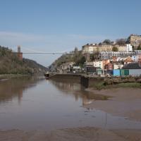
I bumped into my friend Lisa in town during yesterday's wander, and we decided to have a wander today, too. We managed quite a long ramble, starting up through Clifton and nipping down Park Row to investigate the two tower blocks I'd noticed popping up behind Park Street yesterday, then took in a few roads I'd not managed to get to before, including cutting through the grounds of Bristol Grammar School.
This is apparently Jim from Friday Night Dinner. Lisa had to identify him for me.
One of the world's largest archives of British Theatre History. I had no idea it was there.
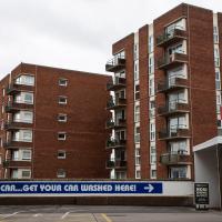
Tucked between Park Row and Park Street, you don't get many sightlines of these little towers.
Hotwells Evening
29 Mar 2021
Just a little potter around Hotwells with Sarah and Vik. I didn't visit any new streets, but I liked a couple of the photos a lot.
Coffee Run
31 Mar 2021
Not a literal run, but I didn't hang about, as I had a job interview to get to (I was an interviewer, not the interviewee, but you still have to be there on time...) Along the way to pick up a lunchtime coffee I mostly seemed to take photos of the high tide, though I also came across a bit of outreach work for small spiny mammals...
Swinging By Sydney Row
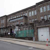
01 Apr 2021
Another workday, another quick coffee excursion. This time I decided to swing past Sydney Row on the way back from the marina car park where Imagine That have their horsebox. I didn't know until recently that the terrace was built for workers at the adjacent dockyard.
I've also gradually come to the conclusion that I don't really think very two-dimensionally when it comes to finding my way around or associating one place with another. I only realised in the last few days that the odd industrial building that takes up the other half of Syndey Row, the one that's always covered with graffiti, is the back of the dockyard works. In my defence, as it's tucked away in a corner of the little industrial estate that I've never ventured into (I rarely find I have a need for the products of safety valve manufacturers), I don't think I've ever seen the front of the building...