Tagged: ashton
A Journey to the Far East
25 Jul 2021
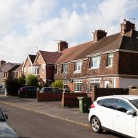
The far east of the intersection of my one-mile radius and Bedminster, anyway. I was feeling a bit tired this morning, so I motivated myself to get out of the door by imagining one of Mokoko's almond croissants. That got me on my way, and I wandered across to Bedminster, through Greville Smyth Park, along most of the length of North Street (looking out for new Upfest 75-pieces-in-75-days artwork as I went) and then onto some new roads at the far end.
I only wanted to knock a few streets off my "to do" list, but by the time I'd diverted here and there to check out various bits of graffiti and other attractions and come back via the aforementioned purveyors of Bristol's finest croissants, I'd walked 7.4km. Not bad for someone who woke up tired, and at least I've done something with my day. I'm very glad the weather broke (we had tremendous thunderstorms yesterday), even if some of the pictures might've looked better with a blue sky. I was getting fed up with walking around in 29°C heat...
A Long Wander Of Miscellany and Magick
08 Aug 2021
This was a wide-ranging wander. I started off crossing the river to Bedminster, to walk a single little cul-de-sac, Hardy Avenue, that I'd managed to miss on at least one previous walk. Then, pausing only to explore a few back alleyways, I headed for a few destinations related mostly by the Hughes family, who I've been researching a little as part of background for a possible novel, as several of them were involved in the Stella Matutina.
However, mostly it's the artistic side of the family I wanted to explore today, as that's where most of their public history lies (as you might expect, there's often not much in the public record about the workings of an occult organisation.) First I visited College Green, where the façade of the Catch 22 Fish & Chip shop still bears the work of Catherine Edith Hughes. Then I wandered up to the top of Park Street to pop into the Clifton Arts Club's annual exhibition, as Catherine, her half-brother Donald, his wife Hope and at least two other Hugheses were members. Donald was chairman for 40 solid years; Hope was Secretary for eight, and Ellard and Margaret Hughes, two more Hughes siblings, were members along with Catherine.
Finally I walked home with a small diversion to Berkeley Square, to confirm the location of Donald Hughes's house by checking for a particular plaque by the front door.
I must admit I'm not entirely sure where all this research is really leading me, but I'm finding it quite interesting to bump across the faint lines of history that link the Hermetic Order of the Golden Dawn, founded in 1888, to modern, quotidian Bristol.
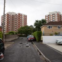
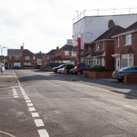
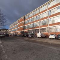
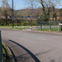
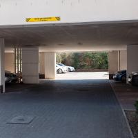
This may be a more interesting view than you'd think at first sight. Whitemead and Winterstoke House, with Southbow House out of sight on the far side, were finished in 1962, as the post-War housing crisis continued. There's a fascinating article in the Bristol Post about them, especially Whitemead House, the block on the left here, which was famously used for external scenes in Only Fools and Horses after filming moved to Bristol, standing in for the fictional Nelson Mandela House in Peckham where the Trotters lived.
My guess is that these rental parking spaces are very popular when there's a match on at Ashton Gate. I could hear the cheering coming from the stadium from my front room in Hotwells over this weekend (I'm writing this on October 3, 2021, as I've got a bit of a photo-processing backlog!) so it seems that biggish matches—either football or Rugby or both—are back on.
Fresh Fields
17 Oct 2021
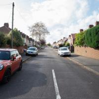
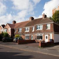
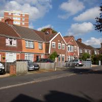
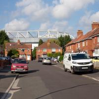
For the first time in a while, I had the time and energy to go further afield and knock off some new roads from my "to do" list. I headed through the first Hotwells Festival to Ashton and Bedminster to cross off a few of the suburban roads south of North Street.
First, though, I decided to try to reproduce an old photo of the now-demolished Rownham Hotel just around the corner from where I live...
I've taken a few photos of the similar place around the corner, but I hadn't noticed there's another one of these odd mansion-mansard-bungalow-what-the-hell places here, too.
The rest of the road is just your normal-for-round-here brick boxes, really. At the end is the back of the little Winterstoke Road retail park, including PC World and Halfords, which I think are the only two shops I've ever been in there.
ODE says a "bower" is "a pleasant shady place under trees or climbing plants in a garden or wood." This road (in the Ashton district) is actually pointing in the direction of the UWE campus at Bower Ashton—I wonder if it was named because it led towards that bower?
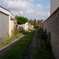
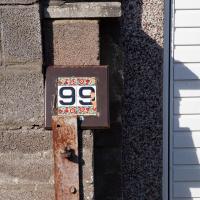
And I was right, the alleyway didn't really lead anywhere apart from people's garages and back gates, but at least 99 Smyth Road had a nice decorative number on the garage to look at.
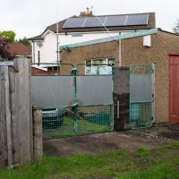
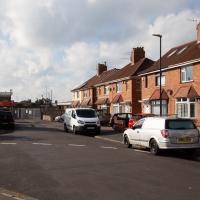
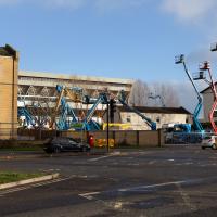
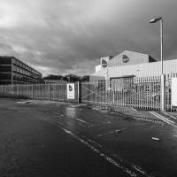
I was just about starting to feel better—the antibiotics seemed to have kicked in for my dental issues, and it had been some days since I'd left the house, and I was at last starting to get itchy feet. So, a wander. But where? Well, there were a few industrial bits near Winterstoke Road in the Ashton/Ashton Vale areas of Bristol that needed walking. I knew they were likely to be quite, well, unattractive, frankly. So why not do them while I wasn't feeling exactly 100% myself? Maybe it would fit my mood. Hopefully you're also in the mood for a bit of post-industrial wasteland, for that's what some of this feels like...
Then, at the last minute, I thought again about the Bristol International Exhibition—I've got a book about it on the way now—and that gave me another goal, which could just about be said to be in the same direction, and I decided to walk significantly further than my normal 1-mile limit and try recreating another historical photo...
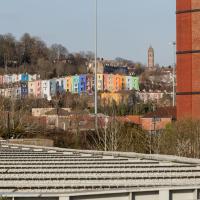
Sadly I don't know much about the Ashton area; it's just on the edges of my mile and I rarely have cause to go there. It's brimming with history, I'm sure: the whole South Bristol area rapidly developed from farmland to coal mines to factories to its current interesting mixture of suburbs and industrial work over the last few hundred years. As a more working class area less attention was paid to it by historians, at least historically-speaking, than the Georgian heights of Clifton, and much of it has been knocked down and reinvented rather than listed and preserved. I see here and there some of this lack is being addressed, but I'm afraid I'll be very light on the history myself on this wander, as most of my usual sources aren't throwing up their normal reams of information as when I point them at Clifton, Hotwells or the old city.
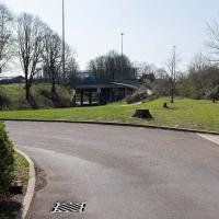
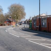
Raised section of the Metrobus route. I've been this way before on a Wander, but also, on a day when there weren't any buses, actually walked that ramp. It was fairly underwhelming.
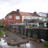
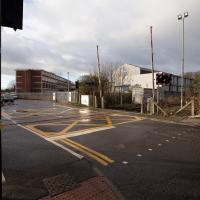
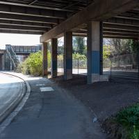
This area continues to be blighted with ugly and neglected-looking infrastructure. We're just on the edges of Ashton Vale, which is among the 30% most deprived areas in the country. At the north of my one-mile radius we have Clifton, among the least 20% deprived. Source: UK indices of deprivation.
I did know this existed at some point, I think, but I'd completely forgotten that there was a level crossing within my mile. We need to wander over it, too, as this road, Ashton Vale Road, is one of the roads within my mile that I've not ventured down yet.
Partly that's because no bugger wants to walk down roads like this with me, as it's basically just industrial wasteland, especially in this interregnum period, where there's not even the buzz of industry to keep things interesting, but seeing as we're here...
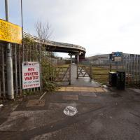
Interesting sign up on the left there. This isn't talking about the Metrobus line, which as you can see rises above the crossing, but about the MetroWest train plans, I think, which would see a revivial of the old Portishead line. That's not happening until at least 2024, but clearly the business park is fearful of the impact.
"Hello? Yes, I'd like to order a cubic mile of bland industrial building, please. No, anything'll do."
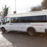
I'd really hope for at least a chartreuse microbus for carrying long-haired friends of Jesus...
Here's a working office that I'd heard of: V Cars are one of Bristol's biggest cab firms, and the only one whose phone number I have memorised. On my first trip in one, back in 1999 (in a differently-named, earlier incarnation, I think), the driver said to remember the number as "Christmas Day, Boxing Day, Boxing Day". Most (all?) central Bristol phone numbers were prefixed with a 9 back then, so you just needed to add 25, 26, 26...
There was even a cab dispatcher at work behind the window, from what I could see. It reminded me of my childhood, when my mum worked as a dispatcher at Radio Cars in Ilford.
I mostly went out to hang out with my friends Sarah and Vik in Bedminster, but along the way I thought I'd take a closer look at something a little nearer home: the last crossing point of the Rownham Ferry.
Getting back to the Rownham Ferry, the Ashton Avenue Bridge is one of the reasons it was closed. On the excellent Bristol City Docks website you can find a photo called "Rownham Ferry c1906 with Ashton Avenue Bridge nearly built.".
As you'll see in that photo, at low tide the Rownham Ferry was basically just a bridge made out of boats, so it probably still seemed a quick shortcut compared to walking all the way to Ashton Avenue Bridge. I imagine the foot traffic gradually migrated to the new bridge as the ferry was a more daunting prospect at high tide, from what I can gather. Also, the combined road/rail bridge would have allowed people to get the train across the river, rather than stopping at Clifton Bridge Station and using the ferry, I think.
A Coffee and a Curve
27 Mar 2022
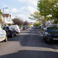
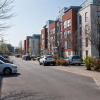
I wanted to have a wander along to the Tobacco Factory Market for some shopping, and checking the map for any leftover nearby streets I noticed a tiny curve of road on the way into the modern flats at Paxton Drive that it didn't look like I'd walked down before. I wouldn't take me too far out of my way, so I decided to head there first and then across to North Street to get my groceries and a coffee...
Here we are at the tiny loop of road that looked like it hadn't been walked. It has very little to recommend itself in any other capacity.
Paxton Drive always reminds me of Blake's 7, but in fact in the episode Stardrive it's actually Doctor Plaxton's drive that's the MacGuffin.
Well, I hope he's bringing the sign he nicked from this end of Paxton Drive with him.
It looks on the map like there are little side streets off Paxton Drive. There really aren't, just these little car parking areas. Hence I didn't walk down any of them.
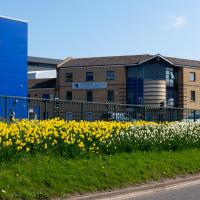
It's better than no daffodils, but they're still rather swamped by the rather industrial setting.
Which then becomes North Street, my destination. I need a coffee and some lunch and some veg.
A Swing of the Plimsoll Bridge
24 Apr 2022
I was originally going to head over to the Ashton area to see if I'd missed any bits around the football stadium—and also to grab some lunch from the Tobacco Factory Market—but in the end I got a little distracted by having accidentally chosen exactly the right time to see the Plimsoll Bridge swing on one of the first busy days of Spring, where a lot of pleasure trips tend to head out down the Avon (and possibly the New Cut) from Hotwells.
In the end I mostly snapped that, and just a couple of photos from the Ashton area where I grabbed some lunch but didn't do any new exploring.
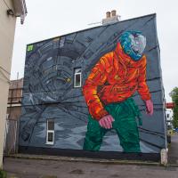
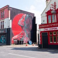
Pikto's piece on the side of the Coopers Arms was looking particularly eye-catching in the sunshine...
I've been pretty awful at reading so far this year, apparently averaging about one book per month. That's a far cry from 2019, say, where I got through 41 books in the year. Today's wander was prompted by my rubbish reading, as I needed to go hand back some books to the library, because I'd managed to renew them so many times that I hit the limit on renewals. Oops. Several of them were still unread.
So, off to the Central Library for me, tail between my legs. On the way there I did my best to recreate a historical photo of Dowry Square; while I was in the area I walked under the adjacent Norman arch and poked around behind the Cathedral, and I also had a little diversion to the city centre and came back along the south side of the river, hitting some trouble with the lock gates as I finally crossed the harbour back towards home.
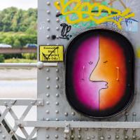
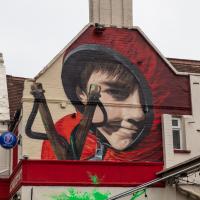
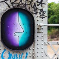
I'd seen from maybepaints feed that they'd popped a couple of new faces up on the Ashton Avenue bridge. Here's the first...
I'm in the habit of going over to the Tobacco Factory Market on a Sunday. I think I've walked all the routes around that way, but as a Plimsoll Bridge swing let me cross the road to the far side of Brunel Way on my return journey and I took a couple of photos of the brownfield development at the old Ashton Gate Depot site I thought I'd call it a Wander and pop some photos up.
I've recently been playing the computer game Life Is Strange, and it's inspired me to get a bit more snappy. The heroine is a photography student, and part of the game is to go around snapping artistic pics with her Polaroid camera. I don't have a polaroid, but the game did inspire me to stick the simple 50mm prime lens on the camera and to trust my instincts on things to snap. This was probably the best result of the day.
The Clean Air Zone is being introduced later this year (currently they say 28 November 2022, but I think it's already been delayed twice.)
The scheme will see charges instituted for certain vehicles entering parts of the city, especially older diesel cars. This is to encourage people to change these older cars or find alternative routes or modes of transport. Apparently there are grants and loans available for upgrades on offer to private citizens and businesses.
This should only have positive effects for me, as I live just inside the zone, and I drive a recentish petrol car with an efficient and not-so-pollutey engine. In a perfect world, therefore, this scheme means my area might eventually start meeting the government's standards for air quality. This Bristol 24/7 article has some good info, including an estimate that there are currently 300 premature deaths per year from traffic-related air pollution in the proposed Bristol zone.