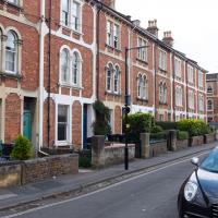
Tagged: brick
An Evening Wander to the Gallows
06 Apr 2021
I'd originally intended just to pop up to the area around Alma Road, where I'd missed a few streets on earlier wanders. It was such a nice evening, though, I decided to extend my walk up to the very top of Pembroke Road, just outside my one mile radius, to take a few snaps of something intriguing I'd found in my researches.
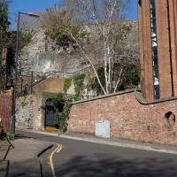
I've driven, walked and jogged past the little triangle of land at the top of Pembroke road a great deal in my time in Bristol, but I didn't know that it used to be the site of a gibbet, in fact that the road itself there used to be called Gallows Acre Lane. According to the Durdham Down history trail, by Francis Greenacre (an excellent name for a Downs researcher!) among other sources:
...it was below this quarry near the top of Pembroke Road, once called Gallows Acre Lane, that a gibbet stood. It was sometimes occupied by those who had committed robberies on the Downs and was last used in 1783 to hang Shenkin Protheroe for the murder of a drover. Stories quickly spread that he descended from the gibbet at midnight every night and stalked through Clifton. Such was the alarm that his body was cut down
and buried.
Also very close to this little triangle of land was one of the gates of the extensive turnpike system...
Anyway. Along the way I encountered a wooden tortoise and a real squirrel, among other things. It was a good walk, and more light in the evenings means I can move my wanders out of the ticking countdown clock of work lunch-hours and be a bit more leisurely.
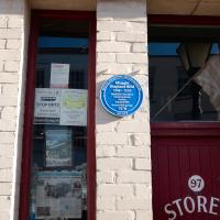
The late, great Maggie Shapland was a familiar feature to anyone interested in historical industry in Bristol.
I think the first time I saw her was on an Open Doors Day for the Clifton Rocks railway, the disused funicular from the Avon Gorge Hotel down to near the landing stage in Hotwells, and the last time was when she was helping to restore Brunel's Other Bridge at Howard's Lock.
Both times I think she'd driven there in one or other of the classic cars she maintained. Sometimes when the garage door here was open on the way past you could sneak a look at the collection.
The last thing I saw her drive was this Moss kit car.
An amazing person by all accounts, I never knew that we shared the profession of "Database Consultant"...
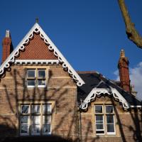
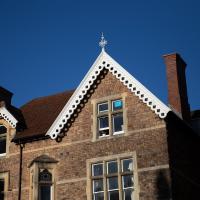
Although the low sun was a bit annoying for some photos (and for walking directly towards) it did bring out some of Clifton's features very well.
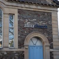
This is now Alma Church.
According to the ever-useful churchdb:
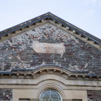
It was founded in 1871 as a daughter church of Bethesda Chapel in Great George Street, Brandon Hill, and was called "Clifton Bethesda" to distinguish it.
I didn't remember noticing the original Bethesda Chapel on Great George Street and apparently I didn't miss it—it seems from churchdb that it was hit by a bomb during WWII and later demolished. The KYP map from after the war shows its outline on the corner of Charlotte Street South, tagged "Ruin", and there's a picture of it. It's back to being grassland on Brandon Hill now, pretty much exactly where this earlier photo was taken.
Bethesda Chapel was founded by George Müller, one of the founders of the Plymouth Brethren, and director of Ashley Down orphanage, looking after more than ten thousand orphans in his lifetime.
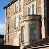
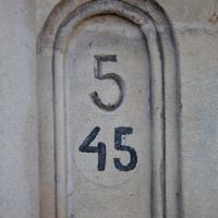
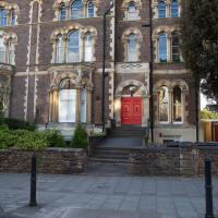
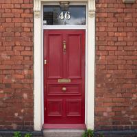
I wonder if this is another street that's been renumbered. It's 45 Apsley Road, but I guess this particular terrace (see next pic) might have had standalone numbering in the past.
There's some fantastic verbiage in the listing:
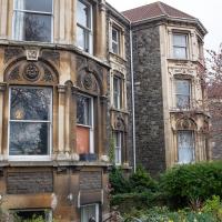
A symmetrical front has the middle set forward, quoins, and sill and lintel bands, recessed party wall with quoins, and overhanging eaves. Openings have semicircular arches with alternate sandstone and limestone voussoirs, hoodmoulds, foliate springers and plate-glass sashes.
Personally, I just rather like the front door.
Clifton Village Lunchtime Coffee
07 Apr 2021
Unusually for my recent lunchtime coffee trips, I managed to find a new road to walk down: Caledonia Mews, which has a little entrance off Princess Victoria Street and runs between it and Caledonia Place. I've noticed it before a couple of times—if you look up from Princess Victoria Street you can see some of it, standing tall above the low buildings on the street itself—but until last night I'd not set foot in it, I think.
As well as focusing on this charming little mews, I looked in on the demolished site of the old WH Smith, and spotted what I think is part of the now-private-houses St Vincent Rocks Hotel that I'd not really noticed before, tucked away between Sion Lane and Sion Hill.
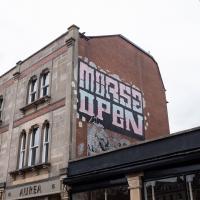
I'm glad I added a search feature to the site recently, as it let me find this earlier photo when the name rang a vague bell. Morsa clearly gets about a bit.
A London Wander in Southville
10 Apr 2021
There's a bit of Southville that I've been meaning to get to for some time, where the streets seem to take some strong inspiration from London. There's a Camden Road that crosses with an Islington Road, and a Dalston Road, even an Edgeware Road. For me these names are more evocative than the rather more exotic names I passed by to get there—Sydney Row or Hanover Place, say, because I've actually been to the places in London. The last time I was in Islington I saw Monkey Swallows the Universe play at The Angel, and I can't think of Camden without remembering a gondola trip with my friend Tara where a cheery youth played Beatles music for us on a saz...
I really liked this little area, with its mostly well-kept pretty houses and hints here and there of the creative side of the residents. It's arty and down-to-earth at the same time, and I wouldn't mind living there, I think.
On the way there I got the chance to walk through Underfall Yard for the first time in a while, and on the way back I had my first take-away hot food for many months, grabbing some crispy fried squid from the excellent Woky Ko at Wapping Wharf.
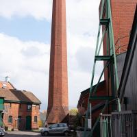
Or, I imagine, chimney. But the fins at the bottom really do make it seem quite rockety, and when I asked about it on Twitter someone did find a strong resemblance to some NASA hardware.
As to why Charles Hill & Sons apparently needed an industrial incinerator in the basement of their office, I've not yet found out.
Like the building with the clock tower around the corner, this was apparently offices for the shipbuilding firm. The listing says it's mid-nineteenth century, and:
Originally offices for Charles Hill & Sons, formed 1848, shipbuilders at the Albion Dockyard (qv). Their last ship was launched in 1976
The door across this is normally closed. You can just about see Wallace and Gromit smiling on the side of the building, presumably not coincidentally, given that Aardman Animations' office is down there and up the driveway to the left.
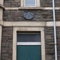
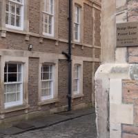
I think this may be a remnant of St Raphael's Church, whose adjacent almshouses for aged seamen are now the site of the flats at Perret's Court, just to the left there.
Ah! Yes, according to ChurchCrawler:
1853-9 by Henry Woodyer, closed 1878 following disapproval of the bishop and not reopened until 1893. Some war damage, the church was again closed and became part of a factory in 1953 and demolished 1954. Part of the W front still stands in the garden between two blocks of flats.
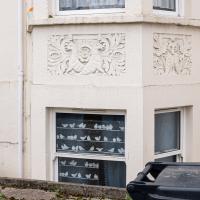
It was actually the decorative stone carvings of animals that caught my eye, but the birds in the window stand out a lot more in the photo.
A famous contralto, apparently. Contralto Corner quotes Sir Thomas Beecham:
"On a clear day, you could have heard her across the English Channel"
...and notes that:
She gained her DBE as a result of the WWI concerts that she organized.
I think it's a guesthouse. There are several on this stretch of Coronation Road. Nice big place, and that stonework would probably clean up a treat. I imagine we'll see less of this once electric vehichles become more of a thing.
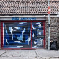
I've actually looked this place up with a view to getting a bumper repaired. Apparently he's very good.
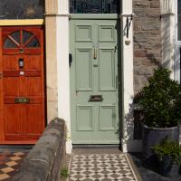
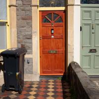
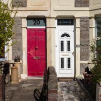
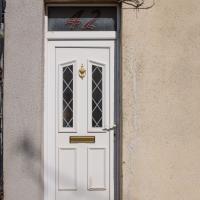
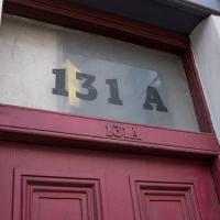
I love Bedminster and Southville's habit of having house names above the door, and bold numbering in the transom lights.
Long Bemmie Wander with Lisa
11 Apr 2021
My friend Lisa joined me again, this time for a long wander through "Bemmie". In fact, I tweeted recently using "Bedmo" as my abbreviation for Bedminster, and apparently there's something of a culture war going on. From what I can glean, the longer-term residents call it "Bemmie" and consider "Bedmo" a name made up by hipster gentrifiers.
I had no idea, but then I didn't grow up around here, and I don't live in Bedminster, and I'm not a hipster. I'm not sure I've ever gentrified anywhere, either; Hotwells was already quite gentrified by the time I arrived. I probably just lowered the tone a bit.
Anyway. Lisa and I entered Bemmie by the traditional toll gate (though actually you'd only have paid if you were coming from the Long Ashton direction, not merely nipping across from Hotwells) and then almost literally combed the streets to knock several new roads off my list of targets. Along the way we saw lots of street art, as you'd expect, and admired the area's panoply of gorgeous knockers.
We'll see a Cromwell House in a minute. Clearly they're New Model Army fans around here. Nice path.
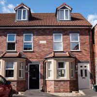
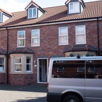
Normally when you're looking at a date on the side of a building in Bristol it's a little further in the past. It's interesting to see one so recent. I wonder if in a hundred years time people will stand here thinking about the dim and distant past.
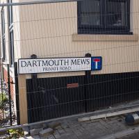
Dartmouth Mews is basically a tiny square with a little terrace down two opposite sides, built very much to match the character of the existing little Victorian houses around here.
Better Look at an Extension
14 Apr 2021
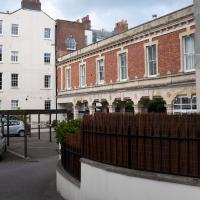
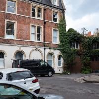
Apart from a lovely coffee and a slice of Victoria sponge from Twelve, there weren't any new sights on this little lunchtime jaunt except for a slightly better look at the long raised extension at the back of the St Vincent's Rocks Hotel, where I at least got to see the arches it's raised up on. I also got a fair bit of exercise by walking up the Zig Zag to get there, and saw far more people out than I have in months, what with the lockdown having just been significantly lifted. As I walked past The Mall pub they were turning people away from their already-full garden, and the (outdoor) cafe tables were pretty full up.
I only found out that this was a raised extension when I read the listing after snapping the last photo. Today I ventured as close as I could and got to glimpse a bit of the rather nice support arches.
I'm guessing there used to be a grand front door, but then later the hotel annexed the building and didn't need it any more? But it's only surmise.
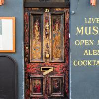
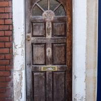
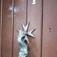
Maybe I'm starting a knocker fixation after last weekend's walk. Interesting that it's mounted on a Maltese cross. I wonder if it was a holiday souvenir?
Coffee, Pirates and a Spitfire
15 Apr 2021
Just a quick trip to Imagine That for a flat white and a date ball (they're really nice), snapping the general sights along the way. No new roads, as has rapidly become the default on my lunchtime wanders, but as I'm in the routine of this project it almost seems strange not to pop my wanders up on the site.
Man on a Mission
17 Apr 2021
I went rather outside my area today, as I went to pick something up from the Warhammer shop on Wine Street (Games Workshop as-was, and before that I think perhaps a rare retail outlet for Her Majesty's Stationery Office? I may be mis-remembering...) Anyway, a friend of mine wanted something picking up and posting to him, so I figured I'd knock some streets off my list along the way.
I first headed for the St George's Road area, walking down the narrow Brandon Steps and finding some strange wall art on Brandon Steep, then headed to the Old City via Zed Alley. The Warhammer shop visit was friendly and efficient, and, mission accomplished, I treated myself to a sausage roll and a flat white from Spicer + Cole, to take away and eat in Queen Square with its current decoration of hearts. I finished off with a detour up Park Street, looking out for St John's Conduit markers, before finally crossing Brandon Hill on the way home.
Quite a long wander, all told, and I'm a bit knackered today...
I came down Brandon Steps, but I also needed to walk along Brandon Steep from the same place. I figured I might as well do a little circuit to knock this one off the list while I was here, so it's back up here to the top of the steps I go...
This doesn't seem particularly to belong to anyone, as a space, so it's interesting that someone's made a bit of an effort with this corner.
A New Wander, a New Cafe
21 Apr 2021
Obviously, I was trying to connect to the industrial history of the Canon's Marsh area, to the old gasworks, the docks railway, the warehouses they blew up to make way for all the rather soulless modern stuff (though I do like the Lloyds building, at least.) But what I mostly got out of today's walk is a new cafe to go to for my lunchtime outings. It's perhaps a little closer than both Imagine That and Hopper Coffee; not quite as close as Foliage and Twelve up in Clifton Village, but also not at the top of a steep hill.
No, not the mediocre Costa, but only a little way away from there: Rod and Ruby's, which opened in 2018 and which I've seen in passing several times but never popped into until today. What can I say? I was foolish. Great flat white, lovely interior, astoundingly good cannoli.
Sometimes you just have to get your head out of history and enjoy a pastry.
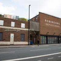
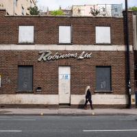
I know very little about the history of these buildings. There's a removals firm called Robinsons with some links to Bristol, and a building in Brimingham with an old sign saying "Robinsons Furniture Depositories", so I suppose it's possible this is a long-defunct furinture repository for a removals firm. Last planning application I can find is from 1998, before I even moved to Hotwells, granting permission to demolish "two storey office building and single storey store", which very much sounds like these two buildings.
The bit on the right still has a sign up saying it's Gnodal and Bioinduction—the firms whose car park is around the back—though Gnodal is defunct and Bioinduction sadly don't have any pictures from the Bristol office on the one-page website.
I really must poke my nose in and see if there's anything more than the apparently-tiny couryard back there.
Canons Marsh Coffee Trip
29 Apr 2021
Another quick excursion to Canon's Marsh, tempted back by Rod & Ruby's cannoli and flat white. This time I poked around some bits of the modern flats I'd not really experienced before, mused on the old gasworks, and headed back down the Hotwell Road, spotting a re-opening gallery and finishing off at the Adam & Eve, for which some locals are currently rushing to launch a bid to turn it into a community business rather than have a developer turn it into yet-more flats.
I was in a bouncy, positive mood, helped out by Life Without Buildings' Live at the Annandale Hotel album1. Note to self, though: the album is nearly an hour long, so if you hear the encore starting and you're still halfway down the Hotwell Road, you'll probably be late back from lunch...
1 That review's well worth a read. Music journalists tend to go extra-dreamy when trying to describe Sue Tompkins. See what I mean:
She circles her limber tongue-twisters, feints, and attacks from unexpected angles, dicing and rearranging them with the superhuman brio of an anime ninja and a telegraphic sense of lexical rhythm.
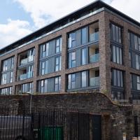
So new it doesn't seem to be on Google or Bing Maps yet, at least on the actual map bit, this is the one new build that stands alongside the two historic-building-conversion jobs (Purifier House and Engine House) at Brandon Yard, basically the site of the old gasworks.
They were one of the last sites to be regenerated, after some failed attempts to turn them into offices, including by the Soil Association. I don't know much about what they do in a gasworks, but I heard that the ground was highly polluted and needed a lot of remedial work before anything new could be put there.
Leftovers with Lisa
01 May 2021
I didn't get to all the little leftover streets around the northeastern part of my area in today's wander, but I definitely knocked a few off the list, plus Lisa and I enjoyed the walk, and didn't get rained on too badly. We spotted the hotting-up of Wisteria season, checked out Birdcage Walk (both old and new), ventured onto the wrong side of the tracks1 and generally enjoyed the architecture.
1 Well, technically we probably shouldn't have been on the grounds of those retirement flats, but nobody started chasing us around the garden with a Zimmer frame
This basement club will be more student flats soon, by the looks of it. Though I actually took this photo to remind myself of a possible plot point for a story I'm writing...
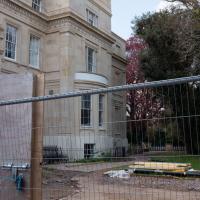
A peek through the building site railings at the back of Worcester House, the grand house at the end of Worcester Terrace.
I've walked above these tracks many a time, but I've never been down on this level on this side of them—the other side is the pub next to the station, where I've been quite a few times...
