Tagged: building
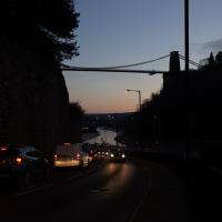
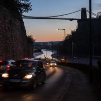
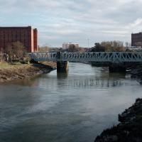
My historical research took a wander underground recently, partly inspired by the Canynge Square sinkhole, partly by St Vincent's (Ghyston's) cave and its tunnel to the Observatory, and I was surprised to find that there might be an intact tunnel from the Bristol Port Railway and Pier still just sitting there under Bridge Valley Road. A quick search turned up this recent video by an intrepid explorer, so it's definitely still there.
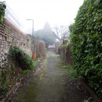
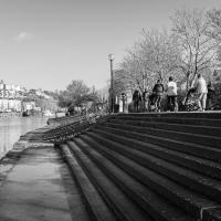
I went looking for the entrances today, and definitely found the south entrance, at the start of the Bridge Valley Path, the footpath that starts with steps at the bottom of Bridge Valley Road. It's easy to miss if you're not looking for it. I think I've figured out where the north entrance is, too, but it was getting dark at that stage and the Portway was still busy enough that crossing the road was still the normal nuisance, so I thought I'd leave further explorations for another day.
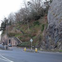
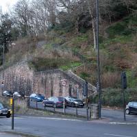
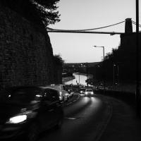
Despite its looks, this is neither of the two footpaths actually called the Zig Zag (the Zig Zag itself, closer to town, and the New Zig Zag, further out.) This is in fact the Bridge Valley Path
I have other pictures of the Bridge Valley Path from other days; it's not entirely photogenic, though it is a nice walk if you're okay with hills. I skipped the photos this time until I emerged at the top, in Clifton.
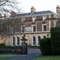
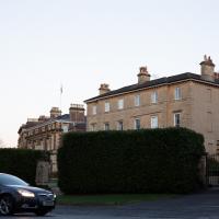
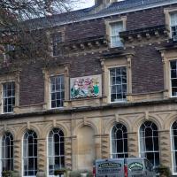
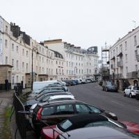
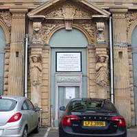
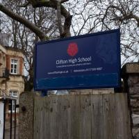
I'm not sure I knew until today's wander that the Bridge Valley Path exited almost opposite the Society of Merchant Ventuers' clubhouse.
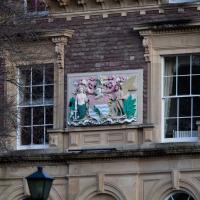
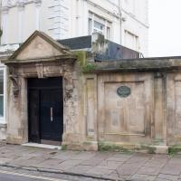
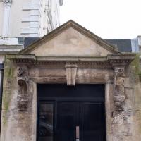
A fragment from Horace's Odes: "not taught to suffer poverty."
Wikipedia says that the defunct Bristol magazine Venue once did a bit of investigative journalism on them:
Venue claimed that the Merchant Venturers control 12 charities and 40 trust funds, and also a private unlimited company, SMV Investments, that has major investments in defence contracting, tobacco, genetically modified agriculture and the petroleum industry. Merchant Venturers serve on the boards of many local charitable and cultural organisations, and are guaranteed seats on the University of Bristol Court and the Downs Committee. It quotes Paul Burton of the University's School of Policy Studies as saying, "they exert quite a bit of influence and we, the people of Bristol, don't know much about them and can't hold them to account"
A Promenade on New Year's Day
01 Jan 2021
I wandered along the gorge today and found the entrance to the disused Portnalls Number 1 railway tunnel of the Bristol Port Railway and Pier. The door was unlocked, but as soon as I opened it I felt a sense of current habitation and decided discretion was the best option. There's a lot of people homeless in Bristol at the moment, and they don't need disturbing. For the same reason, I've omitted posting some pictures of a little encampment somewhat off the beaten track of the new Zig Zag, where I reversed direction as soon as I realised I'd come across a current habitation of some sort.
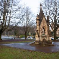
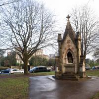
Up in Clifton it took me a little while to work out that the picture of the Promenade I was trying to reproduce was taken from the viewpoint I'd thought, it was just that the Alderman's fountain was moved from the top of Bridge Valley Road to the other side of the promenade in 1987, so trying to use it as my initial landmark wasn't very helpful!
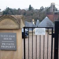
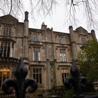
Finally I swung past the Society of Merchant Venturers, who presumably still own most of Clifton, having bought the entire manor, including Clifton Down, in 1676, and I imagine aren't in much danger of running out of money. That's true to their motto: indocilis pauperiem pati is apparently from the Odes of Horace, and translates as "will not learn to endure poverty"...
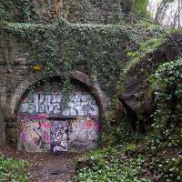
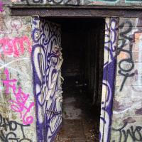
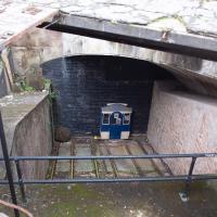
Oooh, it opens. However, it also looks like it closes fairly solidly and can be bolted from the outside. And it felt just a tad like there might be someone inside. So I didn't venture in.
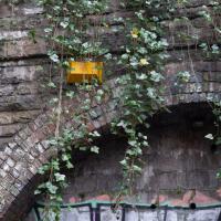
I imagine this alarm was last connected to anything during the tunnel's last commercial incarnation, where is was a shooting range for a Bristol gun club. Not even the lights are wired up these days. Or the water.
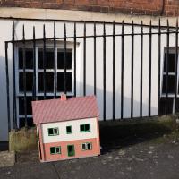
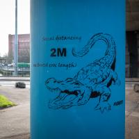
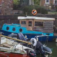
Tiny Houses, Crocodiles and Views
05 Jan 2021
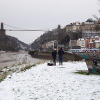
I didn't really intend to record my walk today, but once I was out and about I couldn't really resist taking some pictures. The sun was lovely, but it was cold...
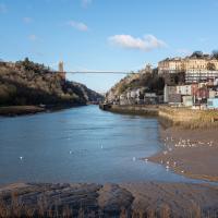
"He liked to take a walk on a Saturday afternoon with Flora for his companion, across the bridge, pausing there to look leftwards at the spreading city far below, the tangled waterways, the warehouses, the ships, the medley of houses and trees lifted to the heights of Upper Radstowe, and on the right where the gorge narrowed, to see the river sluggishly making for the Channel between banks of glistening mud on which was reflected, now and then, the white swoop of the gulls; or, at high tide, to hear the hooting of a siren and watch the ship coming slowly round the bend. It was a scene of which he did not tire for it was never twice alike. The form, the opaqueness, the colour or absence of clouds had their way with it, darkening or lightening the trees on the farther cliff and the splashes of red and yellow rock on the nearer one." — E.H. Young, Chatterton Square, 1949
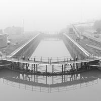
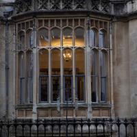
I wanted to catch the jogger in the blast of reflected sunshine, and apparently I succeeded.
Prince's Lane
06 Jan 2021
The International Grotto Directory website says:
Prince’s Lane might have been one of the original ancient tracks from Hotwells to Clifton, in the Avon Gorge. The site later formed part of Rownham Woods which comprised some thirteen acres. By the end of the 18th century and the early 19th century, the Society of Merchant Venturers granted to Samuel Powell a building lease, for The Colonnade (1786), St. Vincent’s Parade (1790), Prince’s Buildings (1796), and Rock House. Rock House is generally considered to be the oldest surviving building associated with the Hotwell (see Chapter 20). John Power conveyed part of the woods to William Watts for the construction of Windsor Terrace (1790-1808).
The above development of the Avon Gorge cleared Rownham Woods, and created a triangle of land on the north side of the gorge, that became enclosed as a result, by Mansion Houses, whose garden walls all entered on to Prince’s Lane. The Lane started at the bottom of the gorge, at the base rock of Windsor Terrace, and came out half way up Sion Hill. It is clearly shown as a public footpath, dotted with trees, in Ashmead’s map of 1828. Some of the gardens were quite steep in parts and therefore, had to be terraced, because of the gradient of the gorge.
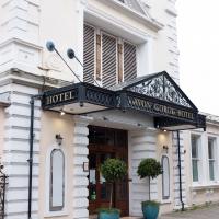
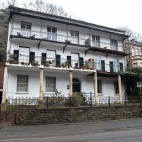
I've passed Prince's Lane literally thousands of times in my life, every time I've walked past the Avon Gorge Hotel, which itself started (in 1898) as the Grand Clifton Spa and Hydropathic Institution and pumped water up from the Hot Well for its hydropathic treatments. I've never actually ventured down it until today, or at least nothing like as far down it as I did this afternoon—I may have poked my head around the back of the hotel to see the original pump rooms at some point in the past.
This was a great wander, though it does very much feel like a private road, and frankly I may have been pushing my luck a bit by winding my way between the astoundingly big back gardens of the houses of some presumably very wealthy Cliftonites, but I felt vaguely justified in exploring the history of one of the oldest footpaths in my part of Bristol...
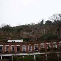
Or the first sight of them in the distance, anyway. The terrace on the left is Prince's Buildings; we'll be walking being their gardens in a bit...
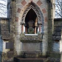
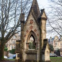
This building is 1894, but commemorates the original Hot Well House down in actual Hotwells, built in 1694.
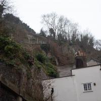
The nice folk who look after the Clifton Rocks Railway have an example of what one of the carriages would look like at the top, though the tunnel here has been bricked up for a long, long time. If you get the chance to visit on one of their open days, it's pretty fascinating.
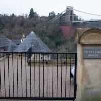
I always enjoy peeping down Prince's Lane on the way past and enjoyin the view of distant hills.
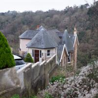
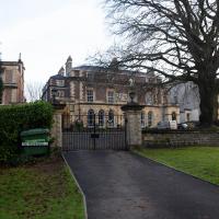
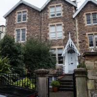
I had a quick look, and apparently this grand house with an amazing view is split into flats, with a two-bedroom example going for somewhere in the region of three quarters of a million pounds. Clifton, eh?
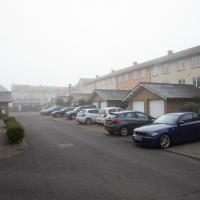
A Little Local Wander
07 Jan 2021
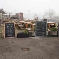
Which included a literal "local", the Pump House, to try out their shop/deli/cafe. A flat white, some apples and a New York Deli toastie. Eleven quid, mind, but the Pump House was never a cheap pub...
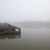
I enjoyed the fog, and wandering down a few more out-of-the-way back alleys and what-have-you on the Hotwell Road.
I'm thinking of getting up early and going for a morning walk tomorrow, weather-depending, but at the moment my motivation to do things like this seems to be much strong in the evenings when I'm just thinking about it rather than in the morning when I actually have to do it. But it's going to be cold, and low tide is quite early, so there's always a chance of getting some footage of the hot well actually being visibly hot; you never know...
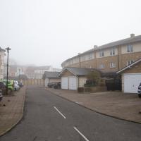
I decided to explore the Freeland Place car park briefly today. As expected it's basically just a car park, though at least it links up with Hinton Lane at the bottom so I didn't have to retrace my steps.
From the article I was reading to accompany yesterday's Prince's Lane wander:
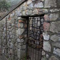
"In the 1970s, access to Prince’s Lane from Hotwell Road was walled off, and a gate was put in the wall on Hinton Lane, which was locked and prevented people from using it."
I think this is likely to be that gate. It's certainly close to the most likely path for Prince's Lane to shimmy between the back gardens of St Vincent's Parade and the back gardens of Windsor Terrace to emerge from the Clifton hillside onto Hinton Lane, anyway.
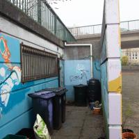
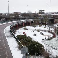
I seem to recall from the community newsletter that when coming to plant trees and flowers and generally make Cumberland Piazza a bit more pleasant, the local team of volunteers found that they had no easy access to a water supply. This is one part of their cunning plan to provide one—see the adjacent phtoo for the other part that feeds the rainwater butts.
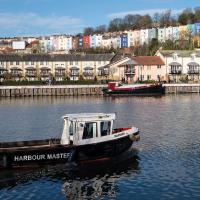
Is "knts" really a helpful abbreviation for "knots"? It's not like there wasn't room for the "o"...
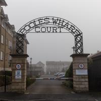
It's a private estate, but I figured nobody would object too much if I wandered straight through. I don't push my way into private areas too much on these walks—my intention in the first place was to only walk down public roads—but sometimes my curiosity about a place I've walked past for decades but never set foot on gets the better of me.
It helps, I'm sure, that I'm white, approaching middle age and have a vaguely RP accent. Plus I do my best to look as un-furtive as possible and only wander through private areas in broad daylight and carrying a big obvious camera, which might be helping rather than hindering. In all the years I've been walking around places and poking my nose in I've never been asked to leave anywhere, anyway, so I've been taking that as a sign that my hopefully-repectful approach is working.
I liked the slightly flying-saucer curve of this bit of Poole's Wharf. I like the Lloyds building on Canon's March, too, which is pleasingly circular.
Morning Walk
08 Jan 2021
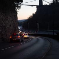
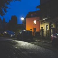
Tempted by a hopeful repeat of yesterday's weather, I got up early this morning and went for a short walk up into Clifton Village, around Observatory Hill, back down the Zig Zag and home. Instead of beautiful and mysterious fog and crisp freezing brightness I got some murk and slight dampness which included witnessing a road-raging van driver and finding that it still wasn't cold enough for the hot well to be even gently steaming when I got down there. I've still never seen it steaming, but I've been told it does, on colder days.
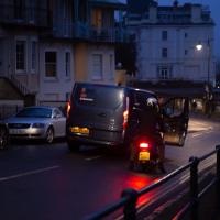
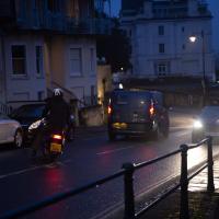
The van driver, who'd nearly driven into the side of the motorcyclist while doing a three-point turn just this side of the blind bend at the top of Sion Hill, became increasingly aggressive in the ensuing "discussion", including pointedly shouting that it didn't matter who was right, because he was in a van and the other man was on a bike, "so who'd be working afterwards?" in the event of a crash.
I'd stopped to make sure nothing terrible happened; when he got out of his van, walked right up to the motorcyclist and started shouting in his face, I started walking back towards them, taking the occasional photograph in the hopes that realising his actions were being witnessed and documented might make him think twice about turning physically violent. I don't know whether it helped, whether it was the car coming up behind us, or something else that made him get back in the van. Whatever, he got back in and screamed off far too quickly down the hill.
As you can tell, I didn't have time to change the camera settings. Getting the monopod back unfolded was also not much of an option :)
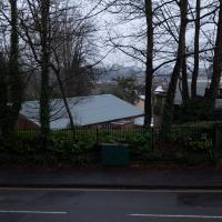
I quite liked the colours and the light, but this photo doesn't really capture the feeling. Ah well.
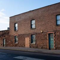
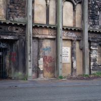
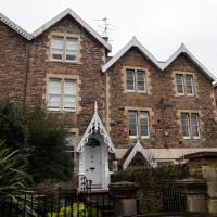
The way the left-hand side looks a lot more together than the right-hand side may be explained by the very first part of the listing:
Rock House, now divided into 2. c1800. Render with limestone dressings, roof not visible. Double-depth plan. Late Georgian style. 3 storeys and basement; 5-window range. A symmetrical front has pilaster strips to a moulded coping, a wide basement area with Pennant-stepped bridge to an elliptical-arched doorway with metal batswing fanlight and 2-leaf 12-panel door with fluted lower panels. In front of the basement area is a later colonnade of 6 slim Tuscan columns, square to each end, to a deep first-floor balcony, and a shallow, tented second-floor balcony on cast-iron brackets with flat stanchions, both with pointed-arched wrought-iron railings with quatrefoils; 8/8-pane ground-floor sashes, French windows above, and plate-glass basement sashes.
However, I've found several references that suggest that even Historic England's estimate of the date of the property is wrong. I just found one in a planning document, part of an objection to a planning application related to Prince's Lane by the Cliftonwood and Hotwells Improvement Society:
Rock House (412 Hotwell Rd) is shown in an early engraving by William Halfpenny in 1731 so is much older than any of the neighbouring buildings and is the sole survivor of the original Hotwell Spa. It is incorrect to say it dates from 1800, and the planners have been told this.
I haven't, sadly, tracked down the engraving itself.
Northern Clifton
16 Jan 2021
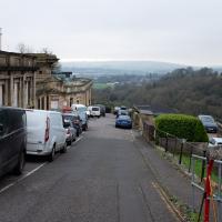
A raggedy wander with my friend Lisa, picking up a few stray streets and venturing only briefly onto Whiteladies Road, where it was too damn busy, given the current pandemic. We retreated fairly quickly. Found a couple of interesting back alleys, and got a very pointed "can I help you?" from a man who was working in his garage in one of the rather run-down garage areas behind some posh houses, and clearly didn't want us just wandering around there.
Here's an interesting sinkhole-related snippet:
"In September 2007, Peter Insole of Bristol City Council visited no.52 Clifton Park Road, Clifton to investigate the report of a mine shaft in the rear garden that had been exposed during gardening work. In the southwestern corner of the garden a rough rock cut shaft approximately 1m in diameter was observed. It was not possible to fully survey the feature for health and safety reasons, but it appeared to be excavated through sandstone or Dolomitic Conglomerate and was at least 2m deep. The shaft opened out into tunnels or chambers beneath the rear gardens of the Canynge Square properties. It is possible that this feature was associated with a previously observed cellar or chamber beneath the rear garden of 22 Canynge Square, although there are no known cartographic or documentary records for mining activity in the area."
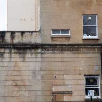
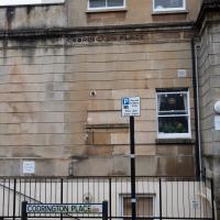
Oddly, this is a little crescent that two-thirds Coddrington Place and one-third Belgrave Place, it seems
Birthday Coffee
21 Jan 2021
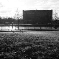
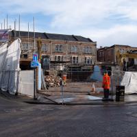
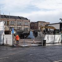
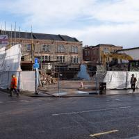
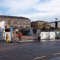
A quick jaunt to Clifton Village to grab a birthday coffee and cake (courgette, lime & pistachio, thanks for asking) from Twelve, and rubberneck at the demolition of the block that used to house the WH Smith, among other things. I remember the Havana Cafe, Mail Boxes Etc (for those who wanted a Clifton postcode without living there?) and others.
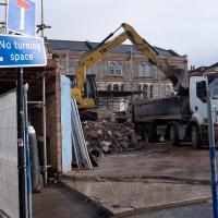
Tearing down the old eyesore that used to be a collection of random offices, a cafe, and WH Smith.
Coffee and Graff
22 Jan 2021
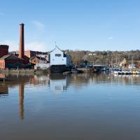
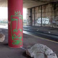
Took myself around the harbour to Imagine That's horsebox cafe and treated myself to a flat white and a sourdough cheese toastie. On the way there and back I encountered some local flooding and various bit of graffiti, from some ugly tagging on someone's front windows to a large new piece being added to Cumberland Piazza in the ongoing attempts to cheer the place up.
This was covered with graff & tags last time I saw it; I don't imagine it'll be long before it is again.
Because the main path seemed far too busy for the middle of a pandemic. I suppose I'm literally avoiding people like the plague.
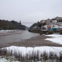
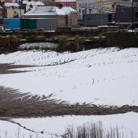
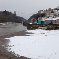
Snowy Leigh Wander
24 Jan 2021
I started this wander with my "support bubble" Sarah and Vik, after Sarah texted me to say "SNOW!" We parted ways on the towpath and I headed up into the bit of Leigh Woods that's not actually the woods—the village-like part in between Leigh Woods and Ashton Court, where I'd noticed on a map a church I'd not seen before. I found St Mary the Virgin and quite a few other things I'd never experienced, despite having walked nearby them many, many times over many years, including a castellated Victorian water tower that's been turned into a house...