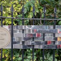
Tagged: onemilematt
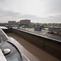
A Wide Angle View
30 Oct 2021
I had an unsuccessful wander last week, on Tuesday afternoon: my GPS died within about five minutes of leaving the house, and I didn't notice, plus I found hardly anything I'd been looking for. On the plus side, as I was wandering around Park Street I decided to nip into London Camera Exchange on the offchance they had a secondhand Canon 17-40mm lens. I've been thinking of buying one for around a year, I think.
Long story short: not only did they have one, but due to a mistake with their price labelling which they kindly honoured, I now have a shiny new (to me) wide-angle lens and it cost me less than £300, which is a very good price for one of these in good condition (and including a lens hood.)
So, rather than try to salvage Tuesday's walk, here's a walk where I basically just bimbled up to Clifton Village for a coffee and wandered around taking photos of as many wide views as I could find. I took a lot more photos than these seventeen, but as you might expect, a new lens takes some practice getting used to, so most of them ended up in the "outtakes" pile.
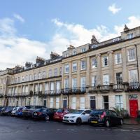
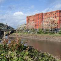
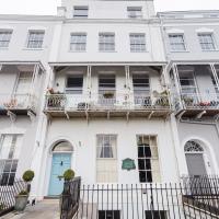
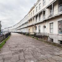
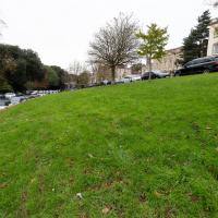
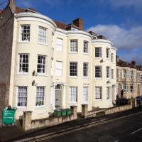
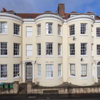
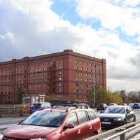
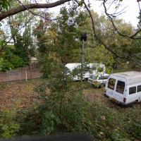
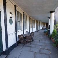
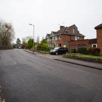
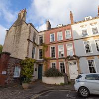
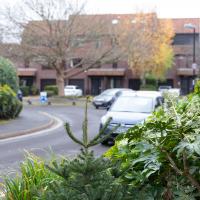
Pretty sure I couldn't have snapped the whole length of this terrace with my previous-widest lens, the 24-70. Fits fine in the 17-40.
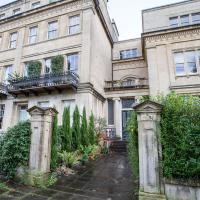
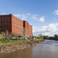
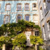
Set back on the end of Worcester Terrace is Worcester House. I've never succeeded in getting a good snap of it. Today does not seem to be an exception. Oh well.
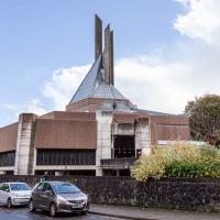
I've mentioned the spire before, I'm sure: colloquially known as the "three pin plug", it's apparently meant to represent the Holy Trinity.
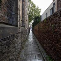
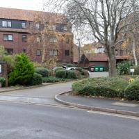
One of several odd short-cuts and alternative routes I worked out to vary my commute to work, when work was at the top of Whiteladies Road.
Ticking Off a Few Streets in Bedminster
31 Oct 2021
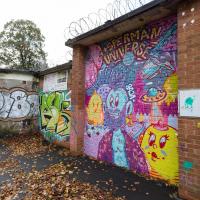
There were only a few streets left to wander in the more residential bit of Bedminster, so I thought I should target those today. The streets themselves weren't that notable, though Balfour Road has a contrasting mix of old and new housing. I tried to snap a few more interesting things along the way there and back, snapping all three of the familiar bond warehouses, nipping onto North Street to find some new street art, and finding a few pumpkins for good measure. It is hallowe'en, after all...
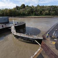
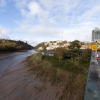
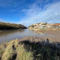
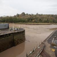
You can see the disturbance in the water on the river side as the sluices drain water from the lock to equalise the levels.

Recreating a Loxton Drawing on a Lunchtime Jaunt
05 Nov 2021
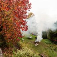
I did do a much longer wander earlier in the week, but that'll take me some time to process (and cast a plethora of photos into the "out-takes" pile!) In the meantime, here's my lunchtime jaunt, taken to give myself a break from doing the company bookkeeping to send to my accountant so the taxman doesn't sling me in chokey.
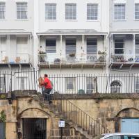
I've recently bought a slightly creased secondhand copy of Redcliffe Press's 1992 collection of Samuel Loxton drawings, Loxton's Bristol: The city's Edwardian years in black and white. It's a nice selection of Bristol Library's collection of the drawings. I'd noticed a drawing of 25 Royal York Crescent, a house I pass quite often, so I thought I'd wander up the crescent on the way to pick up some lunch and try to reproduce it.
On the way back I took a few photos of Clifton Hill Bank as the crowdfunder to make quite a lot of it into a wildflower meadow has just hit its target, so I figured some "before" shots might be a good investment for the future...
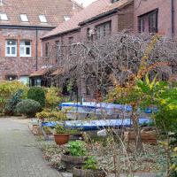
Autumn's a busy season in Royal York Crescent Gardens.
(This is also the reason the photos of Royal York Crescent that come along in a minute look slightly hazy! It's not my lens, honest...)
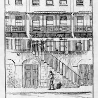
Loxton drawing from Bristol Library collection via Loxton's Bristol, Redcliffe Press, 1995 ISBN 1 872971 86 5.
I tried to capture something of the feeling of the Loxton drawing by snapping a busy postman as part of the general scene :)
There's a plan to cover this with wildflowers, and I just heard that it has achieved funding, so I figured I'd take a chance on taking a few "before" photos, even though I didn't know where the planting will take place!
As it turns out, having read the crowdfunder info, this is roughly the "westernmost third" where the wildflower meadow will be planted.
The crowdfunding effort has blown past its original £1400 target and stands at £1775 so far. The original target was to cover:
- £300 for wildflower seed to sow in the next few weeks
- £100 for non-plastic signage explaining what’s happening – crucial for public support
- £1,000 for plug plants to go in next spring
They also say that most of the existing popular daffodils will stay, which is nice, as that was my favourite spring feature of the bank.
I went out simply wanting to knock off the very last little unwalked section of Clanage Road, over by Bower Ashton, which has been annoying me for a while as it's quite close by and I've walked the other bits of it several times. So, my plan was to nip over to Greville Smyth Park via a slightly unusual route to wander Clanage Road and tick it off.
Along the way, though, I inevitably got a bit distracted. I took a few photos of Stork House, a grand Hotwell Road building that's recently been done up a bit (I imagine it's student lets, though I'm not sure) and which I found a reference to in a book about the Port Railway and Pier the other week, and also tried to match up a historical photo of Hotwells before the Cumberland Basin Flyover System laid it waste, which included some interesting markers I'll have to do a bit more digging into...
I've always loved the bow windows; if you look closely you'll see the window frames are slightly curved to match the curvature of the walls. Must be quite pricey to have repairs done, I'll wager.
Stork House was the Stork Hotel back when the Bristol Port Railway and Pier, which connected Hotwells with a deep-water pier at Avonmouth, was in its heyday.
The Stork Family Hotel at Hotwells sought custom by advertising to seamen on ships arriving at Avonmouth, a combined rail ticket to Bristol and meal in this hotel. The same concern also advertised bed, breakfast, hot evening meal and seven days’ ticket to Avonmouth by BPR for sixteen shillings a week.
— Colin Maggs, The Bristol Port Railway & Pier, Oakwood Press, 1975
I imagine this would have been quite an attractive deal to a sailor, who could stay in Hotwells with its vast plethora of pubs and other entertainments and pop back to his ship in the comparative wastelands of Avonmouth when necessary. (There would also have been plenty of sailors who were already quite used to hanging around in Hotwells while their ship was in town rather than waiting around at the new pier at Avonmouth, and familiar with the local facilities. Thinking about what other "facilities" there may have been for sailors makes me wonder again if the bit of the Hotwell Road that ended up being called "Love Street" might've been a bit of euphemism at some stage or other...)
I found this image on Pinterest and as usual for that site it was annoyingly uncredited, but it seems to be from the book Hotwells, Spa to Pantomime, which I've just ordered direct from Bristol Books. Hopefully I'll be able to update the credit a bit when it arrives.
There's quite a lot in here that I didn't know about and will be researching a bit more, especially the Spa Assembly Rooms, which I think later turned into a school before being demolished for the flyover system, and also Anderson's workshop, a last vestige of the figurehead-carving industry.
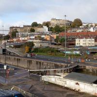
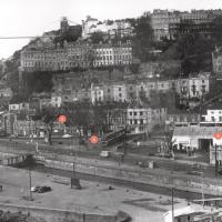
I was trying to recreate the angle of the old, pre-Cumberland Road Flyover System photo that comes next. I couldn't get the angle, mostly because of the height, but this seems to be shot from about the right direction.
That historical photo seems to have been taken from a higher vantage point. The most likely place seems to be the B Bond, perhaps from that fire escape, or maybe the roof? Something tells me it's unlikely they'd let me up there, but you never know, maybe one day I'll ask an archivist; I think that area's part of the Bristol Archives stores...
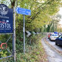
Because yes, we have just had a little excursion into Somerset, technically. So welcome back to Bristol, home of traffic jams.
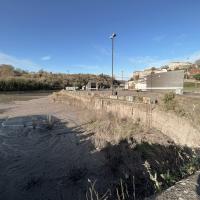
Or possibly a caravan-park-to-be. This is the old Police stables and kennels, and dog-training ground, I think. There are plans afoot for the Baltic Wharf caravan park, forced out of its home by the plan to redevelop the area as flats (which I imagine will be touted as "affordable" and then turn out to be luxury apartments with at most 5% barely-"affordable" apartments around the back), to this site.
The more I research it, the more I find that Hotwells had far better transport links back in Victorian and Edwardian times than it has today. Along with buses that went to more useful places than the City Centre, there were trams, the funicular up to Clifton, the landing stage for paddle steamer services and two railway stations all within easy walking distance of me.
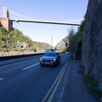
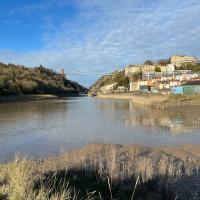
Today I took a day off work as preparation for doing the bookkeeping for my tax return1, and took a wander along to the site of what would have been my nearest station, Hotwells (or Clifton, as it started out in life), nestled in the shadow of the suspension bridge, the Bristol terminus of the Bristol Port Railway and Pier.
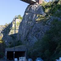
From there I wandered down the Portway, following the original line, until I got to the area around Sneyd Park Junction, where the tunnel from the slightly later Clifton Extension Railway joined up with this originally-isolated BPR line. Then I headed up to Clifton through the "goat gully" at Walcombe Slade, seeing the few above-ground bits of evidence of the tunnel (which is still in regular use) along the way.
It was a lovely day, and a good walk, and it was interesting to daydream of the times when I could have walked a few minutes from my flat down to Dowry Parade, caught a short tram ride to Hotwells Stations, and then headed from there to Avonmouth, perhaps even to board a transatlantic passenger service. The completion of the Clifton Extension Railway that linked the Avonmouth station with Temple Meads made relatively direct transatlantic travel from London via Bristol possible, with passengers travelling up from Paddington to Temple Meads, on to Avonmouth on the Clifton Extension Railway and Port Railway and Pier line, then perhaps catching a Cambpell's paddle steamer—which sometimes acted as tenders for large steamers—to a larger ship that was headed out for Canada, say.
1 I've learned that the best approach is to take two days off and deliberately do something that's not my bookkeeping on the first day, as otherwise I just inevitably end up procrastinating and feeling guilty on the first day no matter what. I have an odd brain, but at least I'm learning strategies for dealing with its strange ways as I get older...
2 Information mostly gleaned from Colin Maggs' The Bristol Port Railway & Pier and the Clifton Extension Railway, The Oakwood Press, 1975.
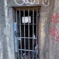
I'm pretty sure from looking at some maps that this is the gate that would have led to Prince's Lane, if it were still passable.
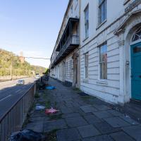
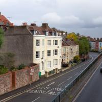
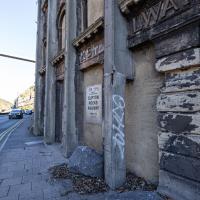
St Vincent's Parade looking a bit more run-down than normal. This street, like the one I live in, was built as lodging houses for visitors to the hot wells. I imagine it was quite a pleasant aspect before later developments like the building of the Portway.
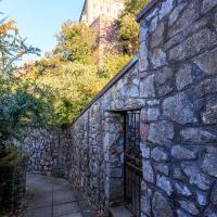
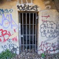
I didn't go inside, just shot through the gate with a steady hand. I have been in there, though, on one of the open day tours.
From The Bristol Hotwell, by Vincent Waite, ISSN 1362 7759, Bristol Branch of the Historical Association, 2002 reprint.
...in 1867 the new Pump Room was in turn demolished so that Hotwell Point could be removed and river navigation made safer. Thus the spring was lost after a long and eventful history. After much public agitation and complaining in the local press the spring was enclosed and piped to a small grotto hollowed out in the rock. Here a pump was set up in 1877 and an attendant provided by the Bristol Docks committee. In 1880 Dr. Griffin wrote a warning letter to the newspapers claiming that his analysis of this pump water proved that it was not from the original spring which in any case was too far away to retain its correct temperature. Yet up to 1913 the pump was still in use, and sometimes supplied as many as 350 persons a day. Then the long-threatened pollution of the water by the river became too obvious to be ignored and the pump was closed. The entrance, blocked up by a small wooden door, can still be seen in Hotwells Road near the Suspension Bridge.
The wooden door is no longer here, but this is definitely the place.
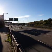
One of the many problems with the Hotwell Road and Portway is the complete dearth of places to safely cross this road, with a varying number of lanes and a speed limit that hits 50mph for stretches.
You can stand for a very long time looking both ways before taking your life into your hands and scurrying across. It took me quite some time to dash to the other pavement at the point where this one runs out and your only choice is to head up the Zig Zag or cross.
Bower Ashton is an interesting little area just south of the river from me—in fact, the Rownham Ferry used to take people over from Hotwells to Bower Ashton, operating from at least the twelfth century to around the 1930s.
It's a strangely contradictory little area, with a cluster of old and new houses sandwiched in between the busy A-roads and significantly more industrial area of Ashton and the bucolic country estate of Ashton court roughly east to west, and also between Somerset and Bristol, north to south.
I've been around here before, mostly poking around Bower Ashton's arguably most well-known bit, the Arts faculty campus of the University of the West of England, but I'd missed at least Parklands Road and Blackmoors Lane, so I initially planned just to nip across briefly and wander down each in turn. On a whim, though, I texted my friends Sarah and Vik in case they were out and about, and ended up diverting to the Tobacco Factory Sunday market first, to grab a quick flat white with them, extending my journey a fair bit.
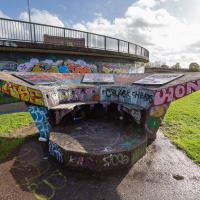
To start with, though, I nipped to a much more local destination, to see something that you can't actually see at all, the Gridiron...
(I also used this wander as a test of the cameras in my new phone. I finally upgraded after a few years, and the new one has extra, separate wide and telephoto lenses compared to the paltry single lens on my old phone. Gawd. I remember when speed-dial was the latest innovation in phones...)
You can't actually see the Gridiron in this photo, but I believe it's still there, under that amazing buildup of silt.
The Gridiron—one of the few photos of it can be seen on the Maritime Mud and Miasma page of About Bristol—was a cheaper alternative to putting your boat in a dry dock. It was a 200-foot long grid (there seems to be some debate over whether the grid itself is actually metal, or in fact timber; I'll have to try to find out), 38 feet wide, nestled here between the north and south entrance locks. A ship captain could sail his vessel over here at high tide, then as the tide gradually receded, the ship—up to 250 feet, as overhanging a bit was apparently okay—would settle onto the gridiron.
At that point an inspection and repair crew could make their way down to the gridiron by ladder and do whatever work they could manage before the tide rose up again.
You can still see some ladders in place, I can only presume they were there to get you down to the gridiron, but that is just a guess; information on it seems quite hard to find.
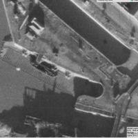
Image from 1946 Aerial layer of KYP Bristol/English Heritage.
As you can see, it was pretty big, and clearly still in use in 1946...
One last snap before we move on. I'm using the wide lens on the iPhone here, and have managed to include a silhouette selfie...
I decided to try out the three lenses on my new iPhone camera. This is the "telephoto" lens. It does a reasonably creditable job, though the phone is oversharpening things a bit and I'm not sure I like the colours much.
And here's the middling lens on the camera. Not bad, though on every shot I've taken on the iPhone so far where it's been able to see blue sky it's managed to oversaturate it for my tastes. Still, I guess they're aiming at the mass market, and the mass market does seem to like oversaturated colour and the sharpening turned up to eleven.
Not bad, and it's certainly better than not having a wide-angle lens in your pocket everywhere you go. I won't complain too much. "My iPhone oversaturates my photos. Also my wallet is too small for my fifties and my diamond shoes are pinching..."

I love the little details in this piece by Philth and N4T4. — see how it's signed by N4T4 in the hair on the left... It's on the corner of Clift House Road and the bit of Coronation Road that heads toward North Street and has replaced this previous piece.
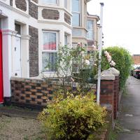
Most of the front gardens on this little stretch retain what's presumably the original garden walls, all rather nicely put together in a chequerboard pattern of bricks.
The Gridiron and Bower Ashton Part Two
03 Dec 2021
On my last wander, to Bower Ashton, I was intending to knock Blackmoors Lane off my list "to-do" list, but got a bit diverted. I also took a little look into the history of the Gridiron, once a cheaper alternative to dry dock that was nestled just south of North Entrance Lock.
Today I had to go to send a parcel off somewhere, so I decided on going to the North Street Post Office via Blackmoors Lane. I didn't have much intention of anything else, but as luck would have it I walked out both at low tide and also as some lockkeepers seemed to be having a bit of a training session, and one of the more senior people was (a) happy to answer a few random questions on the Gridiron and (b) actually knew a lot about it, as Gridiron maintenance had been one of his jobs, more than twenty years ago...

Interesting to see a flatscreen TV left out in the traditional "please take this away for free" place, even if it is only a little Alba.
If you look at the lock wall, about halfway between the lock gates and the inset ladder, you'll see a little square hole. I had no idea what it was for until today, and I had no idea I was going to find out...
There were various people on the other side, I got the impression it was some kind of training session, perhaps. Later I'll have a quick chat with the man in the high-vis jacket over there.
In the meantime, I do always enjoy seeing the giant gridded lock gates uncovered by a low tide.
This used to be a view of the Gridiron, the structure I mentioned on yesterday's wander.
I got curious and went back to ask one of the lockkeepers about it. As it turned out, he knew lots about it as he'd previously been responsible for cleaning it! More about that when I come back (including a historical photo of a boat on the Gridiron for some context) as some of the things he told me needed me to retrace my steps for some more photos.
First, though, we'll nip over to Bower Ashton and North Streeet for a quick bit of shopping and to knock Blackmoors Lane of my "to do" list.
So I might have missed the deadline a bit, then. Just as well I don't own any land around here...
The delights of the Bower Ashton roundabout. Here's a picture of it under construction in the 1960s from the Bristol Archives. Don't tell me I don't know how to show you a good time.
Here it is: my target road to tick off the list.
These are the houses in that archive photo.
Some of the houses along here are definitely 1950s, as you can hear in this oral history, where Eileen Pimm describes the process of watching the house she still lives in being built in 1957.
A Door, a Square, a Few Night Shots
04 Dec 2021
I didn't take many pictures on this quite long wander, partly because Lisa and I wandered across to Bedminster via Bower Ashton, which I've snapped quite a lot of on the last couple of walks, and also because we lost the light fairly quickly, though spending a half-hour drinking mulled wine in the Ashton might have had a little to do with that...
Before we left Hotwells I wanted to visit a door I'd heard about on Cornwallis Crescent and also take a little look at a couple of houses in Dowry Square to consider the 1960s regeneration of Hotwells.
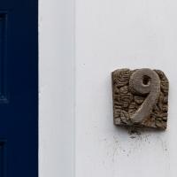
Not the front door we were looking for, but I like the hand-carved digit at 9 Cornwallis Crescent.
I have snapped this section of Cornwallis Crescent before, but apparently only en bloc.
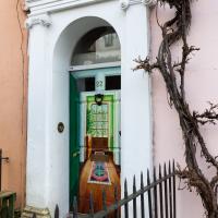
When it's three doors in one! Apparently this door has had this trompe-l'œil effect since the summer, but the vine was only recently cut back, which might explain why I've not noticed it before...
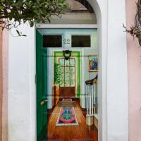
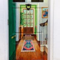
Favourite detail: the American Gothic style family portrait. (Though I'm guessing it depicts the husband and wife of the family, as opposed to father and daughter, like the original...)
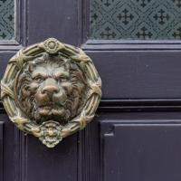
Well, seeing as we're snapping details. Lisa pointed this one out. It's pretty damn big.
A glimpse of Cornwallis Avenue across the back gardens between St Vincent's Road and Dowry Road.
I've snapped this before, but I wanted to give it a bit of context. Peter Ware very much helped to save Dowry Square, as one of a group of "Newcomers" to the Hotwells area in the 1960s and 70s. Hotwells was basically a slum before then, with many of the buildings in a terrible state, including Dowry Square and Hope Square.
As I've recently been reading in Hotwells - Spa to Pantomime, these newcomers took their chances on a very dodgy area and decided to buy and do up a lot of the grand old houses that were almost ruins in some cases.
This early gentrification was important enough that John Boorman, of Excalibur fame made a BBC documentary about it called The Newcomers.)
I've snapped this before, too: the home of Humphry Davy, but here it again for context, as it's currently on the market for £1,200,000...
And here, at the other end of the terrace, is Peter Ware's old house. According to Hotwells - Spa to Pantomime, during the area's regeneration:
One house in Freeland Place was bought for £250 and Peter Ware, a charismatic local architect, bought a stunning corner house in Dowry Square for £200 including bed bugs!
A Water-Based Wander
11 Dec 2021
I woke up on this Saturday with a headache, feeling like I'd not slept at all. As well as that, I'm still in some pain from the wisdom tooth extraction I had a few weeks ago. I moped about the flat for a while and then decided that the best thing to do was to force myself out on at least a small walk to get some fresh air and coffee.
Was there anywhere I could walk locally that I'd never been? Actually, yes! Although it's not a road, and I didn't walk it, there is actually one route that I've not travelled so far in my wanders. And it even had coffee near its far end...
Built on the site of Champions Dock, 1982, it says on the sign.
I walked through this little estate every weekday for years, on my way to catch the commuter ferry into town when I used to work on Victoria Street (in the days before the ripples of the global financial crash finally swept away the council subsidy for the beloved early-morning boat service.)
The Society of Merchant Venturers did, of course, own this dock, like most of the rest of Bristol. Perhaps the most curiosity-inducing document in the Bristol Archives for Champions Dock is "Papers re the Quays & Nuisances, 1751 - 1784", including "Proposals to cleanse the quays to take on Champions Dock and to deal with nuisances in the river". Well, I'm sure there are fewer nuisances now they've filled it in and built an estate on it, but it took them a while...

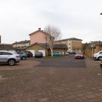
It took me some time to realise that it's the well-planned and well-cared-for plants around this estate that really improves it as a place. It's less of a fairly bland 1980s housing estate, and more of a rampant shrubbery that just happens to have a fairly bland 1980s housing estate inside it. There's a huge variety of greenery, a lot of shrubs and trees and some lovely well-kept individual gardens to boot.
It's also been quite cleverly thought out with a view to defending against such dangers as tagging—much of the ample wall-space is protected by cubic yard upon cubic yard of dense and often prickly planting.
And boats. And bird-feeders. We're only one street back from the Hotwell Road and it's already quite a different feeling.
I came this way on a whim, assuming that I'd be able to find my way back out to the Hotwell Road. At this point we've moved from Rownham Mead to Pooles Wharf Court, who always feel like they're a bit more protective of their space, so a quick exit seemed only polite...
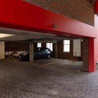
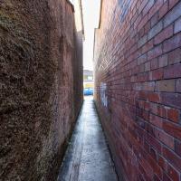
I've walked down this alley once before, but in the other direction, so I don't think I've ever noticed this before. This is a car park, but ...
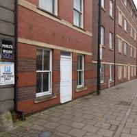
...but you can't tell that it's not a house from the Hotwell Road. I wonder how many times I've walked past the windows and front door and not realised that they're just the frontage of the car park?
I'm heading for a coffee from Imagine That, in the Bristol Marina. Which is on the other side of harbour. Normally I'd have walked down that side to get there, but today...
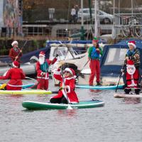
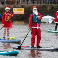
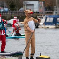
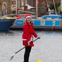
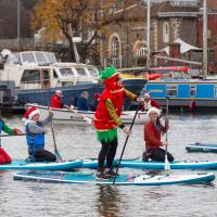
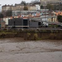
My friend Lisa texted me to see if I wanted to pop down and take a photo or two of the event she was taking part in: Santa SUP. SUP Bristol organise stand-up paddleboarding on the floating harbour, and their annual Santas-on-paddlboards event is quite the sight.
On the way there, I grabbed a historical photo I'd been wanting to recreate for a while of the shiny and new Cumberland Basin flyovers back in 1965, because I reckoned I could fit finding the same viewpoint into my outbound journey. Also, after having only used it on a wander for the very first time yesterday, I managed two crossings in the cross-harbour ferry today to get to the best locations for snapping the paddleboarders...
So, then, this wander is mostly a bunch of photos of paddleboarding Santas. Tis the season... Enjoy!
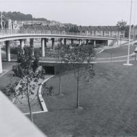
So, mostly this wander will be a panoply of photos of my friend Lisa and her paddleboarding friends making their way around the harbour dressed in Christmas outfits. But, on the way, I figured I'd try to reproduce another historical photo.
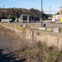
This one's from the Bristol Archives' collection of council Public Relations photos. Its title is "The northern side of the Cumberland Basin Bridges Scheme: Completed and landscaped, 1965".
I find that this actually looks quite nice, all clean and shiny and new. It probably looks very similar to the architect's drawing and scale models and what-have-you that they produce for these sorts of things.
Via Bristol Archives/Know Your Place.
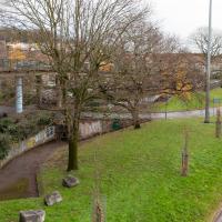
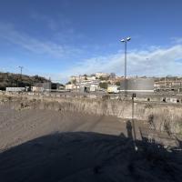
And here's the site today. The weathered concrete and tagging doesn't really improve things, but at least it looks like one of the original trees has thrived.
It's less so much the look of the road system, perhaps, and more that on a busy day it's just an urban hellscape of traffic and noise. On a Sunday like this you could actually believe that children could play here (there was originally a playground to go with the fountain and other features I'm mentioned in the past...)
However, most of the time, just like with the Portway, the sheer weight and (acoustic) volume of the traffic and its accompanying fumes and danger has clearly increased beyond anything the original planners ever envisaged.