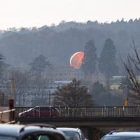
Tagged: sky
I mostly went out to hang out with my friends Sarah and Vik in Bedminster, but along the way I thought I'd take a closer look at something a little nearer home: the last crossing point of the Rownham Ferry.
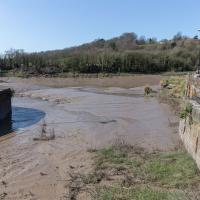
You don't often see Entrance Lock cycle at this kind of tide, but a little boat like that doesn't need a lot of water in the river to manoeuvre.
Yes, okay, it's quite the challenge to spot the hand-made historic artifact in this picture. In the next pic I'll zoom in a bit.
If you were following this route you'll have noticed I just magically took a shortcut through a bunch of houses. That's because I've elided the bit of the route that goes to Sarah and Vik's place and stays there for an hour or two.
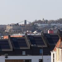
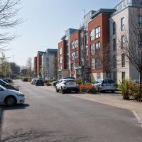
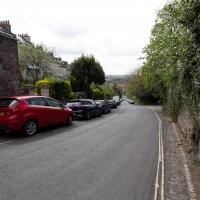
A sign of the times: all the new build homes of Balfour Road have solar panels on top. I bet they're grateful of that, given the current energy price crisis.
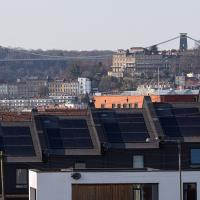
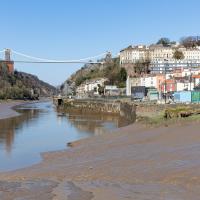
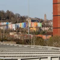
It's interesting to be able to look pretty much a mile back and see the familiar buildings of home. Descending from the top right in the distance we can just see the Observatory on Observatory Hill, then the end of Royal York Crescent, then the Paragon just eclipsing the suspension bridge, then below the bridge on the left there's Windsor Terrace and the more modern Windsor Court flats just visible behind the Bedminster foreground.
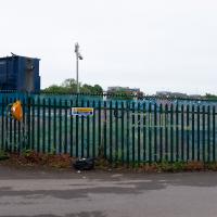
In the distance is EE's temporary cell tower, which I've mentioned before, put up in November 2020.
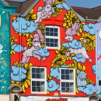
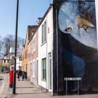
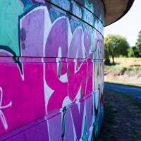
Thought I'd grab a close-up of one of the Six Sisters. This one's Oodles of Poodles by "Lucas Antics", aka Alex Lucas & Paul Fearnside, apparently.
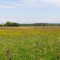
Inflating in the field behind Ashton Court mansion, by the looks of it, the usual venue for the Balloon Fiesta.
Getting back to the Rownham Ferry, the Ashton Avenue Bridge is one of the reasons it was closed. On the excellent Bristol City Docks website you can find a photo called "Rownham Ferry c1906 with Ashton Avenue Bridge nearly built.".
As you'll see in that photo, at low tide the Rownham Ferry was basically just a bridge made out of boats, so it probably still seemed a quick shortcut compared to walking all the way to Ashton Avenue Bridge. I imagine the foot traffic gradually migrated to the new bridge as the ferry was a more daunting prospect at high tide, from what I can gather. Also, the combined road/rail bridge would have allowed people to get the train across the river, rather than stopping at Clifton Bridge Station and using the ferry, I think.
A Coffee and a Curve
27 Mar 2022
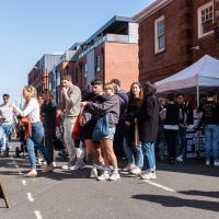
I wanted to have a wander along to the Tobacco Factory Market for some shopping, and checking the map for any leftover nearby streets I noticed a tiny curve of road on the way into the modern flats at Paxton Drive that it didn't look like I'd walked down before. I wouldn't take me too far out of my way, so I decided to head there first and then across to North Street to get my groceries and a coffee...
Here we are at the tiny loop of road that looked like it hadn't been walked. It has very little to recommend itself in any other capacity.
Paxton Drive always reminds me of Blake's 7, but in fact in the episode Stardrive it's actually Doctor Plaxton's drive that's the MacGuffin.
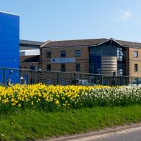
It's better than no daffodils, but they're still rather swamped by the rather industrial setting.
Which then becomes North Street, my destination. I need a coffee and some lunch and some veg.
I squeezed through the busy market and grabbed some ham and some cheese, then exited through the farm shop where I picked up a bottle of milk (an actual glass bottle that I can wash and bring back for a refill; they're like that around here) and some veg. Oh, and a honey and chia seed flapjack. Well, it is the weekend...
I headed here for a take-away flat white for the walk home. I may have to come here for brunch one day soon; I saw a pair of amazing looking brunch plates being delivered as I was waiting for my coffee. Looking at the brunch menu it could have been the Bubble and Bacon, and the Turkish Tagine.
I noticed I had a few things on my "potential wanders" list that could all be done relatively close to home, and in a fairly straight line, so I set off at lunchtime to recreate a photo of a now-defunct pub, wander behind a Spar (which turned out to be more interesting than I'd expected, but I admit it's a low bar) and spend some time browsing in Dreadnought Books before coming home via a coffee from Spoke & Stringer, a little diversion up Gasworks Lane and a tiny bit of the Rownham Mead estate I'd somehow previously skipped.
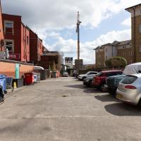
Here we are at the end of Pembroke Place, wandering a little alleyway I'd not previously filled in on the map. I didn't have high hopes for much of interest in this parking area behind Spar and Marcruss Stores. However, I did find something interesting, as we'll see in a couple of photos' time.
I can only guess that the Raj Bari restaurant has been trying to grow their own herbs and spices. Doesn't look that successful at the moment, to be honest, but maybe I'm looking at things that aren't in season...
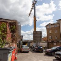
Not much to be seen in this direction except the crane on the site where they're busily filling a gap with new flats. We'll see the front in a little while.
Remnants of the docks railway. These ran around the harbour to Ashton Avenue Bridge to the west, and along to the main Goods Depot at Anchor Lane to the east.
I think this may be the last visible remnant of the harbour railway on this entire stretch of the Hotwell Road. There may still be some tracks around Canons March—that whole area south of Anchor Road had a lot of rail lines—but I've not seen any others west of Jacobs Wells Road.
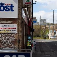
Here's the entrance to Pembroke Place on the Hotwell Road. Looking at old maps, before it was Pembroke Place it was Blackhorse Lane.
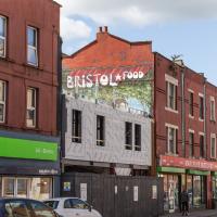
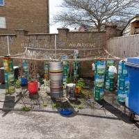
Interesting to think that this street art will presumably be sitting as a layer in between Marcruss Stores and the new-build flats for ever...
Here's a snap from before the cover-up.
Having checked the planning application it seems these may be going to be called the Black Horse Apartments, echoing the former name of Pembroke Place, which is a nice little touch.
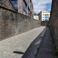
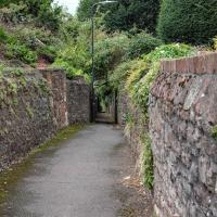
While we're on a theme of things to find down alleyways...
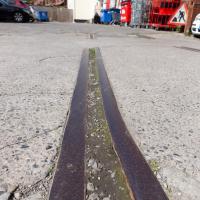
We've had a wander around the old gas works site before but I wanted briefly to focus on one tiny detail, which is to be found in this alleyway called Gasworks Lane.
And here's the detail of Gasworks Lane I find interesting.
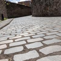
Part of my preferred walk to work is over the cobbles below Redcliffe Parade. It's not one of my favourite bits, because the going is treacherous and you have to look down at your feet all the time to make sure you don't come a cropper on the old and very uneven cobbles.
Here in Gasworks Lane things are different. Apparently the council used an interesting new technique that, according to Bristol247, they've experimented with in a few places across town.
The idea is to keep the classic look of the cobblestones but smooth out the ride for pedestrians and cyclists by taking the existing stones, cutting them in half to give a nice flat edge, then re-laying them lumpy-side down.
I'd not noticed it until I read the article, but I appreciate this technique now, and it'll be interesting to see how much more it gets used around the city.
Easter Monday Gardens and Flowers
18 Apr 2022
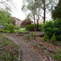
I didn't really set out with a theme of flowers and gardens in mind for this walk. I just fancied heading up to Clifton Village to get lunch. As it turned out, though, Spring was springing, so a minor theme emerged as I started off with the graveyard flowers of Hope Chapel and wandered up to see the beginnings of the new wildflower garden at Clifton Hill Meadow.
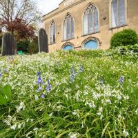
There will be a minor theme of flowers and gardens for this little trip. We'll start at Hope Chapel, though this is more a graveyard than a garden.
A lovely garden. Sadly a little lacking in facilities at the moment, after some scrote (or presumably a team thereof) had it away with their cast iron table and chair set at the end of March. This is why we can't have nice things, etc. etc.
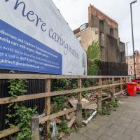
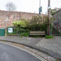
Where fly tipping happens, more like. This scrap of land (with a public bench hidden on the far end, against the back fence behind the red bins) has been a bit of an eyesore for years. I've never been a fan of public billboards.
Recently, though, a property developer has applied for planning permission for a block of flats here, and apparently fenced off the bit where the main entrance will be, even though it's fenced in this little corner of land that everyone assumed was public, council bench and all. And now it's attracted fly tippers, it seems.
I've tweeted at the councillor for the area, Alex Hartley, and he's said he's alerted the council and will try to investigate it/get it cleaned up, so here's hoping...
In the long run, maybe there will be some new flats instead of an ugly billboard and some dull fencing, and I'm all for that.
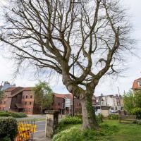
I've taken plenty of snaps looking at Holy Trinity from the road, but I think this may be my first looking at the road from Holy Trinity.
There was a somewhat precarious path in the road protected by those yellow plastic barriers to get around some holes being dug in the pavement. I chose the safer route through the church garden and thought I might as well take a pic from the main entrance.
On a previous wander I posted a historical photo of the church including this tree, and one from the modern day.
It's grown up quite a lot in the last hundred years...
Strategically-placed grit box, because this tight blind (hence the mirror) zig-zag is hard enough work without a sheet of ice on the corner on a winter morning.
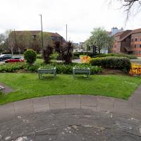
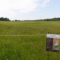
I thought I'd come and see how the wildflower garden was getting along. It's its first year, after a crowdfunder last year raised nearly £2000 to buy seeds, plug plants and signage.
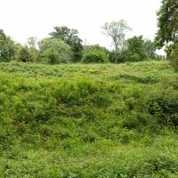
This is one of the three experimental areas. Nothing too apparent so far, but it's early dyas.
A Swing of the Plimsoll Bridge
24 Apr 2022
I was originally going to head over to the Ashton area to see if I'd missed any bits around the football stadium—and also to grab some lunch from the Tobacco Factory Market—but in the end I got a little distracted by having accidentally chosen exactly the right time to see the Plimsoll Bridge swing on one of the first busy days of Spring, where a lot of pleasure trips tend to head out down the Avon (and possibly the New Cut) from Hotwells.
In the end I mostly snapped that, and just a couple of photos from the Ashton area where I grabbed some lunch but didn't do any new exploring.
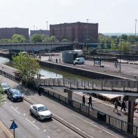
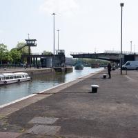
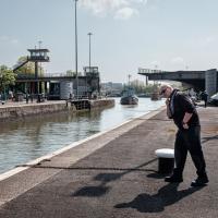
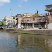
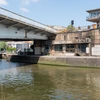
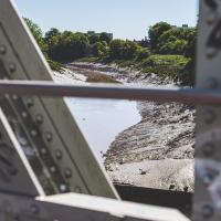
My first hint that there might be something interesting to look at was that the lock gates that I was planning on walking over were open rather than closed. Then I spotted the pleasure boat in the lock, just behind the descending steps from the footbridge there.
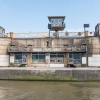
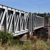
The Plimsoll Bridge is definitely not the oldest swinger in town. In fact, it may be the youngest swinger in town. I think the only other functioning swing bridges on the floating harbour (side-to-side rather than up-down like Redcliffe Bascule) are Junction Bridge (hidden in this picture, it's on the far side of the Cumberland Basin, carrying Merchants Road) and Prince Street Bridge, built in 1925 and 1879 respectively. The Plimsoll Bridge is mid-1960s.
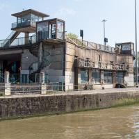
You don't often see this view of the brutalist bridge abutment, because the bridge itself is normally blocking and overshadowing the view here. Excuse me while I take far too many photos of it to be healthy.
I've always particularly liked the spiral staircases and the control tower, which looks like it's escaped from a prison camp.
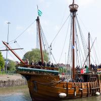
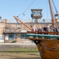
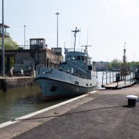
The brutalist bridge abutment is the old bit, of course, as it's mid-1960s. The boat that looks like John Cabot's 15th century caravel is the new bit. This replica was made in the 1990s, and replicated the original's 1497 trip to Newfoundland in 1997, arriving in June at Bonavista, to be greeted by Queen Elizabeth.
She's just had her annual inspection in the Albion dry dock, so I suppose this is one of her first gorge trips of the summer season.
You can see the man whose job it is to work the rather complicated-looking controls in the control tower has come out onto his balcony now the opening procedure is done.
Ticking Off a Pocket of Paths in Leigh Woods
03 Jun 2022
I managed to go for a wander a while ago that was meant to finish off a little tangle of paths in Leigh Woods, or at the very least finish off my wandering of the Purple Path there. And I managed to miss doing either of those things through some kind of navigational incompetence.
Today I woke up with a bit of a headache, feeling a bit knackered as soon as I dragged myself out of bed, but at least with the energy to realise that I'd be better off (a) going for a walk in what looked likely to be the last of the Jubilee weekend sunshine than (b) moping around the flat until it started raining, at which point I could mope more thoroughly.
I had a look at my map, considered going to Ashton Court, but remembered that there was a music festival there today, and instead found these little leftovers of Leigh Woods and decided to have one more try at walking them.
At this point I'd just walked up the steep bit of Rownham Hill and was already too hot and a bit knackered. Still, at least it's levelling out.
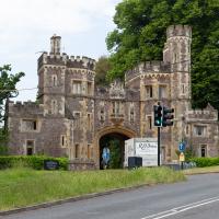
While my main target is Leigh Woods, I do also want to nip into Ashton Court and walk a little path I missed last time I was in the field with the little steam railway in it, so to the gatehouse we cross...
There was actually a gatekeeper today, as it's the weekend of the Love Saves the Day festival, being held at Ashton Court for the first time this year, I think. Happily, as long as you just want to walk a stretch of the grounds away from the festival site, they just wave you in. I wanted to walk a footpath behind the railway track I walked past back in...gosh! November 2020. I've been doing this a while, haven't I?
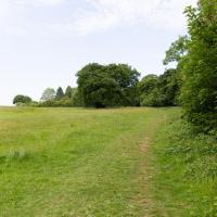
To the left is the edge of the golf course. I'm looking to wander along the edge and the behind the railway, which is behind those trees.
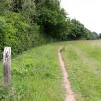
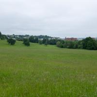
I think I'm pretty much a mile away from my house right here. Nice of someone to erect a marker.
I'm reminded why I like living in Hotwells. In a pretty leisurely hour's walk I can be in the countryside, basically. Or in the centre of town, or Temple Meads station, or shopping on Whiteladies Road, or on North Street... There's a lot of possibility, but it's generally a very quiet area to live in.
I rarely come in this way to Leigh Woods—it's basically the car entrance, and I almost always walk here. On those few occasions I've driven here, I've mostly parked on North Road near my usual pedestrian entrance through sheer habit, rather than driving in and using the official car park that's actually in the woods.
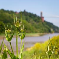
There's a viewpoint "Quarry 5 Viewpoint" marked somewhere along here on OpenStreetMap. I think pretty much all the viewpoints on this stretch have gradually been overcome by forest growth. Here you can just make out the cliffs on the far side of the gorge through trees.
So, I finished off my route along the uncompleted sections of the paths, and by then felt a bit lost, with all the turning around and circling. I headed in what I hoped was the right direction, wondering if I'd spot a landmark, and then realised that the giant hill I was right next to was the man-made iron age fort of Stokeleigh Camp, and of course I knew where I was. D'oh. Sometimes you really can't see the wood for the trees.
I was put into something of an altered state by the little pilgrimage to this random little area of the woods and my backwards-and-forwards wandering. This kind of state has been used, apparently, as a form of divination, which is something I've been researching a bit recently.
It took me a while to find the right term. At first I thought that divination through walking along my map routes might be cartomancy, by comparison with cartography, but of course the "cart" comes from the Latin for "card", so cartomancy covers divination by cards, like the Tarot. Then I thought perhaps geomancy, what with it being somewhat geographical, but the "geo" bit is "earth" in Greek, and geomancy covers, as Chambers says, "divination by shapes formed, eg when earth is thrown down onto a surface".
In the end I tripped over the right name: ambulomancy—"any of various forms of divination that involve walking, often in circles", according to Wictionary. Lexico puts its appearance as early 19th century.
Of course, presumably one actually has to divine something to be an ambulomancer, and the main thing I was divining was that there was coffee and and sandwich in my future now I knew I was near the Leigh Woods exit that would take me across the bridge to Clifton Village.
A Quick Swing Past Ashton Court
05 Jun 2022
Another day not dissimilar to my last wander: I'm feeling a bit tired and rather than just moping around the house I thought I'd find some tiny bit of somewhere that I'd not yet walked and get outdoors. This time I headed for the Tobacco Factory Market in Bedminster, as I often do, but went the long way around via Ashton Court Mansion as I knew there were some footpaths and a small section of road I'd not ticked off up there. Finishing all the Ashton Court footpaths will be quite a long job, but you've got to start somewhere...
I did feel rather better by the time I got home, and, pretty much astoundingly given the weather forecast, managed to avoid the rain completely.
First hint of Jubilee-related decorations on this rather odd balcony at the bottom of Granby Hill. The other decoration on this building is a peeing "KEEP YOU JOB KEEP THE POUND" sticker in the next window along that looks like it dates from the 1990s.
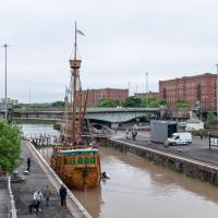
Fairly typical Bristol scene here, as the traffic is held up for a bridge swing caused by a replica of a 15th century caravel.
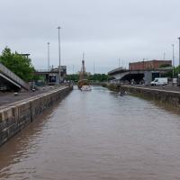
I'd normally walk over those open lock gates she's just sailed through, but it's easy enough to walk down to the gates at the river end.
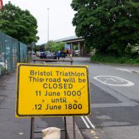
Ah, so it's the triathlon next weekend, then. The swimming bit is done in the Cumberland Basin, so I expect they'll be draining it and re-filling it with fresher water towards the end of the week. I wouldn't fancy it, even in a wetsuit.
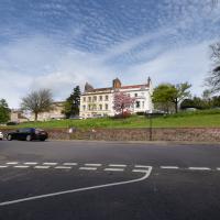
Looks like work has finally started on the new flats on the site of the former railway depot/concrete factory/Bristol International Exhibition site.
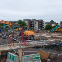
Yup, it's definitely all kicking off. They'll probably manage to build an entire development here before the Council finish fixing the bit of Cumberland Road that collapsed just around the corner.
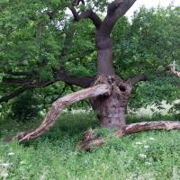
Hard to do this tree justice, as it was both wider and taller than the widest angle of my camera, and any further back the fence gets in the way.
Of course, if I'd brought a full-frame camera with a wide-angle lens, this is exactly the moment when a peregrine falcon would land on a branch at the same time a magnificent stag wandered past in the middle distance. You never have the right lens...
I do enjoy the bits of my walks where I can look back and see Hotwells, or at least the higher bits surrounding Hotwells.
I've been pretty awful at reading so far this year, apparently averaging about one book per month. That's a far cry from 2019, say, where I got through 41 books in the year. Today's wander was prompted by my rubbish reading, as I needed to go hand back some books to the library, because I'd managed to renew them so many times that I hit the limit on renewals. Oops. Several of them were still unread.
So, off to the Central Library for me, tail between my legs. On the way there I did my best to recreate a historical photo of Dowry Square; while I was in the area I walked under the adjacent Norman arch and poked around behind the Cathedral, and I also had a little diversion to the city centre and came back along the south side of the river, hitting some trouble with the lock gates as I finally crossed the harbour back towards home.
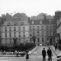
I don't know anything about this photo, really; I saw it pop up on eBay in one of my automated searches for "Hotwells" and this nice, open view of Dowry Square, which is a lot more overgrown these days, made me click that "buy" button. This is a print from a negative in a private collection but more that that I can't really tell you. The "Hepworth" could be Watler Hepworth, as it seems there was a Bristol photographer of that name in about the right period, which I"m guessing to be sometime between the First and Second World Wars. The tram rails and electrical lines are still in place, as you can see.
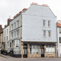
One nice detail is the Bass signs in the windows of what was clearly still back then the York Hotel on the corner of the square. There's some pictures of what I've been assuming is the main bar entrance that faces onto the main road and remains quite well-preserved in a moment...
Nowadays known as York House, and apparently offices, this was originally built by George Tully, like a lot of the rest of the square.
According to this Heritage Statement about No. 10 by Mark Hines Architects he started building in 1723, imagining accommodation houses for Hotwells visitors, but later built this large hotel and other buildings like the Clifton Dispensary at No 12 as the spa became more popular and the square evolved into a centre of medicine. I'm a little confused by that claim as the York Hotel went up c. 1780, according to the listing, when Tully had been dead for ten years, but perhaps it means he planned it before he died.
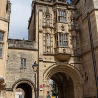
And now we've teleported down the Hotwell Road to College Green, where I found that the library wasn't open yet (I'd forgotten they didn't open until 1pm on a Sunday) so carried on past it and turned through an old Norman archway.
This was a section I wanted to walk, as although I have actually wandered through the arch and pottered around this bit of Bristol before, I think that was one of the days my GPS battery died halfway through a walk, so I never posted any records of it. Here I can redress the issue. We've seen the other side of this grand bit of architecture before, and the next photo has the information plaque which will tell you more about it more concisely than I could.
One fact that isn't on the plaque is that Catherine Hughes, the local artist who made the pomegranates for the front of the Cabot Cafe, had her studio in one of the upper rooms for a time. I presume this was wangled by her father, a local estate agent who was heavily involved in the whole College Green area. From the Clifton and Redland Free Press, 18 April 1900:
Comparatively few people are aware that the interesting structure known as the Abbey Gate House, College Green, the fifteenth century building above the fine old Norman archway, is now given over to the fine arts. It is the studio of Miss Catherine Hughes, and a private view of a charming exhibition of water colour drawings, by that young lady and Miss Ludlow, both local limners, was held last week, when a large number of ladies and gentlemen accepted the invitation to inspect the works, among the company being some local artists. Miss Hughes and Miss Ludlow studied under Ludovici in London, and are now following their profession in Bristol
The Bristol Cathedral School has seen some controversy over the years, especially after it was given permission in 2013 for the Primary School to take over some of the Central Library. They turfed out some of the archives, which is presumably why I need to wait a week when I order an old book from the library, as someone now has to hoof it down to the B Bond warehouse to fetch it for me, rather than just downstairs.
Founded in 1140, dissolved and then re-founded by Henry VIII in 1542 after he dissolved the monastery, it's only very recently become a City Academy. It is allegedly non-selective these days, but my guess would be that its pupils' parents are significantly posher and richer than others in the local catchment area.
One last view of the Choir School building, the old Deanery, before we leave this area and head into town.
A fairly wrong clock, given that I took this at about 12:40. This used to be the Midland Bank.
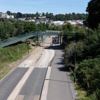
I'm in the habit of going over to the Tobacco Factory Market on a Sunday. I think I've walked all the routes around that way, but as a Plimsoll Bridge swing let me cross the road to the far side of Brunel Way on my return journey and I took a couple of photos of the brownfield development at the old Ashton Gate Depot site I thought I'd call it a Wander and pop some photos up.
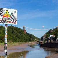
"STEEP DROP INTO MUD AND FAST FLOWING WATER".
This sign has been mildly annoying photographers since it was put up, getting a bit in the way of several alternative views from this bit of land. I presume it was installed in response to some kind of accident, but I'd hazard a guess that whatever difficulties someone got into probably wouldn't have been prevented by a sign that stated the completely bloody obvious.
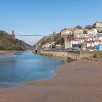
We start the day wandering around the periphery of the Cumberland Basin flyover system. Across Entrance Lock and then around the edge of Spike Island is my preferred route to get to Asthon Avenue Bridge and cross the river.
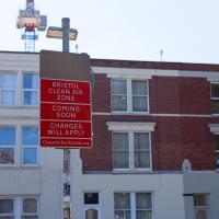
The Clean Air Zone is being introduced later this year (currently they say 28 November 2022, but I think it's already been delayed twice.)
The scheme will see charges instituted for certain vehicles entering parts of the city, especially older diesel cars. This is to encourage people to change these older cars or find alternative routes or modes of transport. Apparently there are grants and loans available for upgrades on offer to private citizens and businesses.
This should only have positive effects for me, as I live just inside the zone, and I drive a recentish petrol car with an efficient and not-so-pollutey engine. In a perfect world, therefore, this scheme means my area might eventually start meeting the government's standards for air quality. This Bristol 24/7 article has some good info, including an estimate that there are currently 300 premature deaths per year from traffic-related air pollution in the proposed Bristol zone.
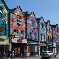
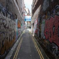
The street art is still looking good, but one of these properties has been turned into such low-end multiple-occupancy accommodation that it got into the Bristol Post this week with pictures of one tiny room with a shower alongside the bed serving as the sole room per person, with a toilet shared between four "studio rooms". I suppose this is actually better than the student accommodation I had in my first year at Warwick, but at least that was actually on campus...
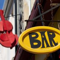
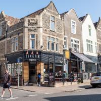
El Rincon is a long-established Spanish cafe/bar on North Street. The BAR sign always reminds me of the quirky typefaces used in things like The Pink Panther.
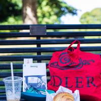
Veg from the Tobacco Factory farm shop in my Idler tote and a market croissant to go with my Coffee #1 iced latte, I feel only the need to sit on a bench and read a Saul Bellow novel to fully sink into my Southville hipster character. I should probably have ridden a penny farthing here and bought some chia seeds.
But, of course, no Metrobuses, as they don't do anything as useful as running on a Sunday.
Nipping Up the Zig Zag to the Shops
19 Aug 2023
It's been a long while since I did one of these walks.
I'm thinking of finishing up the project by walking one or two last bits of road, thus being able to declare with all honesty that I've done my best to walk every public road within my mile (and quite a few alleyways besides.) As a prelude, and just because I felt like it, I decided to drag out the camera and GPS on this little wander to the local shops.
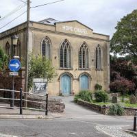
I may not personally be a fan of evangelical Christianity, but at least they keep the place looking nice. It's still very tidy since the recent renovation, installaltion of solar panels on the roof and repainting of the HOPE CHAPEL sign.
My exercise for the day is to be a short sharp shock: first we descend down Hinton Lane to the Hotwell Road, then I'm going to ascend the Zig Zag, and possibly die in the process. My fitness has suffered recently because although I've been keeping my step count up it's mostly been on the fairly flat commute to work and back, so hills are coming as a bit of a shock to the system at the moment.
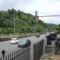
I would absolutely love to have lived in this area before World War II, before the widening of the road knocked down so many interesting things and replaced them with a few busy lanes of traffic, before the tramways were bombed into oblivion, and while you could still wander down to these moorings and catch a White Funnel boat out to Ilfracombe, or at least wander down to Hotwells Station and catch a steam train out to Shirehampton, Sea Mills or Avonmouth. Pre-1934 I could even have skipped the arduous walk up the Zig Zag and taken the 40-second ride up the funicular railway to Clifton Village...
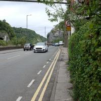
The Hotwell Road really needs more facilities for pedestrians. I spotted plenty of other walkers just on my brief trip along this short section, but all of us were being forced out to share the road with the busy traffic or prevented from crossing to the safer side and back as we made our way.
Thin pavements and a lack of crossings really show how much the car is king in this bit of Bristol, despite the gorgeous landscape.
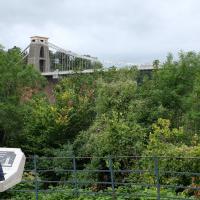
The reward at the top is the viewing platform of the Suspension Bridge, always busy with tourists.
I was actually planning to take an unexpected short-cut through a pub as an interesting little diversion on this wander, but sadly the pub was closed—I suppose before midday it's a bit of a reach to expect any pub to be open, even on a Saturday—so I headed for the shops instead. I'll have to do the short-cut trip one afternoon...
First I browsed the books at Rachel's & Michael's Antiques on Princess Victoria Street, where I bought CFW Dening's Old Pubs of Bristol as it mentions Hotwells a few times, then I grabbed my lunch from Parsons Bakery. There didn't seem to be anything new or interesting to snap along the way, so we'll now skip to the last couple of photos I took on my way home...