Tagged: sky
A Constitutional to Burwalls and Back
21 Dec 2021
The recent lack of posts here is mostly due to my feeling very run down following having a couple of wisdom teeth extracted. Having had an emergency appointment yesterday1, hopefully I'll be on the mend now, though it does mean I'm on the kind of antibiotics where you can't touch alcohol for the whole of the Christmas period. I have tried to keep myself a little distracted from the pain by working on the nuts and bolts of this website—you should notice that the front page loads rather faster now than it used to, and that there's a shiny new statistics page that I'll probably be continuing to work on. Oh, and you should find that the tags below the photos are now clickable and will take you to a page of all other wanders that have photos with the same tag.
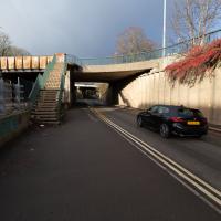
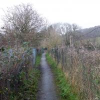
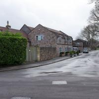
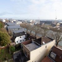
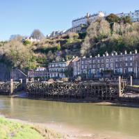
Today I felt like I needed to drag myself out of the house, but I didn't want to go too far, and I needed to get to the Post Office up in Clifton Village to post a Christmas card (spoiler for my parents: it's going to be late. Sorry.) As luck would have it, idly looking at the map I spotted that I'd missed off a section of Burwalls Road in the past, and that's basically one of the long-ways-round to Clifton Village, crossing the river to Rownham and walking up the hill on the Somerset side before coming back across the Suspension Bridge.
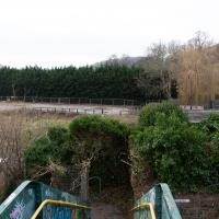
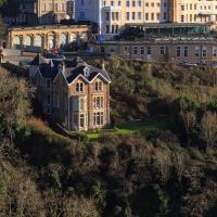
As I was heading for Burwalls Road I decided to make Burwalls itself the focal point of the walk, but unfortunately the mansion grounds are private and the place is hard to snap. Still, at least it gave me a destination. Burwalls was the mansion built by Bristol press magnate Joseph Leech, who I've mentioned before after buying a vintage book he wrote on a previous wander. There's a good article about the house on House and Heritage which has some photos from angles I couldn't ever get to. (Well, maybe with a drone, but it seems like the kind of area where they may be kitted out for clay pigeon shooting, so I probably wouldn't risk it.)
1 My dentist admitted that she probably needed to keep her internal monologue a bit more internal after we started the appointment with her staring into my mouth and immediately saying, "oh, *that's* weird." These are words one doesn't want to hear from a medical professional.
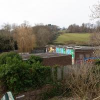
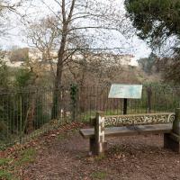
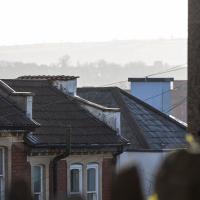
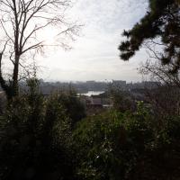
As my plan was to knock off the remaining section of Burwalls Road, my first photo is the small segment of Burwalls itself that you can see from near my house. Burwalls is the mansion on the hilltop, peeping out about halfway from the left edge of the photo and the Suspension Bridge.
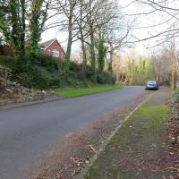
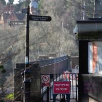
There was a notice of seeking possession on the gate when I got around to the far side. Looks like it's definitely going to be the replacement for the caravan park at Baltic Wharf. Shame for the caravan folk, really; this is sandwiched between major roads and not anything like as close to the pubs and other tourist-friendly places around the harbourside.
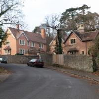
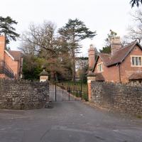
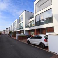
The Burwalls site is split into two halves, according to some of the estate agents' details I've looked at. This read section has some more modern-looking places where you can buy an entire house, if you're rich.
The mansion itself has been divided up into "lateral apartments". If you don't know what those are, you probably can't afford one.
Maybe if I'd got interested in this project before the university sold the place, I'd have been able to pop in and have a look around. Still, I can't blame them; when the estate was on the market in 2012 it was Bristol's most expensive house, valued at £5m, according to the Daily Mail.
That was for the main house and the old stables and lodge, which have been converted to the housing we're looking at. Given that by 2017, just a single one of the five aforementioned lateral apartments in the main manor house was on the market for £1.5, I think the developers probably did quite well...
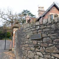
Our first close-up sight. Sadly the main building is disappointingly hard to take a photo of. Still, I suppose if I'd just bought a flat for one-and-a-half million quid I'd probably not want some plebe with a camera being nosy around the place.
I was just about starting to feel better—the antibiotics seemed to have kicked in for my dental issues, and it had been some days since I'd left the house, and I was at last starting to get itchy feet. So, a wander. But where? Well, there were a few industrial bits near Winterstoke Road in the Ashton/Ashton Vale areas of Bristol that needed walking. I knew they were likely to be quite, well, unattractive, frankly. So why not do them while I wasn't feeling exactly 100% myself? Maybe it would fit my mood. Hopefully you're also in the mood for a bit of post-industrial wasteland, for that's what some of this feels like...
Then, at the last minute, I thought again about the Bristol International Exhibition—I've got a book about it on the way now—and that gave me another goal, which could just about be said to be in the same direction, and I decided to walk significantly further than my normal 1-mile limit and try recreating another historical photo...
Sadly I don't know much about the Ashton area; it's just on the edges of my mile and I rarely have cause to go there. It's brimming with history, I'm sure: the whole South Bristol area rapidly developed from farmland to coal mines to factories to its current interesting mixture of suburbs and industrial work over the last few hundred years. As a more working class area less attention was paid to it by historians, at least historically-speaking, than the Georgian heights of Clifton, and much of it has been knocked down and reinvented rather than listed and preserved. I see here and there some of this lack is being addressed, but I'm afraid I'll be very light on the history myself on this wander, as most of my usual sources aren't throwing up their normal reams of information as when I point them at Clifton, Hotwells or the old city.
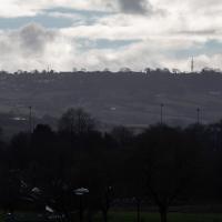
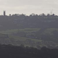
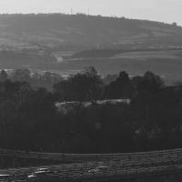
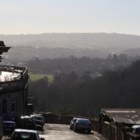
These are some hills I'm not heading for today, but I love the distant view of Dundry from Hotwells. The silhouetted church towards the left is St MIchael's Church, Dundry, whose tower was built in 1481.
The other towers around Dundry have more recent heritage. I believe Dundry East transmitter still sends out the analogue signal for BBC Radio 4, and lets me listen to The Archers on an old Roberts radio when I'm doing my cleaning on a Sunday morning. Some bits of my life are still quite old-fashioned.
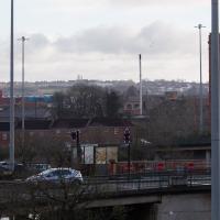
This may be somewhere around my actual destination today, though perhaps a little too much toward the east.
The buildings and green space on the hill in the background are the Knowle West Health Park. I'm pleased to have figured this out by using an OS map and a ruler and projecting a line from where I'm standing through the Tobacco Factory flag that you can just see poking up from Bedminster (you can see it on the corner of the building in this earlier pic](https://omm.gothick.org.uk/image/7175), then looking for densely-packed contour lines further out of town. Very old-school, but it worked!
I'm probably heading in more of a Bedminster Down direction. It's a similarly elevated green space further west, which is hidden behind the bond warehouse on the right in this pic.
I nearly didn't take this photo, having snapped this view so many times before, but I do find it almost completely irresistible.
I've often wondered about writing some kind of neural-computing based app that could look through all of my photos for snaps of this view and mash them all together into a time-lapse, or something, but that would be quite the project.
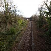
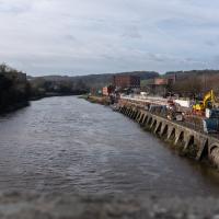
A better view of the ex-railway depot and part of the former Bristol International Exhibition site that I've mused about before. That's why we're on this wander, in fact: curiosity about an old photo of the site. But not a photo from round here: one taken from quite a ways beyond my normal mile radius. It's going to be a bit of a hike.
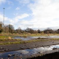
There will also be some terrifyingly industrial bits of south Bristol along the way, so be prepared for a bit of urban decay and industrial scenes.
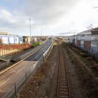
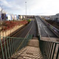
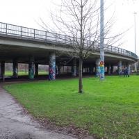
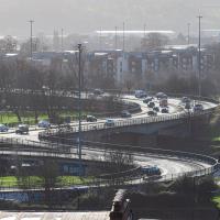
Raised section of the Metrobus route. I've been this way before on a Wander, but also, on a day when there weren't any buses, actually walked that ramp. It was fairly underwhelming.
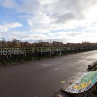
This area continues to be blighted with ugly and neglected-looking infrastructure. We're just on the edges of Ashton Vale, which is among the 30% most deprived areas in the country. At the north of my one-mile radius we have Clifton, among the least 20% deprived. Source: UK indices of deprivation.
A Random New Year's Day Wander
01 Jan 2022
I picked a fairly arbitrary reason for a wander today. Really, I just wanted to do a New Year's Day wander just to get out of the house and to set a precedent for the year to come.
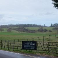
My ostensible reason was to investigate what looked like a road on my map that quartered the lawn in front of the Ashton Court mansion. As it turned out, this is just a muddy footpath/desire line similar to a half-dozen other tracks nearby, and must be some kind of bug or misclassification with the mapping system I'm using, but that's not important. What's important is that I went for a little walk on the first day of the year. As a bonus, I did happen to wander down a couple of sections of new footpath, so technically I broke some new ground too, which is nice.
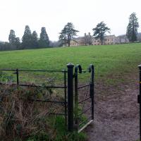
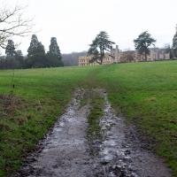
Strange to think that there was once, briefly, a castle here. More on that on some future wander, when I try to recreate another historical photo of the Bristol International Exhibition.
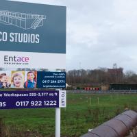
I still have no really clear idea what this place is, and their website's not much enlightenment, either. They seem to think this is ten minutes' walk from the city centre; I'd love to know what kind of space/time warp technology they're using. Seven-league boots, perhaps?
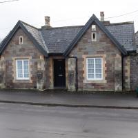
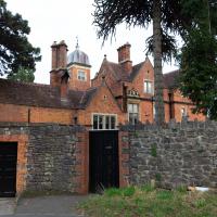
...and this is the Kennel Lodge itself. Presumably you'd want to keep your hounds a fair distance from the house just to keep the racket out of earshot.
Which seems a bit odd, given that it's not in Hotwells wouldn't really lead there in either direction. Looks like a fairly modern development; maybe it's just one of those roads where the developers picked a roughly local name of out a hat.
Though this isn't the allegedly main-ish road I was trying to find, so I didn't pop through it.
This bit that's marked on my map in the same style as a normal, tarmac road. Clearly it's not. I think perhaps I need to figure out what's going on with the mapping on this website, as the main openstreetmap site, which is where I'm getting my data from, does seem to have it as a simple track.
A small challenge for the new year, I suppose... Perhaps a refresh of the way the map looks on the site would be a nice start to the year anyway!
Near and Far
05 Jan 2022
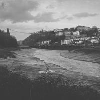
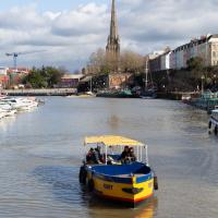
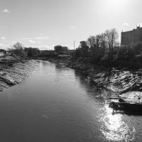
I took advantage of a rare recent day where it wasn't tipping down with rain to get away from my desk on a lunchtime workday and head up to Clifton Village. I'd hoped to snap a reproduction of historical photo which I'd worked out had been taken from the Suspension Bridge, but the gods were not smiling on me. Still, taking only a nice long lens with me worked out very well as the lovely haze of the day made more distant views quite dramatic...
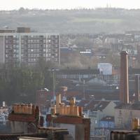
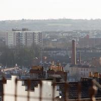
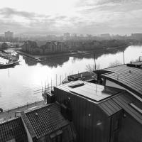
The Nova Scotia pub bottom right, then behind it the chimney of the previously coal-fired pump house at Underfall Yard. In the background behind that and to the right is the Tobacco Factory, with what looks like a little red shed on its roof that I presume is actually a stairwell exit to the roof. On the left-hand side at about the same distance away is the large council block of Little Cross House. It always seems quite calm and tidy when I pass it, which is very regularly, but the Bristol Post painted a different picture in 2019 in their story headlined "Residents of 'forgotten' tower block demand council action over 'nightmare' living conditions":
People living in Little Cross House, a 13-storey council tower block in Southville, said their lives are plagued by poor living conditions, damp and mould, and neighbours from hell, drug dealers, discarded needles, vandalism and anti-social behaviour.
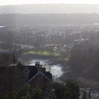
In the far distance, across the Southville rooftops, are the green hills of the Knowle West Health Park, I think.
If I'd really considered it, the fact that there was a bloke in high vis standing on the bit of the bridge I wanted to take a photograph of might have warned me what was going to happen...
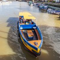
Damn it. That's the bit I wanted to take my photo from. Still, at least on the way here I got some nice pics that I probably wouldn't have tried if I hadn't taken long lens out specially.
This is almost the photo I wanted to take, but the historical photo I want to reproduce was definitely taken from further to my right, on the bridge, and you should still be able to see the remains of Clifton Bridge Station (hidden from here by the trees on the right) and the last bit of slipway of the Rownham Ferry (hidden by the prominent house in the foreground.) This snap is also a bit marred by the temporary safety fencing I had to shoot through.
Ah well, another day, I suppose.
Quick Clifton Jaunt Finishing with Southville
09 Jan 2022
It's been pretty dismal recently, weather-wise, so when Sarah called up to say that she and Vik had just left the swimming pool at the student union building up in Clifton, and would I like to join them for a trip to the Last Bookshop, also known as The £3 Bookshop, for reasons you can probably deduce, I leapt at the chance.
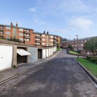
Not many photos on this walk, but I did manage to get down a little road I'd never been to before, basically just the access road to a car park at a block of flats, but it was on the map looking all tempting, so I figured I'd knock it off the list as we were passing.
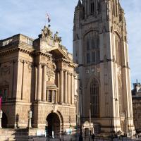
The museum and the Wills Memorial looking resplendent. Behind me on this chilly morning was someone sleeping in a doorway under a quilt, with a plastic suitcase presumably containing their entirely worldly possessions. It's a place of contrasts, Clifton.
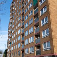
By complete coincidence, I took a photo of this block last week from a great distance (well, a mile, anyway) and then noticed that I hadn't actually walked along its access road and back. So here it is, rather closer up.
After this Sarah and Vik and I nipped to the Tobacco Factory Market where I managed to resist buying a copy of the Cowboy Junkies' The Trinity Session in great condition on the original vinyl. After resisting buying any books in the £3 bookstore earlier this pretty much depleted my reserves of energy for the day, so I headed back home without snapping any more pictures :)
Lunchtime Reproduction (of an old photo...)
17 Jan 2022
This was basically the quick lunchtime jaunt I tried to do at the beginning of January, only this time I actually managed to get to roughly the viewpoint I'd been hoping for to recreate a historical photo of the Bristol International Exhibition.
I did this walk about a month ago, but I've been a bit poorly and not really up to doing much in my spare time, and it's taken me this long to even face processing even these few photos. Hopefully normal service will be resumed at some point and I can carry on trying to walk any roads and paths that I need to do to make this project feel complete...
We've been as far as we can go down there on an earlier wander. From the top you'd just think it led to the Hotel car park.
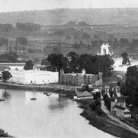
From Bristol's Lost City, by Clive Burlton, available from Bristol Books; photograph from the author's own collection.
(And extra credit goes to my parents for buying me the book for my birthday! Thanks!)
The Bristol International Exhibition site, presumably around 1914 or not long after. You can see the Rownham Ferry in use, too. I still find it pretty amazing that there used to be a busy ferry and a significant railway station on this little scrap of land that I just used to know as the grassy bit at the start of the towpath, let alone a replica of Bristol Castle!
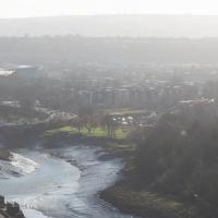
Unlike my last attempt I successfully managed to get somewhere near the vantage point of the historic photo this time...
I should probably have tried to get it at high tide to make it a bit more comparable, but you can't have everything.
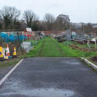
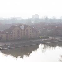
You can see the White City Allotments—those glints of light toward the middle are mostly reflections from greenhouses—where the "White City" of the Exhibition used to stand. There's still a glimpse or two of the railway line to Portishead to be seen, too, along with a vestige of the Rownham Ferry slipway.
Mostly though it's the modern things that stand out—the long line of flats along Paxton Drive, the curve of Brunel Way across the river, and the roof of Ashton Gate Stadium...
Just think, I could upgrade to a flat just up the hill from me, with an extra bedroom, for only about three quarters of a million quid...
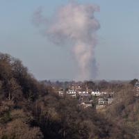
I think this may be the "avonmouth monster"; a plume of outflow from the works at Avonmouth. I took a photo of it some years back and asked BBC weatherman Ian Fergusson about it in the comments on this blog post—I'd recently done a tiny segment for his show "Wild Weather of the West" on how to photograph lightning—and that's what he said it was. This looks suspiciously similar and is in the right direction.
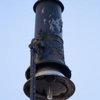
Poor thing needs a lick of paint. If it did used to be an electric arc lamp, I wonder when it last actually worked like one?
Anyway, time to stop my historical wanderings for the day, it's time to pop back home for an afternoon's work, more's the pity...
Lunchtime Cliftonwood Wander
18 Jan 2022
Another workday, another quick lunchtime trip to get me out of the house. This time my flimsy pretext is a tiny bit of Clifton Vale Close that I'd apparently not walked, and the fact that although I'd walked down Church Lane at least once before I still hadn't taken a single photo of it. Really I just fancied a mosey through Cliftonwood in the sunshine, with the promise of a coffee from Clifton Village at the top of the hill.
Or a bit of it, anyway. Getting back into the spirit of this project a bit by knocking off the odd end of a road that I'd noticed wasn't filled in on the map yet.
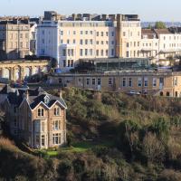
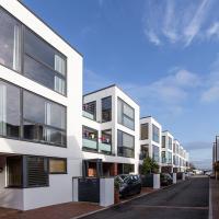
As modern flats go, these seem pleasant enough, and some of them will have amazing views. The don't seem terribly inspiring inside, from what I've seen of Rightmove pictures, but they certainly could be worse.
We've popped down here before, on the site of the Clifton National School that didn't survive bombing in the war.
Today, the modern flats look to me as I imagine their original models would have done back when they were still just an idea on an architect's table (or more likely computer monitor, I suppose.)
I used to live down there, in the block on this end, Portland Court. I recently found a photograph by the late local photographer George Gallop (he had a place on the Hotwell Road) of these Baltic Wharf flats being built, taken from a similar vantage point.
The spire of St Mary Redcliffe, just left of centre on the horizon, is about the same location as the office I work in, at least a few days a week. I took the job half on the basis of the location meaning a lovely commute down one side or other of the harbour. And then a week after I started the first Covid-19 lockdown kicked in and I didn't get to do the commute again for many months.
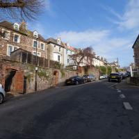
I really do like these little houses. Hate to think how much you'd have to pay for them, though.
Ouch. Just looked it up. Apparently the average property sale price over the last year was £750,000. I suppose the Tesla parked to the left there should have given away the income level; the Model S sells for about £75,000 in the UK.
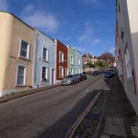
This is the road I didn't have many (or any) snaps of that inspired my route today, not that I need much of an excuse to traipse around Cliftonwood on a sunny lunchtime.
It's a perfectly nice street, but there's nothing too photogenic in it. I suppose that's why I didn't feel the need to raise the camera too much on previous occasions.
Bedminster Trip for New Walking Shoes
26 Feb 2022
I needed to buy new walking shoes—my old ones were squeaking and it was driving me up the wall—so I ordered some for collection from Taunton Leisure on East Street in Bedminster, and decided to make picking them up an official wander.
I didn't cover any new ground within my mile, but I did take advantage of the trip to take in a few interesting things just outside my normal radius, mostly New Gaol-related. Along the way there are a couple of sanitation-related diversions, including a visit to a rare manhole cover. You can hardly wait, I can tell!
Anyway, on to happier contemplations. Here we see the Merchant's Road bridge (Junction Bridge, to give it its official title) swinging closed behind the Pride of Bristol.
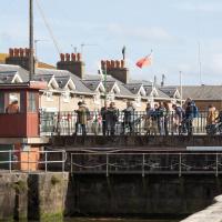
This is about the only circumstance that can slow me down on a harbourside walk, but the bridge swings are normally over fairly quickly and there's usually an alternative crossing not far away, too.
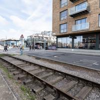
At the end of the tracks is the engine shed built into the end of the M Shed museum.
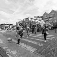
Wapping Wharf was fairly busy. I didn't stop for a coffee from Mokoko or Little Victories, though it's always tempting.
Here's a first glimpse of something I'm interested in seeing even though it's just outside my mile radius.
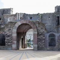
This gateway is a remnant of the New Gaol, which is apparently sometimes called The Old City Gaol, oddly. I suppose it depends on one's historical perspective.
The original New Gaol was destroyed during the 1831 Bristol Riots, and replaced with a redesigned version including this gate. That replacement New Gaol was itself replaced by Horfield Prison (which still stands and still operates as a prison) in 1884 and demolished in 1898. So, in fact, you could argue that this the ex-old-new-New Gaol. Clear? Good.
In Which We Begin and End with Love
05 Mar 2022
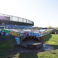
I had a lot to get done around the house, so as soon as I heard there might be a shiny new piece of street art near me, under the Cumberland Basin flyovers, I immediately decided that was all the excuse I needed to set off on a round-the-harbour lunchtime walk to get some fresh air and see if I could spot it. So, here's a circular wander that takes in graffiti, boats, wildlife and graffiti again...
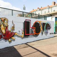
A brand new piece by AcerONE and SEPR, replacing their earlier collaboration.
It's nice to have someone brightening up the space under the flyovers regularly.
There's a few more shots of this one when we return here at the end of the walk.
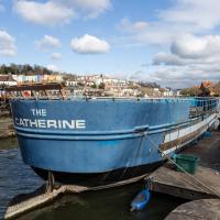
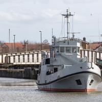
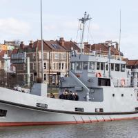
Not much change since the last time I saw her, but certainly a heck of a difference from the start of the "refit".
Leigh Woods Purple Path
12 Mar 2022
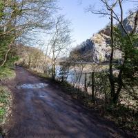
There's a few tracks in Leigh Woods that lie within my mile and show up on my map but that I've not walked yet, so I decided to take one of my traditional big long walks through the woods on this nice crisp sunny morning.
For years—decades, even—I've been doing a similar route from my place, along the towpath to the far woods entrance, up the hill for a varied walk on one of the marked tracks and then across the Suspension Bridge to Clifton Village for a coffee-based reward. It's my default "long walk", really, and I almost always enjoy it. Today, at last, spring actually seemed to be springing, which made for some extra positivity...
There have been new plans put forward by the council for the Western Harbour Development The previous plans would have put a bridge in between here and the suspension bridge. I've not looked at the new ones yet.
I'm sure both the entire flyover system and its monument bench looked splendid when they were first put up, in 1965.
Here you can hear a live performance of the song Virtute et Industrial by Adge Cutler and the Wurzels that includes a brief reference to the then-newly-completed flyover system:
Hast seen our brand new bridge, up there in Cumberland Basin?
The cars go by like thunder, and up and round and under
Where they goes, nobody knows, tain't no bleedin' wonder!
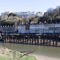
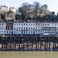
I've always enjoyed the optical illusion that these houses are on stilts from this angle. In fact there's the Hotwell Road the National Express coach is on in between the houses at the back and the disused landing stage at the front, as you'll see in the next pic of the adjacent terrace.
The Campbell Brothers' White Funnel Fleet operated from the Hotwells landing stage up until relatively recently. Last week I bought an old timetable on eBay and popped it up on my blog for anyone who might be interested.
In 1965, the year of the timetable, there were regular sailings from here along the coast or over to Wales. You could go to Ilfracombe and Lundy Island, or head across to Barry, Penarth or Cardiff. All from within five minutes' walk of my front door.
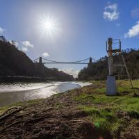
The towpath is a lovely stroll in weather like this. Waterproof walking shoes help, though, as the puddles are often wide enough to span the entire width. I baptised my new walking shoes on this trip.
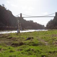
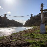
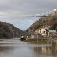
This is probably the most popular spot to take photos of the bridge from this direction. I'd guess the large majority of photos of the Suspension Bridge are taken from the other side.