Tagged: cloud
Near and Far
05 Jan 2022
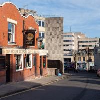
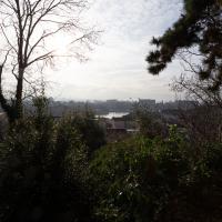
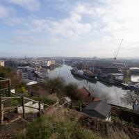
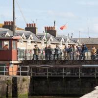
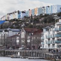
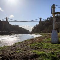
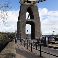
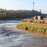
I took advantage of a rare recent day where it wasn't tipping down with rain to get away from my desk on a lunchtime workday and head up to Clifton Village. I'd hoped to snap a reproduction of historical photo which I'd worked out had been taken from the Suspension Bridge, but the gods were not smiling on me. Still, taking only a nice long lens with me worked out very well as the lovely haze of the day made more distant views quite dramatic...
Quick Clifton Jaunt Finishing with Southville
09 Jan 2022
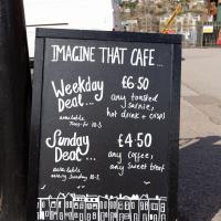
It's been pretty dismal recently, weather-wise, so when Sarah called up to say that she and Vik had just left the swimming pool at the student union building up in Clifton, and would I like to join them for a trip to the Last Bookshop, also known as The £3 Bookshop, for reasons you can probably deduce, I leapt at the chance.
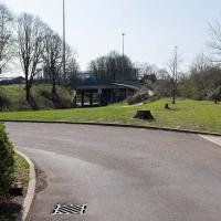
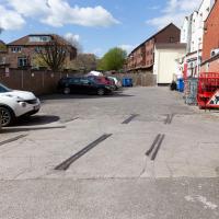
Not many photos on this walk, but I did manage to get down a little road I'd never been to before, basically just the access road to a car park at a block of flats, but it was on the map looking all tempting, so I figured I'd knock it off the list as we were passing.
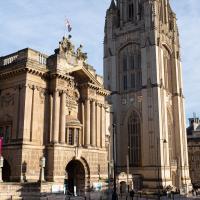
The museum and the Wills Memorial looking resplendent. Behind me on this chilly morning was someone sleeping in a doorway under a quilt, with a plastic suitcase presumably containing their entirely worldly possessions. It's a place of contrasts, Clifton.
Lunchtime Cliftonwood Wander
18 Jan 2022
Another workday, another quick lunchtime trip to get me out of the house. This time my flimsy pretext is a tiny bit of Clifton Vale Close that I'd apparently not walked, and the fact that although I'd walked down Church Lane at least once before I still hadn't taken a single photo of it. Really I just fancied a mosey through Cliftonwood in the sunshine, with the promise of a coffee from Clifton Village at the top of the hill.
Or a bit of it, anyway. Getting back into the spirit of this project a bit by knocking off the odd end of a road that I'd noticed wasn't filled in on the map yet.
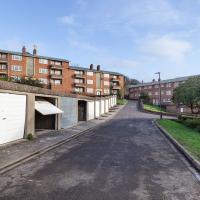
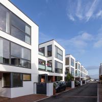
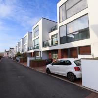
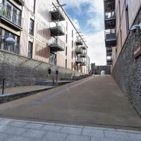
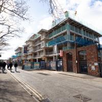
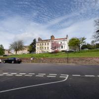
As modern flats go, these seem pleasant enough, and some of them will have amazing views. The don't seem terribly inspiring inside, from what I've seen of Rightmove pictures, but they certainly could be worse.
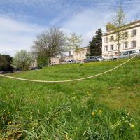
We've popped down here before, on the site of the Clifton National School that didn't survive bombing in the war.
Today, the modern flats look to me as I imagine their original models would have done back when they were still just an idea on an architect's table (or more likely computer monitor, I suppose.)
The spire of St Mary Redcliffe, just left of centre on the horizon, is about the same location as the office I work in, at least a few days a week. I took the job half on the basis of the location meaning a lovely commute down one side or other of the harbour. And then a week after I started the first Covid-19 lockdown kicked in and I didn't get to do the commute again for many months.
I really do like these little houses. Hate to think how much you'd have to pay for them, though.
Ouch. Just looked it up. Apparently the average property sale price over the last year was £750,000. I suppose the Tesla parked to the left there should have given away the income level; the Model S sells for about £75,000 in the UK.
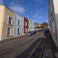
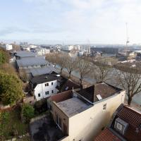
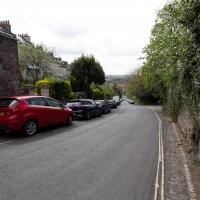
This is the road I didn't have many (or any) snaps of that inspired my route today, not that I need much of an excuse to traipse around Cliftonwood on a sunny lunchtime.
It's a perfectly nice street, but there's nothing too photogenic in it. I suppose that's why I didn't feel the need to raise the camera too much on previous occasions.
Bedminster Trip for New Walking Shoes
26 Feb 2022
I needed to buy new walking shoes—my old ones were squeaking and it was driving me up the wall—so I ordered some for collection from Taunton Leisure on East Street in Bedminster, and decided to make picking them up an official wander.
I didn't cover any new ground within my mile, but I did take advantage of the trip to take in a few interesting things just outside my normal radius, mostly New Gaol-related. Along the way there are a couple of sanitation-related diversions, including a visit to a rare manhole cover. You can hardly wait, I can tell!
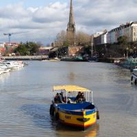
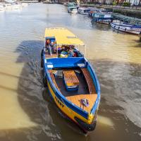
Anyway, on to happier contemplations. Here we see the Merchant's Road bridge (Junction Bridge, to give it its official title) swinging closed behind the Pride of Bristol.
This is about the only circumstance that can slow me down on a harbourside walk, but the bridge swings are normally over fairly quickly and there's usually an alternative crossing not far away, too.
At the end of the tracks is the engine shed built into the end of the M Shed museum.
Here's a first glimpse of something I'm interested in seeing even though it's just outside my mile radius.
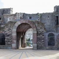
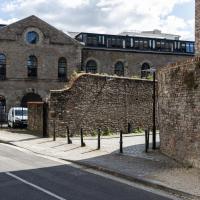
This gateway is a remnant of the New Gaol, which is apparently sometimes called The Old City Gaol, oddly. I suppose it depends on one's historical perspective.
The original New Gaol was destroyed during the 1831 Bristol Riots, and replaced with a redesigned version including this gate. That replacement New Gaol was itself replaced by Horfield Prison (which still stands and still operates as a prison) in 1884 and demolished in 1898. So, in fact, you could argue that this the ex-old-new-New Gaol. Clear? Good.
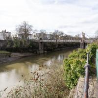
The bridge is in a pretty poor state at the moment, apparently. It's about to be closed for repairs until the end of 2022, though if I know anything about the quality of Council estimates for bridge repairs, I wouldn't expect to see it finished until the end of 2023...
You can see the New Gaol entrance there on the left, poking out incongruously from the modern flats, with the spire of St Mary's rising from behind it in the distance.
In Which We Begin and End with Love
05 Mar 2022
I had a lot to get done around the house, so as soon as I heard there might be a shiny new piece of street art near me, under the Cumberland Basin flyovers, I immediately decided that was all the excuse I needed to set off on a round-the-harbour lunchtime walk to get some fresh air and see if I could spot it. So, here's a circular wander that takes in graffiti, boats, wildlife and graffiti again...

A brand new piece by AcerONE and SEPR, replacing their earlier collaboration.
It's nice to have someone brightening up the space under the flyovers regularly.
There's a few more shots of this one when we return here at the end of the walk.
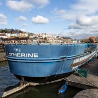
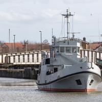
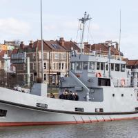
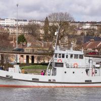
Not much change since the last time I saw her, but certainly a heck of a difference from the start of the "refit".
Leigh Woods Purple Path
12 Mar 2022
There's a few tracks in Leigh Woods that lie within my mile and show up on my map but that I've not walked yet, so I decided to take one of my traditional big long walks through the woods on this nice crisp sunny morning.
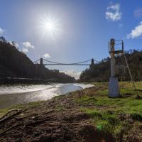
For years—decades, even—I've been doing a similar route from my place, along the towpath to the far woods entrance, up the hill for a varied walk on one of the marked tracks and then across the Suspension Bridge to Clifton Village for a coffee-based reward. It's my default "long walk", really, and I almost always enjoy it. Today, at last, spring actually seemed to be springing, which made for some extra positivity...
There have been new plans put forward by the council for the Western Harbour Development The previous plans would have put a bridge in between here and the suspension bridge. I've not looked at the new ones yet.
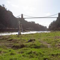
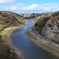
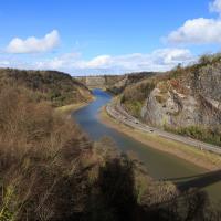
This is probably the most popular spot to take photos of the bridge from this direction. I'd guess the large majority of photos of the Suspension Bridge are taken from the other side.
Now to finish off the walk in my traditional way: buying something pleasantly unhealthy from one of the coffee shops of Clifton Village (I ended up in newly-refurbished Parsons Bakery for food, and the excellent Foliage Cafe for a flat white.)
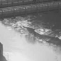
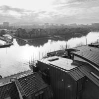
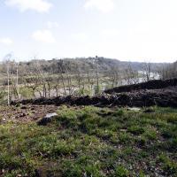
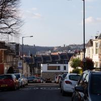
This is the point on the walk where I get to look at how far I've walked, by looking down on the towpath and seeing tiny things in the distance that I was right next to earlier, like the white navigation light you can just see toward the far end of the curving flood plain of the river down there.
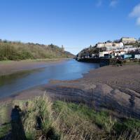
I mostly went out to hang out with my friends Sarah and Vik in Bedminster, but along the way I thought I'd take a closer look at something a little nearer home: the last crossing point of the Rownham Ferry.
If you were following this route you'll have noticed I just magically took a shortcut through a bunch of houses. That's because I've elided the bit of the route that goes to Sarah and Vik's place and stays there for an hour or two.
A Coffee and a Curve
27 Mar 2022
I wanted to have a wander along to the Tobacco Factory Market for some shopping, and checking the map for any leftover nearby streets I noticed a tiny curve of road on the way into the modern flats at Paxton Drive that it didn't look like I'd walked down before. I wouldn't take me too far out of my way, so I decided to head there first and then across to North Street to get my groceries and a coffee...
I noticed I had a few things on my "potential wanders" list that could all be done relatively close to home, and in a fairly straight line, so I set off at lunchtime to recreate a photo of a now-defunct pub, wander behind a Spar (which turned out to be more interesting than I'd expected, but I admit it's a low bar) and spend some time browsing in Dreadnought Books before coming home via a coffee from Spoke & Stringer, a little diversion up Gasworks Lane and a tiny bit of the Rownham Mead estate I'd somehow previously skipped.
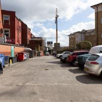
Here we are at the end of Pembroke Place, wandering a little alleyway I'd not previously filled in on the map. I didn't have high hopes for much of interest in this parking area behind Spar and Marcruss Stores. However, I did find something interesting, as we'll see in a couple of photos' time.
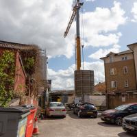
Not much to be seen in this direction except the crane on the site where they're busily filling a gap with new flats. We'll see the front in a little while.
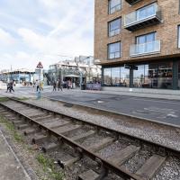
Remnants of the docks railway. These ran around the harbour to Ashton Avenue Bridge to the west, and along to the main Goods Depot at Anchor Lane to the east.
I think this may be the last visible remnant of the harbour railway on this entire stretch of the Hotwell Road. There may still be some tracks around Canons March—that whole area south of Anchor Road had a lot of rail lines—but I've not seen any others west of Jacobs Wells Road.
Here's the entrance to Pembroke Place on the Hotwell Road. Looking at old maps, before it was Pembroke Place it was Blackhorse Lane.
Interesting to think that this street art will presumably be sitting as a layer in between Marcruss Stores and the new-build flats for ever...
Here's a snap from before the cover-up.
Having checked the planning application it seems these may be going to be called the Black Horse Apartments, echoing the former name of Pembroke Place, which is a nice little touch.
While we're on a theme of things to find down alleyways...
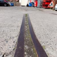
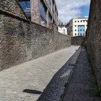
We've had a wander around the old gas works site before but I wanted briefly to focus on one tiny detail, which is to be found in this alleyway called Gasworks Lane.
And here's the detail of Gasworks Lane I find interesting.
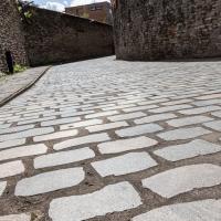
Part of my preferred walk to work is over the cobbles below Redcliffe Parade. It's not one of my favourite bits, because the going is treacherous and you have to look down at your feet all the time to make sure you don't come a cropper on the old and very uneven cobbles.
Here in Gasworks Lane things are different. Apparently the council used an interesting new technique that, according to Bristol247, they've experimented with in a few places across town.
The idea is to keep the classic look of the cobblestones but smooth out the ride for pedestrians and cyclists by taking the existing stones, cutting them in half to give a nice flat edge, then re-laying them lumpy-side down.
I'd not noticed it until I read the article, but I appreciate this technique now, and it'll be interesting to see how much more it gets used around the city.
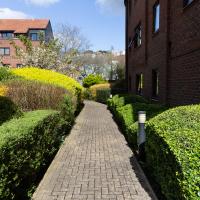
And again—imagine it without all the rampant shrubbery and tree blossom. Great job, landscapers.
Easter Monday Gardens and Flowers
18 Apr 2022
I didn't really set out with a theme of flowers and gardens in mind for this walk. I just fancied heading up to Clifton Village to get lunch. As it turned out, though, Spring was springing, so a minor theme emerged as I started off with the graveyard flowers of Hope Chapel and wandered up to see the beginnings of the new wildflower garden at Clifton Hill Meadow.
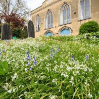
There will be a minor theme of flowers and gardens for this little trip. We'll start at Hope Chapel, though this is more a graveyard than a garden.
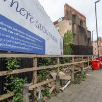
Where fly tipping happens, more like. This scrap of land (with a public bench hidden on the far end, against the back fence behind the red bins) has been a bit of an eyesore for years. I've never been a fan of public billboards.
Recently, though, a property developer has applied for planning permission for a block of flats here, and apparently fenced off the bit where the main entrance will be, even though it's fenced in this little corner of land that everyone assumed was public, council bench and all. And now it's attracted fly tippers, it seems.
I've tweeted at the councillor for the area, Alex Hartley, and he's said he's alerted the council and will try to investigate it/get it cleaned up, so here's hoping...
In the long run, maybe there will be some new flats instead of an ugly billboard and some dull fencing, and I'm all for that.
I've taken plenty of snaps looking at Holy Trinity from the road, but I think this may be my first looking at the road from Holy Trinity.
There was a somewhat precarious path in the road protected by those yellow plastic barriers to get around some holes being dug in the pavement. I chose the safer route through the church garden and thought I might as well take a pic from the main entrance.
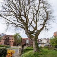
On a previous wander I posted a historical photo of the church including this tree, and one from the modern day.
It's grown up quite a lot in the last hundred years...
I thought I'd come and see how the wildflower garden was getting along. It's its first year, after a crowdfunder last year raised nearly £2000 to buy seeds, plug plants and signage.
This is one of the three experimental areas. Nothing too apparent so far, but it's early dyas.
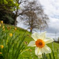
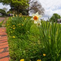
I left it a bit too late for a host of golden daffodils, most are on the turn. So here's a close-up of a selected still-perky individual.