Tagged: natural-landscape
Coffee, Pirates and a Spitfire
15 Apr 2021
Just a quick trip to Imagine That for a flat white and a date ball (they're really nice), snapping the general sights along the way. No new roads, as has rapidly become the default on my lunchtime wanders, but as I'm in the routine of this project it almost seems strange not to pop my wanders up on the site.
Desultory Coffee Wander
16 Apr 2021
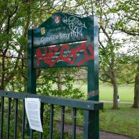
Another day, another quick dash out for a coffee. I did at least try to take a different route from normal, especially on the way back, where I yet again got a bit lost in the strange paths, flyovers and underpasses that make up the odd maze of pedestrian "infrastructure" among the concrete jungle between the west of Greville Smyth and my neck of the woods in Hotwells. I swear one day I'll take a turn I've not tried before and end up being gored by a Bristolian minotaur.
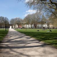
I'd heard there was going to be something of a wild party in Greville Smyth to mark the end of lockdown. It seems it may be the start of a regular thing, with a dance festival bringing 8,000 people to the park. I imagine I'll be able to hear it from my place, and therefore safely avoid it.
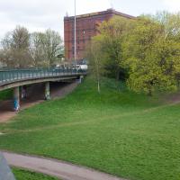
I think I should have gone back down into the park to come back up my normal path, that leads to a place where you can walk under the flyover and get back on the bridge to Hotwells. As it is I just tried heading north and ended up having to cross four lanes of busy traffic.
That seems to be the failure of the pedestrian paths around here: if you know where you're going really well, the best you can hope for is not to make a wrong turn, and then you can end up going all the way around the houses, including quite often back the way you came, and might manage to use some of the provided underpasses and crossings and avoid the most dangerous traffic. But if you don't know them like the back of your hand and just try heading for the place you want to get to, that you can actually see, you'll be led entirely astray and end up in a variety of dead-ends.
Man on a Mission
17 Apr 2021
I went rather outside my area today, as I went to pick something up from the Warhammer shop on Wine Street (Games Workshop as-was, and before that I think perhaps a rare retail outlet for Her Majesty's Stationery Office? I may be mis-remembering...) Anyway, a friend of mine wanted something picking up and posting to him, so I figured I'd knock some streets off my list along the way.
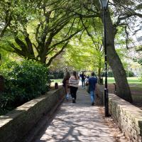
I first headed for the St George's Road area, walking down the narrow Brandon Steps and finding some strange wall art on Brandon Steep, then headed to the Old City via Zed Alley. The Warhammer shop visit was friendly and efficient, and, mission accomplished, I treated myself to a sausage roll and a flat white from Spicer + Cole, to take away and eat in Queen Square with its current decoration of hearts. I finished off with a detour up Park Street, looking out for St John's Conduit markers, before finally crossing Brandon Hill on the way home.
Quite a long wander, all told, and I'm a bit knackered today...
Recently decorated with hearts to kick off the #LoveBristol campaign. It looks amazing from above in this drone footage.
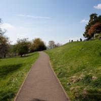
I may have trod some new paths on Brandon Hill. I wasn't sure, as the network of routes is quite complicated and I was too eager to get home to muck around checking my map.
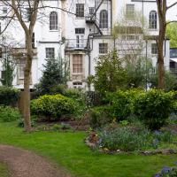
The Mall Gardens
19 Apr 2021
Just a quick errand to the Post Office to send off Mollog's Mob, but afterwards I bought a flat white and a new plant from Foliage Cafe and headed for The Mall Gardens to enjoy sitting in the sun and reading a book on the first day this year that's been properly warm enough for it. Nice.
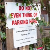
The Mall Gardens does actually have some signs up letting people know it's a public garden, but I think it was only my researches for this project that brought the number of public gardens there are in Clifton to my attention, and reminded me that I could make use of this space in Clifton Village, a little closer to the coffee shops and a little more sheltered than Clifton Down.
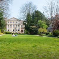
With the neoclassical frontage of The Clifton Club (originally an assembly rooms) looking posh at the back.
Leftovers with Lisa
01 May 2021
I didn't get to all the little leftover streets around the northeastern part of my area in today's wander, but I definitely knocked a few off the list, plus Lisa and I enjoyed the walk, and didn't get rained on too badly. We spotted the hotting-up of Wisteria season, checked out Birdcage Walk (both old and new), ventured onto the wrong side of the tracks1 and generally enjoyed the architecture.
1 Well, technically we probably shouldn't have been on the grounds of those retirement flats, but nobody started chasing us around the garden with a Zimmer frame
I have The Portable Emerson on my "incoming" bookshelf, I think, but I'm not getting through them very quickly at the moment.
There's some fascinating stuff on Victoria Square here, including a lot of jumping-off points for deeper research. The description of the bombings during the war is amazing.
This is the path that used to be known as Birdcage Walk—up until the war it was lined with tall railings—but most people now use that name for the corridor made by the pleached lime trees in St Andrew's Churchyard, just a stone's throw away. I suppose that's the one that most resembles a bird cage today. Here's a Vaughan Collection photo of what it looked like before the war.
Adjacent on the left (Merchant's Road) side would have been the church of St James the Apostle, which survived the war but was demolished for flats in the seventies.
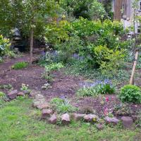
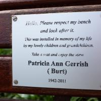
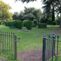
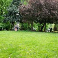
I've been here before, but thought Lisa might want to see this off-the-beaten-track public garden.
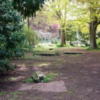
Victoria Square Underpass
06 May 2021
I'm meant to be taking a little break from this project, but in my Victoria Square researches after my last walk I noticed a curiosity I wanted to investigate. The community layer on Know Your Place has a single photograph captioned, "The remains of an 'underpass' in Victoria Square".
Looking back through the maps, I could see that there really did used to be an underpass across what used to be Birdcage Walk. I can only guess that it was there to join the two halves of the square's private garden that used to be separated by tall railings that were taken away during WWII. Maybe it was a landscaping curiosity, maybe it was just to save them having to un-lock and re-lock two gates and risk mixing with the hoi polloi on the public path in the middle...
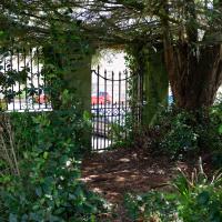
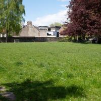
Anyway. Intrigued, I popped up to Clifton Village this lunchtime for a post-voting coffee, and on the way examined the remains of the underpass—still there, but only if you know what you're looking for, I'd say—and also visited a tiny little road with a cottage and a townhouse I'd never seen before, just off Clifton Hill, and got distracted by wandering the little garden with the war memorial in St Andrew's churchyard just because the gate happened to be open.
EDIT: Aha! Found this snippet when I was researching something completely different, of course. From the ever-helpful CHIS website:
When there were railings all round the garden and down the central path, in order that the children could play together in either garden there was a tunnel for them to go through. This was filled in during the 1970s but almost at the south east end of the path if one looks over the low wall the top of the arches can still be seen.
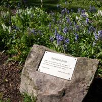
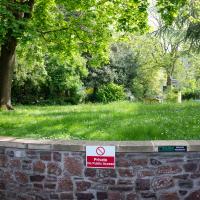
I'm going to call this the memorial garden. Don't know if it has an official name, but it's a railinged-off area with the war memorial in it...
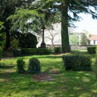
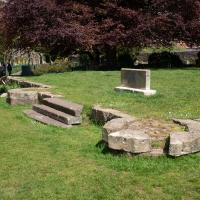
Up until WWII, anyway. The outline of the church remains around this square of land; the stones you can see bottom left are one of its walls. Among the many interesting images accompanying Bristol 24/7's story about the Bristol Blitz you can see an image of St Andrew's Church after the bombing raid of November 1940. I'd call it an interior shot, but most of the interior had become the exterior by that point...
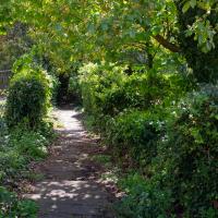
I hadn't realised, from the other end, that this little alley was part of the churchyard rather than a way through into a private back garden; it looked as though it might pop up in the Bishop's House, and you don't want to disturb a bishop. When I worked out it just led through to the main church area I decided to walk it just for completeness, looping around and out through the memorial garden again.
It was parish church up until the Luftwaffe bombed it in 1940; the remains were demolished in 1956 and after that Christ Church became the Clifton parish church.
Until that point there had been a church on or very near this site since at least 1154, from what I can see on ChurchDB and ChurchCrawler...
Here's a snap of what the last building that stood here used to look like from the Bristol Archives, and here's an earlier one.
Sequel Injection
07 May 2021
I saw this tweet the other day and started thinking of my second Covid-19 vaccination as my "Sequel Injection" (to a geek, it's funny. You'll have to take my word for it.) Whatever you call it, this morning I went and got it.
It was in the same place I got my initial injection—my left arm! No, okay, it was at the Clifton College Prep School. I didn't take any photos of the event itself; the NHS production line is so efficient you barely have time to do anything else, even if the privacy of other patients wasn't a factor.
Along the way I mused at all the road resurfacing going on in Clifton, and also discovered a secret (okay, not-well-known and possibly slightly trespassey) way into Canynge Square, and on the way back I knocked off a few streets from my "leftovers list" of north-east Clifton. I've got much of Clifton done now, with the only obvious "to dos" on the east side of Whiteladies Road...
It was quite a long walk, and I'm feeling pretty tired now, though that might be the effects of the jab too, I suppose. Anyway. Tomorrow and Monday I'm walking outside Bristol, I think, and I imagine my feet will need some recovery time on Sunday, so it might be a while before I post another Wander.
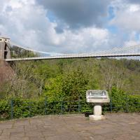
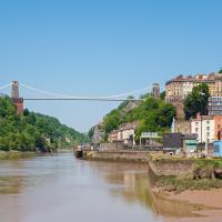
The Fujifilm X100T that I mostly use for these trips is a great camera, but it's also a fixed lens, approximately that of a 35mm focal length on a full-frame camera. So I quite often can't fit in whole buildings, whole terraces, or whole suspension bridges :D
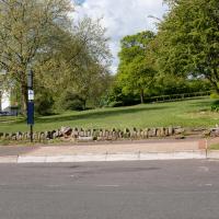
I tried to figure out what this used to be—didn't have a lot of luck, but the next snap is taken from an old OS map showing that this area has been a stand for public transport since long before the modern bus stop here.
Coffee, Coronation and Clift House Road
28 May 2021
Another dash to Greville Smyth Park for a coffee from Rich at Hopper, but at least this time I managed to divert a bit and knock off a small section of Cumberland Road I'd managed to miss on previous excursions. Along the way I muse on a strange residence in between a warehouse and a tannery, and wonder if the Mayor might be deliberately letting the Cumberland Road Flyover area go to seed...
I managed to knock off a reasonable chunk of the roads I had left to walk around the University at the north-eastern extremity of my mile on this nice sunny walk. As well as being impressed by the number of big townhouses now occupied by various departments, I took some time on my way there to check out a war memorial, and some time on the way back to do a little extra wandering of Berkeley Square.
Bank Holiday Street Art
31 May 2021
A nice warm Bank Holiday Monday saw me walk back over to Bedminster to do justice to something we glimpsed on my last wander. Along the way I spotted a couple of new pieces of street art tucked away on the south side of the Cumberland Basin Flyover system, so this turned into a micro-graffiti walk.