Tagged: natural-landscape
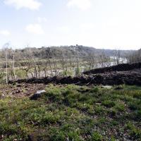
I was just about starting to feel better—the antibiotics seemed to have kicked in for my dental issues, and it had been some days since I'd left the house, and I was at last starting to get itchy feet. So, a wander. But where? Well, there were a few industrial bits near Winterstoke Road in the Ashton/Ashton Vale areas of Bristol that needed walking. I knew they were likely to be quite, well, unattractive, frankly. So why not do them while I wasn't feeling exactly 100% myself? Maybe it would fit my mood. Hopefully you're also in the mood for a bit of post-industrial wasteland, for that's what some of this feels like...
Then, at the last minute, I thought again about the Bristol International Exhibition—I've got a book about it on the way now—and that gave me another goal, which could just about be said to be in the same direction, and I decided to walk significantly further than my normal 1-mile limit and try recreating another historical photo...
Sadly I don't know much about the Ashton area; it's just on the edges of my mile and I rarely have cause to go there. It's brimming with history, I'm sure: the whole South Bristol area rapidly developed from farmland to coal mines to factories to its current interesting mixture of suburbs and industrial work over the last few hundred years. As a more working class area less attention was paid to it by historians, at least historically-speaking, than the Georgian heights of Clifton, and much of it has been knocked down and reinvented rather than listed and preserved. I see here and there some of this lack is being addressed, but I'm afraid I'll be very light on the history myself on this wander, as most of my usual sources aren't throwing up their normal reams of information as when I point them at Clifton, Hotwells or the old city.
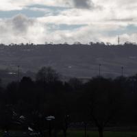
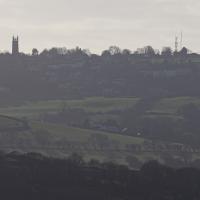
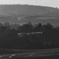
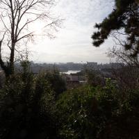
These are some hills I'm not heading for today, but I love the distant view of Dundry from Hotwells. The silhouetted church towards the left is St MIchael's Church, Dundry, whose tower was built in 1481.
The other towers around Dundry have more recent heritage. I believe Dundry East transmitter still sends out the analogue signal for BBC Radio 4, and lets me listen to The Archers on an old Roberts radio when I'm doing my cleaning on a Sunday morning. Some bits of my life are still quite old-fashioned.
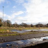
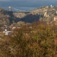
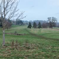
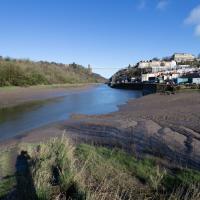
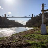
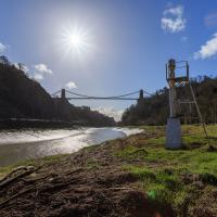
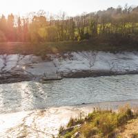
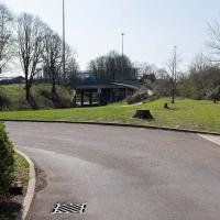
A better view of the ex-railway depot and part of the former Bristol International Exhibition site that I've mused about before. That's why we're on this wander, in fact: curiosity about an old photo of the site. But not a photo from round here: one taken from quite a ways beyond my normal mile radius. It's going to be a bit of a hike.
There will also be some terrifyingly industrial bits of south Bristol along the way, so be prepared for a bit of urban decay and industrial scenes.
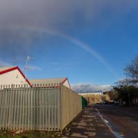
As if to prove that you can find beauty in the most unexpected of places, this is what happens when you turn around at the arse end of nowhere.
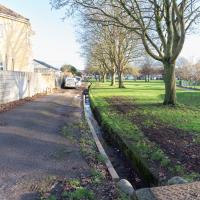
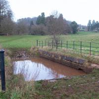
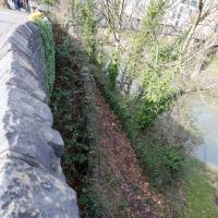
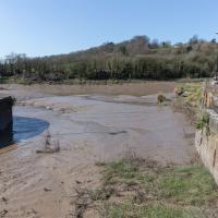
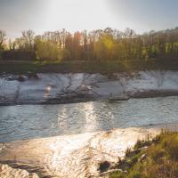
Presumably there's a good reason it's called Greenmarsh Lane, adjacent to Gores Marsh Park. A lot of the names in the area suggest some rather marshy heritage. I'm guessing this drainage is part of what stops it being quite so marshy in the modern day.
In fact, gosh: here's a picture of it during the flood in 1968. The great flood of 1968 apparently killed seven people, and it's worth clicking through to the Evening Post site to take a look at the picture gallery.
These floods were one of the key reasons for the building of the Malago Storm Water Interceptor, whose outfall we've seen in an earlier wander.
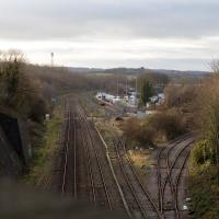
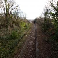
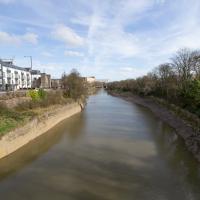
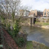
Well out of my one-mile radius now, here's a view from the railway bridge at Bedminster Down Road, looking back to the east.
This is Parson Street Junction, originally called Portishead Junction, where the Bristol to Exeter line, straight on, branches off into the Portishead Railway line, curving away there on the right. Parson Street Station in Bedminster is directly behind us on the other side of the bridge.
Phase One of MetroWest should see the currently-frieght-only Portishead line re-open to passenger traffic, though I wouldn't hold your breath. It seems "Metro-" is an old Roman prefix meaning "multiply all your time and budget estimates by ten".
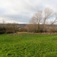
This is near the view I'm trying to recreate. Here are the fringes of Bedminster Down.
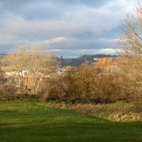
I did take a lot of slightly different angles, clambering around on the slippery slopes of Bedminster Down and having the occasional entanglement with trees. I think this shows pretty much the same view as the historical photo, or at least as close as you can get by wandering around on the ground in about the right place today.
It was nice to be able to find it, and I've never walked to Bedminster Down before. And it's a nice palate cleanser after all that rather dreary industrial stuff, anyway...
And that's the note I'll leave things on, as it was already getting a bit dark for photography, so I mostly plodded my weary way home without any further snapping. At more than 9km it's not my longest wander ever, but it's about twice as long as the average, so I may have overdone it...
A Random New Year's Day Wander
01 Jan 2022
I picked a fairly arbitrary reason for a wander today. Really, I just wanted to do a New Year's Day wander just to get out of the house and to set a precedent for the year to come.
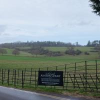
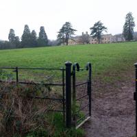
My ostensible reason was to investigate what looked like a road on my map that quartered the lawn in front of the Ashton Court mansion. As it turned out, this is just a muddy footpath/desire line similar to a half-dozen other tracks nearby, and must be some kind of bug or misclassification with the mapping system I'm using, but that's not important. What's important is that I went for a little walk on the first day of the year. As a bonus, I did happen to wander down a couple of sections of new footpath, so technically I broke some new ground too, which is nice.
Though this isn't the allegedly main-ish road I was trying to find, so I didn't pop through it.
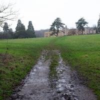
This bit that's marked on my map in the same style as a normal, tarmac road. Clearly it's not. I think perhaps I need to figure out what's going on with the mapping on this website, as the main openstreetmap site, which is where I'm getting my data from, does seem to have it as a simple track.
A small challenge for the new year, I suppose... Perhaps a refresh of the way the map looks on the site would be a nice start to the year anyway!
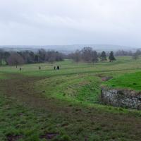
There were quite a lot of people about; I think a New Year's Day walk is still quite the tradition. Good.
Strange little pond, yes? I think this may be a "cart dip" pond, used for rehydrating the wheels of old carts and carriages, which apparently kept things working better. Not sure on the details, though.
However, it just leads you onto a footpath at the edge of the playing fields I wandered across last time I was in the area. Still, it's nice to know where it goes.
Near and Far
05 Jan 2022
I took advantage of a rare recent day where it wasn't tipping down with rain to get away from my desk on a lunchtime workday and head up to Clifton Village. I'd hoped to snap a reproduction of historical photo which I'd worked out had been taken from the Suspension Bridge, but the gods were not smiling on me. Still, taking only a nice long lens with me worked out very well as the lovely haze of the day made more distant views quite dramatic...
This is almost the photo I wanted to take, but the historical photo I want to reproduce was definitely taken from further to my right, on the bridge, and you should still be able to see the remains of Clifton Bridge Station (hidden from here by the trees on the right) and the last bit of slipway of the Rownham Ferry (hidden by the prominent house in the foreground.) This snap is also a bit marred by the temporary safety fencing I had to shoot through.
Ah well, another day, I suppose.
Lunchtime Reproduction (of an old photo...)
17 Jan 2022
This was basically the quick lunchtime jaunt I tried to do at the beginning of January, only this time I actually managed to get to roughly the viewpoint I'd been hoping for to recreate a historical photo of the Bristol International Exhibition.
I did this walk about a month ago, but I've been a bit poorly and not really up to doing much in my spare time, and it's taken me this long to even face processing even these few photos. Hopefully normal service will be resumed at some point and I can carry on trying to walk any roads and paths that I need to do to make this project feel complete...
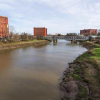
Unlike my last attempt I successfully managed to get somewhere near the vantage point of the historic photo this time...
I should probably have tried to get it at high tide to make it a bit more comparable, but you can't have everything.
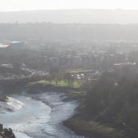
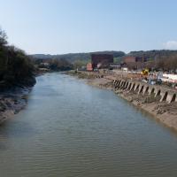
You can see the White City Allotments—those glints of light toward the middle are mostly reflections from greenhouses—where the "White City" of the Exhibition used to stand. There's still a glimpse or two of the railway line to Portishead to be seen, too, along with a vestige of the Rownham Ferry slipway.
Mostly though it's the modern things that stand out—the long line of flats along Paxton Drive, the curve of Brunel Way across the river, and the roof of Ashton Gate Stadium...
There's a couple on the balcony taking a selfie in this direction. I wonder if I've been immortalised as a few pixels in the background of their photo...
Lunchtime Cliftonwood Wander
18 Jan 2022
Another workday, another quick lunchtime trip to get me out of the house. This time my flimsy pretext is a tiny bit of Clifton Vale Close that I'd apparently not walked, and the fact that although I'd walked down Church Lane at least once before I still hadn't taken a single photo of it. Really I just fancied a mosey through Cliftonwood in the sunshine, with the promise of a coffee from Clifton Village at the top of the hill.
Bedminster Trip for New Walking Shoes
26 Feb 2022
I needed to buy new walking shoes—my old ones were squeaking and it was driving me up the wall—so I ordered some for collection from Taunton Leisure on East Street in Bedminster, and decided to make picking them up an official wander.
I didn't cover any new ground within my mile, but I did take advantage of the trip to take in a few interesting things just outside my normal radius, mostly New Gaol-related. Along the way there are a couple of sanitation-related diversions, including a visit to a rare manhole cover. You can hardly wait, I can tell!
That can't really be anything other than a slipway for the old ferry, can it? Especially as there are steps down there from the road, albeit overgrown to the point of invisibility and with their entrance bricked up, as we'll see when we get to the other side.
This bridge was only put up to replace the ferry in the 1930s, so it's not surprising that the ferry facilities are still pretty obvious from this side.
We have, in fact, wandered down there on a previous walk.
You can see the New Gaol entrance there on the left, poking out incongruously from the modern flats, with the spire of St Mary's rising from behind it in the distance.
Well, it slopes down to the riverside at the top of the slipway. I presume there are still steps under there.
Leaning over the wall, we can see the overgrown steps from the bricked up gate leading down to the start of the ramp down to the ferry crossing.
The old ferry crossing, the newer 1930s bridge that replaced it, and the shiny new flats and shops of Wapping Wharf on the far side.
Back in the days of the Bristol International Exhibition we'd have been standing about where the replica of Bristol Castle was, looking toward the Dominions Pavilion and a bandstand.
On the left, B Bond, in the middle, A Bond, and on this side of the New Cut, the C Bond warehouse.
Leigh Woods Purple Path
12 Mar 2022
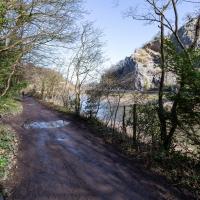
There's a few tracks in Leigh Woods that lie within my mile and show up on my map but that I've not walked yet, so I decided to take one of my traditional big long walks through the woods on this nice crisp sunny morning.
For years—decades, even—I've been doing a similar route from my place, along the towpath to the far woods entrance, up the hill for a varied walk on one of the marked tracks and then across the Suspension Bridge to Clifton Village for a coffee-based reward. It's my default "long walk", really, and I almost always enjoy it. Today, at last, spring actually seemed to be springing, which made for some extra positivity...
There have been new plans put forward by the council for the Western Harbour Development The previous plans would have put a bridge in between here and the suspension bridge. I've not looked at the new ones yet.
The towpath is a lovely stroll in weather like this. Waterproof walking shoes help, though, as the puddles are often wide enough to span the entire width. I baptised my new walking shoes on this trip.
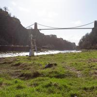
This is probably the most popular spot to take photos of the bridge from this direction. I'd guess the large majority of photos of the Suspension Bridge are taken from the other side.
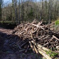
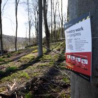
There's been a lot of logging in Leigh Woods recently. Some of it is to control Ash Dieback, some of it to make way for the reintroduction of native trees.
I mostly went out to hang out with my friends Sarah and Vik in Bedminster, but along the way I thought I'd take a closer look at something a little nearer home: the last crossing point of the Rownham Ferry.
Yes, okay, it's quite the challenge to spot the hand-made historic artifact in this picture. In the next pic I'll zoom in a bit.
Although the tide's better now, the light was not great for taking documentary photos. Here we are heading towards sunset on the vernal equinox, so I decided to just try being a bit arty instead. I even took the lens hood off to try to encourage more flare. Just call me JJ Abrams.
Just trying to wring as much lens flare out of the camera as I could here, to be honest :D
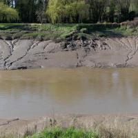
So, one more silt shot and it's time to go home. On this wander I actually walked 6.4km, though the stats won't reflect that as I cut out the section of the walk where I went to Sarah and Vik's house. My feet were definitely tired at this point!
Anyway, hope you've enjoyed the wander and some photos of the last visible vestiges of a ferry that probably ran for around a thousand years...
A Coffee and a Curve
27 Mar 2022
I wanted to have a wander along to the Tobacco Factory Market for some shopping, and checking the map for any leftover nearby streets I noticed a tiny curve of road on the way into the modern flats at Paxton Drive that it didn't look like I'd walked down before. I wouldn't take me too far out of my way, so I decided to head there first and then across to North Street to get my groceries and a coffee...
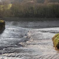
Work on the New Cut, this man-made diversion of the river to allow the harbour to float free of the tide, was officially started on 1st May 1804 and finished on 1st May 1809, with something of a party:
On 1 May 1809 the docks project was certified as complete and a celebratory dinner was held on Spike Island for a thousand of the navvies, navigational engineers who had worked on the construction, at which "two oxen, roasted whole, a proportionate weight of potatoes, and six hundredweight of plum pudding" were consumed, along with a gallon of strong beer for each man. When the beer ran out a mass brawl between English and Irish labourers turned into a riot which had to be suppressed by the press gang.
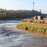
I noticed I had a few things on my "potential wanders" list that could all be done relatively close to home, and in a fairly straight line, so I set off at lunchtime to recreate a photo of a now-defunct pub, wander behind a Spar (which turned out to be more interesting than I'd expected, but I admit it's a low bar) and spend some time browsing in Dreadnought Books before coming home via a coffee from Spoke & Stringer, a little diversion up Gasworks Lane and a tiny bit of the Rownham Mead estate I'd somehow previously skipped.
And again—imagine it without all the rampant shrubbery and tree blossom. Great job, landscapers.