Tagged: natural-landscape
A Longer-than-it-looks Walk With Lisa
06 Jun 2021
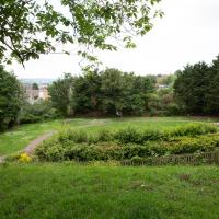
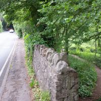
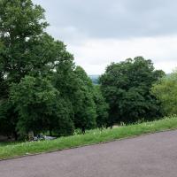
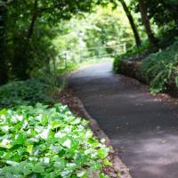
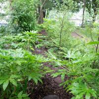
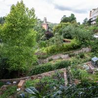
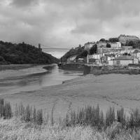
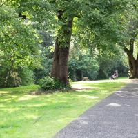
The track on the map doesn't tell the whole story of this walk with Lisa around and about Clifton, Berkeley Square, Brandon Hill and the harbourside, because the batteries on my GPS ran out while we were on the roof of Trenchard Street car park, it seems. Oh well. I think I did most of the area I was interested in finishing off around the University; there were only a few new bits around Brandon Hill that won't be on the track, and I can easily do them again.
Still, technology woes aside it was a nice walk, albeit a bit warm for climbing all those hills, and sat on the harbourside watching the world go by for a while, too. It was good to see the Bristol Ferry Boats carrying people around again, especially.
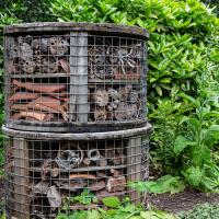
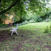
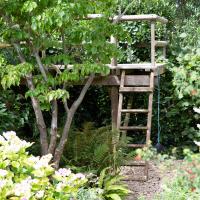
This is clearly a 5-star insect hotel. I imagine the rooms come with hotel-monogrammed bathrobes and that there's a swimming pool around the back.
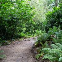
Leigh Woods Solo
19 Jun 2021
I hadn't really planned to go out for a wander yesterday; I just got the urge and thought "why not?" (Well, the weather forecast was one possible reason, but I managed to avoid the rain, luckily.)
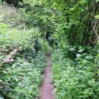
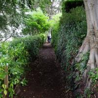
I wanted to finish off the A369—as it turns out I may still have a small section to go, but I've now walked the bulk of it out to my one-mile radius—and also a few random tracks in Leigh Woods. I'm still not really sure that I'm going to walk them all, especially after discovering today that "the map is not the territory" applies even more in the woods, where one of the marked tracks on the map wasn't really that recognisable as a track in real life... I'm glad I'd programmed the route into the GPS in advance!
Anyway. A pleasant enough walk, oddly bookended, photographically at least, by unusual vehicles. Leigh Woods was fairly busy, especially the section I'd chosen, which was positively dripping with teenage schoolkids with rah accents muttering opprobrium about the Duke of Edinburgh. I'm presuming the harsh remarks were more about taking part in his award scheme than the late Consort himself, but I didn't eavesdrop enough to be certain...
I took this as a comparison shot for this non-OMM photo I snapped the other night, to show how much difference the right conditions can make to a photograph :D
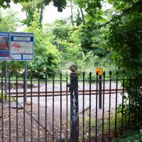
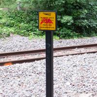
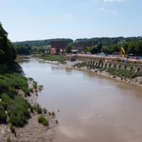
I don't think I've ever been next to these tracks when a train's gone down. I've sometimes seen it from the other side of the river, though. You can read a bit about the nearby disused station here; this used to be a passenger line, but it's freight-only now.
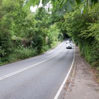
I think it was at this point I decided not to bother walking alongside the road up Rownham Hill and instead divert into Dead Badger's Bottom, which is a prettier alternative. That could be a slogan for this rather mundane strech: "The road up Rownham Hill: less attractive than a dead badger's bottom".
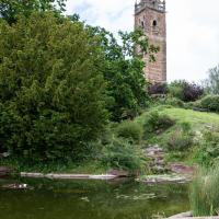
There are some really good photos of the Cumberland Basin and Hotwells area taken from viewpoints on this hill, but the trees have long since overwhelmed the possibility of a good view up here. Don't get me wrong: I like trees, but I do rather wish you could still take photos from up here.
I suppose the thing to do in 2021 is to send a drone up and try to find the same viewpoint that way.
Library, Bookshop, Coffee
03 Jul 2021
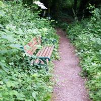
I was headed into town to return RA Gilbert's biography of AE Waite to the library and along the way I noticed that Dreadnought had finished their refurbishment, but wouldn't be open until midday. That left me some time to kill, so I bimbled around the old St Augustine's/Gaunt's area for a while, then headed up Park Street for a coffee and a snack to eat on Brandon Hill before heading home the way I'd came so I could pop in and buy a pamphlet on the Hot Well I'd been interested in for a while.
Coffee Under Pressure seems to have a bit of a Greek theme for its food, so I took a slice of spanakopita up to Brandon Hill with my flat white, to cool down in whatever breeze I could find. It's been a muggy weekend in Bristol. There's not exactly a great view from this bench, but I wanted to be a bit further away from the crowds at the top of the hill.
I presume the wall and railings at the end here peter out about where the Bethesda chapel was demolished.
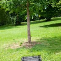
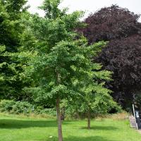
I thought, if anyone was looking at this from the future, they might be interesting in comparing the size of the tree as it is now...
Shops, Hedgehogs and Cows
06 Jul 2021
I really only took the GPS and camera on a "just in case" basis, as I knew I was only going for a coffee in Greville Smyth Park along a well-trodden path this lunchtime. Still, I saw a few new things along the way, so I figured it was worth uploading the handful of photos I took...
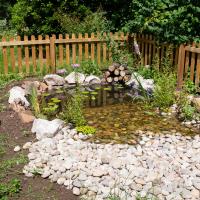
When I passed the (then-empty) fencing back in March I wondered what this would turn out to be. I had no idea it would be a miniature nature reserve...
According to the Friends Of Greville Smyth (FROGS!) Facebook page it's a hedgehog oasis, which is rather sweet.
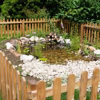
I see from the Facebook group that it was Rich from Hopper Coffee—the little coffee van I was visiting today—who first started the building of the pond, after finding dehydrated hedgehogs suffering in the park. It looks like it then became a group effort with several volunteers and donations of materials. Nice.
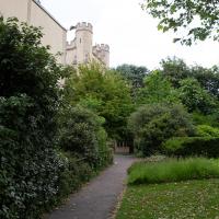
A Cliftonwood Revisit with Lisa
10 Jul 2021
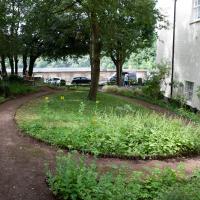
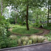
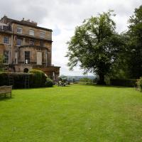
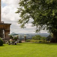
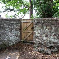
Lisa had a couple of hours to spare before going up in a hot air balloon (exciting!) so we went for a quick local walk, revisiting a bit of Cliftonwood we've seen before, exploring the secret garden I'd visited before that I thought she'd enjoy (I didn't take any new photos there) and then pushing on to another garden, Cherry Garden. Last time we passed this way, I'd noticed the gate, but we hadn't gone in as I'd assumed it was private. I'd since found it on CHIS's list of communal gardens in Clifton, so I wanted to have a look inside this time, and try to figure out whether it was private-communal or public, and possibly Council-owned, like several of the other gardens in Clifton.
This was today's mildly underwhelming destination: I only realised after walking past the gates on an earlier walk and then seeing it later on the CHIS Clifton's Communal Gardens page that this was a public garden, so popped it on my list to take a second look. As Clifton communal gardens go it's small and fairly dark on a day like this, but I don't imagine many people know about it or use it, so it's appealing to me, as a generally quite introverted person, especially one who prefers shade to sun on bright days...
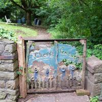
Someone clearly put some good work in on the gate, but thirteen years of weather has taken its toll.
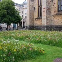
Next to the Cathedral. Which I've still never set foot inside. I should probably put that on the list...
Lunchtime Zig Zag Climb
13 Jul 2021
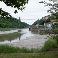
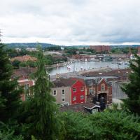
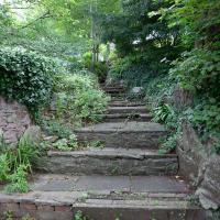
A snappy little trip up the Zig Zag to the shops. It's a steep old route, the Zig Zag, going from just over river level to about the height of the suspension bridge (101 metres) in a compact switchback of a footpath.
I was too busy struggling to breathe to take many snaps of the actual Zig Zag (I've been trying to make it up all the way without stopping the last few times, but I've not quite managed it yet). I did at least take a few snaps either side on this quick lunchtime jaunt to fetch coffee (Coffee #1) and a sarnie (Parsons) from Clifton Village...
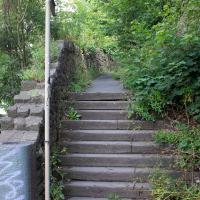
When climbing the Zig Zag it's helpful only to focus on where you are, rather than how far you've got left to go.
Pastures New!
17 Jul 2021
Okay, not much in the way of actual pasture to be had in Bedminster these days, like most of Bristol, but I did take advantage of the current rather toasty weather in Bristol to go and sit under a tree in Greville Smyth Park to read a book for a while before firing up the GPS and taking a little detour around some back streets of Ashton and Bedminster rather than going straight to Coffee #1 for an espresso frappé. This is the first walk in a while where I've actually crossed off an entire new street (the frankly unexciting Carrington Road) as well as exploring a couple of back alleys, just because they were there, really. Along the way I spotted a few examples of graffiti of various qualities, including a live work-in-progress by SNUB23 on Ashton Road and the finished Six Sisters project on North Street.
They've not made much progress on repairing the Chocolate Path, sadly, but it seems they've at least got a budget and a green light now.
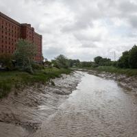
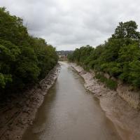
The entire New Cut only took five years to dig out, but on the other hand they had literally a thousand men on the job and I imagine several of them died. Probably have to be a bit more careful these days.
Green Squares and Secret Gardens
31 Jul 2021
At the end of July I went to have a look around some of the private gardens opened up by the annual Green Squares and Secret Gardens event. Sadly it was compressed into a single day this year, for various Covid-related reasons, it seems, so I didn't get to poke around too many places. I went to:
- A talk by the oldest resident of Victoria Square
- The St Vincent's Rocks Hotel garden
- The Paragon garden
- Cornwallis Crescent gardens, both east and west
- The Polygon garden
And snapped a few things in between, too. It was a lovely day—a bit too hot, if anything—and it was interesting to get into a few places I'd only ever seen from the outside, especially The Paragon and Cornwallis gardens, which are the least visible to passing strangers of all of them.
I think at the far left edge of this photo, near the bottom, you can see about as far as I got down the old Prince's Lane on a previous wander. This pic was, I believe, taken looking up at the garden in the foreground. I think the greenhouse there is still being constructed, and wasn't there during my earlier wander, but you can see some of the building materials, I think.
A Long Wander Of Miscellany and Magick
08 Aug 2021
This was a wide-ranging wander. I started off crossing the river to Bedminster, to walk a single little cul-de-sac, Hardy Avenue, that I'd managed to miss on at least one previous walk. Then, pausing only to explore a few back alleyways, I headed for a few destinations related mostly by the Hughes family, who I've been researching a little as part of background for a possible novel, as several of them were involved in the Stella Matutina.
However, mostly it's the artistic side of the family I wanted to explore today, as that's where most of their public history lies (as you might expect, there's often not much in the public record about the workings of an occult organisation.) First I visited College Green, where the façade of the Catch 22 Fish & Chip shop still bears the work of Catherine Edith Hughes. Then I wandered up to the top of Park Street to pop into the Clifton Arts Club's annual exhibition, as Catherine, her half-brother Donald, his wife Hope and at least two other Hugheses were members. Donald was chairman for 40 solid years; Hope was Secretary for eight, and Ellard and Margaret Hughes, two more Hughes siblings, were members along with Catherine.
Finally I walked home with a small diversion to Berkeley Square, to confirm the location of Donald Hughes's house by checking for a particular plaque by the front door.
I must admit I'm not entirely sure where all this research is really leading me, but I'm finding it quite interesting to bump across the faint lines of history that link the Hermetic Order of the Golden Dawn, founded in 1888, to modern, quotidian Bristol.
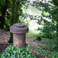
A little remnant of the Avon's history, I assume, gently rusting away on the bank by Cumberland Road
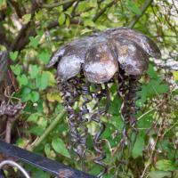
Mostly the Metal Animals of a Clifton Garden
30 Aug 2021
Lisa and I went for a longish walk, but I didn't take many photos. Mostly we just wandered and nattered. Unusually, my target was outside my 1-mile radius on Burlington Road in Redland, where I snapped quite a few photos of the collection of artistic animals by Julian Warren. This was mostly to provide a fairly arbitrary destination for a roundabout walk in Clifton...
From an Avon Gorge Geology Excursion Guide I dug up:
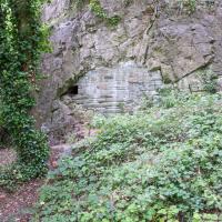
Just south of the Observatory, on the right of the path is a children’s playground [ST 5667 7325] in the remains of a limestone quarry. In the back wall is a bricked-up adit, presumably representing the entrance to a former iron ore or lead mine (Fig. 10C). The roof of the adit is fissured and sparry, crystalline calcite can be seen in fissures.
The playground itself is in one of the the quarries used for the Suspension Bridge materials.
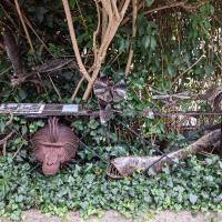
One of our mutual friends had mentioned that there was a house on Burlington Road with metalwork animals in the garden around here somewhere. It took us a while to find, but find it we did.
The artist is Julian Warren.