Tagged: lake
Lunchtime Cliftonwood Wander
18 Jan 2022
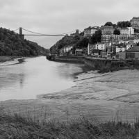
Another workday, another quick lunchtime trip to get me out of the house. This time my flimsy pretext is a tiny bit of Clifton Vale Close that I'd apparently not walked, and the fact that although I'd walked down Church Lane at least once before I still hadn't taken a single photo of it. Really I just fancied a mosey through Cliftonwood in the sunshine, with the promise of a coffee from Clifton Village at the top of the hill.
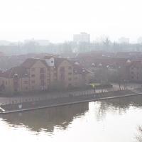
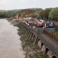
I used to live down there, in the block on this end, Portland Court. I recently found a photograph by the late local photographer George Gallop (he had a place on the Hotwell Road) of these Baltic Wharf flats being built, taken from a similar vantage point.
Bedminster Trip for New Walking Shoes
26 Feb 2022
I needed to buy new walking shoes—my old ones were squeaking and it was driving me up the wall—so I ordered some for collection from Taunton Leisure on East Street in Bedminster, and decided to make picking them up an official wander.
I didn't cover any new ground within my mile, but I did take advantage of the trip to take in a few interesting things just outside my normal radius, mostly New Gaol-related. Along the way there are a couple of sanitation-related diversions, including a visit to a rare manhole cover. You can hardly wait, I can tell!
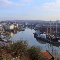
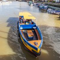
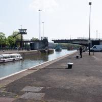
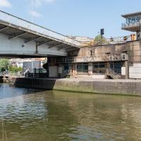
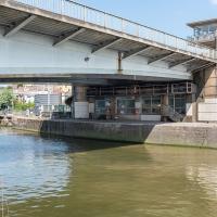
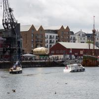
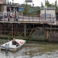
Anyway, on to happier contemplations. Here we see the Merchant's Road bridge (Junction Bridge, to give it its official title) swinging closed behind the Pride of Bristol.
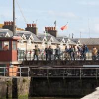
This is about the only circumstance that can slow me down on a harbourside walk, but the bridge swings are normally over fairly quickly and there's usually an alternative crossing not far away, too.
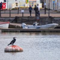
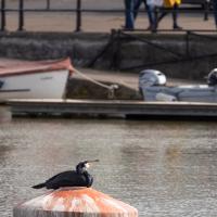
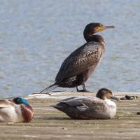
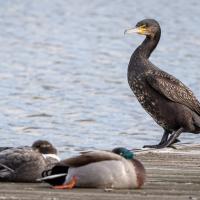
I took a long lens with me today in case the cormorants were around; I've been meaning to try taking a better snap of them for a while. Here's one on a buoy that seems to have "hosting cormorants" as its only purpose. There's often one there, anyway.
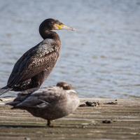
And there's often also a cormorant and some other birds hanging out on the end of this pontoon at the slipway near the Nova Scotia, too.
In Which We Begin and End with Love
05 Mar 2022
I had a lot to get done around the house, so as soon as I heard there might be a shiny new piece of street art near me, under the Cumberland Basin flyovers, I immediately decided that was all the excuse I needed to set off on a round-the-harbour lunchtime walk to get some fresh air and see if I could spot it. So, here's a circular wander that takes in graffiti, boats, wildlife and graffiti again...
Not much change since the last time I saw her, but certainly a heck of a difference from the start of the "refit".
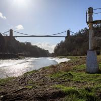
Leigh Woods Purple Path
12 Mar 2022
There's a few tracks in Leigh Woods that lie within my mile and show up on my map but that I've not walked yet, so I decided to take one of my traditional big long walks through the woods on this nice crisp sunny morning.
For years—decades, even—I've been doing a similar route from my place, along the towpath to the far woods entrance, up the hill for a varied walk on one of the marked tracks and then across the Suspension Bridge to Clifton Village for a coffee-based reward. It's my default "long walk", really, and I almost always enjoy it. Today, at last, spring actually seemed to be springing, which made for some extra positivity...
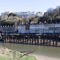
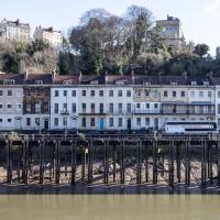
I've always enjoyed the optical illusion that these houses are on stilts from this angle. In fact there's the Hotwell Road the National Express coach is on in between the houses at the back and the disused landing stage at the front, as you'll see in the next pic of the adjacent terrace.
The Campbell Brothers' White Funnel Fleet operated from the Hotwells landing stage up until relatively recently. Last week I bought an old timetable on eBay and popped it up on my blog for anyone who might be interested.
In 1965, the year of the timetable, there were regular sailings from here along the coast or over to Wales. You could go to Ilfracombe and Lundy Island, or head across to Barry, Penarth or Cardiff. All from within five minutes' walk of my front door.
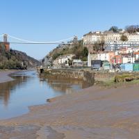
I mostly went out to hang out with my friends Sarah and Vik in Bedminster, but along the way I thought I'd take a closer look at something a little nearer home: the last crossing point of the Rownham Ferry.
That reminds me; I must re-read Iain M Banks's Use of Weapons again. In the novel he used the name Size Isn't Everything for one of the Culture's General System Vehicles, a spacecraft approximately 80km long... In the Culture, spacecraft are sentient and Culture ships choose their own names, often ironically.
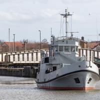
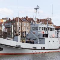
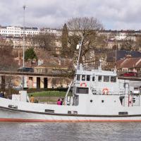
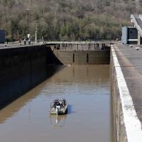
He we have something of the opposite size of craft.
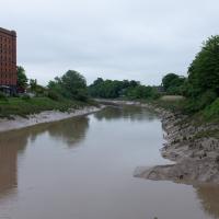
You don't often see Entrance Lock cycle at this kind of tide, but a little boat like that doesn't need a lot of water in the river to manoeuvre.
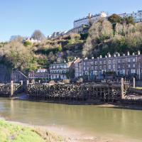
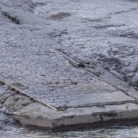
There, hopefully you can see it now—the slipway of the last incarnation of the Rownham Ferry, in use from as early as the 12th century to 1932, when this particular slipway was last used.
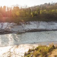
There's not much to see at the moment, as the tide's a bit too high. I'm going to head over to the Tobacco Factory Market, meet some friends, do a crossword or two, and head back at lower tide.
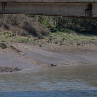
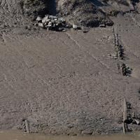
Again, the slipway is easy to miss. I like these little barely-visible curiosities that hide such heritage. The site of the crossing moved around—it's fairly obvious it wasn't right here in the 12th century, for example, because the river was only diverted into the New Cut, which the ferry crosses here, in the early 1800s. Earlier it was further downstream.
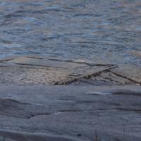
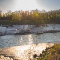
Now the tide's lower, we can see the end of the slipway we looked at earlier poking out from the Somerset side. According this article from the Bristol & Avon Family History Society:
In 1793 the ferry was identified as being used by many passengers to "cross the river at Rownham ferry and walk to the sweet and wholesome village of Ashton to eat strawberries and cream"
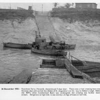
And here's the picture that inspired this little local visit today. A week or so back I was browsing the boxes of books at Rachel's and Michael's Antiques on Princess VIctoria Street, and flipping through their collection of Reece Winstone books. Winstone's famous Bristol As It Was series are an amazing documentary source created by a man who loved both photography and Bristol and effectively became Bristol's foremost documentary photographer for decades. A lot more of Bristol's history is visible today because of him.
In the Bristol As It Was 1939 - 1914 book I saw this picture of the Rownham Ferry. Unfortunately the book was a first edition and priced at £20, so I ordered a cheaper edition from an independent dealer in Stockport when I got home! (Let's consider that as me leaving the rare first edition for the true connoisseurs, rather than just being cheap.)
Here we see the ferry just five days before its closure on the last day of 1932. Looking closely, it seems to be perhaps operating as a reaction ferry, with the boat tethered to a static line across the river, and the ferryman using the rudder to turn the boat and use the power of the flowing water to shuttle the boat from side to side. Clever!
Photo © Reece Winstone Archive. (I recommend buying the books if you like old photos of Bristol. They're amazing!)
Looks like the stones at the bottom corner were replaced with some simple poured concrete with grip lines drawn across it at some point.
Although the tide's better now, the light was not great for taking documentary photos. Here we are heading towards sunset on the vernal equinox, so I decided to just try being a bit arty instead. I even took the lens hood off to try to encourage more flare. Just call me JJ Abrams.
Just trying to wring as much lens flare out of the camera as I could here, to be honest :D
A Swing of the Plimsoll Bridge
24 Apr 2022
I was originally going to head over to the Ashton area to see if I'd missed any bits around the football stadium—and also to grab some lunch from the Tobacco Factory Market—but in the end I got a little distracted by having accidentally chosen exactly the right time to see the Plimsoll Bridge swing on one of the first busy days of Spring, where a lot of pleasure trips tend to head out down the Avon (and possibly the New Cut) from Hotwells.
In the end I mostly snapped that, and just a couple of photos from the Ashton area where I grabbed some lunch but didn't do any new exploring.
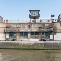
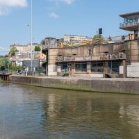
The Plimsoll Bridge is definitely not the oldest swinger in town. In fact, it may be the youngest swinger in town. I think the only other functioning swing bridges on the floating harbour (side-to-side rather than up-down like Redcliffe Bascule) are Junction Bridge (hidden in this picture, it's on the far side of the Cumberland Basin, carrying Merchants Road) and Prince Street Bridge, built in 1925 and 1879 respectively. The Plimsoll Bridge is mid-1960s.
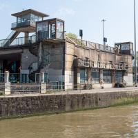
You don't often see this view of the brutalist bridge abutment, because the bridge itself is normally blocking and overshadowing the view here. Excuse me while I take far too many photos of it to be healthy.
I've always particularly liked the spiral staircases and the control tower, which looks like it's escaped from a prison camp.
You can see the man whose job it is to work the rather complicated-looking controls in the control tower has come out onto his balcony now the opening procedure is done.
...as I look hopefully down the river to see if there's a single sign of the Chocolate Path re-opening, as I have done dozens, possibly hundreds of times over the last several years...
Ticking Off a Pocket of Paths in Leigh Woods
03 Jun 2022
I managed to go for a wander a while ago that was meant to finish off a little tangle of paths in Leigh Woods, or at the very least finish off my wandering of the Purple Path there. And I managed to miss doing either of those things through some kind of navigational incompetence.
Today I woke up with a bit of a headache, feeling a bit knackered as soon as I dragged myself out of bed, but at least with the energy to realise that I'd be better off (a) going for a walk in what looked likely to be the last of the Jubilee weekend sunshine than (b) moping around the flat until it started raining, at which point I could mope more thoroughly.
I had a look at my map, considered going to Ashton Court, but remembered that there was a music festival there today, and instead found these little leftovers of Leigh Woods and decided to have one more try at walking them.
A Quick Swing Past Ashton Court
05 Jun 2022
Another day not dissimilar to my last wander: I'm feeling a bit tired and rather than just moping around the house I thought I'd find some tiny bit of somewhere that I'd not yet walked and get outdoors. This time I headed for the Tobacco Factory Market in Bedminster, as I often do, but went the long way around via Ashton Court Mansion as I knew there were some footpaths and a small section of road I'd not ticked off up there. Finishing all the Ashton Court footpaths will be quite a long job, but you've got to start somewhere...
I did feel rather better by the time I got home, and, pretty much astoundingly given the weather forecast, managed to avoid the rain completely.
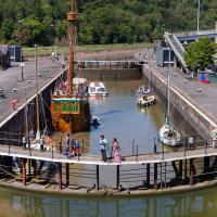
I'd normally walk over those open lock gates she's just sailed through, but it's easy enough to walk down to the gates at the river end.
I've been pretty awful at reading so far this year, apparently averaging about one book per month. That's a far cry from 2019, say, where I got through 41 books in the year. Today's wander was prompted by my rubbish reading, as I needed to go hand back some books to the library, because I'd managed to renew them so many times that I hit the limit on renewals. Oops. Several of them were still unread.
So, off to the Central Library for me, tail between my legs. On the way there I did my best to recreate a historical photo of Dowry Square; while I was in the area I walked under the adjacent Norman arch and poked around behind the Cathedral, and I also had a little diversion to the city centre and came back along the south side of the river, hitting some trouble with the lock gates as I finally crossed the harbour back towards home.
Library business concluded, I decided that my feet weren't quite sore enough, so decided to head back home by completing a circuit of the harbour rathter than just heading back down the noisy Hotwell Road. Wandering past the Arnolfini, I spotted this from a viewpoint not far from where the status of John Cabot stands, surveying the docks.
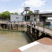
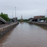
While I was taking the last few photos I'd been hearing the two-tone alarm signal of a bridge swing, so I knew something would be going on at the lock when I got here. This time, though, I got more than I bargained for.
I was coming up to cross at these lock gates like normal when I saw that the lock keeper operating the hydraulics was having some difficulties. Sure enough, after a few attempts at closing the gates, it became apparent that they just weren't having any of it. They were getting this close to closing and then jamming.
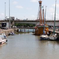
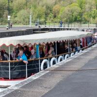
As you can see, there were quite a lot of boats waiting to leave Bristol for a jaunt down the river, most notably the Matthew, and Bristol Packet's Bagheera.
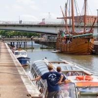
As a pedestrian I have a few alternative routes to cross. I decided to stroll down to the outer lock gate and get back to my side of the harbour there rather than going the long way around over the Plimsoll Bridge.
In the distance you can see a lockkeeper fishing in the water with a grappling hook on the end of some blue line to see if he can figure out what the gate is fouling on.
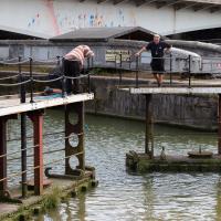
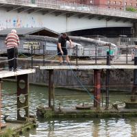
I was expecting them to pull a shopping trolley out at any moment. They weren't managing to snag anything, though.
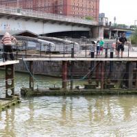
While I was tempted to hang around to see if they eventually pulled anything out of the way, the heat of the day was beating down pretty hard by this point and I didn't want to risk sunburn, so I headed home. As did all the boats in the lock, who returned back into Cumberland Basin and presumably eventually back to the city, refunding/rebooking their passengers.
I found out that my decision to leave had been a good one two days later, on Tuesday evening, when I happened to be on my walking commute home during another locking out, this time with the lock gates working. I asked the lock keeper about the problem, and apparently they'd tried hooking out whatever was fouling the gate for quite some time on Sunday, but eventually gave up and sent divers in on Monday, who pulled out a large section of chain-link fence that was fouling the south lock gate and got everything working again.
I'm in the habit of going over to the Tobacco Factory Market on a Sunday. I think I've walked all the routes around that way, but as a Plimsoll Bridge swing let me cross the road to the far side of Brunel Way on my return journey and I took a couple of photos of the brownfield development at the old Ashton Gate Depot site I thought I'd call it a Wander and pop some photos up.
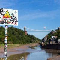
"STEEP DROP INTO MUD AND FAST FLOWING WATER".
This sign has been mildly annoying photographers since it was put up, getting a bit in the way of several alternative views from this bit of land. I presume it was installed in response to some kind of accident, but I'd hazard a guess that whatever difficulties someone got into probably wouldn't have been prevented by a sign that stated the completely bloody obvious.