Tagged: road
Downs Wander
23 Feb 2021
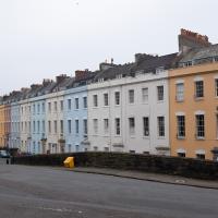
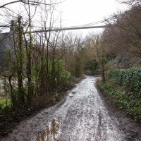
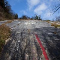
Just a quick trip to knock off a path or two on Clifton Down. I'm not actually convinced I walked down the paths I was hoping to, but I suppose I'll see once I upload this and look at it on the map :)
Today's highlight turned out to be retrospective—looking up Gertrude Hermes' amazing wood engravings when I got home. (By complete coincidence, I was trying to discover the location of the Stella Matutina's former Hermes Lodge in Bristol as part of my researches last night...)
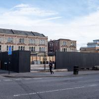
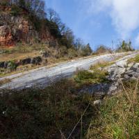
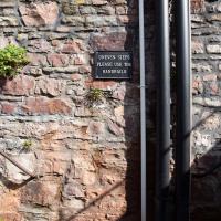
Chances are we'll never see this site levelled again in my lifetime. I'm glad I snapped it last week before the boarding went up.
Harbour Circumnavigation
01 Mar 2021
Normally I don't have enough time in my lunch hour to get all the way around the harbourside. This is a shame, as Wapping Wharf is a great place to get coffee and a snack, but it's pretty much diametrically (perimetrically?) opposite me on the harbour. Today I had the day off, so I decided to go and knock off a few streets around Anchor Road that I'd not covered, as well as visiting the site of the Read Dispensary (well, one of them) and dropping into Mokoko for one of their astounding almond croissants. From there I came back along the south side, checking out the views from as much of the Chocolate Path as you can venture down at the moment, and swapping from Cumberland Road to Coronation Road at Vauxhall Bridge.
There's a lot of meh photos on this walk—my chief output from this project could be politely described as "record shots"—but a few turned out well, especially those of Vauxhall Bridge from the Chocolate Path, which reminded me how much of a loss the current closure of the Chocolate Path is to walkers and cyclists in Bristol.
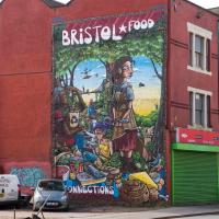
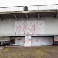
One day I'll get a decent picture of this mural without a sodding car parked in front of it.
EDIT: I never did, and now they've built flats in front of it instead!
Clifton Down Dash
02 Mar 2021
A quick wander up to Clifton Village to wander down a path or two either around Observatory Road that I'd missed out previously. On the way around I took a moment to take in the incongruous 11 Windsor Terrace, smiled at a couple of mounted police, stopped to smell the crocuses, grabbed a coffee in Foliage and came home through the Polygon accompanied by the delightful Spring sound of a woodchipper running at full blast. Nice.
Of Bridges and Buoys
04 Mar 2021
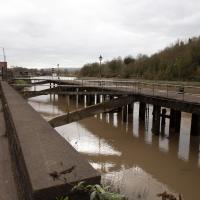
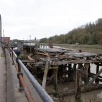
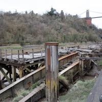
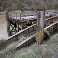
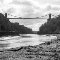
A trip to Imagine That coffee, so no fresh roads knocked off my list, but I stopped off to snap a couple of the engineering-related bits of the docks: the Campbell Buoy (used by P&A Campbell for mooring their paddle steamers) and Brunel's "other" bridge, the foot/horse swing bridge that now sits sadly disused in the shadow of the Plimsoll Bridge at Howard's Lock.
This is the pivot point for the Plimsoll Bridge. I don't think I've ever been down right here when it's swung.
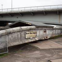
Brunel's Other Bridge ("Bob") was originally made to carry traffic over the South Entrance lock.
As part of the redesign/replacement of the North Entrance lock by Docks Engineer Thomas Howard, it was shortened and moved here, to the lock now known as Howard's Lock.
It was decommissioned in 1968 after the giant Plimsoll swing bridge that dwarfs it in the picture was put in as part of the Cumberland Road Flyover system.
A team of dedicated volunteers have been restoring it and documenting the process, and the bridge itself.
I bought a vintage post card from eBay this week. It's a well-known photo of the Hotwells landing stage, showing what's likely to be a P&A Campbell paddle steamer moored there. (Just yesterday I snapped a photo of their buoy on display at Underfall Yard with its information sign.) It was posted from here to Canada in 1936, and has now returned via a presumably quite circuitous route.
Local journalist Maurice Fells (really local—I could probably hit his house with a well-flung teacake from here) notes in The A-Z of Curious Bristol (£) that:
For tens of thousands of people, the pier at Hotwells was the starting point of their day trip as they boarded steamers with names like Glen Avon, Glen Usk and Britannia. The salty tang of the sea was never far away as the steamers headed for Ilfracombe, Weston-super-Mare, Clevedon and Portishead on the Devon and Somerset coast and Barry, Porthcawl and Tenby in South Wales.
The landing stage is long-abandoned. A variety of economic issues, including fuel prices, the increasing prevalence of the motor car, the construction of the Severn Crossing giving easier access to Wales, and the collapse of Clevedon Pier during safety testing in 1970, which prevented larger pleasure boats from stopping at the resort, all led to dwindling trade.
I went to have a poke about there today, not staying for long as it's a cold day and the wind was biting. I couldn't reproduce the postcard's view—you'd need to risk life, limb and presumably a trespass prosecution—but I did try to judge the rough viewpoint and angle of the photo by lining up with Rock House, the Colonnade and the Suspension Bridge and snapped a photo looking back to where the original photographer would have stood on the pontoon.
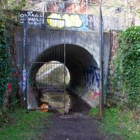
This Bristol City Docks history page has many good photos of the landing stage and the nearby Port and Pier Railway line (whose tunnel I was in the other day) and the Hotwells Halt railway station, which was just the other side of the suspension bridge from here.
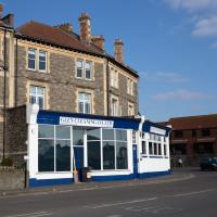
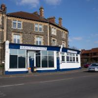
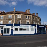
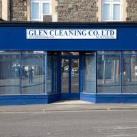
I headed to Bedminster to do a crossword with my support bubble today. On the way I delved into a couple of bits of Hotwells history, first of all snapping a "now" shot to go with a historical photo of Holy Trinity I happened across recently, and second of all to snap the Britannia Buildings.
The Britannia Buildings are a little strip of offices on a corner of the Hotwell Road. They've mostly been the headquarters of a cleaning company for years, but I've often wondered what this distinctive curve of offices, its ground floor standing proudly out from the upper floors, used to be. Well, after my last wander, where I poked about the landing stage just down the road, I found out! Researching the paddleboat company P&A Campbell I came across this nugget in The A-Z of Curious Bristol, by Maurice Fells (£):
The firm of P & A Campbell was the main steamer operator in the Bristol Channel, with its local headquarters in offices close to the Hotwells pier and overlooking the harbour at the Cumberland Basin. Campbell's named their offices Britannia Buildings, after one of the ships in their White Funnel Fleet.
So! Turns out the Britannia Buildings were named after a paddle steamer—you can see some pictures of Britannia here.
In related news, I've now bought three of Maurice Fells' local history books, and they were hand-delivered by the author on Sunday, a half-hour after I ordered them online (through a message exchange on Nextdoor!) Not even Amazon Prime has managed to deliver me anything that quickly...
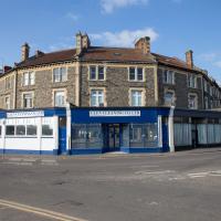
The Britannia Buildings were named for a paddle steamer in the P&A Campbell fleet, who used to have thier headquarters here.
There's some pictures of the Britannia, built in 1896, on the paddlesteamers.org site
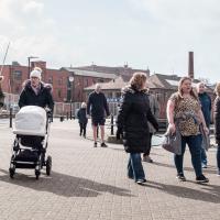
One Albermarle Row, Granby Green and... People
12 Mar 2021
I was browsing some historical photos the other day, and came across "Rear of Unspecified House" in the Bristol Archives' John Trelawny Ross collection, and immediately recognised it as being the back of 1 Albermarle Row, just around the corner from me. I've not had much time to research the history of this odd little addition to Albermarle Row, or what happened to 1-4 Cumberland Place, number 4 of which used to be attached to the side of 1 Albermarle Row, but it was interesting to look at old maps for a few minutes and work out what used to be where.
That all connects with the little local bit of land at Granby Green, too, as it used to be numbers 1-3 Cumberland Place. There was something of a planning battle over Granby Green, and I've included an old edition of Hotwells & Cliftonwood News that I found online, a copy of which would have been popped through my letterbox at the time.
I was also inspired by some old pictures of Hotwell Road to try to put a few more people in my pictures, though I set my pre-focus a couple of extra metres out from normal to make sure I didn't get too close to anyone!
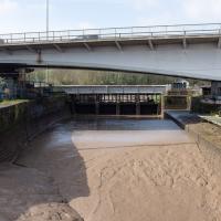
South Entrance lock, re-done by Brunel in 1844-49 because it was too narrow, but has been walled up since the 1950s, hence it not mattering too much about the silt these days.
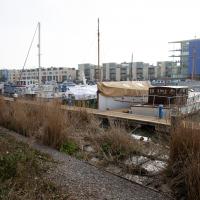
You can just about see the wire stretched across from left to right that the kayak polo teams that play here string their goals from.
Leigh Woods Walk
14 Mar 2021
An enormous walk today, or at least it felt enormous. My feet are sore, anyway. I started off recreating a couple of local historical photos in Hotwells, but then headed for my traditional walk along the towpath in the Avon Gorge to the far extreme of Leigh Woods, up and through the woods to the height of the Suspension Bridge, finally crossing into Clifton Village for a well-deserved vanilla latte.
I say "traditional" because this used to be a very regular route for me, first walking, years and years ago, and later jogging—this route combined with a circuit of the Downs on the other side used to be my way of making sure I was fit to do a half-marathon (I did six of them in total, between 2010 and 2014).
I miss the routine of this walk, even though it's a long way and it used to pretty much wipe me out when I did it—I'd come back home and collapse and do very little for the rest of the day. But perhaps that's what Sundays are for, and I should try to remember that.
Doing this walk regularly was quite a meditative experience. Not so much of that today, but once I got to the further extreme of the towpath, where the roar of the Portway traffic on the other side of the river dwindles and I turned into Leigh Woods to climb ever closer to birdsong and further from rushing cars, I did seem to recapture a little of the feeling of previous walks. (I would say my mind cleared, but I was mentally singing along to Life Without Buildings' The Leanover for most of the wander. There are worse songs to have stuck in one's head, though; it's a great track...)
Anyway. Apparently the walk made me more likely to ramble in words, too. I'll stop now :)
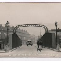
Photograph by L. Worsell, Bristol. Courtesy Bristol Archives/The Vaughan Collection
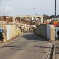
I'm not sure what the cross-beam over the top with the height restriction on is called, but I much prefer the original one. Although the bridge is very utilitarian in looks, anyway.
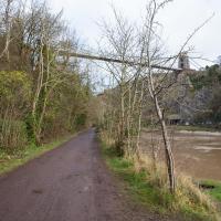
I enjoy shooting it from the other side, but it's hard to catch it at a photogenic moment. It's great when it's misty.
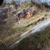
This is the rock face more traditionally viewed from the other side. There were a couple of lads right at the top. I can barely see them if I zoom in on this photo on my giant Mac screen, so you'll probably have to take my word for it.
John Carr's Terrace
16 Mar 2021
I wanted a nice simple lunch-hour walk that took me past a cafe today, and I managed to find the perfect road to knock off my list of targets to do it. Situated just off Jacobs Wells Road, right next to Queen Elizabeth's Hospital, John Carr's Terrace, and Rosebery terrace above it, which I'd completely forgotten existed, are a little cul-de-sac that many Bristolians will have wandered past a thousand times without ever seeing.
There's a reason it's next to QEH:
Known traditionally as "The City School", Queen Elizabeth's Hospital was founded by the will of affluent merchant John Carr in 1586, gaining its first royal charter in 1590.
John Carr's terrace itself isn't much to write home about, architecturally, but I like the secluded feel of it, and I really liked Rosebery Terrace with its little houses, commanding position and friendly, slightly tumbledown feel.
On the way home I popped into Foliage Cafe for a coffee and a very pleasant nutella and banana pastry, then walked home past the refurbishment of the old Thali Cafe into a new and interesting clinic...
At the end of John Carr's Terrace. Apparently it's a 5 bedroom semi and is ranked as the most expensive property in BS8 1DW, with a valuation of nearly two million quid. I couldn't see much of it. I wonder if it's owned by QEH's headmaster, or something...
Adjacent to the hospital, this is apparently now a nursing home. The listing says:
Formerly known as: No.3 Clifton Court CLIFTON GREEN Clifton. House, now nursing home. 1742. Possibly by William Halfpenny
It's just the kind of grand old Clifton Hill house that got Clifton's posh houses off to a start in the mid-18th century. It sounds like it's remained rather posh inside, too:
Fully-panelled right-hand rooms connected by an arch with fluted Ionic pilasters, panelled, arched recesses, good marble fire surrounds with rocaille woodwork, an eared overmantel in the front room with foliate festoons and bracketed pediment; doorways with raised pediment, and 4-panel mahogany doors.
Harbourside Milestone
17 Mar 2021
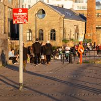
The other day I realised (hello, Maggie!) that my next walk would be my hundredth, and that I'd done 393.4km so far. I figured it would be nice to get to 100 walks and 400km on the same walk, so I went for a nice long harbourside wander after work, rather than dashing out at lunchtime. As it turned out, we're just coming up to the time of year where I can leave the house at 5:30 in the evening and there's still just enough light to take photos by the time I've made it around the harbourside. Though only just, and mostly because I've got a full-frame camera that's not bad in low light...
Still, the evening light made a lovely change, and some of the photos turned out to be pretty good photos per se, rather than just record shots of my walk. I'm looking forward to more evening walks like this as summer approaches.
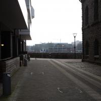
On the way around this evening I wandered through one of the oldest bits of the city to extend my walk and snapped some interesting bits of architecture, including an NCP car park(!) and a nighttime shot of one of my favourite subjects, the clock tower at the Albion dockyard.
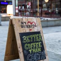
Cheeky. I also run a Cafe Signs Tumblr so I'm always on the lookout for good signage.
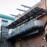
It's never occurred to me that when I"m wandering up the ramp at this entrace to the library that I'm also hanging suspended in mid-air
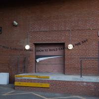
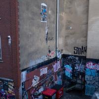
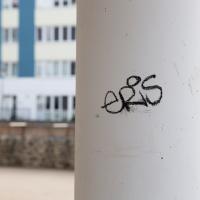
This is actually a Banksy work, not as well-known as many. Oddly, it seems like this loading bay may have been added after the graffiti was put there, and the graffit carefully transferred. I'll have to find out whether that's what actually happened...
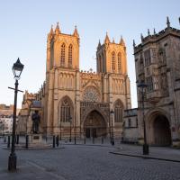
The Cathedral of the Holy and Undivided Trinity, in fact. An Augustinian abbey, given cathedral rank by Henry VIII in 1542. And also explaining why the row of shops on the Centre nearby is St Augustine's Parade, I imagine.
Augustinians follow the Rule of St Augustine:
The Rule of Saint Augustine, written about the year 400, is a brief document divided into eight chapters and serves as an outline for religious life lived in community.[1] It is the oldest monastic rule in the Western Church.[2]
The Rule, developed by Augustine of Hippo (354-430), governs chastity, poverty, obedience, detachment from the world, the apportionment of labour, the inferiors, fraternal charity, prayer in common, fasting and abstinence proportionate to the strength of the individual, care of the sick, silence and reading during meals. It came into use on a wide scale from the twelfth century onwards and continues to be employed today by many orders, including the Dominicans, Servites, Mercederians, Norbertines, and Augustinians.
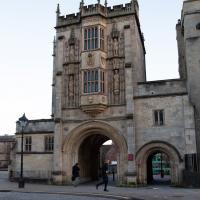
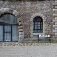
Archway for an Augustinian abbey, twelfth century. Apparently the upstairs has "rooms with Tudor-arched fireplaces, and oriels with tracery panels to the soffits; stone winder stair."
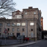
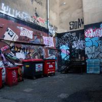
Oddly, everyone in Bristol knows the wall above this little alleyway/loading bay, but probably woudln't recognise this bit down here.