Tagged: shrub
(Photographic Lack of) Worcester Terrace
09 Feb 2021
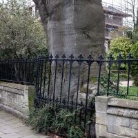
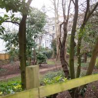
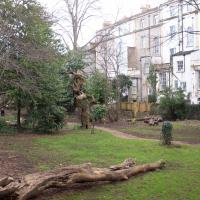
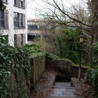
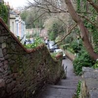
A nice walk, but something of a failure, photographically. I went to knock Worcester Terrace off my list, a not dissimilar terrace to Vyvyan Terrace, but one street further away from me. Like yesterday, it was very chilly but this time I went prepared with an extra layer and a winter coat. I think this may have been my downfall, as it may have been the X100T's control wheel brushing against the coat that put it in aperture priority mode at f/16, which I didn't notice at the time, and made most of my photos a little too blurry to use. Apparently in this mode, the X100 doesn't bump up the ISO if it can tell things might be a little too wobbly. Ah well.
So, a nice enough walk, and technically I did Worcester Terrace, but if you didn't take a photograph, were you really there? I'll have to go back...
Arlington Villas and WH Smith Destruction
10 Feb 2021
I actually dashed up to Clifton to take a look at Arlington Villas, just around the back of St Paul's Road, one of those slightly odd little enclaves of overlooked housing that you know is there, but you never have a reason to visit or travel down. As it turned out, interesting though the (public) garden is, I actually took far more pictures of the now-completely-demolished site bounded by King's Road, Boyce's Avenue and Clifton Down Road where WH Smith and other places used to stand.
It's interesting to imagine how nice this little area would be if turned into a permanent public square, but of course the developers already have their planning permission to build it right back up again.
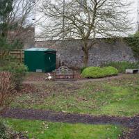
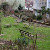
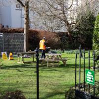
This is another of Clifton's private-seeming gardens that are actually now in council ownership, not that the council actually has any money to maintain them, but there's a local resident's association here that seems to be doing their best. This might be a pleasantly shady spot to have lunch in on a hot summer's day, if I remember it's here.
Another day, another coffee. I think I may have knocked a tiny footpath in Baltic Wharf from my list of leftover paths in the area, but mostly this walk was about getting out into the crisp February cold and enjoying the walk. On the way I posted a letter at 13 Dowry Parade (home of a surgeon called Willam Falls back 1830, according to Pigot's Directory of Gloucestershire...) and pondered the strange duality of Dowry Parade and Hotwell Road, then wandered through the Dowry Parade end of Cumberland Piazza, enjoying the clean lines of the glyph graff, before taking the causeway route past a Cumberland Basin empty of water but full of seagulls, to make my way south of the harbour.
There was a smell of unpleasant fire—more the acrid, plasticky smell of some kind of accidental fire than the pleasant harbourside aroma of wood-burners on narrowboats. I think the source was on the south side of the river, but I didn't have the time to find out.
There was, coincidentally, a burning BMW outside the Counts Louse today, apparently, but that would have been too far away to smell.
Clifton Village, including Oxford Place
15 Feb 2021
I've noticed Oxford Place as a tiny little side/back road I've overlooked on my wanders a few times. Today I decided to pop down and have a look, as well as taking a few general snaps of Princess Victoria Street, which I thought deserved more pictures, as it's basically my closest decent shops, and in the Beforetimes I'd visit the Co-Op up there all the time, as well as the cafes (you'll be missed, Clifton Village branch of Boston Tea Party, recently closed in favour of Eat a Pitta.)
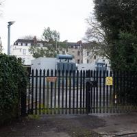
I'm definitely becoming more familiar with the area through the One Mile Matt jaunts and associated reading. Today I didn't just think, "oh, I'll head home down that weird alleyway with the electrical substation in it"—no, I thought, "I'll head home down Hanover Lane", because I actually knew its name. And on the way back from there I nodded sagely to myself as I passed St Vincent's Road, knowing now which St Vincent it's likely to be (St Vincent of Saragossa) and also eyed up the modern flats on Clifton Vale and wondered if they might have been built on the site of the former Vauxhall Pleasure Gardens... I don't know all the answers, but at least I have some idea of the historical questions I'm interested in.
Meridian
17 Feb 2021
The long road between Clifton Road and Park Place—the little triangle of grass in front of the Pro-Cathedral, which also houses Quinton House pub, the Park Launderette and Mr Swantons Barbers—is one I've travelled a lot, as it's a nice route between my place and the top of Park Street, especially Ocado. It has many names along the way, even though it feels like just one continuous road. It's York Place, Tottenham Place, Meridian Place and Bruton Place before it finally spits you out onto Park Place.
It was Meridian Place I was interested in today, as I wanted to explore the set of steps that lead down from it in the direction of Jacobs Wells Road. Turns out they lead to Meridian Vale and Meridian Mews, and come out between the Strangers Burial Ground and the Eldon House, opposite the entrance to Bellevue Terrace. I liked the little terrace on Meridian Vale, though they probably don't get a lot of light in the front windows, what with Meridian Place and Tottenham Place towering above them.
On the way back home I popped into the little lane behind Regent Street that houses the Chesterfield Hospital, as I realised I'd neglected that up until now. It was... unexciting.
Considerate. I wonder how often this little cut-through is used? I suppose it's a very quick way of getting to The Eldon House from up here, at least.
It doesn't look like much. Behind that wall is my regularly-used cut-through between Saville Place and Fosseway.
I went to get my first dose of the Oxford/AstraZeneca Covid-19 vaccine today. Handily, the vaccination centre was Clifton College Prep School in Northcote road, next to Bristol Zoo, a road that's just within my 1-mile range that I hadn't visited before.
I parked up near Ladies Mile and tried to find a few of the tracks marked on the map I'm using, but couldn't see most of them. Whether that's just because they've disappeared over time, or with the recent lack of use or waterlogging from the 24 hours of rain we just had, I'm not sure. It was a pretty fruitless search, anyway.
The vaccine shot was virtually the same setup as when I got my winter flu jab back in November, except for the venue. I snapped a couple of pictures of the school while I was there, but I was in and out in five minutes, and you probably don't want to linger around a vaccination centre, I suppose.
Instead I wandered around the compact block of the Zoo, now sadly scheduled for closure. By coincidence I finished E H Young's Chatterton Square this morning: set in Clifton (fictionalised as "Upper Radstowe") near the Zoo, the occasional roars of the lions that can be heard by the residents of the square (Canynge Square in real life) form part of the background of the novel. The book's set in 1938 (though written and published post-war, in 1947). It seems a shame that the incongruous sounds of the jungle will no longer be heard from 2022. All I heard today were some exotic birds and, I think, some monkeys.
I was told not to drive for fifteen minutes following the jab, so I wandered out of my area up to the top of Upper Belgrave Road to check out an interesting factoid I'd read while looking into the history of the reservoir at Oakfield Road, that the site of 46 Upper Belgrave Road was a bungalow, shorter than the adjacent houses, and owned by Bristol Water, kept specifically low so that the pump man at Oakfield Road could see the standpipe for the Downs Reservoir (presumably by or on the water tower on the Downs) and turn the pump off when it started overflowing. Sadly I couldn't confirm it. There is one particularly low house on that stretch, but it's number 44, and though small, it's two-storey, not a bungalow, so nothing really seems to quite fit in with the tale.
I'm writing this about nine hours after getting the jab, by the way, and haven't noticed any ill effects at all. My arm's not even sore, as it usually would be after the normal flu jab. In twelve weeks I should get an appointment to get the second dose.
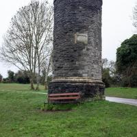
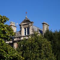
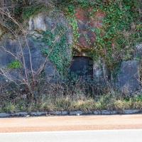
This is a ventilation shaft for the Clifton Down Tunnel. The railway tunnel was opened in 1877, and is still in use. According to this page (which might've been put together by my friend Rob, by the looks of it!): this ventilation shaft used to be topped with crenellations, and also:
Clifton Down Tunnel is 1751 yards long. Halfway along its length there is an opening into a cave that exits half way up the cliffside of the Avon Gorge.
...so that's quite fascinating. I think it also used to connect to the Bristol Port Railway and Pier tunnel that I found in the Avon Gorge on another wander.
EDIT TO ADD (14 Oct 2021): I'm just reading Colin Maggs' The Bristol Port Railway and Pier (Oakwood Press, 1975) and the tunnel was indeed built for the Clifton Extension Railway, which linked the Bristol Port Railway line with the rest of the national network. It sounds like quite a feat of engineering, including the use of a diamond boring machine invented by Major Beaumont, MP: "Cutting facets of black diamonds were fixed round the end of a steel tube to form a kind of auger. This tube was rapidly revolved by compressed air and advanced so that its diamond points came into contact with the rock and water forced through the tube washed away grit and kept the tube cool."
Downs Wander
23 Feb 2021
Just a quick trip to knock off a path or two on Clifton Down. I'm not actually convinced I walked down the paths I was hoping to, but I suppose I'll see once I upload this and look at it on the map :)
Today's highlight turned out to be retrospective—looking up Gertrude Hermes' amazing wood engravings when I got home. (By complete coincidence, I was trying to discover the location of the Stella Matutina's former Hermes Lodge in Bristol as part of my researches last night...)
Picture Postcards, Bikers and Wild Food
25 Feb 2021
I almost didn't bother bringing out my GPS today, but as it turned out I may have knocked off a tiny bit of Baltic Wharf, having been diverted through there on my way back from Imagine That café by finding Cumberland Road closed. Not sure whether it was just some kind of delivery to the roadworks there or if they're surfacing the increasingly-dodgy looking bit of the one lane that's left open...
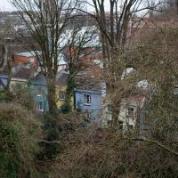
I also snapped a picturesque view of Cliftonwood, hung out with a biker gang, and found a little something to nibble on growing on the Hotwell Road.
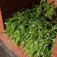
Even if you didn't know what it was on sight, you'd probably be able to tell from the smell...
A Day Off Wander in Clifton
26 Feb 2021
I'm on the first day of a long weekend, and I certainly picked the right one for it. This may be the first proper spring-like day of the year in Bristol; it was glorious.
I headed up to Clifton, around the area where I got my Covid vaccine jab the other day, to knock off a few remaining roads in that area and because it would be good exercise for an extended lunchtime walk.
Along the way I saw some very Clifton sights, including an Aston Martin, some Jacobethan architecture, and some private college sports grounds. Mostly, though, I just enjoyed the sunshine, and took every opportunity I could to snap views across the city.
It was the interesting architectural style that first caught my eye on Auburn House here. Apparently "Jacobethan", which means exactly what you'd expect: a mixture of Jacobean and Elizabethan.
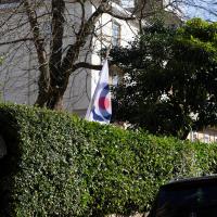
As well as the vintage vechicles we saw earler, Canynge House was also flying the RAF roundel. Clearly a characterful place.
At first glance you might think this is a lawnmower, but I believe this is actually a geophysical survey being carried out around the sinkhole that opened up in Canynge Road garden over Christmas. Looks like a geophysicist using ground-penetrating radar to me, anyway. I've seen Time Team!
Ah, there's something of a clue: his hi-vis tabard says "Fugro" on the back. That's Ingenieursbureau voor Funderingstechniek en Grondmechanica, Dutch for "Engineering Company for Foundation technology and Soil Mechanics". Sounds fairly ground-survey-ey to me.
I'm glad my friend Lisa joined me today; she drove in from Shirehampton and told me that the Portway was looking rather lovely, so we set off that way. She's also braver than I am when it comes to doing urbex stuff, so this was just the opportunity to take a peek into the Portnalls Number One Railway Tunnel/Bridge Road Deep Valley Shelter whose entrance I'd found on a previous wander.
It was definitely dark and spooky and impressively big, with a side tunnel that Lisa explored that leads to a little door I don't think I've previously noticed on the side of the Portway. I didn't get many photos—even my astoundingly powerful little torch (£) didn't do much to light things up, and you're not going to get much joy hand-holding a camera in that darkness—but I did shoot a little video, which I might edit and add later.
After plumbing the bowels of the earth, we went up Bridge Valley Path to Clifton, explored some bits around the College and Pembroke Road, then came home via Foliage Cafe for coffee. Nice.
Lisa went right to the end of the side tunnel that leads to this door inside the Portnalls tunnel.
