Tagged: landscape
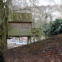
John Carr's Terrace
16 Mar 2021
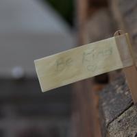
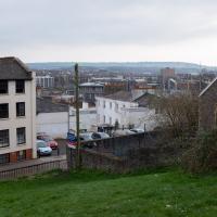
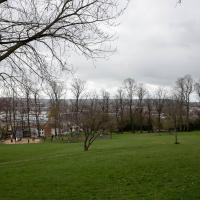
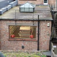
I wanted a nice simple lunch-hour walk that took me past a cafe today, and I managed to find the perfect road to knock off my list of targets to do it. Situated just off Jacobs Wells Road, right next to Queen Elizabeth's Hospital, John Carr's Terrace, and Rosebery terrace above it, which I'd completely forgotten existed, are a little cul-de-sac that many Bristolians will have wandered past a thousand times without ever seeing.
There's a reason it's next to QEH:
Known traditionally as "The City School", Queen Elizabeth's Hospital was founded by the will of affluent merchant John Carr in 1586, gaining its first royal charter in 1590.
John Carr's terrace itself isn't much to write home about, architecturally, but I like the secluded feel of it, and I really liked Rosebery Terrace with its little houses, commanding position and friendly, slightly tumbledown feel.
On the way home I popped into Foliage Cafe for a coffee and a very pleasant nutella and banana pastry, then walked home past the refurbishment of the old Thali Cafe into a new and interesting clinic...
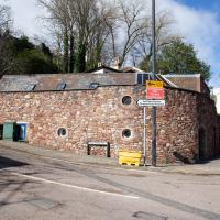
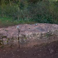
At the end of John Carr's Terrace. Apparently it's a 5 bedroom semi and is ranked as the most expensive property in BS8 1DW, with a valuation of nearly two million quid. I couldn't see much of it. I wonder if it's owned by QEH's headmaster, or something...
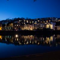
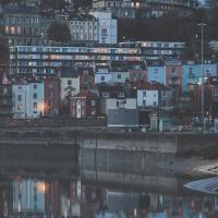
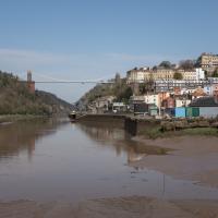
Harbourside Milestone
17 Mar 2021
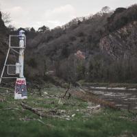
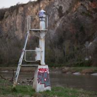
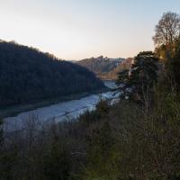
The other day I realised (hello, Maggie!) that my next walk would be my hundredth, and that I'd done 393.4km so far. I figured it would be nice to get to 100 walks and 400km on the same walk, so I went for a nice long harbourside wander after work, rather than dashing out at lunchtime. As it turned out, we're just coming up to the time of year where I can leave the house at 5:30 in the evening and there's still just enough light to take photos by the time I've made it around the harbourside. Though only just, and mostly because I've got a full-frame camera that's not bad in low light...
Still, the evening light made a lovely change, and some of the photos turned out to be pretty good photos per se, rather than just record shots of my walk. I'm looking forward to more evening walks like this as summer approaches.
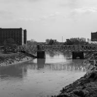
On the way around this evening I wandered through one of the oldest bits of the city to extend my walk and snapped some interesting bits of architecture, including an NCP car park(!) and a nighttime shot of one of my favourite subjects, the clock tower at the Albion dockyard.
The road on the other side there used to just be called Mardyke; the wharf was Mardyke Wharf. Apparently it means "boundary ditch", which presumably was what was there historically.
Quick Around-the-Harbour Wander with Lisa
20 Mar 2021
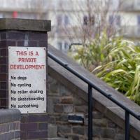
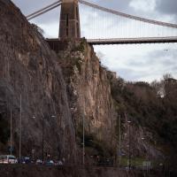
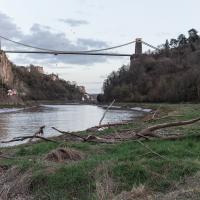
My friend Lisa was meeting another friend for a walk near the suspension bridge, so we fitted in a quick harbourside loop from my place first. We discussed gardening (we're both envious of the gardening skills of the Pooles Wharf residents; we can just about keep herbs alive, whereas they're growing heartily-fruiting lemon trees outdoors in England along with everything from bonsai to magnolias), cafes, work and architecture, among other things.
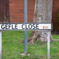
I lived near here when I first moved to Bristol in the mid-1990s. I never had to say the name of the street out loud, but it always reminded me of "GELF" back then—the Genetically Engineered Life Form that was a monster-of-the-week in a couple of Red Dwarf Episodes.
Having just done the tiniest bit of research after noticing while looking at maps that a section of harbourside here used to be Gefle Close, I found out a couple of things that make me feel a bit dim now: It's pronounced, as near as I can work out, "Yev-leh", not "geffel", and it's a port in Sweden, more properly spelled "Gävle", apparently.
Which makes a lot of sense, given that this street is on the Baltic Wharf housing estate, on the site of the wharves where apparently a lot of things from that area were imported and unloaded, especially timber, though Gävle seems to be more well known copper and iron.
It seems Gävle is pleasantly green and widely-spaced these days, having had major fires rip through it three times in the last three hundred years, and finally rebuilit itself with big espanades and a larger grid system with firebreaks. Sounds nice.
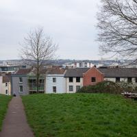
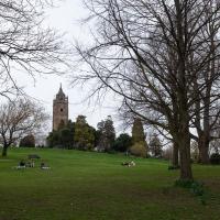
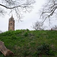
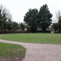
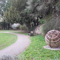
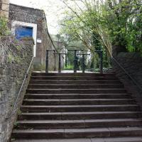
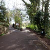
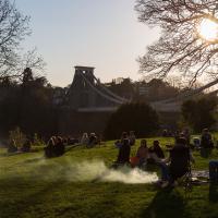
I wasn't going to take a very long walk on this nice spring evening; it just happened. I was going to knock off a path or two on Brandon Hill, home over centuries to hermits and windmills, cannons and Chartists, and then just wander home, stopping only to fill up my milk bottle at the vending machine in the Pump House car park.
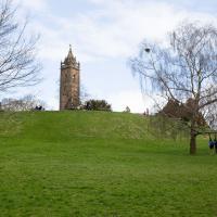
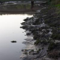
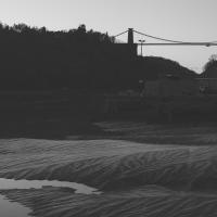
However, when I heard a distant gas burner I stayed on the hill long enough to see if I could get a decent photo of both the hot air balloon drifting over with Cabot Tower in the same frame (spoiler: I couldn't. And only having the fixed-focal-length Fuji with me didn't help) and then, on the way home, bumped into my "support bubble", Sarah and Vik, and extended my walk even further do creep carefully down the slipway next to the old paddle steamer landing stage and get some photos from its furthest extreme during a very low tide...
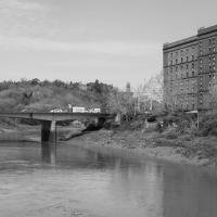
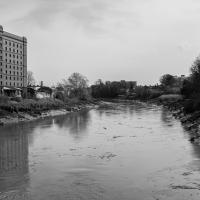
Towpath Evening
25 Mar 2021
I was honestly just about to do the homework from my oh-so-thrilling ITIL course when my friends Sarah and Vik asked me if I'd like to come out for a wander down the towpath with them. I enjoyed the company, the evening light and the delicate clouds.
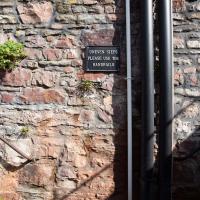
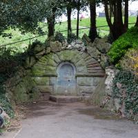
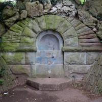
I got interested in Bristol's medieval water supplies after poking around near Jacobs Wells Road and Brandon Hill. It was during that research I found out about a pipe that's still there today, and, as far as I know, still actually functioning, that was originally commissioned by Carmelite monks in the 13th century. They wanted a supply of spring water from Brandon Hill to their priory on the site of what's now the Bristol Beacon—Colston Hall, as-was. It was created around 1267, and later, in 1376, extended generously with an extra "feather" pipe to St John's On The Wall, giving the pipework its modern name of "St John's Conduit".
St John's on the Wall is still there, guarding the remaining city gate at the end of Broad Street, and the outlet tap area was recently refurbished. It doesn't run continuously now, like it did when I first moved to Bristol and worked at the end of Broad Street, in the Everard Building, but I believe the pipe still functions. One day I'd like to see that tap running...
There are a few links on the web about the pipe, but by far the best thing to do is to watch this short and fascinating 1970s TV documentary called The Hidden Source, which has some footage of the actual pipe and also lots of fantastic general footage of Bristol in the seventies.
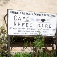
On my walk today I was actually just going to the building society in town, but I decided to trace some of the route of the Carmelite pipe, including visiting streets it runs under, like Park Street, Christmas Street, and, of course, Pipe Lane. I also went a bit out of my way to check out St James' Priory, the oldest building in Bristol, seeing as it was just around the corner from the building society.
There are far too many pictures from this walk, and my feet are now quite sore, because it was a long one. But I enjoyed it.
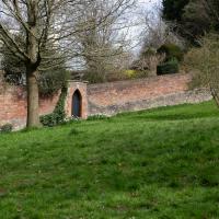
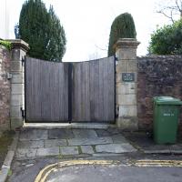
I was tempted to investigate, just to see if it still seemed to be in use as a private entrance to Brandon HIll, from presumably either QEH or possible the Field House at the end of John Carr's Terrace, but I knew I had a lot more walking to do, so didn't divert...
I bumped into my friend Lisa in town during yesterday's wander, and we decided to have a wander today, too. We managed quite a long ramble, starting up through Clifton and nipping down Park Row to investigate the two tower blocks I'd noticed popping up behind Park Street yesterday, then took in a few roads I'd not managed to get to before, including cutting through the grounds of Bristol Grammar School.
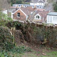
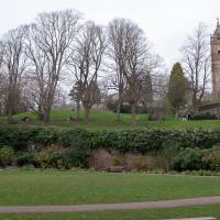
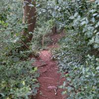
Back on Brandon Hill, we sat and drank coffee and then had another little explore. This looks like it used to be a little path along the wall, but it's overgrown now. I couldn't remember whether it was on the map.
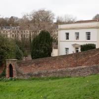
This is the upmarket property whose main entrance is a gate at the end of John Carr's Terrace. It has its own private entrance to Brandon Hill, which must be nice.
Hotwells Evening
29 Mar 2021
Just a little potter around Hotwells with Sarah and Vik. I didn't visit any new streets, but I liked a couple of the photos a lot.
Coffee Run
31 Mar 2021
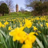
Not a literal run, but I didn't hang about, as I had a job interview to get to (I was an interviewer, not the interviewee, but you still have to be there on time...) Along the way to pick up a lunchtime coffee I mostly seemed to take photos of the high tide, though I also came across a bit of outreach work for small spiny mammals...
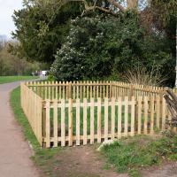
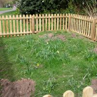
The enclosure seems to be there to keep some daffodils safe, but that sounds too much like overkill to be true.
I noticed I'd missed a bit of Circular Road and Ladies Mile, and it was a nice evening for a sunset wander up to Clifton. There was something I recorded along the way, not photographically but in video.
Bristol Zoo, the world's oldest provincial zoo, has recently decided to close its Clifton site after 185 years of occupation, which means that the sounds of wild animals will no longer drift incongruously through this leafy Georgian area. They're moving everything up to their existing second site, The Wild Place Project near Cribbs Causeway. As I was wandering the Downs, I heard some fierce roaring noises, so I decided to see if I could get a little closer while they were still going on and record a sound that's soon to disappear.
I don't have a way yet to put video directly on this site, so here's a link to the video of my attempt to catch a bit of the zoo noises that I just popped on YouTube. It's sad that this might be the last time I hear such noises in Clifton.
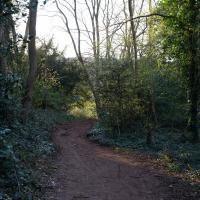
I thought this was a fairly short shortcut to Bridge Valley road that I was tryihg to knock off my list. I was wrong, and I retreated. There's a big network of paths all through this (literal) neck of the woods.
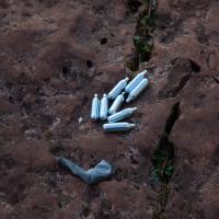
So named because they're often extracted from whipped cream cans.
Nitrous oxide is a common recreational drug. It was Thomas Beddoes and Humphrey Davy who pioneered its use, at the Pneumatic Institute on Dowry Square, coining the name "laughing gas" and inviting friends like Samuel Taylor Coleridge to give it a go, so I don't suppose we can criticise the local youth too much...
I wonder how many generations of mildly disreputable youth have got up to no good on this rock?
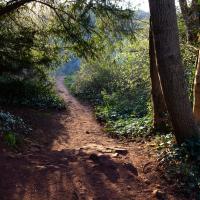
Slightly stymied again by not knowing my way thorugh this little network of overgrown paths, I mostly just followed my ears towards the sound of traffic on Bridge Valley Road.