Tagged: shrub
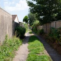
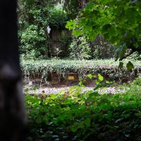
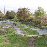
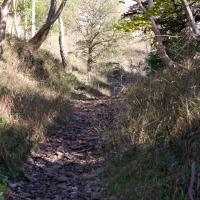
Lunchtime Zig Zag Climb
13 Jul 2021
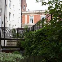
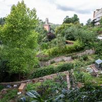
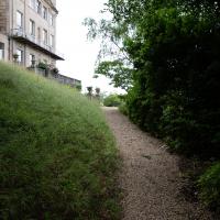
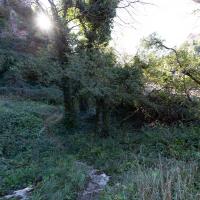
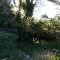
A snappy little trip up the Zig Zag to the shops. It's a steep old route, the Zig Zag, going from just over river level to about the height of the suspension bridge (101 metres) in a compact switchback of a footpath.
I was too busy struggling to breathe to take many snaps of the actual Zig Zag (I've been trying to make it up all the way without stopping the last few times, but I've not quite managed it yet). I did at least take a few snaps either side on this quick lunchtime jaunt to fetch coffee (Coffee #1) and a sarnie (Parsons) from Clifton Village...
When climbing the Zig Zag it's helpful only to focus on where you are, rather than how far you've got left to go.
Pastures New!
17 Jul 2021
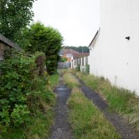
Okay, not much in the way of actual pasture to be had in Bedminster these days, like most of Bristol, but I did take advantage of the current rather toasty weather in Bristol to go and sit under a tree in Greville Smyth Park to read a book for a while before firing up the GPS and taking a little detour around some back streets of Ashton and Bedminster rather than going straight to Coffee #1 for an espresso frappé. This is the first walk in a while where I've actually crossed off an entire new street (the frankly unexciting Carrington Road) as well as exploring a couple of back alleys, just because they were there, really. Along the way I spotted a few examples of graffiti of various qualities, including a live work-in-progress by SNUB23 on Ashton Road and the finished Six Sisters project on North Street.
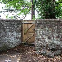
In my defence, this little alleyway/service road looked more like a road on the map. Still, seeing as I'm here...
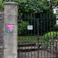
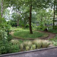
Green Squares and Secret Gardens
31 Jul 2021
At the end of July I went to have a look around some of the private gardens opened up by the annual Green Squares and Secret Gardens event. Sadly it was compressed into a single day this year, for various Covid-related reasons, it seems, so I didn't get to poke around too many places. I went to:
- A talk by the oldest resident of Victoria Square
- The St Vincent's Rocks Hotel garden
- The Paragon garden
- Cornwallis Crescent gardens, both east and west
- The Polygon garden
And snapped a few things in between, too. It was a lovely day—a bit too hot, if anything—and it was interesting to get into a few places I'd only ever seen from the outside, especially The Paragon and Cornwallis gardens, which are the least visible to passing strangers of all of them.
The Victoria Square event was at 11am, and I didn't have a lot of energy, so hanging around until 2pm for the Richmond Terrace Garden to open would've been too much for me. Maybe next year! The event might be back up to the whole weekend by then, rather than being squeezed into a single day.
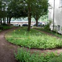
I think at the far left edge of this photo, near the bottom, you can see about as far as I got down the old Prince's Lane on a previous wander. This pic was, I believe, taken looking up at the garden in the foreground. I think the greenhouse there is still being constructed, and wasn't there during my earlier wander, but you can see some of the building materials, I think.
A Long Wander Of Miscellany and Magick
08 Aug 2021
This was a wide-ranging wander. I started off crossing the river to Bedminster, to walk a single little cul-de-sac, Hardy Avenue, that I'd managed to miss on at least one previous walk. Then, pausing only to explore a few back alleyways, I headed for a few destinations related mostly by the Hughes family, who I've been researching a little as part of background for a possible novel, as several of them were involved in the Stella Matutina.
However, mostly it's the artistic side of the family I wanted to explore today, as that's where most of their public history lies (as you might expect, there's often not much in the public record about the workings of an occult organisation.) First I visited College Green, where the façade of the Catch 22 Fish & Chip shop still bears the work of Catherine Edith Hughes. Then I wandered up to the top of Park Street to pop into the Clifton Arts Club's annual exhibition, as Catherine, her half-brother Donald, his wife Hope and at least two other Hugheses were members. Donald was chairman for 40 solid years; Hope was Secretary for eight, and Ellard and Margaret Hughes, two more Hughes siblings, were members along with Catherine.
Finally I walked home with a small diversion to Berkeley Square, to confirm the location of Donald Hughes's house by checking for a particular plaque by the front door.
I must admit I'm not entirely sure where all this research is really leading me, but I'm finding it quite interesting to bump across the faint lines of history that link the Hermetic Order of the Golden Dawn, founded in 1888, to modern, quotidian Bristol.
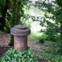
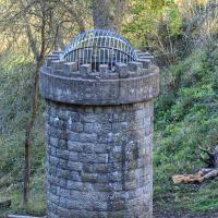
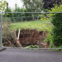
A little remnant of the Avon's history, I assume, gently rusting away on the bank by Cumberland Road
Museum of the Moon, and a Bit of Redland
21 Aug 2021
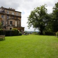
Lisa and I mostly went out to have a look at Luke Jerram's Museum of the Moon as its tour hit Bristol Cathedral—I missed it when it was previously in town, at Wills Hall, I think—but we also took a trek up to Redland. Lisa's kind enough to indulge my strange current fascination with the Edwardian eccentrics that made up the Stella Matutina, so we swung by a couple of places with a vague connection to the Bristol branch of the organisation. Well, it was good walking, anyway...
As a stunning bonus, one of the picture's descriptions has more information than you'd probably want on the Bristol Port Railway and Pier's Clifton Extension Railway line, but I did happen to coincidentally write up this wander after reading about the extension line during my lunch hour at work today. It's a thrilling life, I tell you...
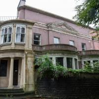
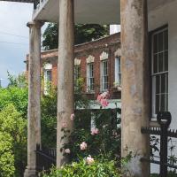
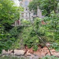
Formerly a house, now a nurses' home, according to Historic England. Seems to add up, as it appears to now be on the grounds of the Bristol Homeopathic Hospital, which is "being used as the student health service for Bristol University"
On the left of the door is the service wing, apparently. It's a sprawling old place, and seems very awkwardly shoehorned into this corner. It looks from old maps like it was backing onto a quarry for a while, before that was filled in and the homeopathic hospital was built there.
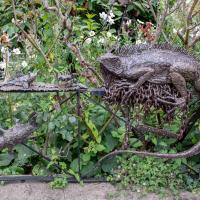
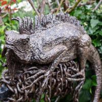
Mostly the Metal Animals of a Clifton Garden
30 Aug 2021
Lisa and I went for a longish walk, but I didn't take many photos. Mostly we just wandered and nattered. Unusually, my target was outside my 1-mile radius on Burlington Road in Redland, where I snapped quite a few photos of the collection of artistic animals by Julian Warren. This was mostly to provide a fairly arbitrary destination for a roundabout walk in Clifton...
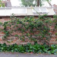
I don't know enough about fruit trees to know what this was, but I can tell you that the fruit was apple-ish and very sharp indeed.
Unusual to see an espalier on a north-facing wall. This one faces the little car park behind Freeland Place
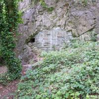
From an Avon Gorge Geology Excursion Guide I dug up:
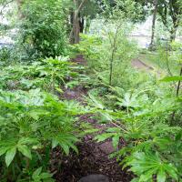
Just south of the Observatory, on the right of the path is a children’s playground [ST 5667 7325] in the remains of a limestone quarry. In the back wall is a bricked-up adit, presumably representing the entrance to a former iron ore or lead mine (Fig. 10C). The roof of the adit is fissured and sparry, crystalline calcite can be seen in fissures.
The playground itself is in one of the the quarries used for the Suspension Bridge materials.
I recently indulged myself by buying a little piece of history. I've mentioned Samuel Loxton and featured and linked to his drawings before, often in the eminently browsable Loxton Collection albums that Bristol Libraries has on Flickr. So when I saw a Loxton drawing of Hotwells pop up on eBay, I decided to get myself a little treat.
I don't think there's any Loxton drawing that features the road I actually live in—it's not very visible from anywhere else, not being one of these Clifton terraces that's perched at the top of a hill, or anything like that, and it's invisible in most views of the area. However, this Loxton drawing, Hotwells, Looking across the river from near the Clifton Bridge station, is probably the closest near-miss I've seen.
I decided to wander out one morning and see if I could reproduce the picture, and also take a photo or two of what's now become of the Clifton Bridge Station, which is still just about discernible in places.
(Then on an even stranger whim I decided to check out a possible little cut-through from Cumberland Road to the harbourside I'd been eyeing up on my commute to work, so walked to Wapping Wharf for a croissant via this potential new route, but that bit's not quite as interesting...)
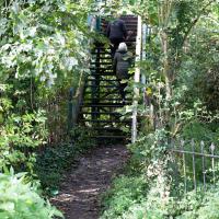
After carefully skirting the edges of the homeless people's camp that I accidentally found skirting the edges of the tall grass between the allotments and here, I came across my first destination: the footbridge from Clifton Bridge railway station. This is apparently the actual station footbridge, still in service for crossing the lines.
Many people in Bristol will know this as one of the chief ways people from this end of town used to get to Ashton Court, especially for the music festival or the balloon fiesta, before the shiny new Festival Way footpath was installed a decade or two back.
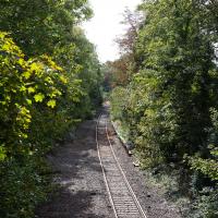
I've been across it before on my wanders, but I didn't know then that it was a remnant of a railway station, rather than just a standalone bridge.
You can just about make out the platform still, there on the left. There used to be a second line and an eastern platform, too.
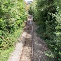
Clifton Bridge Railway Station was also known as Rownham Station from 1891 to 1910.
It was part of the Port and Pier railyway (as was Hotwells/Clifton station on the north side, nearer my house), opened in 1867, and closed, inevitably, by Beeching, with passenger services stopping in 1964 and freight a year later.
Wikipedia says "Freight trains continued to pass through the station, but their number decreased over time, with the line falling out of regular use from 30 March 1981. The route however was kept intact by British Rail, with occasional freight trains, and in 2002 a single track was relaid to allow rail access to Royal Portbury Dock", so I suppose even the single line we see here is newish.
Adjacent to the station was the New Inn, Rownham, which you can see a bit of in this photo from the Tarring Collection on KYP (or in this Tweet.
People will know the station site as the place where the local police's mounted and dog sections had their headquarters/stables/kennels, though they moved out a couple of years ago, I think.
Although the line is scheduled to return to passenger service as part of MetroWest, the nearest station will still be Temple Meads, so even though there may be passenger trains heading out to Pill and Portishead through here, ten minutes' walk from my house, I'd have to get all the way into town to come back out again, so it would probably be quicker for me to drive. Shame.
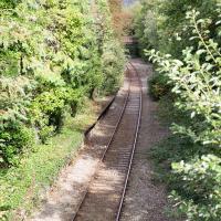
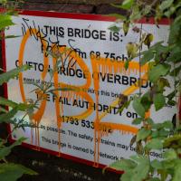
At the other end of the Clifton Bridge Railway Station is a little road bridge that I've crossed many times. It's nice to see, under the inevitable tagging, that it's called Clifton Bridge Overbridge, so the name of the old station does live on a little in reality, at least for Network Rail.
(The footbridge from earlier is called Rownham Hill Bridge on its little placard.)
Fresh Fields
17 Oct 2021
For the first time in a while, I had the time and energy to go further afield and knock off some new roads from my "to do" list. I headed through the first Hotwells Festival to Ashton and Bedminster to cross off a few of the suburban roads south of North Street.
First, though, I decided to try to reproduce an old photo of the now-demolished Rownham Hotel just around the corner from where I live...
Makes a change from a doorbell. Foxcote road had quite a lot of these little boho touches; it's clearly one of those Bemmie streets that attracts the slightly eccentric type.
I went out simply wanting to knock off the very last little unwalked section of Clanage Road, over by Bower Ashton, which has been annoying me for a while as it's quite close by and I've walked the other bits of it several times. So, my plan was to nip over to Greville Smyth Park via a slightly unusual route to wander Clanage Road and tick it off.
Along the way, though, I inevitably got a bit distracted. I took a few photos of Stork House, a grand Hotwell Road building that's recently been done up a bit (I imagine it's student lets, though I'm not sure) and which I found a reference to in a book about the Port Railway and Pier the other week, and also tried to match up a historical photo of Hotwells before the Cumberland Basin Flyover System laid it waste, which included some interesting markers I'll have to do a bit more digging into...
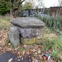
A milestone, perhaps? And there looks to be a benchmark on the bigger bit.
Aha! A quick look at the historic OS maps on Know Your Place finds a marker right on this spot marked "B.S.", which the National Library of Scotland's helpful abbreviations page translates as "Boundary Stone". With that in mind I then had a look on the wonderful geograph site and there it is:
The front stone appears to be an old boundary stone, delineating the Administrative County, Parliamentary County and Rural District boundaries that were part of the Bristol limits in the twentieth century, possibly dated 1897? Behind it is a larger block of stones that may have been part of the Smyth estate further up the hill. On the latter is a partly hidden benchmark.
So I spotted the partly hidden benchmark correctly, too :) There is, of course, a benchmarks directory with an entry for the benchmark itself. What did people do before the internet?
EDIT TO ADD Nearly a year later, I watching a DVD Bristol Railway Stations by Mike Oakley and found out what the larger bit behind the milestone actually is: it's the last remnant of the Clifton Bridge Station buildings, which once faced out onto the road here.
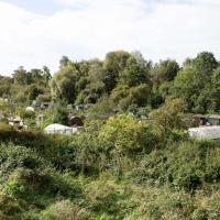
It's surprising how much I forget is packed into this little area. There's the old station, the vast allotments, the cricket ground, the former police horse and dog unit, all the other stuff... Looking at Google Maps there may also be a day nursery and an escape room. It's a busy little area.
The more I research it, the more I find that Hotwells had far better transport links back in Victorian and Edwardian times than it has today. Along with buses that went to more useful places than the City Centre, there were trams, the funicular up to Clifton, the landing stage for paddle steamer services and two railway stations all within easy walking distance of me.
Today I took a day off work as preparation for doing the bookkeeping for my tax return1, and took a wander along to the site of what would have been my nearest station, Hotwells (or Clifton, as it started out in life), nestled in the shadow of the suspension bridge, the Bristol terminus of the Bristol Port Railway and Pier.
From there I wandered down the Portway, following the original line, until I got to the area around Sneyd Park Junction, where the tunnel from the slightly later Clifton Extension Railway joined up with this originally-isolated BPR line. Then I headed up to Clifton through the "goat gully" at Walcombe Slade, seeing the few above-ground bits of evidence of the tunnel (which is still in regular use) along the way.
It was a lovely day, and a good walk, and it was interesting to daydream of the times when I could have walked a few minutes from my flat down to Dowry Parade, caught a short tram ride to Hotwells Stations, and then headed from there to Avonmouth, perhaps even to board a transatlantic passenger service. The completion of the Clifton Extension Railway that linked the Avonmouth station with Temple Meads made relatively direct transatlantic travel from London via Bristol possible, with passengers travelling up from Paddington to Temple Meads, on to Avonmouth on the Clifton Extension Railway and Port Railway and Pier line, then perhaps catching a Cambpell's paddle steamer—which sometimes acted as tenders for large steamers—to a larger ship that was headed out for Canada, say.
1 I've learned that the best approach is to take two days off and deliberately do something that's not my bookkeeping on the first day, as otherwise I just inevitably end up procrastinating and feeling guilty on the first day no matter what. I have an odd brain, but at least I'm learning strategies for dealing with its strange ways as I get older...
2 Information mostly gleaned from Colin Maggs' The Bristol Port Railway & Pier and the Clifton Extension Railway, The Oakwood Press, 1975.
But both unlocked, and standing open. I chanced it, on the basis that I wasn't going to do any harm to the place, and there weren't any signs telling me to keep out.
I don't know for sure if I was even trespassing, but for goodness' sake don't trespass on actual railways, kids. I'd carefully done my research and there haven't even been tracks here since 1921.
There are no signs of the railway to be found between the gate and the nearest tunnel entrance further north, as you'd expect, really.
I'm fairly sure I'm standing about where the train tracks used to be, facing the entrance to the station at the south platform end. To the left would have been the turntable for rotating the train onto the run-around loop to go back the way it came, and behind that the little stationmaster's house.
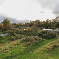
It's so overgrown today you can't even tell if the shape of the landscape from the postcard is still in place.
If I hadn't seen the photos and maps I'd have had no clue that there was once a busy railway station here, with three tracks, a platform, a ticket office, a turntable, a station master's house and so on. The last train would have been, I think, on 19 September 1921.
Hotwells Halt, the extension platform put in just north, on the other side of the first tunnel, survived until 1922, but after that everything would have changed for the Portway.
Not everything was lost, though. The rest of the line was effectively saved by the fact that it joined up to the main rail network (and didn't need to be completely obliterated to make room for the road.)
The joining to the mainline was achieved by the Clifton Extension Railway, which included a tunnel from Clifton Down to Sea Mills, the next station along from Hotwells Halt, and the closest surviving Bristol Port Railway station to Bristol.
The CER line is still in use, and we'll be taking a route that checks in on the tunnel in a few pics from here...
I've already earmarked that bench as a nice place to come and sit with a flask of tea on similar days.