Tagged: road-surface
Near and Far
05 Jan 2022
I took advantage of a rare recent day where it wasn't tipping down with rain to get away from my desk on a lunchtime workday and head up to Clifton Village. I'd hoped to snap a reproduction of historical photo which I'd worked out had been taken from the Suspension Bridge, but the gods were not smiling on me. Still, taking only a nice long lens with me worked out very well as the lovely haze of the day made more distant views quite dramatic...
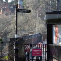
Damn it. That's the bit I wanted to take my photo from. Still, at least on the way here I got some nice pics that I probably wouldn't have tried if I hadn't taken long lens out specially.
Quick Clifton Jaunt Finishing with Southville
09 Jan 2022
It's been pretty dismal recently, weather-wise, so when Sarah called up to say that she and Vik had just left the swimming pool at the student union building up in Clifton, and would I like to join them for a trip to the Last Bookshop, also known as The £3 Bookshop, for reasons you can probably deduce, I leapt at the chance.
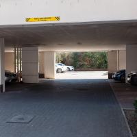
Not many photos on this walk, but I did manage to get down a little road I'd never been to before, basically just the access road to a car park at a block of flats, but it was on the map looking all tempting, so I figured I'd knock it off the list as we were passing.
Lunchtime Reproduction (of an old photo...)
17 Jan 2022
This was basically the quick lunchtime jaunt I tried to do at the beginning of January, only this time I actually managed to get to roughly the viewpoint I'd been hoping for to recreate a historical photo of the Bristol International Exhibition.
I did this walk about a month ago, but I've been a bit poorly and not really up to doing much in my spare time, and it's taken me this long to even face processing even these few photos. Hopefully normal service will be resumed at some point and I can carry on trying to walk any roads and paths that I need to do to make this project feel complete...
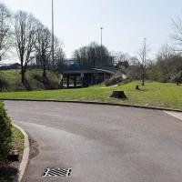
We've been as far as we can go down there on an earlier wander. From the top you'd just think it led to the Hotel car park.
The Colonnade, the Rock House, St Vincent's Parade and the old landing stages for Campbell's paddle steamers. The leftover fruit of bygone boom years.
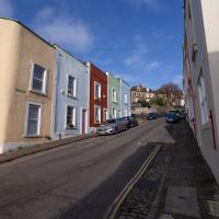
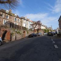
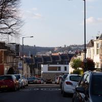
Lunchtime Cliftonwood Wander
18 Jan 2022
Another workday, another quick lunchtime trip to get me out of the house. This time my flimsy pretext is a tiny bit of Clifton Vale Close that I'd apparently not walked, and the fact that although I'd walked down Church Lane at least once before I still hadn't taken a single photo of it. Really I just fancied a mosey through Cliftonwood in the sunshine, with the promise of a coffee from Clifton Village at the top of the hill.
Or a bit of it, anyway. Getting back into the spirit of this project a bit by knocking off the odd end of a road that I'd noticed wasn't filled in on the map yet.
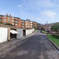
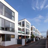
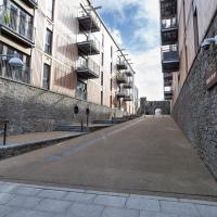
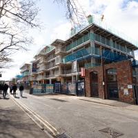
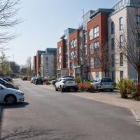
As modern flats go, these seem pleasant enough, and some of them will have amazing views. The don't seem terribly inspiring inside, from what I've seen of Rightmove pictures, but they certainly could be worse.
We've popped down here before, on the site of the Clifton National School that didn't survive bombing in the war.
Today, the modern flats look to me as I imagine their original models would have done back when they were still just an idea on an architect's table (or more likely computer monitor, I suppose.)
This is the road I didn't have many (or any) snaps of that inspired my route today, not that I need much of an excuse to traipse around Cliftonwood on a sunny lunchtime.
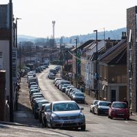
Bedminster Trip for New Walking Shoes
26 Feb 2022
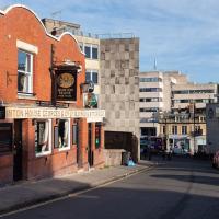
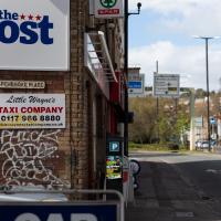
I needed to buy new walking shoes—my old ones were squeaking and it was driving me up the wall—so I ordered some for collection from Taunton Leisure on East Street in Bedminster, and decided to make picking them up an official wander.
I didn't cover any new ground within my mile, but I did take advantage of the trip to take in a few interesting things just outside my normal radius, mostly New Gaol-related. Along the way there are a couple of sanitation-related diversions, including a visit to a rare manhole cover. You can hardly wait, I can tell!
At the end of the tracks is the engine shed built into the end of the M Shed museum.
Wapping Wharf was fairly busy. I didn't stop for a coffee from Mokoko or Little Victories, though it's always tempting.
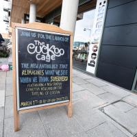
The blurb for The Cuckoo Cage sounds fun:
In this unique experiment, twelve authors have been tasked with resurrecting that tradition: to spawn a new generation of present-day British superheroes, willing to bring the fight back to British shores and to more progressive causes.
But I'd probably take issue with the experiment's claimed uniqueness, given that it sounds virtually the same concept as 1991's Temps. Still, I'll be interested to read it and I snapped this to remind myself that I might want to get a ticket for the launch.
Here's a first glimpse of something I'm interested in seeing even though it's just outside my mile radius.
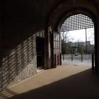
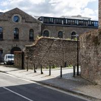
Or possibly the way in. Can't've been much fun, being escorted through these gates and knowing you were going to stay here for some time. I doubt prisons have ever been a barrel of laughs, but Victorian prisons definitely have a fairly terrifying reputation.
You can see the New Gaol entrance there on the left, poking out incongruously from the modern flats, with the spire of St Mary's rising from behind it in the distance.
Presumably this was the entrance to the stairs down to the ferry, long ago bricked up. There certainly seems to be a stairway behind it, though it's hard to tell for sure...
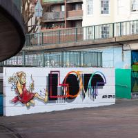
In Which We Begin and End with Love
05 Mar 2022
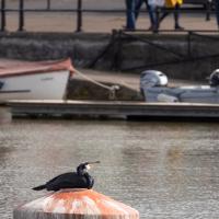
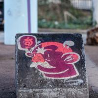
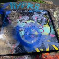
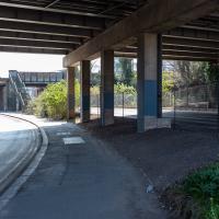
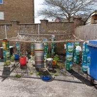
I had a lot to get done around the house, so as soon as I heard there might be a shiny new piece of street art near me, under the Cumberland Basin flyovers, I immediately decided that was all the excuse I needed to set off on a round-the-harbour lunchtime walk to get some fresh air and see if I could spot it. So, here's a circular wander that takes in graffiti, boats, wildlife and graffiti again...
Leigh Woods Purple Path
12 Mar 2022
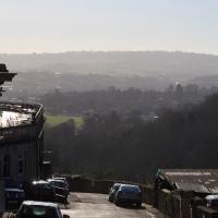
There's a few tracks in Leigh Woods that lie within my mile and show up on my map but that I've not walked yet, so I decided to take one of my traditional big long walks through the woods on this nice crisp sunny morning.
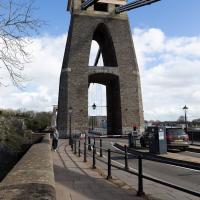
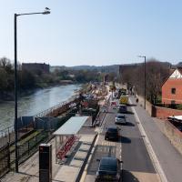
For years—decades, even—I've been doing a similar route from my place, along the towpath to the far woods entrance, up the hill for a varied walk on one of the marked tracks and then across the Suspension Bridge to Clifton Village for a coffee-based reward. It's my default "long walk", really, and I almost always enjoy it. Today, at last, spring actually seemed to be springing, which made for some extra positivity...
"Swing bridge machinery by Sir William Arrol & Co. Ltd": Sir William was knighted for his commitment to his work on both the Forth Bridge and the replacement Tay Bridge, erected following the loss of the previous bridge in the great Tay Bridge Disaster. He was also responsible for knocking up some other little bridges around the country, like london's Tower Bridge, to pick an example...
My friend Sarah made a podcast episode about Sylvia Crowe (credited bottom right on the plaque) and her development of the landscape in this area, with Wendy Tippett, a local landscape architect. It's a great listen if you're familiar with the area, and explains all sorts of things, including the PPILA after Sylvia Crowe's name on the plaque: Past President, Institute of Landscape Artists.
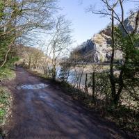
The towpath is a lovely stroll in weather like this. Waterproof walking shoes help, though, as the puddles are often wide enough to span the entire width. I baptised my new walking shoes on this trip.
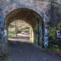
There are several ways into Leigh Woods along the towpath, all underneath bridges of the Portishead branch line that runs above.
At the one before this, which is normally locked and leads into a disused police shooting range, a woman beckoned me over to where she was standing with her bike, looking through the gates. "I think I've found your best shot today," she said Sadly, the very wide lens on the camera would have made any picture of the young deer that was standing in the sunlit distance a bit rubbish, so I contented myself with a few moments just looking at the scene.
One of the things you learn as you improve as a photographer is when not to bother trying to take a photo because you can't do it justice, and to just be in the moment and enjoy it instead.
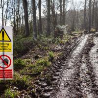
I was heading for my usual mid-walk picnic bench but I guess they're logging in that area right now, so I had to divert.
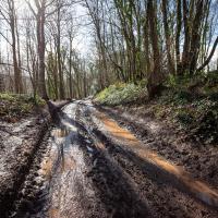
The going is normally a little firmer here. I guess that tractor's been going back and forth a lot, and the recent near-continuous rain probably hasn't helped.
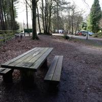
It's not my favourite bench, but it'll do. And it's a decent distance away from the mediocre cafe in the car park that seems to need to run a generator all the time. Maybe they should hook it up to that abandoned electric pole, at least it would be quieter.
I'd mind less if they did a decent flat white #firstworldproblems, but they don't. Their cakes are decent, though.
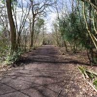
I knew that bits of the Purple Path in the woods were on my map but as-yet-unwalked, so I figured I'd do the loop. I couldn't easily check any maps as Leigh Woods is pretty much a black spot for mobile data. That's one of the reasons I like it, really: you're surprisingly out-of-touch in these woodlands. A shortish walk out of the city and you're in a forest with no access to Instagram or Twitter or what-have-you.
Now to finish off the walk in my traditional way: buying something pleasantly unhealthy from one of the coffee shops of Clifton Village (I ended up in newly-refurbished Parsons Bakery for food, and the excellent Foliage Cafe for a flat white.)
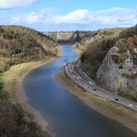
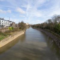
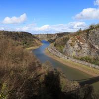
This is the point on the walk where I get to look at how far I've walked, by looking down on the towpath and seeing tiny things in the distance that I was right next to earlier, like the white navigation light you can just see toward the far end of the curving flood plain of the river down there.
I mostly went out to hang out with my friends Sarah and Vik in Bedminster, but along the way I thought I'd take a closer look at something a little nearer home: the last crossing point of the Rownham Ferry.
If you were following this route you'll have noticed I just magically took a shortcut through a bunch of houses. That's because I've elided the bit of the route that goes to Sarah and Vik's place and stays there for an hour or two.
In the distance is EE's temporary cell tower, which I've mentioned before, put up in November 2020.
Looks like the stones at the bottom corner were replaced with some simple poured concrete with grip lines drawn across it at some point.
A Coffee and a Curve
27 Mar 2022
I wanted to have a wander along to the Tobacco Factory Market for some shopping, and checking the map for any leftover nearby streets I noticed a tiny curve of road on the way into the modern flats at Paxton Drive that it didn't look like I'd walked down before. I wouldn't take me too far out of my way, so I decided to head there first and then across to North Street to get my groceries and a coffee...
Here we are at the tiny loop of road that looked like it hadn't been walked. It has very little to recommend itself in any other capacity.
Paxton Drive always reminds me of Blake's 7, but in fact in the episode Stardrive it's actually Doctor Plaxton's drive that's the MacGuffin.
Well, I hope he's bringing the sign he nicked from this end of Paxton Drive with him.
It looks on the map like there are little side streets off Paxton Drive. There really aren't, just these little car parking areas. Hence I didn't walk down any of them.
Which then becomes North Street, my destination. I need a coffee and some lunch and some veg.
At some point, the Council say that the Chocolate path will finally be repaired and I can at last add one of my favourite paths in Bristol to my One Mile Matt project.
Here's hoping.
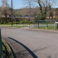
I noticed I had a few things on my "potential wanders" list that could all be done relatively close to home, and in a fairly straight line, so I set off at lunchtime to recreate a photo of a now-defunct pub, wander behind a Spar (which turned out to be more interesting than I'd expected, but I admit it's a low bar) and spend some time browsing in Dreadnought Books before coming home via a coffee from Spoke & Stringer, a little diversion up Gasworks Lane and a tiny bit of the Rownham Mead estate I'd somehow previously skipped.
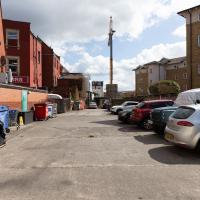
Here we are at the end of Pembroke Place, wandering a little alleyway I'd not previously filled in on the map. I didn't have high hopes for much of interest in this parking area behind Spar and Marcruss Stores. However, I did find something interesting, as we'll see in a couple of photos' time.
I can only guess that the Raj Bari restaurant has been trying to grow their own herbs and spices. Doesn't look that successful at the moment, to be honest, but maybe I'm looking at things that aren't in season...
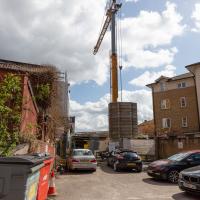
Not much to be seen in this direction except the crane on the site where they're busily filling a gap with new flats. We'll see the front in a little while.
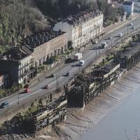
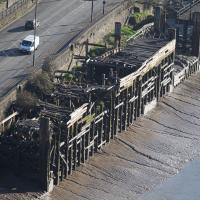
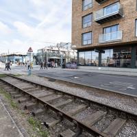
Remnants of the docks railway. These ran around the harbour to Ashton Avenue Bridge to the west, and along to the main Goods Depot at Anchor Lane to the east.
I think this may be the last visible remnant of the harbour railway on this entire stretch of the Hotwell Road. There may still be some tracks around Canons March—that whole area south of Anchor Road had a lot of rail lines—but I've not seen any others west of Jacobs Wells Road.
Here's the entrance to Pembroke Place on the Hotwell Road. Looking at old maps, before it was Pembroke Place it was Blackhorse Lane.
While we're on a theme of things to find down alleyways...
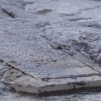
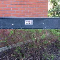
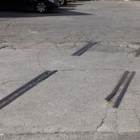
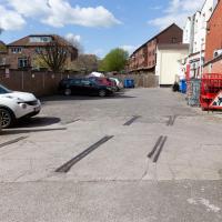
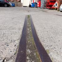
We've had a wander around the old gas works site before but I wanted briefly to focus on one tiny detail, which is to be found in this alleyway called Gasworks Lane.
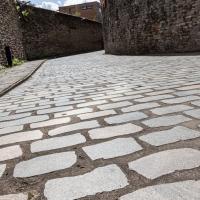
And here's the detail of Gasworks Lane I find interesting.
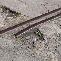
Part of my preferred walk to work is over the cobbles below Redcliffe Parade. It's not one of my favourite bits, because the going is treacherous and you have to look down at your feet all the time to make sure you don't come a cropper on the old and very uneven cobbles.
Here in Gasworks Lane things are different. Apparently the council used an interesting new technique that, according to Bristol247, they've experimented with in a few places across town.
The idea is to keep the classic look of the cobblestones but smooth out the ride for pedestrians and cyclists by taking the existing stones, cutting them in half to give a nice flat edge, then re-laying them lumpy-side down.
I'd not noticed it until I read the article, but I appreciate this technique now, and it'll be interesting to see how much more it gets used around the city.