Tagged: hotwell-road
Coffee and Graff
22 Jan 2021
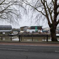
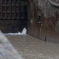
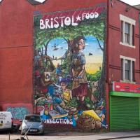
Took myself around the harbour to Imagine That's horsebox cafe and treated myself to a flat white and a sourdough cheese toastie. On the way there and back I encountered some local flooding and various bit of graffiti, from some ugly tagging on someone's front windows to a large new piece being added to Cumberland Piazza in the ongoing attempts to cheer the place up.
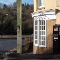
Can't be pleasant to have your house tagged. I don't imagine that anyone living in a house right on an arterial road whose front door opens virtually onto a pllar supporting one of the ugliest street signs of the Cumberland Basin is exactly swimming in money or time to re-paint their frontage, either.
Another Lunchtime, Another Quick Coffee Trip
28 Jan 2021
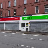
With very little photography, and no new streets. Still, I did manage to buy milk at the "Simple Cow" vending machine—and "simple" is very definitely false advertising; it took me bloody ages to work out how to use the thing—and snap the new ACER/SEPR piece down in Cumberland Piazza.
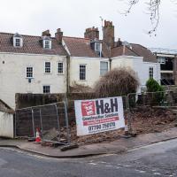
This was just a little car park, presumably for the house behind? Probably going to be turned into half a dozed bijou flats, or something...
Unexpected Snow
31 Jan 2021
I just nipped out to post a blood test (not Covid-related) and check that my car was okay, because I've not driven it for weeks. I was just going to walk up to Clifton Village, but I spotted the opportunity to re-park the car on my street rather than up the hill around the corner where it was, so instead I got in, intending just to move a hundred metres, but it turned over slowly before it started, and then warned me that the battery was very low and I should go for a long drive to recharge it.
So, I did my best, zipping up the A4018 to the motorway junction and back again, dropping off my blood at a postbox along the way, and while I did that, it started snowing. I noticed it was low tide, too, so when I got back home I headed back out again, this time on foot and with a camera so I could see if I could find any evidence of the Hot Well steaming.
I saw not a single sign of the Hot Well steaming, but it was quite a nice quick outing and I enjoyed my brief walk in the snow. Iike Hinton Lane, too, and while it's all old ground I was re-treading, I did at least get a picture or two with a bit of snow and some of the cold winter atmosphere of the trip, I think.
Went down to see if I could see it steaming. No dice. I really want to clear the spring of all that junk every time I see it, but I have no means to do it, let alone the knowledge and wisdom to know if it might do more harm than good...
Jacob's Well Wander
01 Feb 2021
I just wanted to get some exercise, really, so I set out to knock off the lower bit of Jacobs Wells Road that I'd not managed to walk up yet. I set the new signboard that the community association had had erected as my destination, after reading about it on their blog.
As it turned out, I couldn't even read it, as the building that houses the actual Jacob's Well had water flooding out onto the pavement. I wonder if it was actual Jacob's Well water? Have the soles of my walking shoes been mystically blessed now?
You can't see much of the flood in the photos I snapped, but I did shoot a little video, too. Ed on Twitter said:
I spoke to the seller at the time with a view to buying it - I mentioned an old friend who grew up nearby remembers it flooding regularly. He swore blind my friend was wrong.
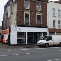
The first local electric bike shop was at the bottom of Jacobs Wells Road; it seems to have attracted some larger competition. I think this place was a sporting goods shop before, specialising in cricket equipment, if my memory isn't deceiving me. When the shutters are up, they've got a large range of electric bikes and scooters on display.
It's a bit higgledy-piggledy, this little stretch that leads to the car park by the Grain Barge mooring. The Thai restaurant at the end was a fusion restaurant called Michael's with an excellent reputation when I first moved to Hotwells. The Thai is great, from what I remember, but I don't eat out very often, not even locally.
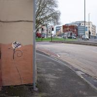
I'm guessing by local artist ©opy®ight, though I may be wrong, of course. Graff's not really my strong point.
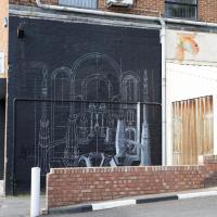
Another day, another coffee. I think I may have knocked a tiny footpath in Baltic Wharf from my list of leftover paths in the area, but mostly this walk was about getting out into the crisp February cold and enjoying the walk. On the way I posted a letter at 13 Dowry Parade (home of a surgeon called Willam Falls back 1830, according to Pigot's Directory of Gloucestershire...) and pondered the strange duality of Dowry Parade and Hotwell Road, then wandered through the Dowry Parade end of Cumberland Piazza, enjoying the clean lines of the glyph graff, before taking the causeway route past a Cumberland Basin empty of water but full of seagulls, to make my way south of the harbour.
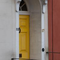
I went down to Dowry Parade to deliver a letter that had unaccountably been delievered here, a few streets away. It was only because the address as 13 Dowry Parade that I noticed this strange duality I'd not spotted before. The start of "Dowry Parade" has numbers in the three-digit range, because it's actually Hotwell Road, really. But a handful of them have both Hotwell Road numbers and their presumably-older Dowry Parade numbers. So, here's a snap of either/both of 315 Hotwell Road, or 17 Dowry Parade.
Brief Jaunt to the not-so-Hot Well
13 Feb 2021
It's been very cold the last few days, so seeing as it was low tide at a convenient afternoon hour, I just wandered out to see if I could see the hot well steaming. I've been told that you sometimes can, on a cold day, but today, as with every other day I've tried, there was nothing in evidence.
It may be that the emergent spring has already filtered through too much cold river silt by the time it hits the surface these days, or even that it's running cooler than it used to. But perhaps I've just been unlucky.

You'll forgive me if I don't get my factual information on the pandemic from stickers on railings.
The latest Public Health England information shows that since 21 March 2020, there have been 89,698 excess (compared to recent previous averages) deaths in England (stats to end of January 2021). 105,081 deaths mentioned Covid-19. For the most recent week we have figures, nearly 5,000 people died compared to the same week in recent years.
(Also, who gives a toss if the people had some kind of "prior condition"? They still fucking died. 'Oh, well, he was two stone overweight, and his wife had anaemia. It's perfectly fine they died an agonising death from Covid-19 in their forties, because they were clearly too weak to bother about anyway...")
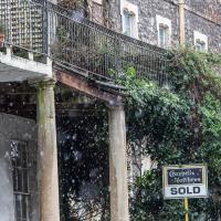
According to the estate agent's brochure I just found, including the cellars this place has 567 square metres of space to offer. There was not a price in the brochure, but back in 2017 they were asking for "offers over £1,995,000".
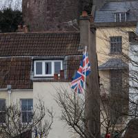
Very Brief Hotwells Wander
18 Feb 2021
Really just a quick loop of the Cumberland Basin. I was going to go further, and it was a nice early spring day, but I hadn't slept that well and I wasn't really in the mood. Ah well. Not every walk is great. At least I got out of the house for a bit.
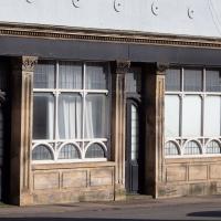
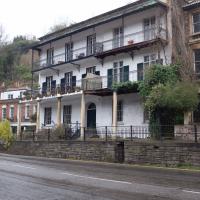
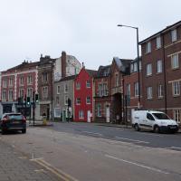
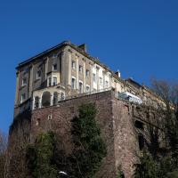
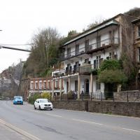
I've not been able to find much detail on this one. It's marked as a public house for a long stretch in the old maps, and on the 1879-1888 town plans named as the York Hotel. I've also seen the names York House Hotel and New Inn associated with it.
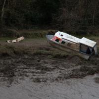
I'm glad my friend Lisa joined me today; she drove in from Shirehampton and told me that the Portway was looking rather lovely, so we set off that way. She's also braver than I am when it comes to doing urbex stuff, so this was just the opportunity to take a peek into the Portnalls Number One Railway Tunnel/Bridge Road Deep Valley Shelter whose entrance I'd found on a previous wander.
It was definitely dark and spooky and impressively big, with a side tunnel that Lisa explored that leads to a little door I don't think I've previously noticed on the side of the Portway. I didn't get many photos—even my astoundingly powerful little torch (£) didn't do much to light things up, and you're not going to get much joy hand-holding a camera in that darkness—but I did shoot a little video, which I might edit and add later.
After plumbing the bowels of the earth, we went up Bridge Valley Path to Clifton, explored some bits around the College and Pembroke Road, then came home via Foliage Cafe for coffee. Nice.
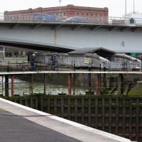
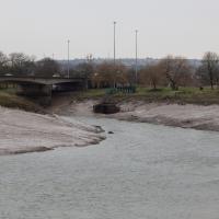
Harbour Circumnavigation
01 Mar 2021
Normally I don't have enough time in my lunch hour to get all the way around the harbourside. This is a shame, as Wapping Wharf is a great place to get coffee and a snack, but it's pretty much diametrically (perimetrically?) opposite me on the harbour. Today I had the day off, so I decided to go and knock off a few streets around Anchor Road that I'd not covered, as well as visiting the site of the Read Dispensary (well, one of them) and dropping into Mokoko for one of their astounding almond croissants. From there I came back along the south side, checking out the views from as much of the Chocolate Path as you can venture down at the moment, and swapping from Cumberland Road to Coronation Road at Vauxhall Bridge.
There's a lot of meh photos on this walk—my chief output from this project could be politely described as "record shots"—but a few turned out well, especially those of Vauxhall Bridge from the Chocolate Path, which reminded me how much of a loss the current closure of the Chocolate Path is to walkers and cyclists in Bristol.
One day I'll get a decent picture of this mural without a sodding car parked in front of it.
EDIT: I never did, and now they've built flats in front of it instead!
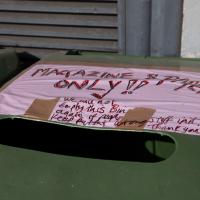
I dream of a future like the past, where we just had one bin, but where everything from robots to enzymes at the recycling centre nevertheless manage to pull everything back apart.
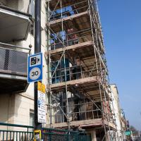
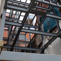
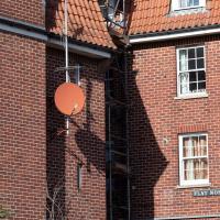
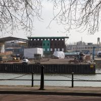
I'm following the progress of this new building going up with a snap every time I pass this way. Last time it had the frame but not the scaffolding, I think.
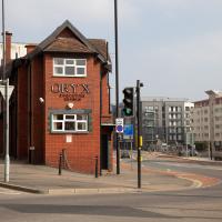
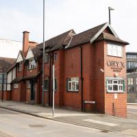
Every time I pass this building on the way into town, it reminds me that I've never read Margaret Atwood's Oryx and Crake. But I was here for a different reason today.
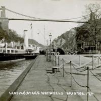
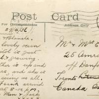
I bought a vintage post card from eBay this week. It's a well-known photo of the Hotwells landing stage, showing what's likely to be a P&A Campbell paddle steamer moored there. (Just yesterday I snapped a photo of their buoy on display at Underfall Yard with its information sign.) It was posted from here to Canada in 1936, and has now returned via a presumably quite circuitous route.
Local journalist Maurice Fells (really local—I could probably hit his house with a well-flung teacake from here) notes in The A-Z of Curious Bristol (£) that:
For tens of thousands of people, the pier at Hotwells was the starting point of their day trip as they boarded steamers with names like Glen Avon, Glen Usk and Britannia. The salty tang of the sea was never far away as the steamers headed for Ilfracombe, Weston-super-Mare, Clevedon and Portishead on the Devon and Somerset coast and Barry, Porthcawl and Tenby in South Wales.
The landing stage is long-abandoned. A variety of economic issues, including fuel prices, the increasing prevalence of the motor car, the construction of the Severn Crossing giving easier access to Wales, and the collapse of Clevedon Pier during safety testing in 1970, which prevented larger pleasure boats from stopping at the resort, all led to dwindling trade.
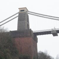
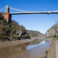
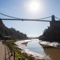
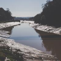
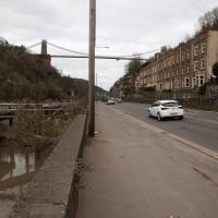
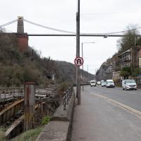
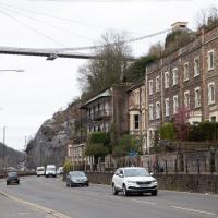
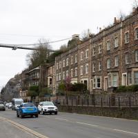
I went to have a poke about there today, not staying for long as it's a cold day and the wind was biting. I couldn't reproduce the postcard's view—you'd need to risk life, limb and presumably a trespass prosecution—but I did try to judge the rough viewpoint and angle of the photo by lining up with Rock House, the Colonnade and the Suspension Bridge and snapped a photo looking back to where the original photographer would have stood on the pontoon.
This Bristol City Docks history page has many good photos of the landing stage and the nearby Port and Pier Railway line (whose tunnel I was in the other day) and the Hotwells Halt railway station, which was just the other side of the suspension bridge from here.
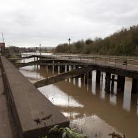
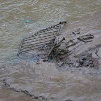
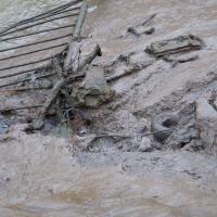
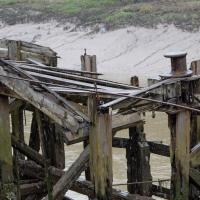
Not sure what the gap was for, or what the metal bridge-like-thingy that's gently rusting into the water was for, either.
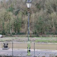
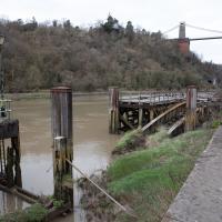
On closer inspection, this looks similar, but not the same as the lamp posts in the picture.
I think this roughly lines up with the viewpoint in the picture. You can just see the suspension bridge stanchion in about the right place behind the tree above the Colonnade.